Kraj Skadar
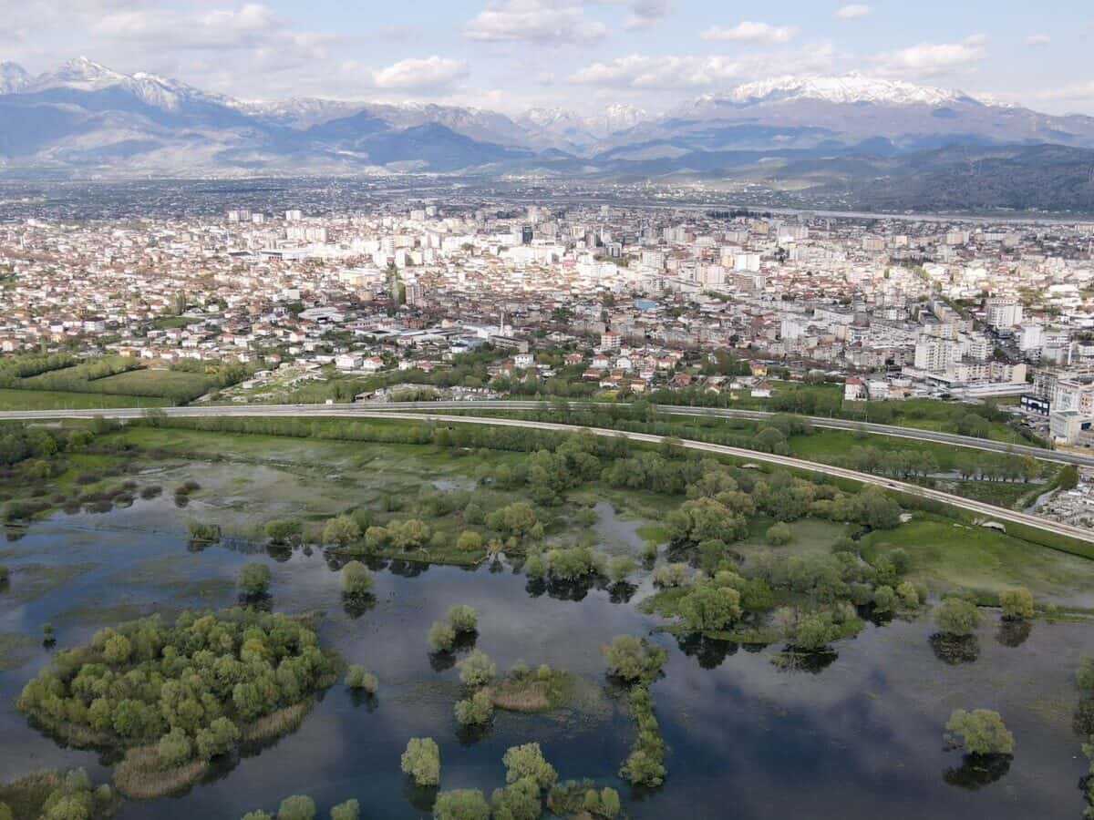
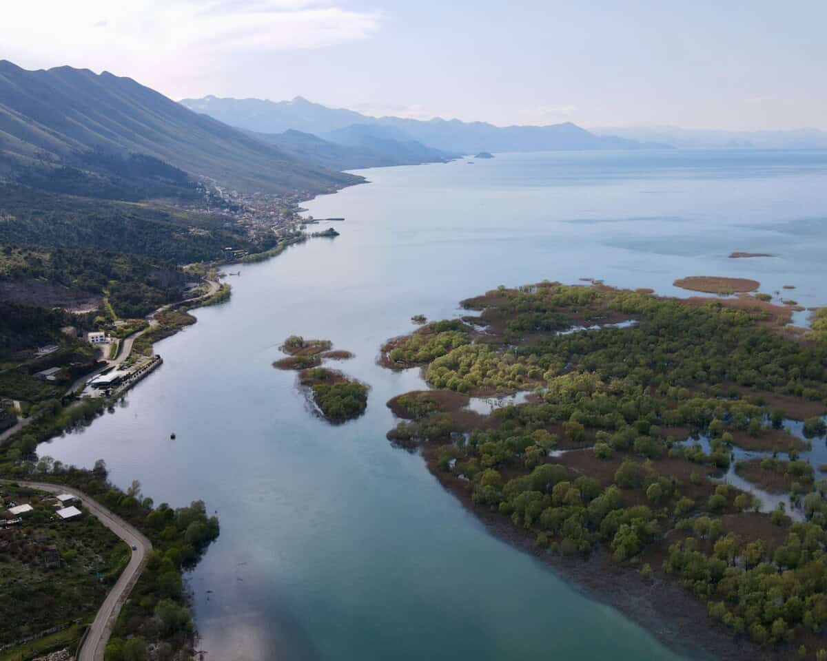
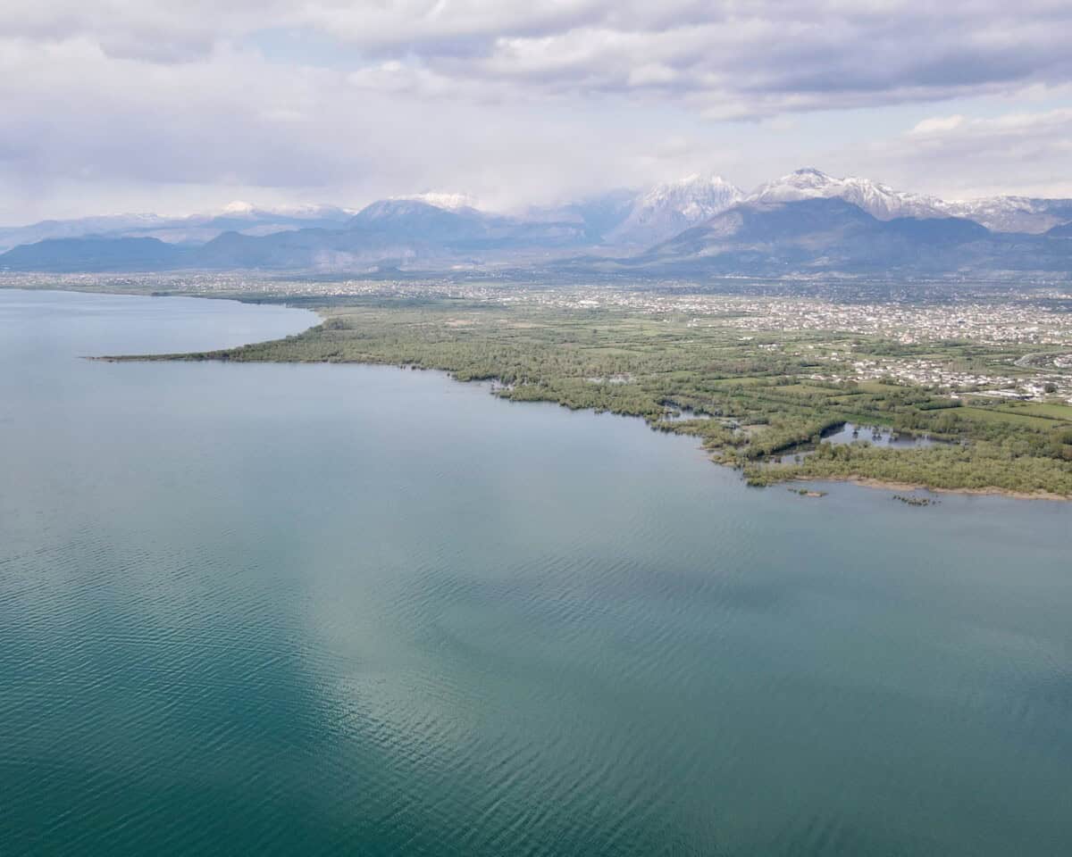
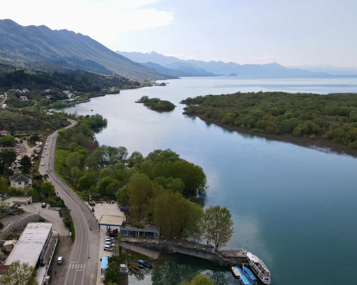
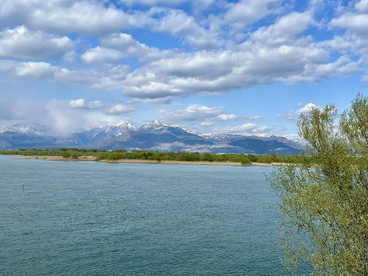
The dominant feature of the region is Lake Skadar (Liqeni i Shkodrës), which is the largest lake in the Balkans. The historic heart of the region is formed by the city of Skadar (Shkodër). Water enthusiasts should not miss a ferry ride across Lake Komani, whose fjord-like landscape with high cliffs is among the most impressive experiences in Albania.
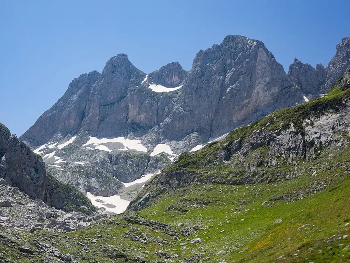
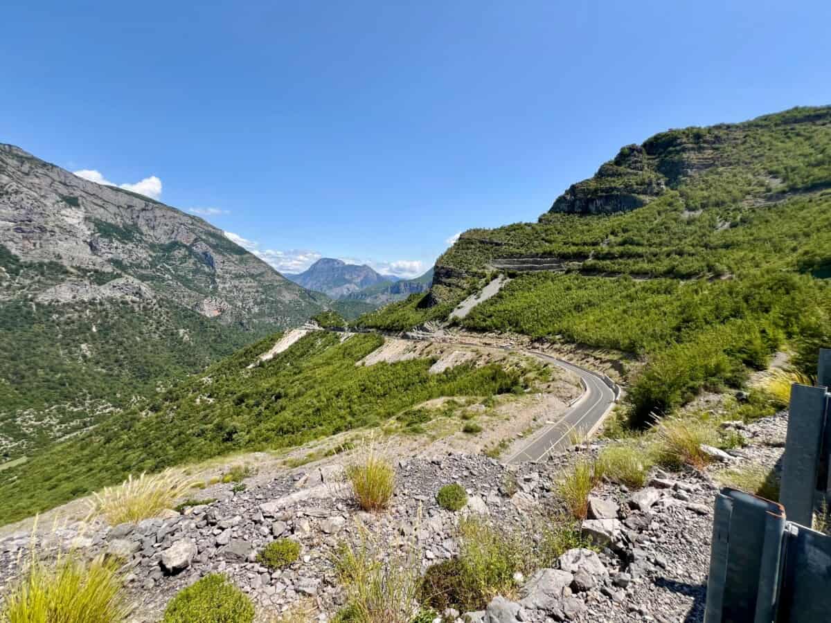
For mountaineers and hiking enthusiasts, there are the Albanian Alps Prokletije – a rugged and wild mountain range with the highest peak Maja e Jezerces (2694 m). An excellent starting point is the mountain village of Theth, from which routes lead to Valbona Pass or a less demanding family trip to Grunas waterfall and the crystal-clear Blue Eye spring (Syri i Kaltër).
Those looking for true mountain solitude and minimal tourists should head to remote village Vermosh – Albania’s northernmost location, where you will encounter traditional life in a valley surrounded by mountains.

City Skadar
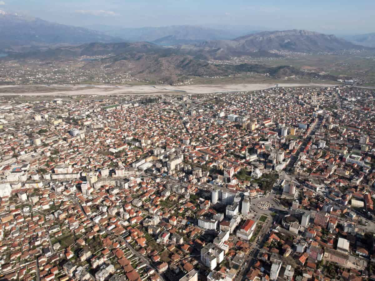
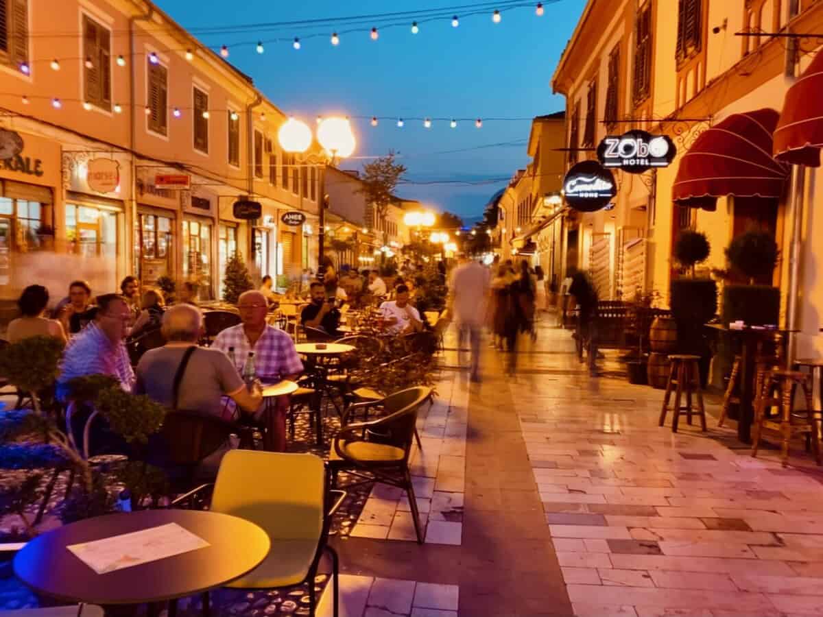
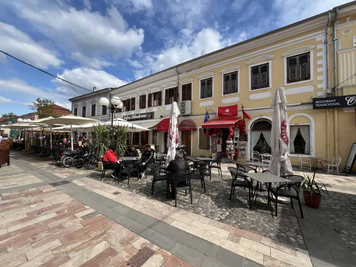
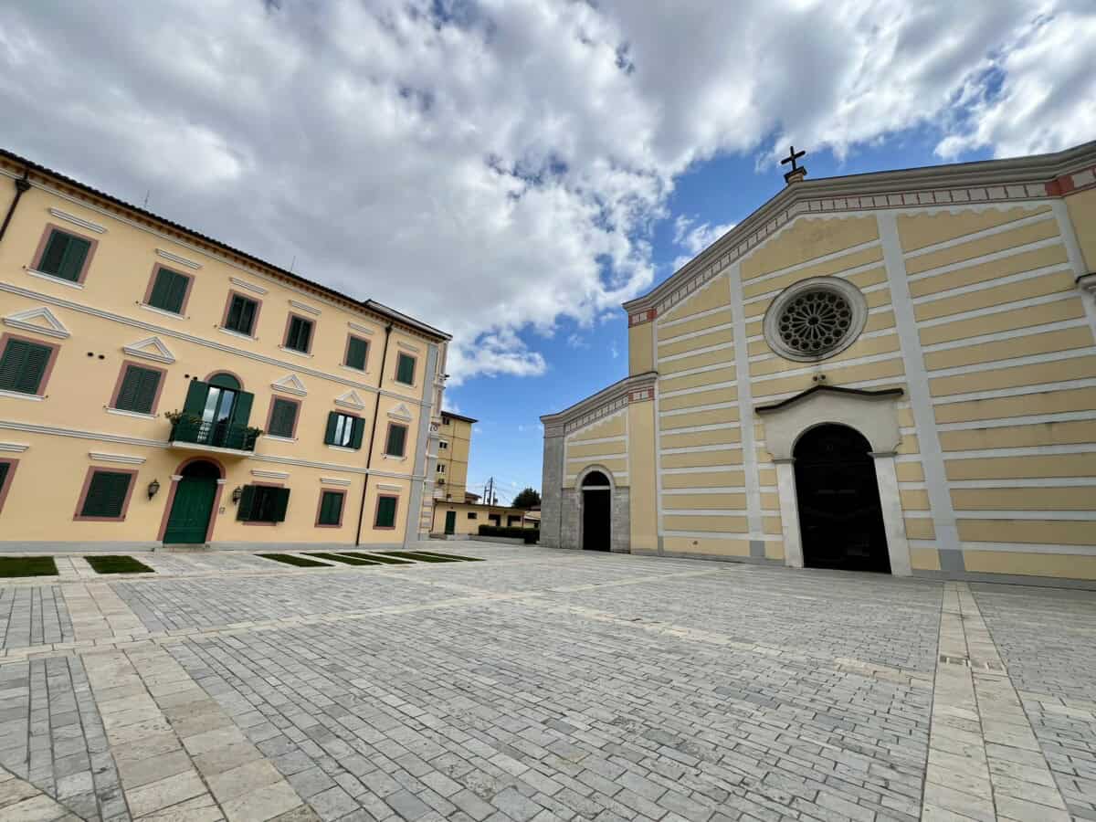
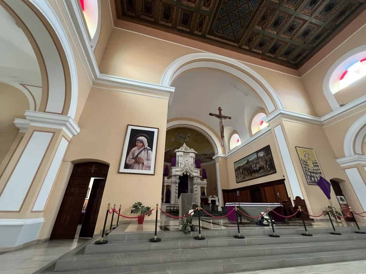
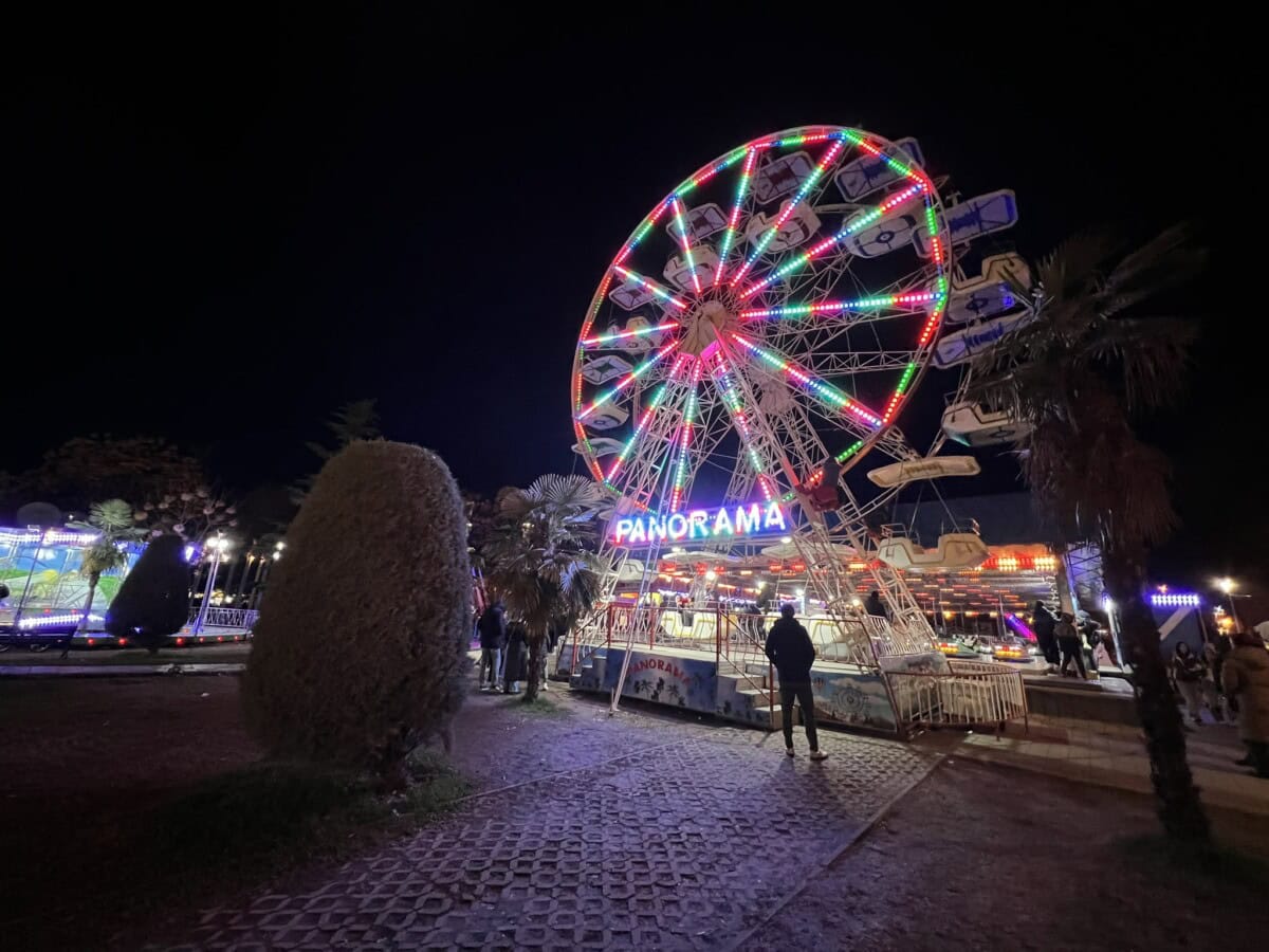
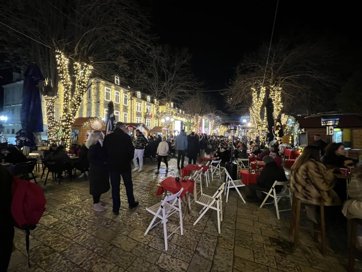
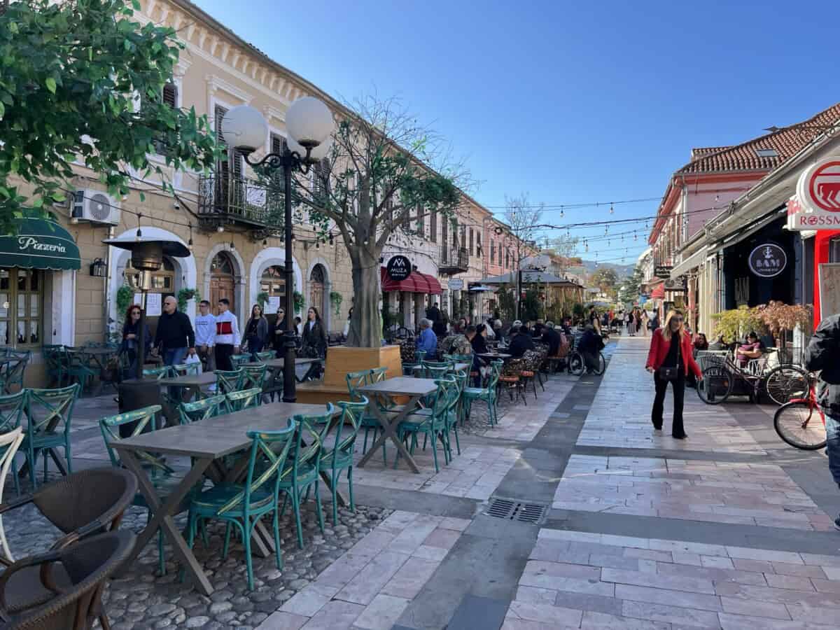
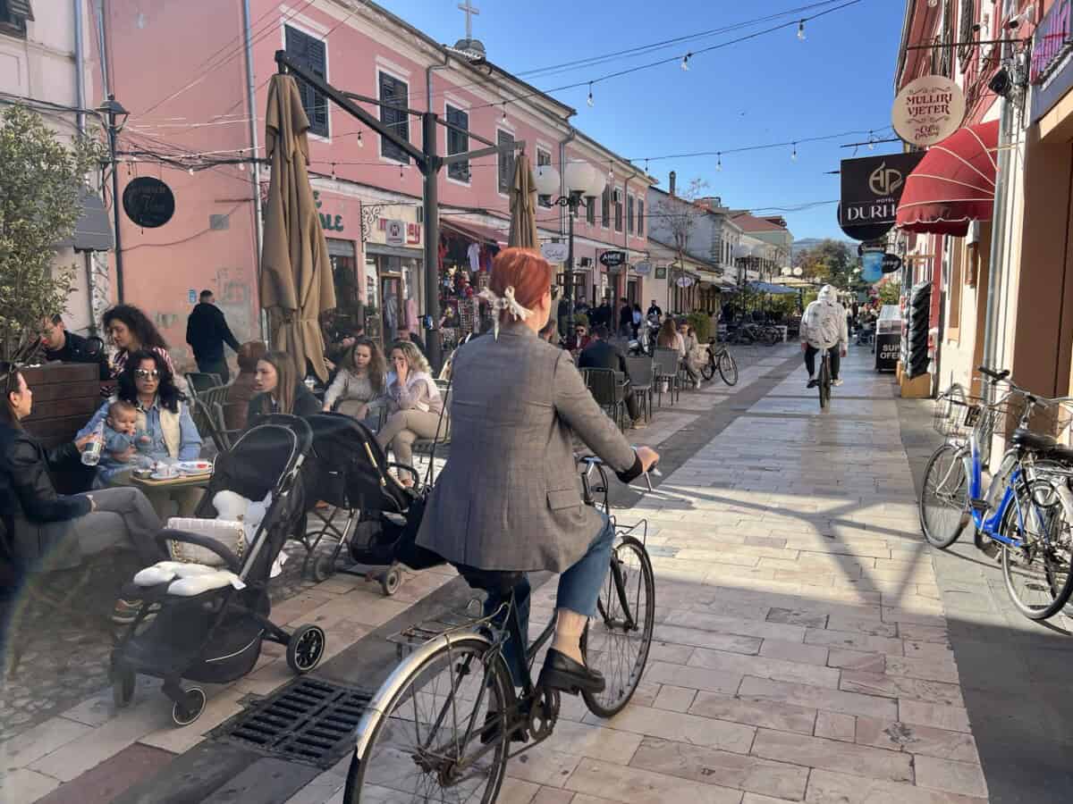
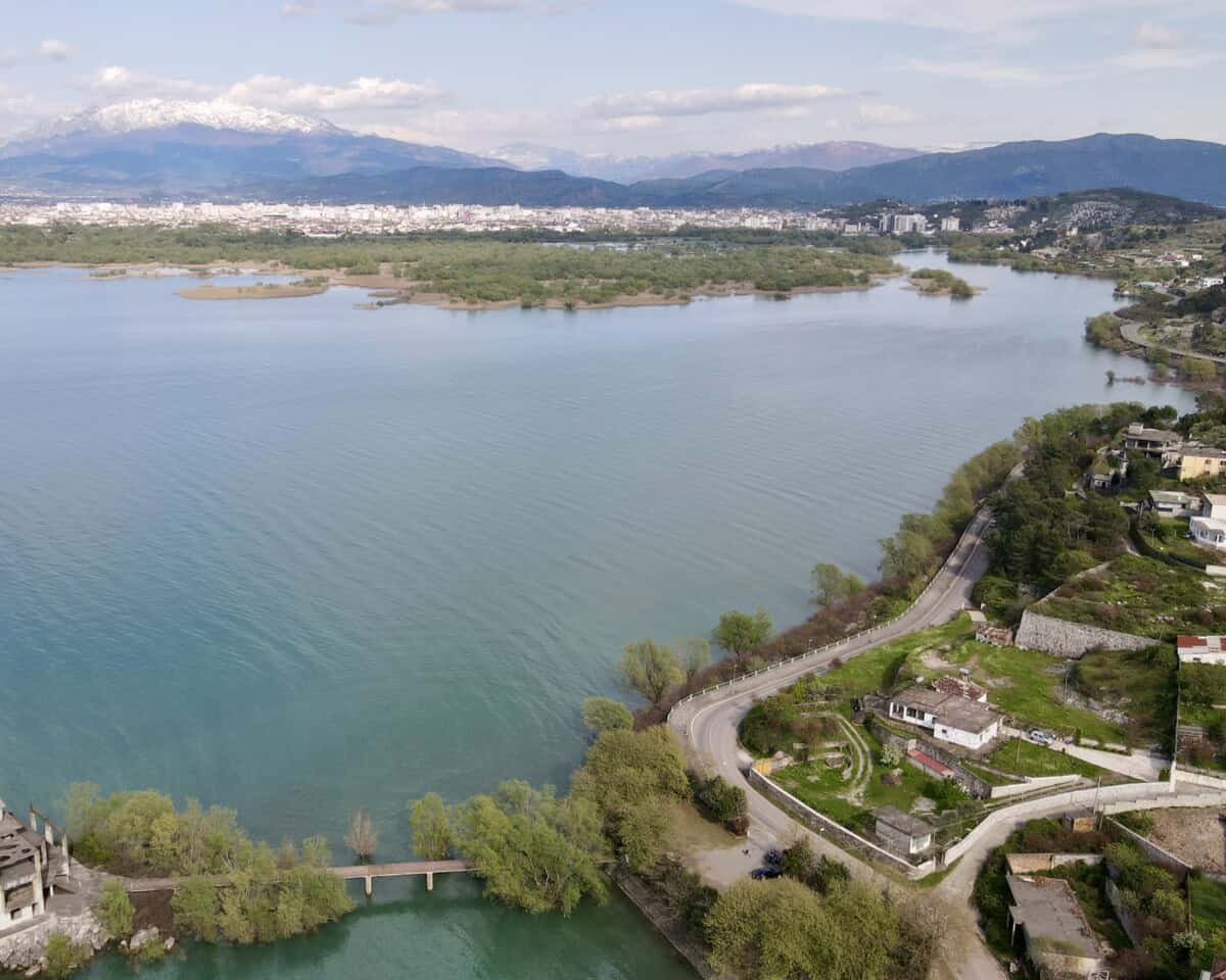
Skadar (Shkodër) is the largest city in northern Albania and the fourth largest in Albania. It has around 100,000 inhabitants. The atmosphere of the city is very young and vibrant. It is the metropolis of Albanian Catholicism with an even distribution of Catholics and Muslims, among whom there is absolute peace and harmony. This harmony between believers of different faiths exists throughout Albania.
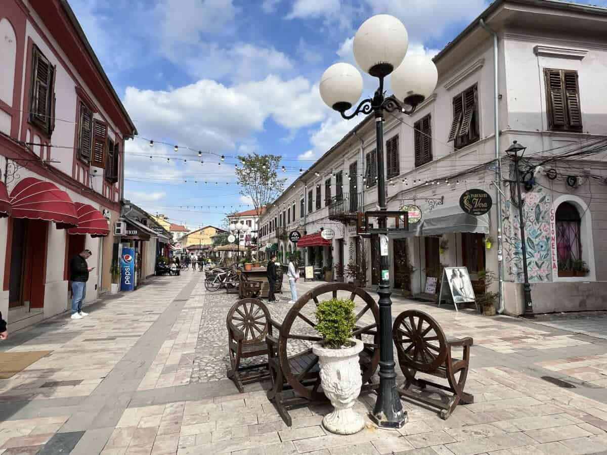
Among Albanian cities, it has the best developed infrastructure friendly to cyclists. Skadar is somewhat like the Albanian Amsterdam in this respect. A modern technical feature of the city is the rotating bridge over the Buna River, which allows boats to sail into Lake Skadar.
Více o Skadaru
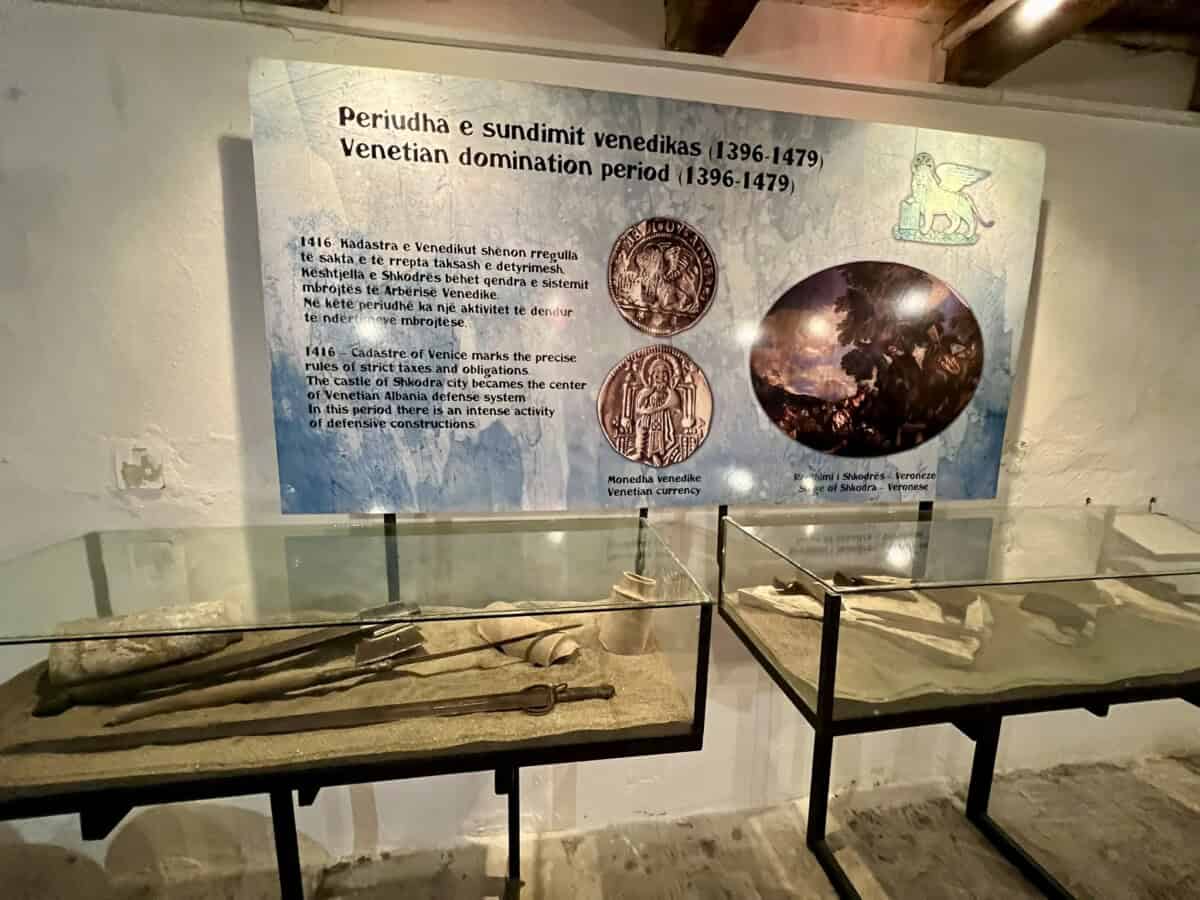
The first mentions of the city date back to Illyria. There was already a settlement called Scodra here in the 4th century BC. It was subsequently conquered by the Romans and, thanks to its relative proximity to the trade route Via Egnatia, the city prospered. The city’s history was subsequently influenced by Montenegrins, Serbs, and Venetians. Like all of present-day Albania, this city fell into Ottoman hands in the 15th century. The city’s history is also represented by Rozafa Castle, whose origins date back to the Illyrian period.
The atmosphere of the city of Skadar was best described in his work by the most famous Albanian writer of the 20th century, Ismail Kadare: “Skadar is vast and full of life. Skadar, one of the oldest cities on the entire peninsula, contemporary of ancient Rome, capital of Illyrian kingdoms, has despite all the storms that swept over it, always retained its face and its shadow… Beautiful, sinful Skadar with streets, gates, courtyards full of secrets, with shops, cafes, prostitutes, with bell towers, minarets, processions, secret eroticism, with after-dinner conversations, prominent figures and beggars, intelligence and stupidity… Besides the castle and churches, besides towers, bell towers and minarets, Skadar has cultural life, libraries, medieval archives, consulates, literary magazines that were distributed throughout the country. It has intellectuals and places where various problems are discussed and debated, beautiful women with complicated love stories, shops selling books and Parisian perfumes, adventurers, scandals and also maniacs.”
Praktické
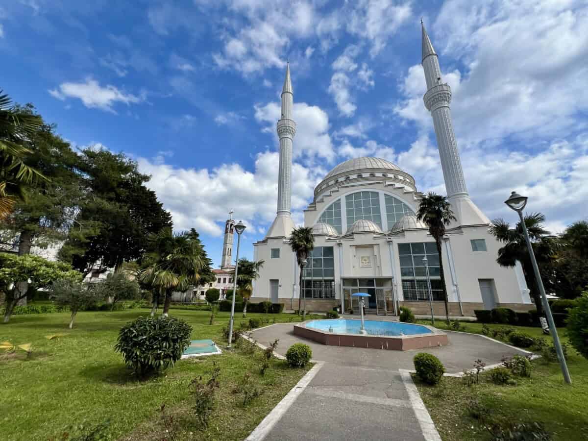
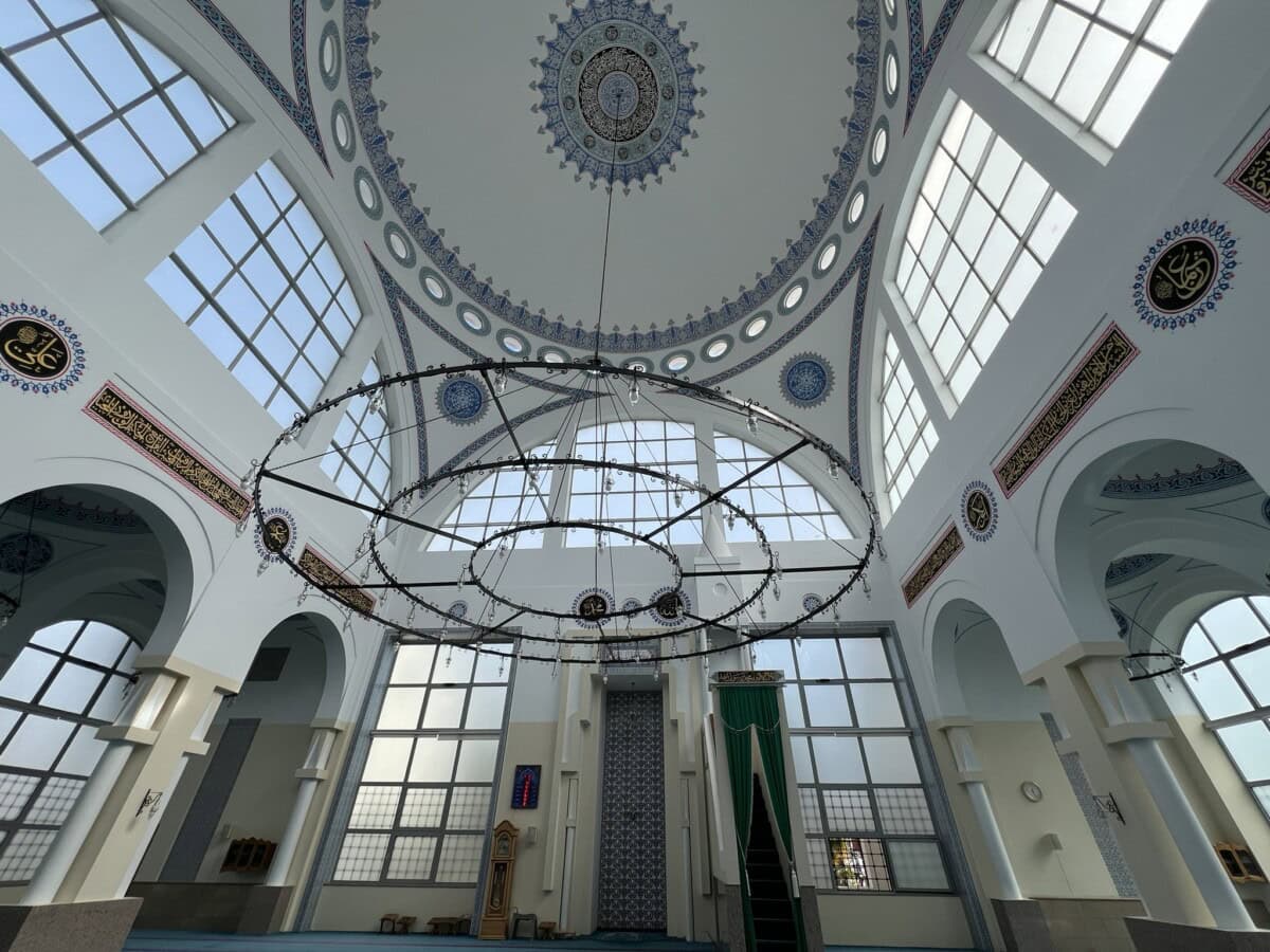
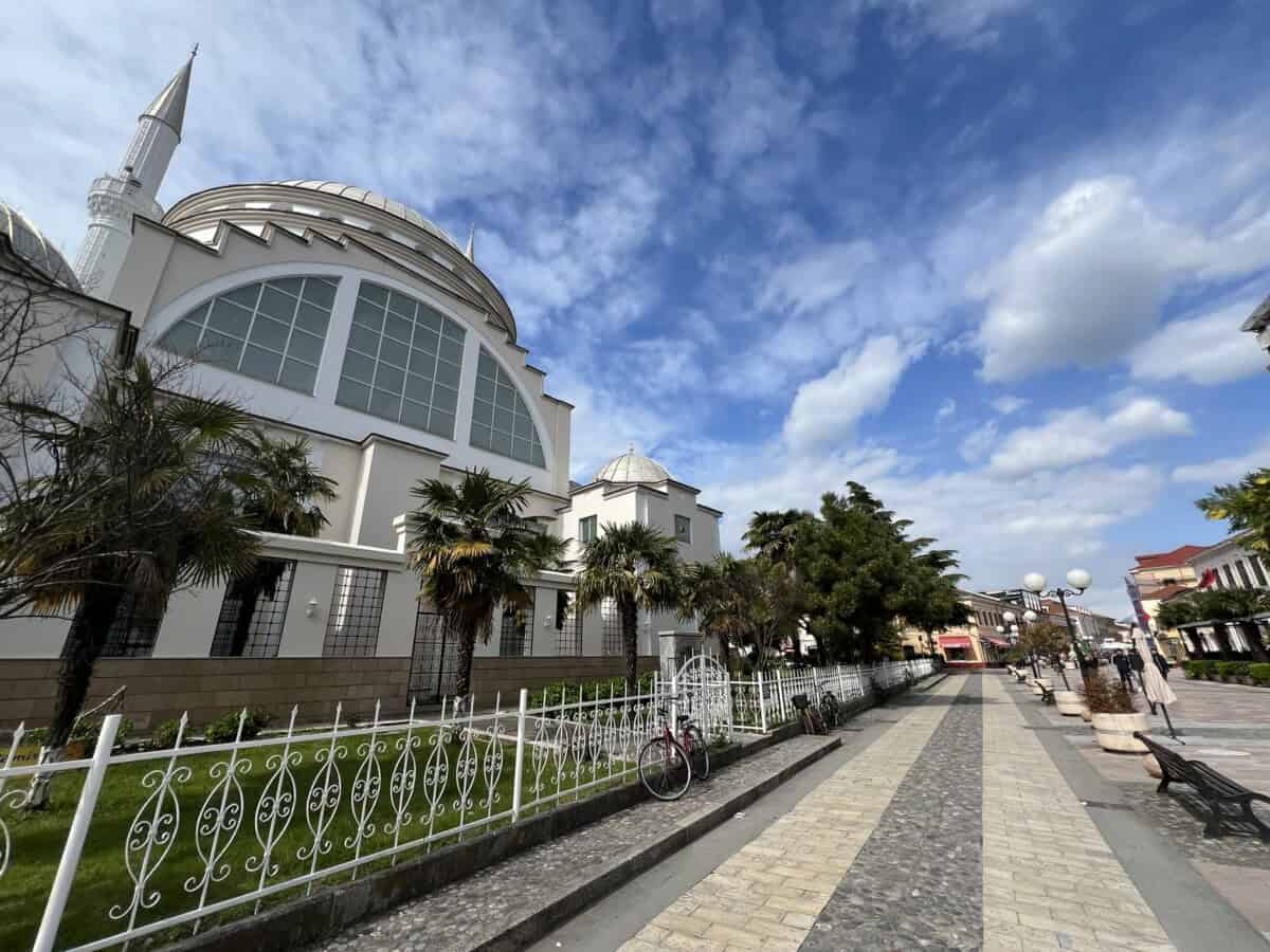
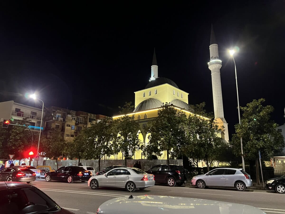
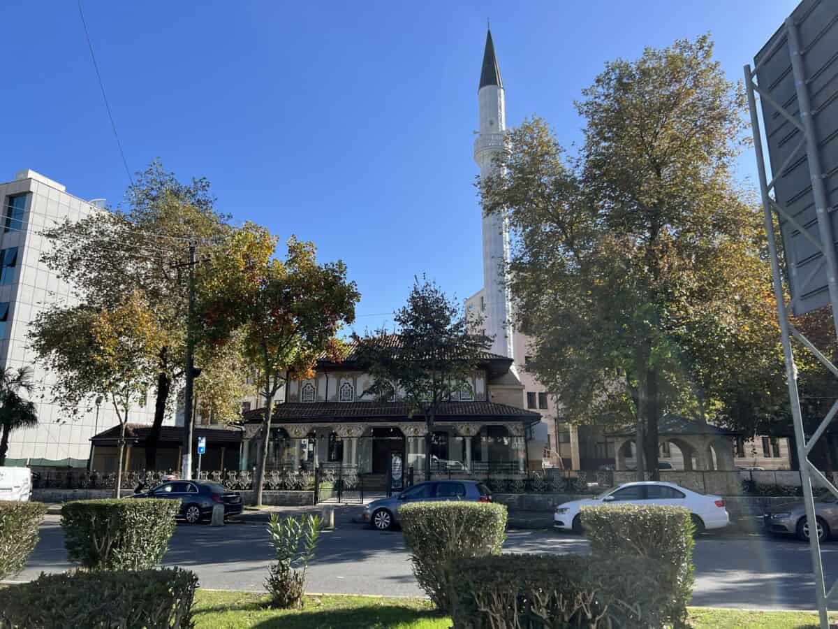
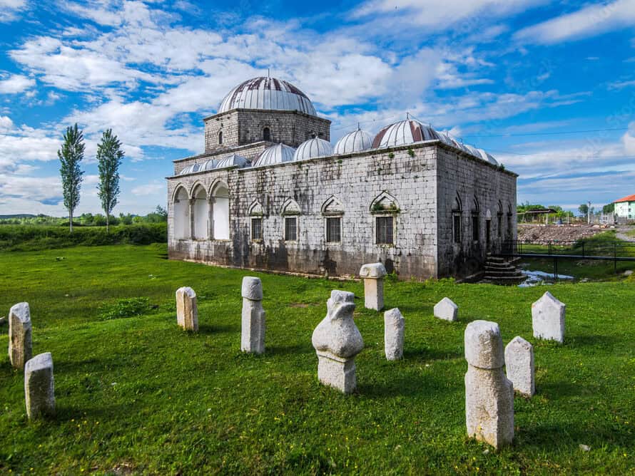
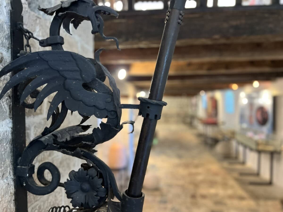
There is really a lot to see in the center of Shkodër, so it is worth taking enough time for this vibrant city. You will gladly catch the atmosphere of the city. Parking is mostly along the main streets, but sometimes you will find private parking lots. Just follow the signs. What you should not miss: Pedestrian zone and square, Museum of Historical Memory, Marubi Museum, Great Mosque, Lead Mosque or Catholic Cathedral of Saint Stephen
Mapa
Lake Skadar jezero
Více o jezeru
In its waters lives the Skadar Carp (Krapi i Shkodrës – Alburnus scoranza). It is an endemic fish, which means you won’t see it anywhere else in the world. This species is an important element of the lake ecosystem.
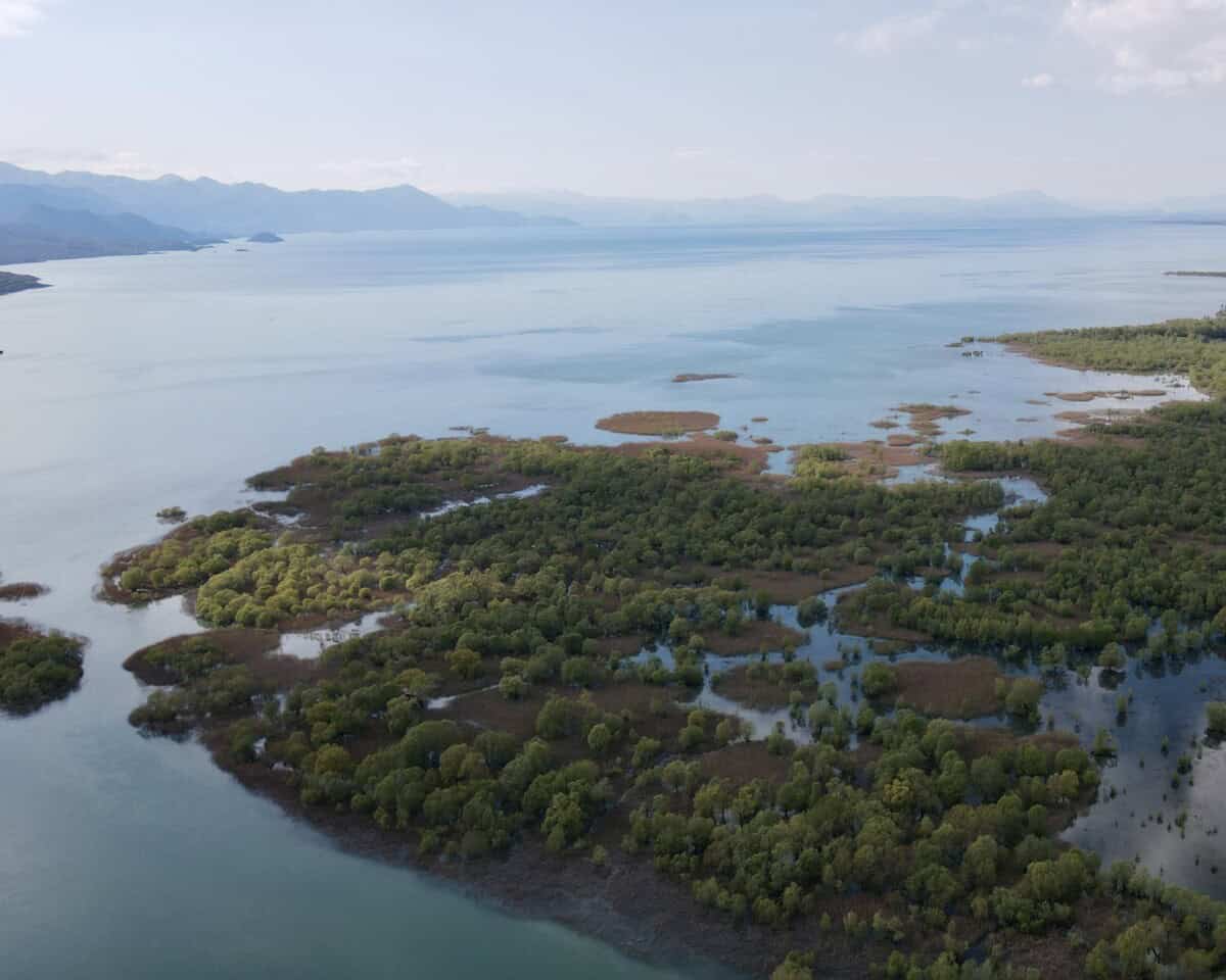
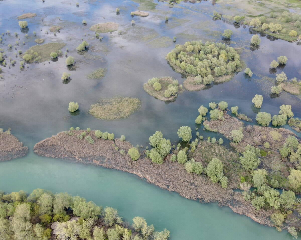
In the northern part of the Albanian section of the lake is located Syri i Sheganit (Shegan’s Eye). Like many place names in Albania, there is also a legend about the origin of this name. Long ago, a traveler sailed into this area late at night with his boat and was looking for shelter in one of the houses, where there are now three springs. The first two brothers did not open the door for him, only the third brother – Shegan – welcomed him in his home. This place is now called Syri i Sheganit after the name of the third brother. The traveler subsequently cursed the first two brothers and as a result of his curse their houses turned into lagoons with stagnant water. Shegan’s house, however, remained standing. Later, when the house fell apart with age, Syri i Sheganit eye was formed in its place, where spring water gushes out from a karst chimney over 25 meters deep. Places shrouded in legends attract.
Praktické
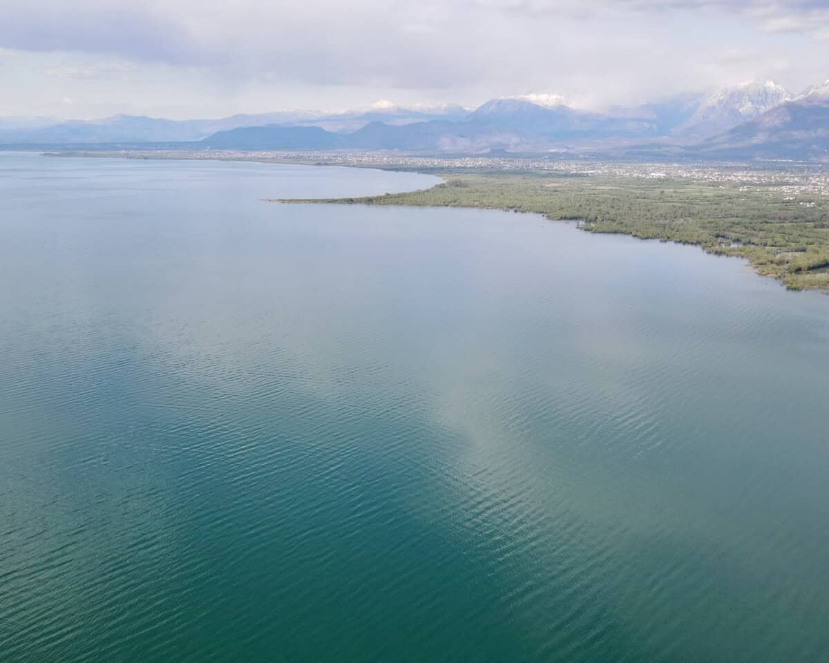
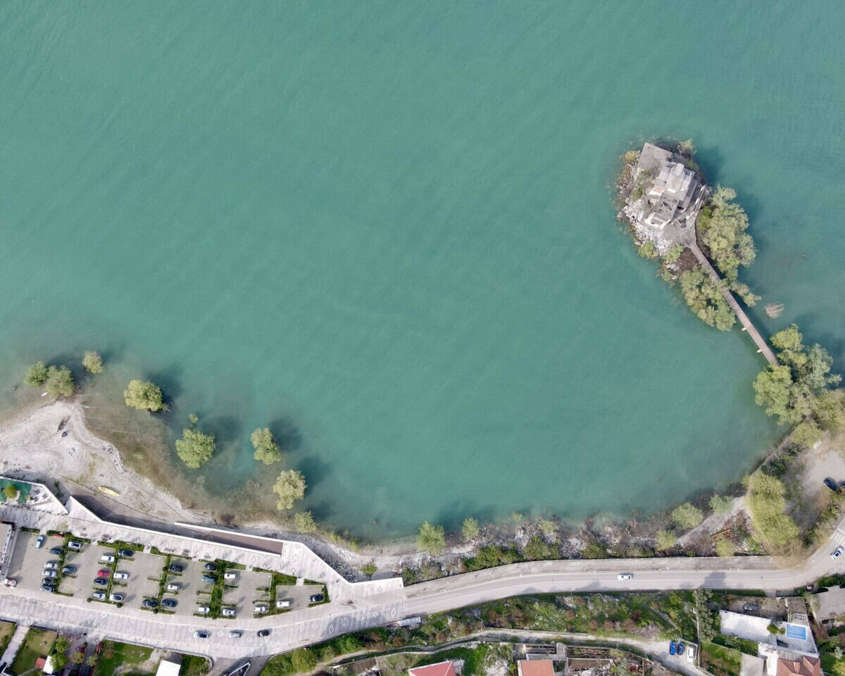
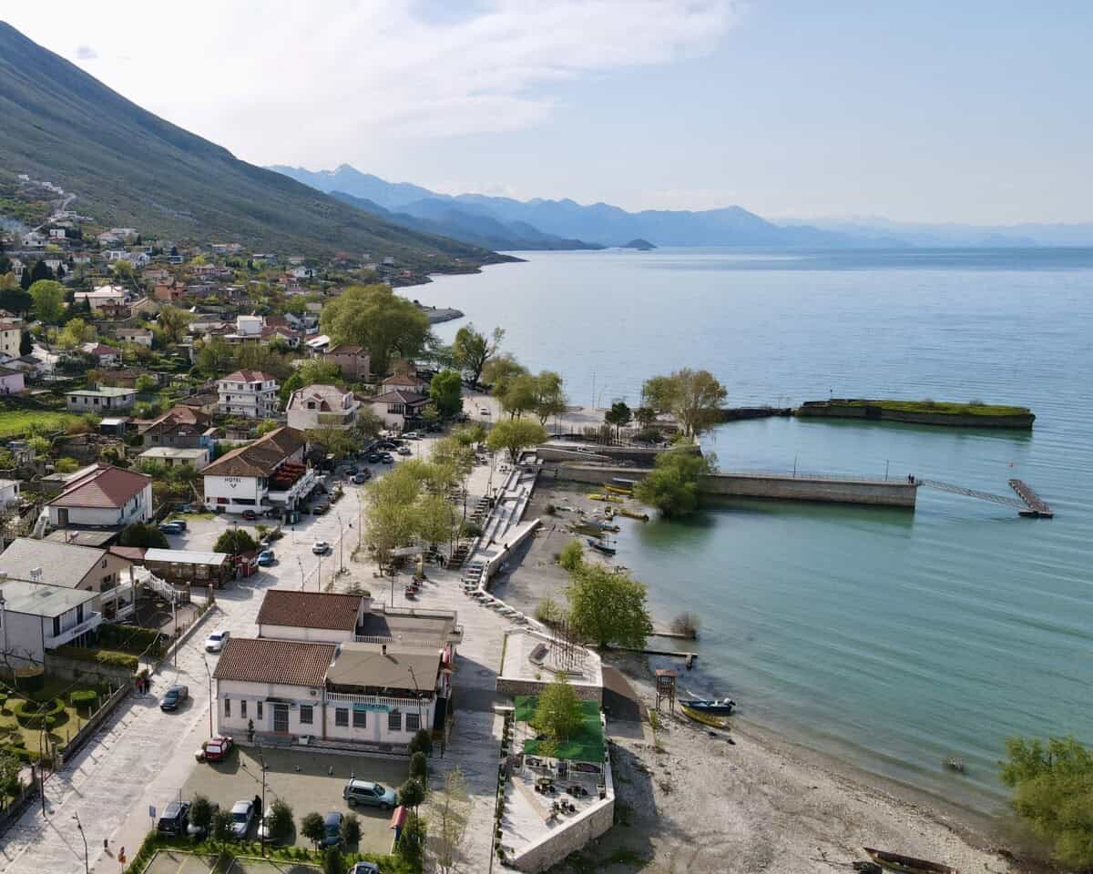
On the Albanian side of the lake, the most frequently visited place is the village of Shirokë. From here it is possible to take an organized boat tour of the lake on a tourist boat and there are also places suitable for swimming. There are also plenty of restaurants, whose menus include, among other things, the local endemic carp. There is plenty of parking. In 2025, the captain of one of the tourist boats drowned in the lake.
Israeli tourists did not heed his warning not to venture far from the boat while swimming in strong wind. However, the tourists did not heed his call and found themselves at a distance from which they did not have the strength to return. The captain jumped into the water and saved them. He himself, however, did not have the strength to return to the boat. So be careful when swimming in the lake.
Mapa
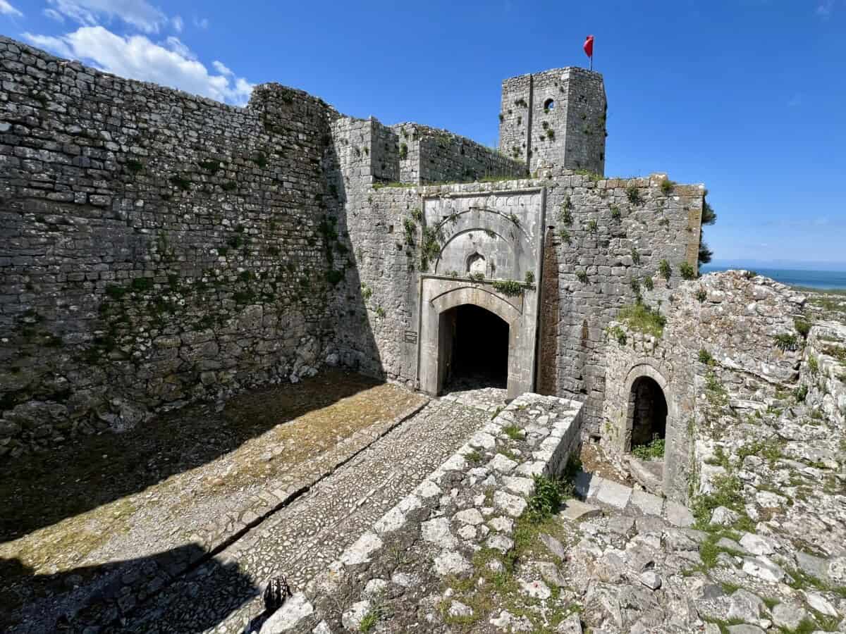
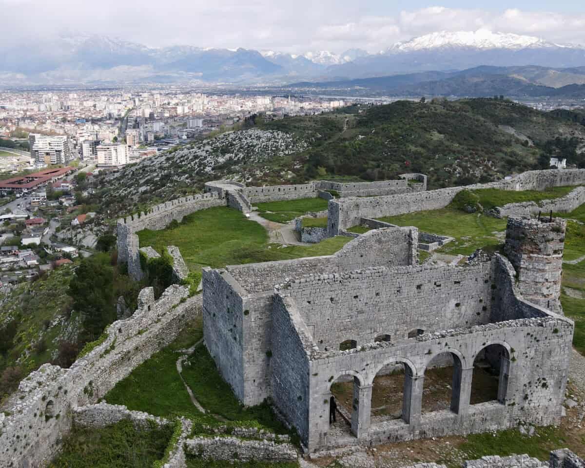
Hrad Rozafa
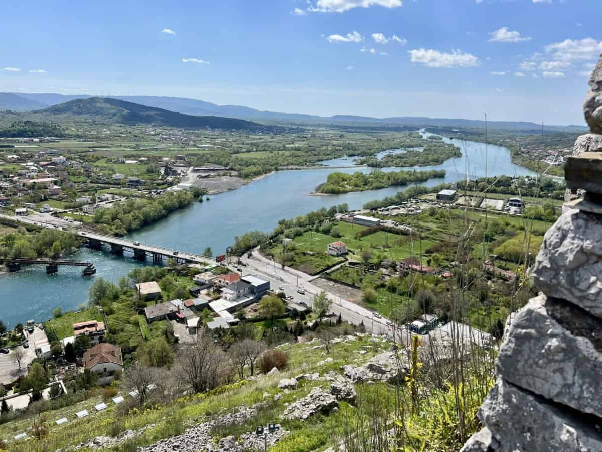
Rozafa Castle bears its name after a woman who was allegedly walled into the fortress walls to prevent the structure from collapsing. We explore the legends below. The hill above the confluence of the Buna and Drin rivers, where Rozafa Castle now stands, was settled as far back as the early Bronze Age. The first fortress walls date from the 4th–3rd century BC, when the Illyrians ruled there. In 168 BC, the fortress became the spoils of the Romans.
And we skip “a couple” of centuries – in 1479, after a long siege and the capitulation of the Venetians (who were starved between the walls), the Ottomans took it over. The sultan Mehmed II himself, nicknamed the Conqueror, even participated in the battles. The Turks held the fortress until 1913, when Montenegro conquered it after a six-month siege. Today, Rozafa naturally belongs to Albania.
Více o hradu
Three brothers – Vukašin, Uglješa and Gojko – tried to build a fortress. But whatever they built during the day collapsed at night. And so it went for three whole years. Until one day they met a mysterious old man who told them that without a sacrifice, the fortress would not stand. They had to wall in one of their wives. The one who would bring her husband lunch to the construction site first tomorrow.
The brothers promised that they would tell no one at home – they would leave it to fate. But Vukašin and Uglješa warned their wives that evening. Gojko alone kept his promise. And so his wife Rozafa set out to the fortress the next day.
When Gojko saw her, his heart broke. But it was too late. The two older brothers led her away and began to wall her in. At first she thought they were joking. But when the wall reached her waist, she understood it was the end.
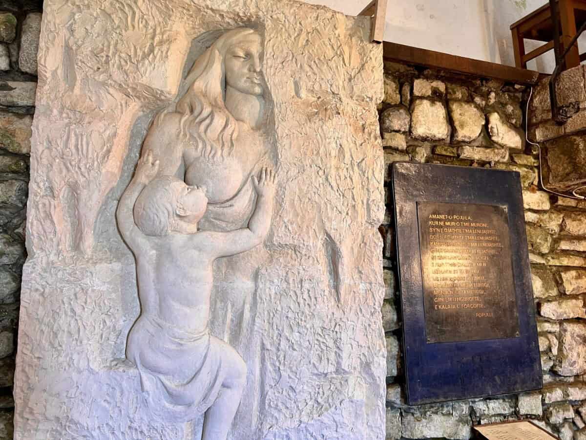
She asked for only one thing – to leave an opening at her right breast, right arm and eye so that she could breastfeed her little son and see him when they brought him to her. She fed him for another week. Then her strength faded. But according to legend, her milk for her son flowed down the castle walls for the entire year.
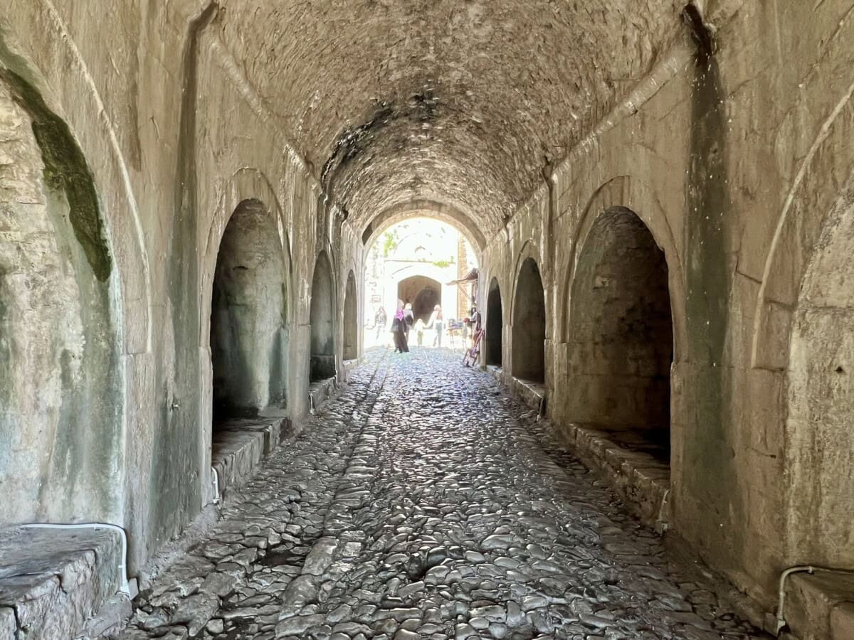
Locals claim that Rozafa’s milk flows from the walls to this day. In the original Illyrian gate, limestone drops actually fall from the ceiling. Women from the surrounding area collect them, mix them with water and use them as a traditional remedy to support breastfeeding. They believe that in this way they pass on to their children the strength and courage of Rozafa.
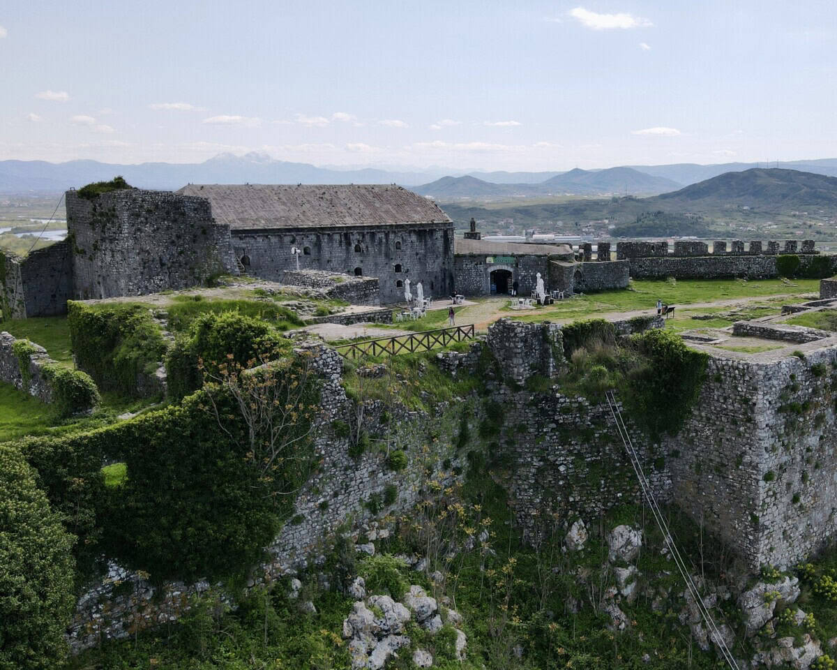
Praktické
The drive to the castle is absolutely trouble-free and you can get there directly by car. There are usually plenty of parking spaces even at the height of the season. The admission fee is around 4€. There is usually a refreshment stand in the courtyard during the season.
Mapa
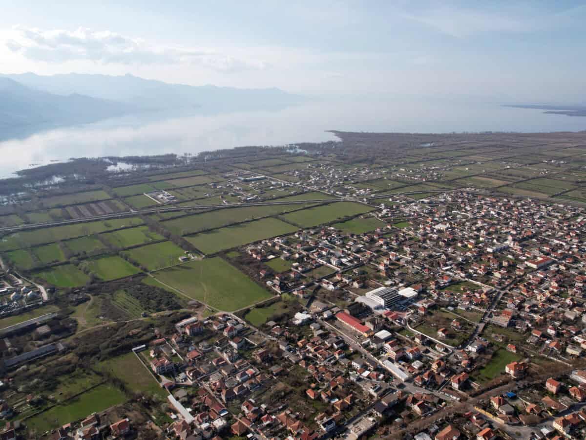
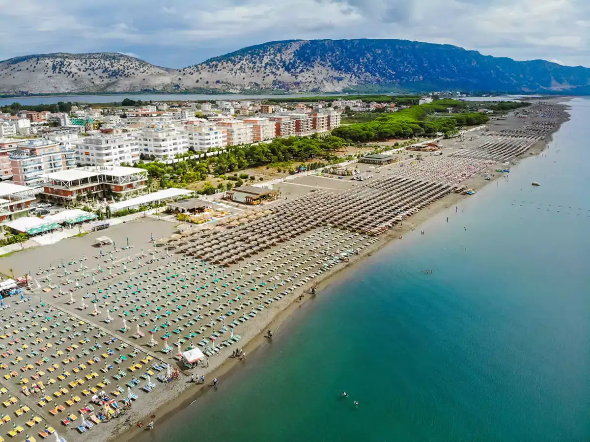
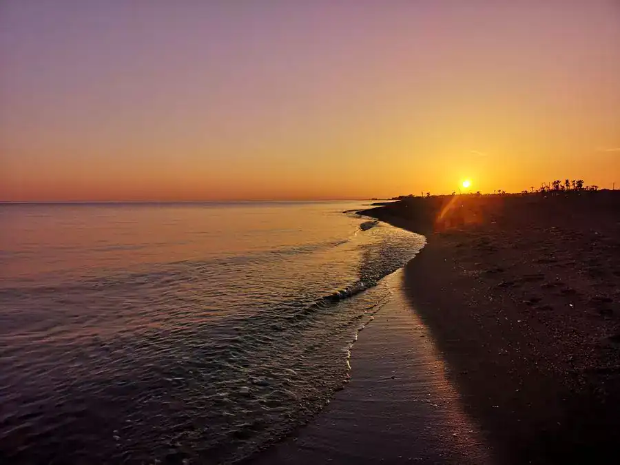
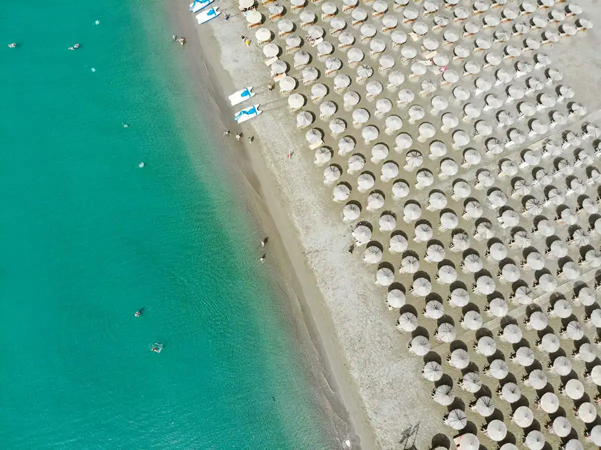
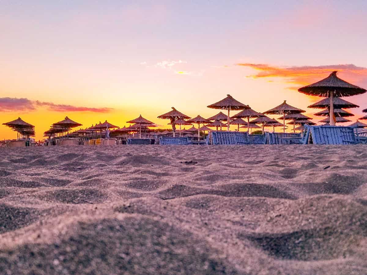
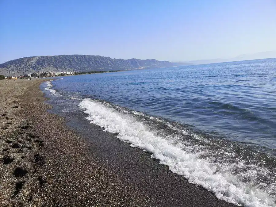
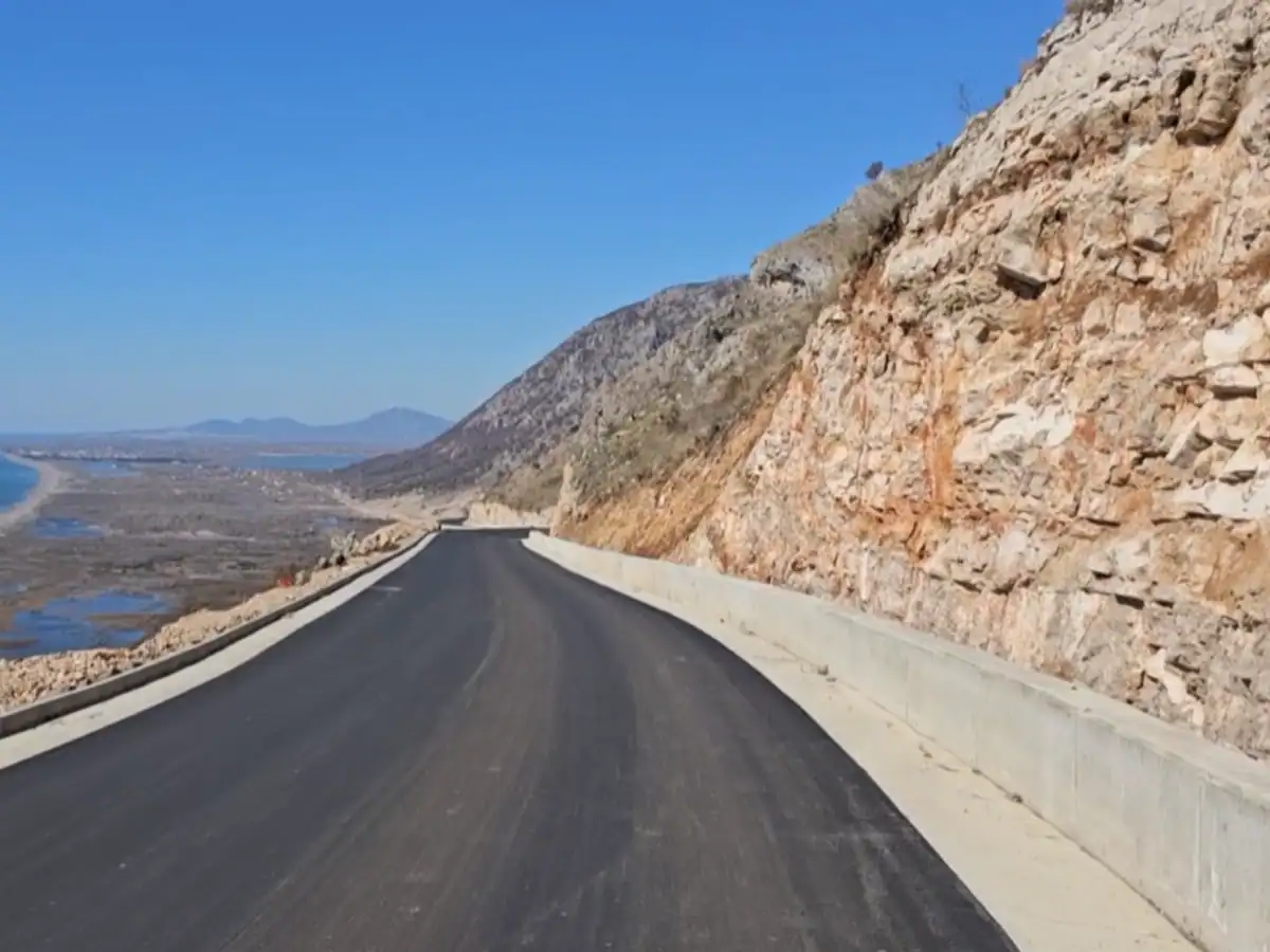
Letovisko Velipojë
Více o Velipojë
The name Velipoje comes from the Slavic word Velikopoje, which in Czech means Great Plain. The name probably originated during the Slavic invasion of the territory.
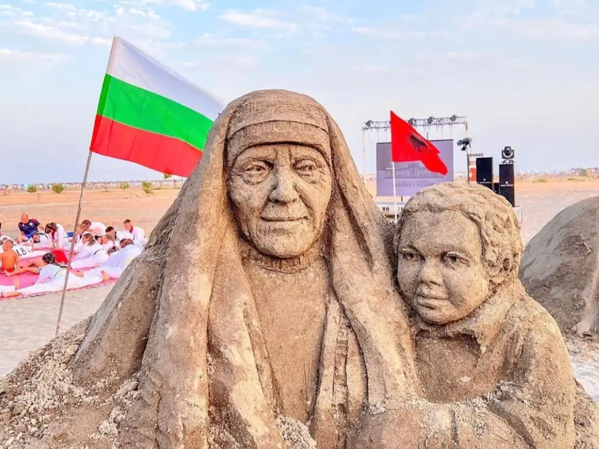
Since 2022, the “Land&Sand” Festival has been held on the beach every year in August, which is based on building sand sculptures. Sculptors from around the world participate in the festival.
Praktické
The standard approach to Velipojë is the road from the city of Shkodër. In 2025, a new 40-kilometer access road from the south from Shëngjin was opened. Driving on it not only speeds up the journey, but also offers beautiful views of the Adriatic Sea. You can access it HERE.
Mapa
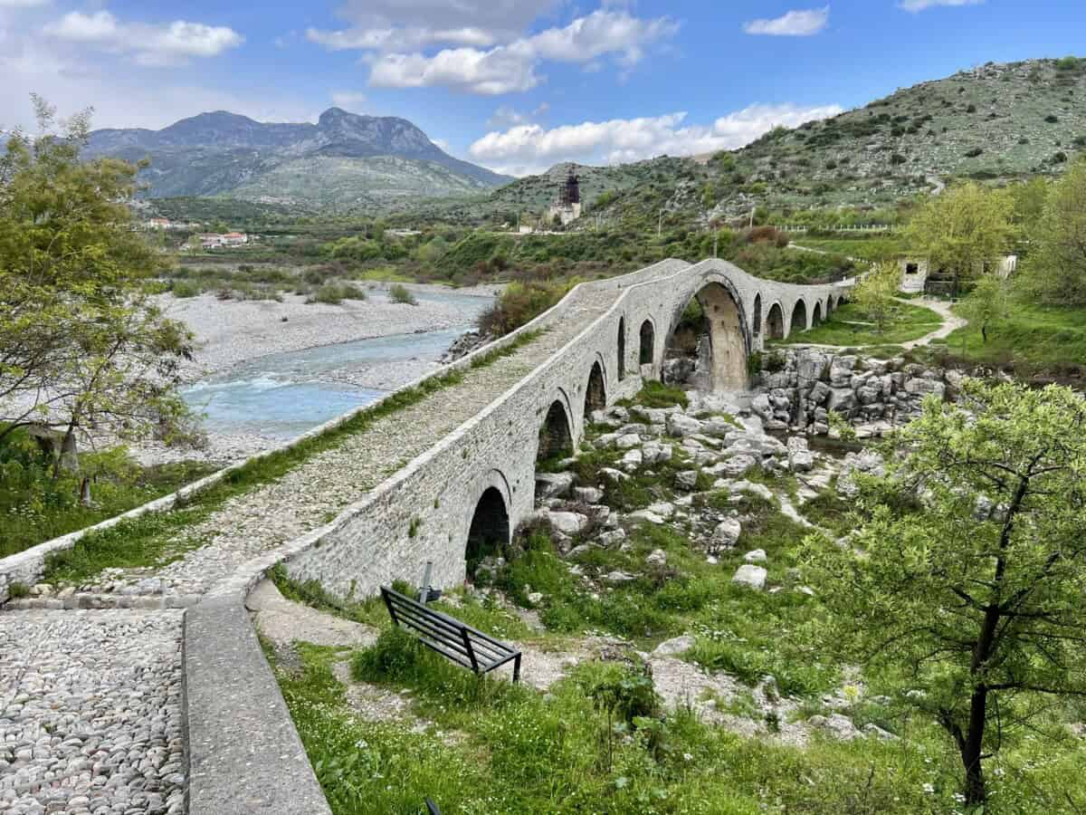
Most Ura e Mesit
Více o mostu
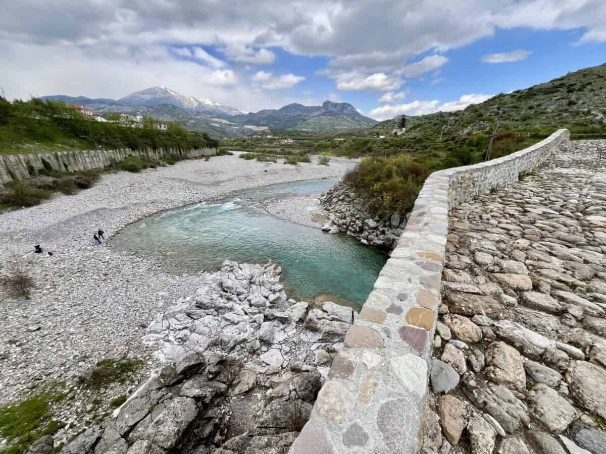
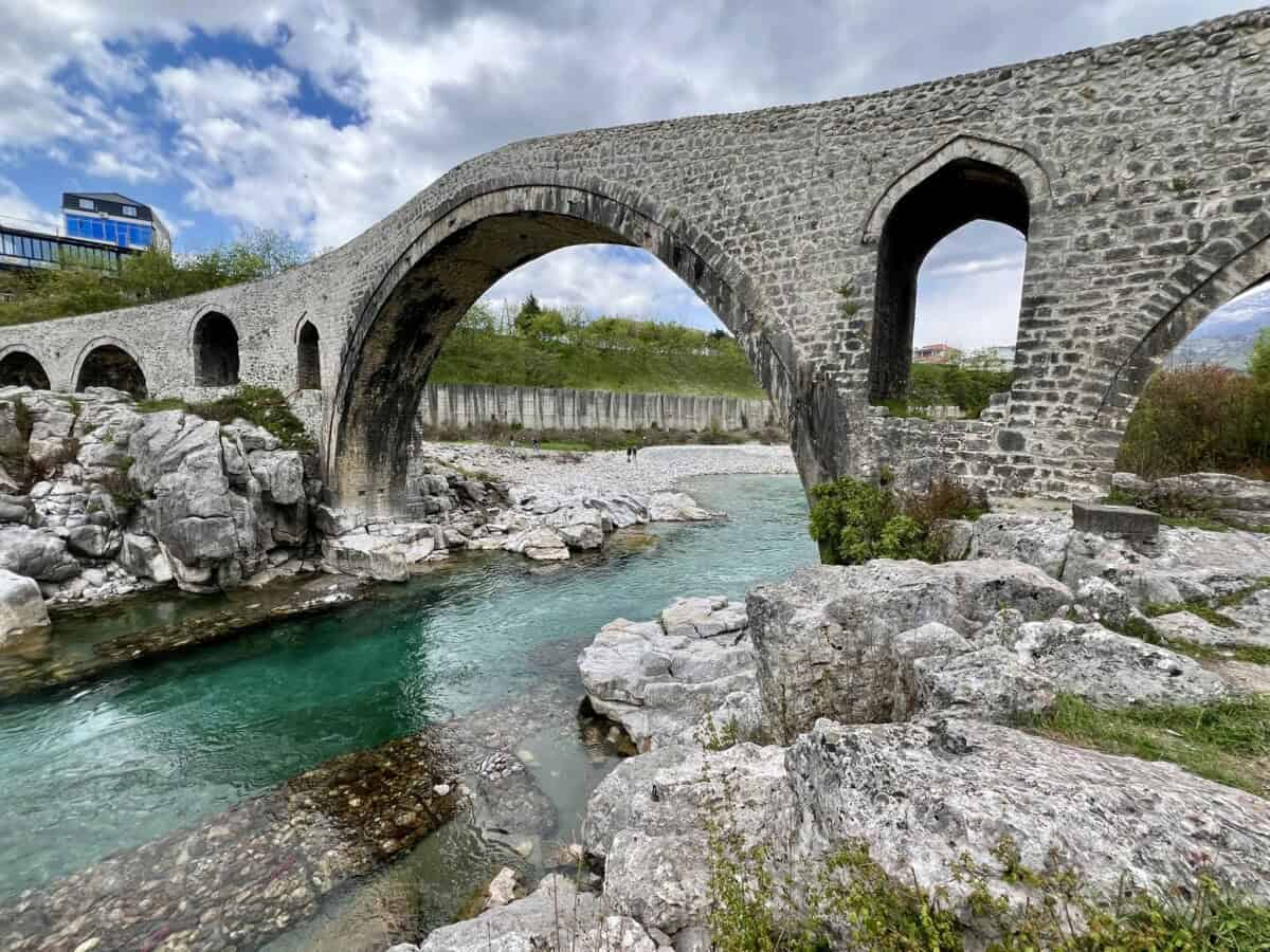
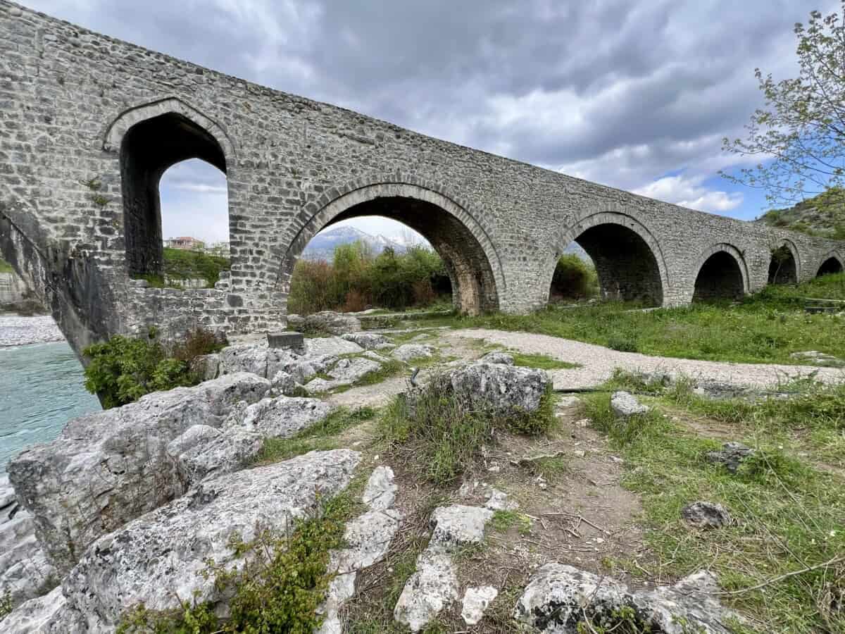
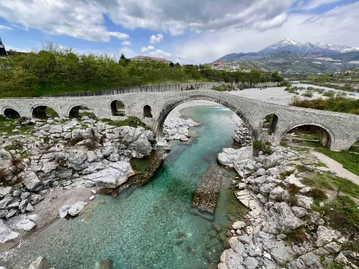
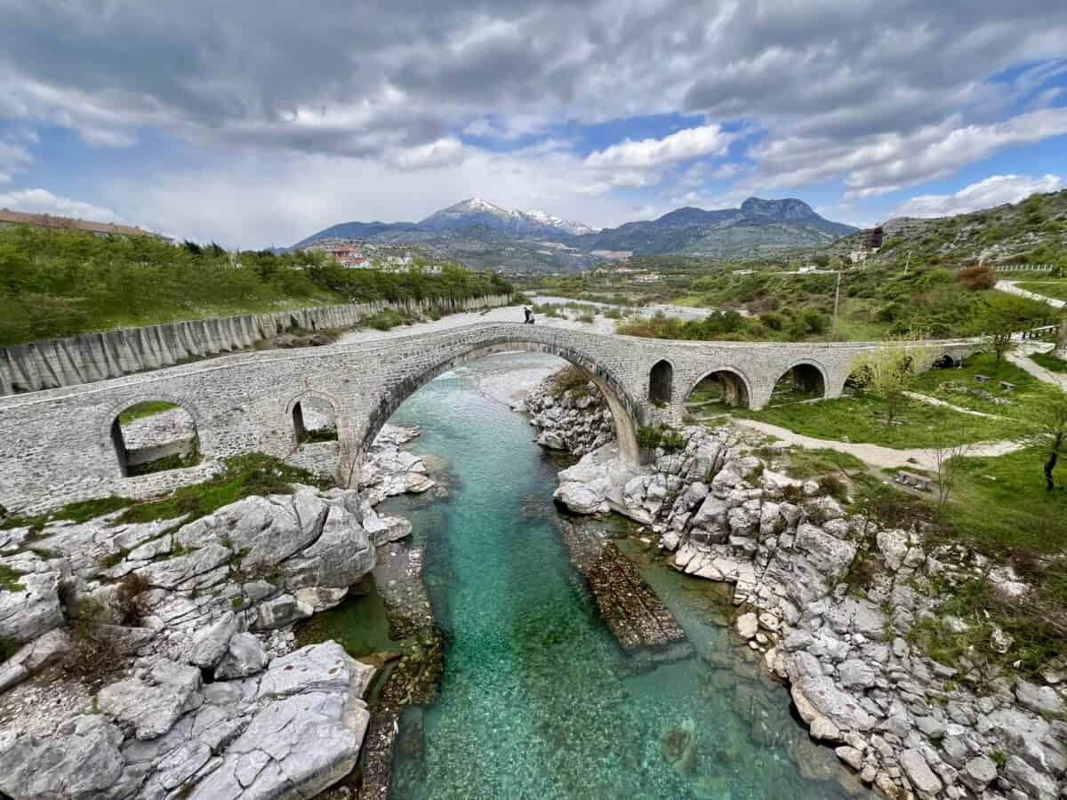
Messky Bridge (Ura e Mesit – Middle Bridge) was built in the 18th century, thanks to the intention of Ottoman pasha Kara Mahmud Bushati. Its construction was divided into two phases. The first stage was the main central arch and three smaller arches adjacent to the main one. The second phase included the construction of the remaining arches.
Historical sources disagree on the duration of construction. A range of three to five years is mentioned. Since its creation, the bridge has been admired for its harmonious lines and symbiotic imitation of the surrounding terrain. It was certainly not built for the sake of appearance or for the possibility of visiting relatives. Its clear purpose was to commercially connect the city of Shkodër with Drisht and other northern regions. The path led down the valley of the Kir River and ended in the Kosovo city of Pristina.
A legend is associated with the construction of the bridge, which says that the bridge was built using only slaked lime, which “matured” for twenty years in a pit, despite the fact that in those times cement was standardly used. Although the bridge suffered damage from floods and erosion over time, and perhaps the occasional earthquake, it survived. Today it stands near Shkodër for almost 350 years. It was reconstructed in 2010 and further projects for its renewal and tourist use are being prepared.
Praktické
The drive to the bridge is absolutely trouble-free and you can get there directly by car. Right next to it stands a bridge designed for regular traffic. Definitely combine your visit to the bridge with a tour of the city of Shkodër.
Mapa
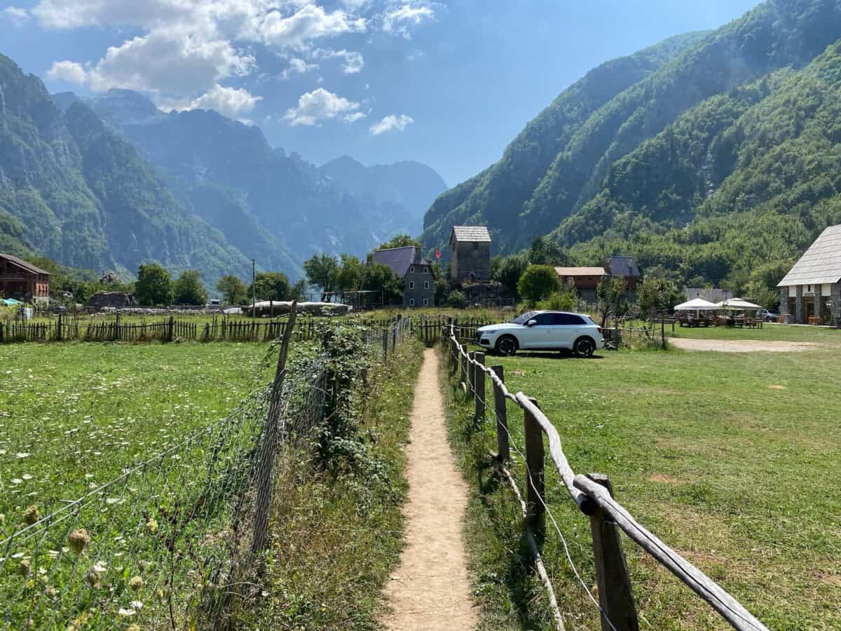
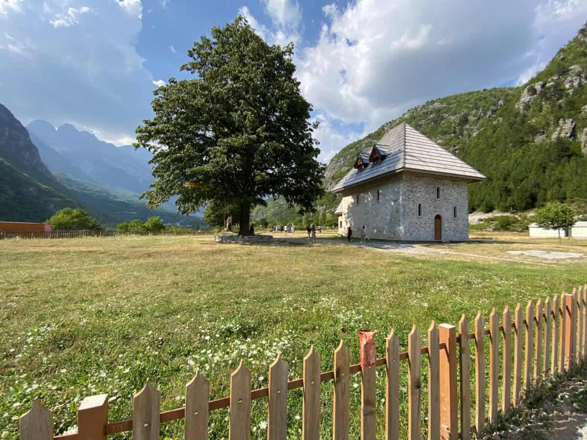
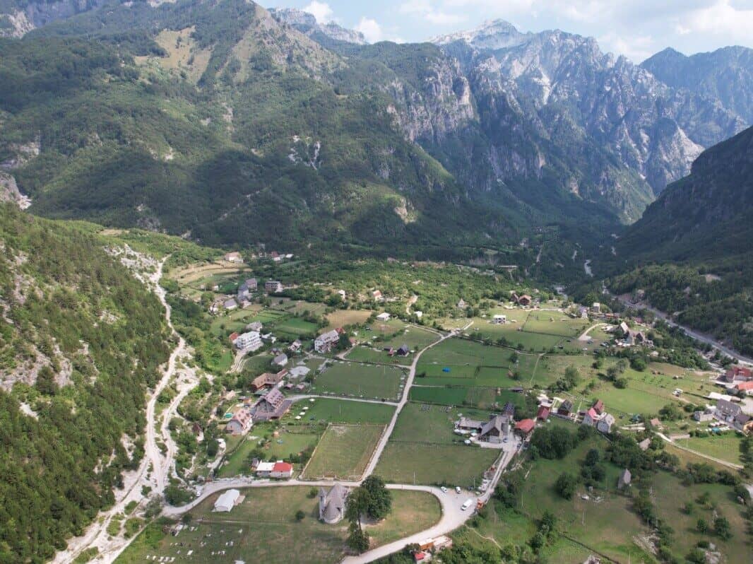
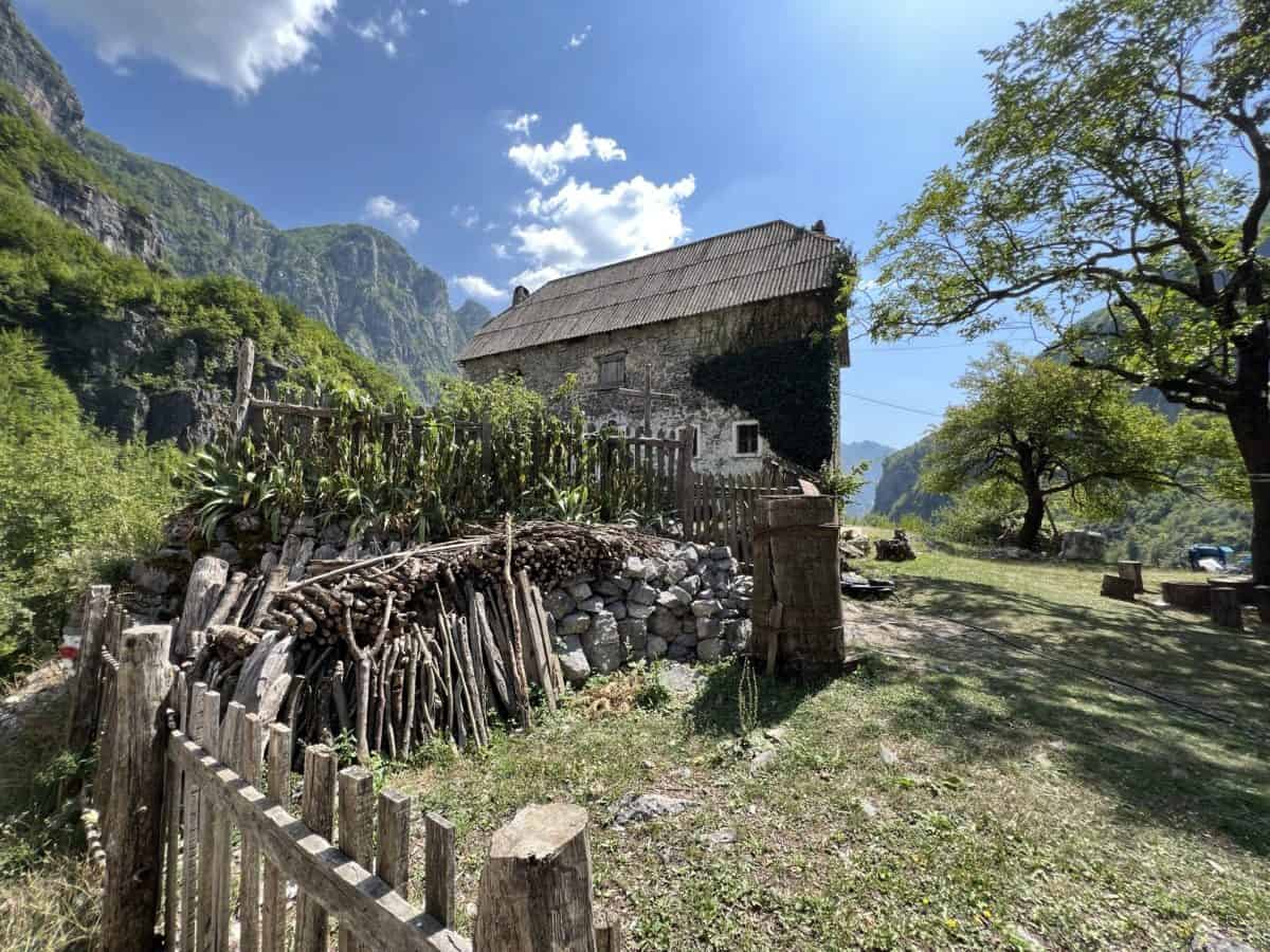
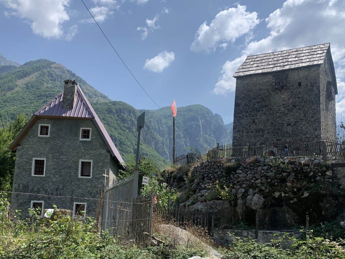
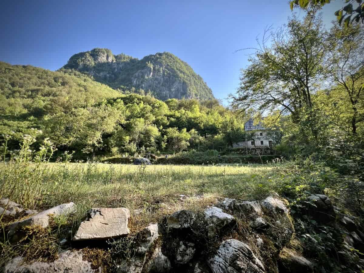
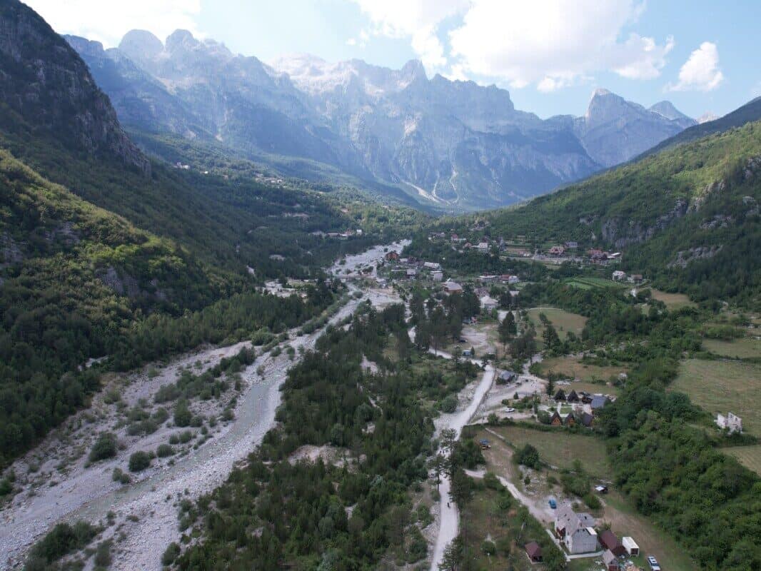
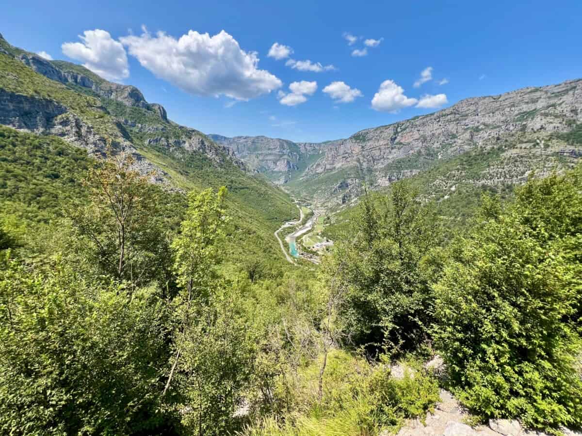
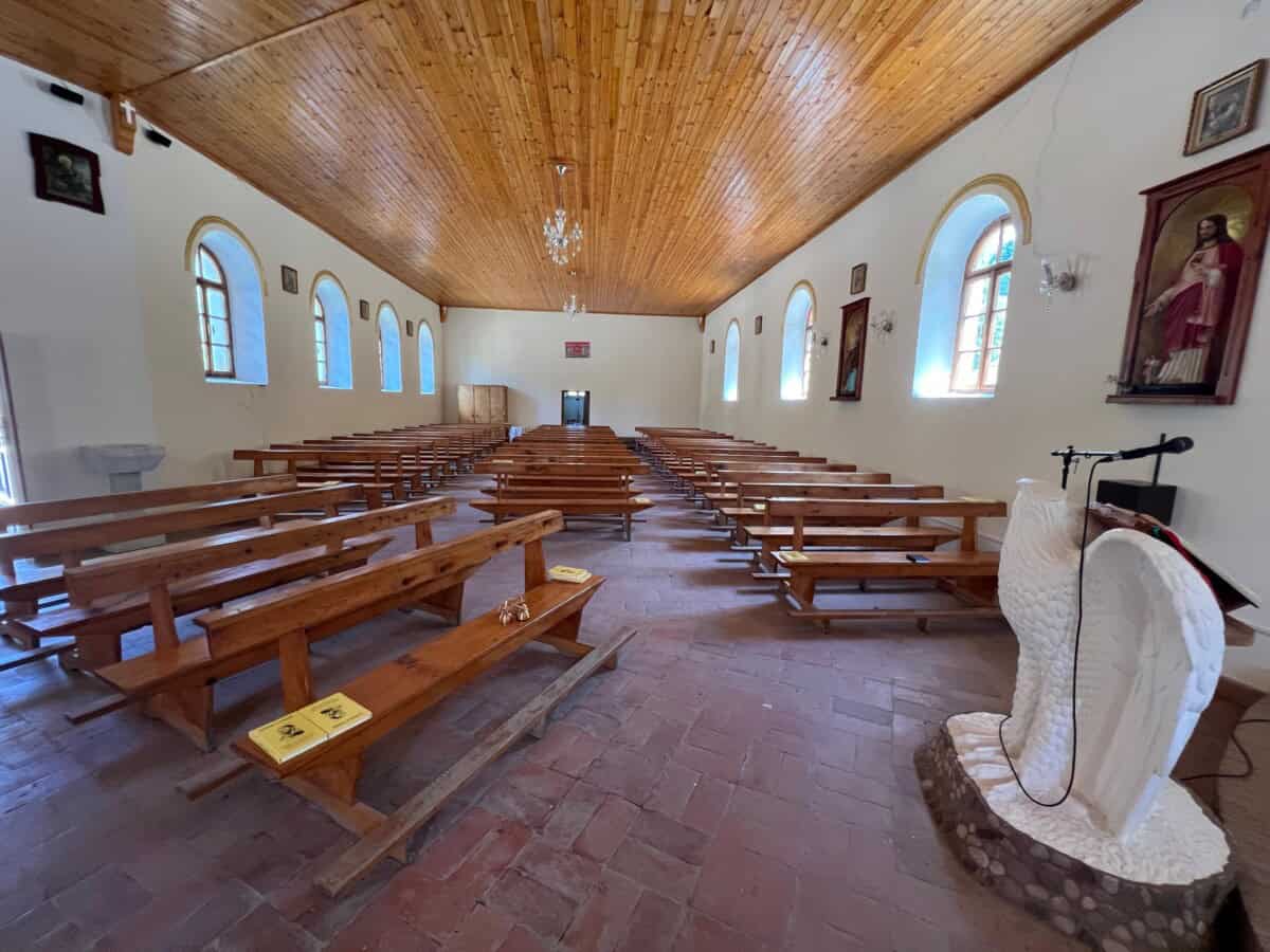
Mountain village Theth
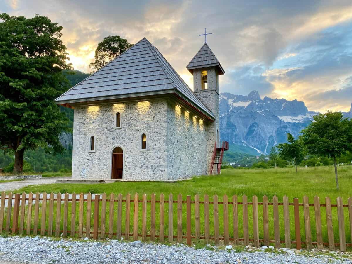
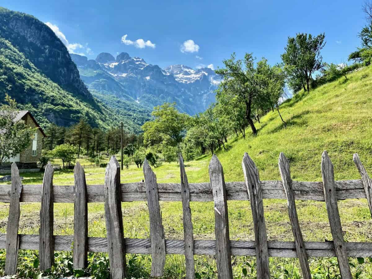
Theth is a picturesque mountain village in northern Albania, known for its traditional stone houses and cultural heritage. The village is surrounded by the peaks of the Albanian Alps. Visitors are attracted not only by the mountains themselves, but also by the iconic Franciscan church, built in 1892. You will also find here the so-called kulu (tower), into which victims of blood revenge would hide. You can learn more about it from a guide and witness rolled into one.
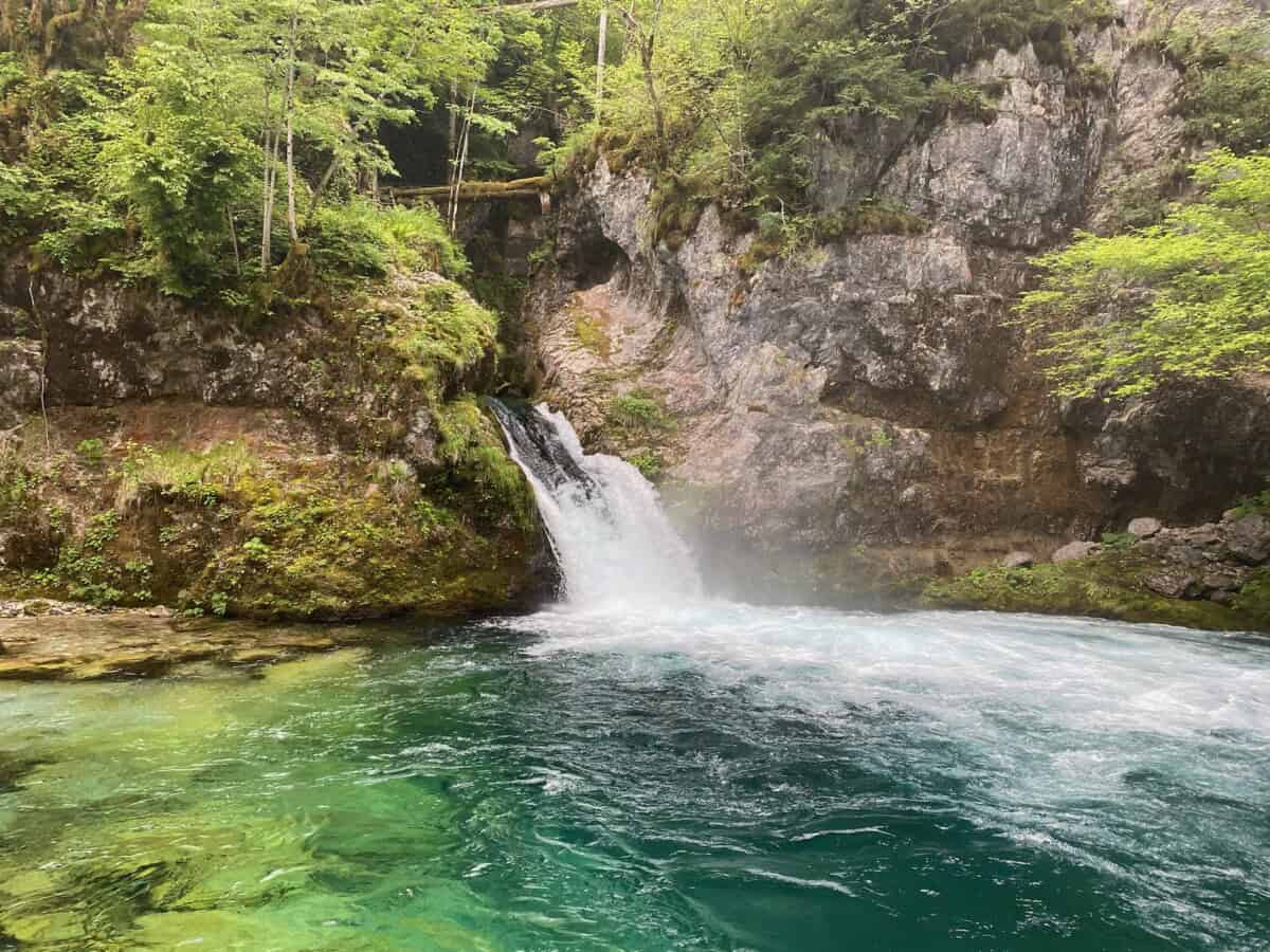
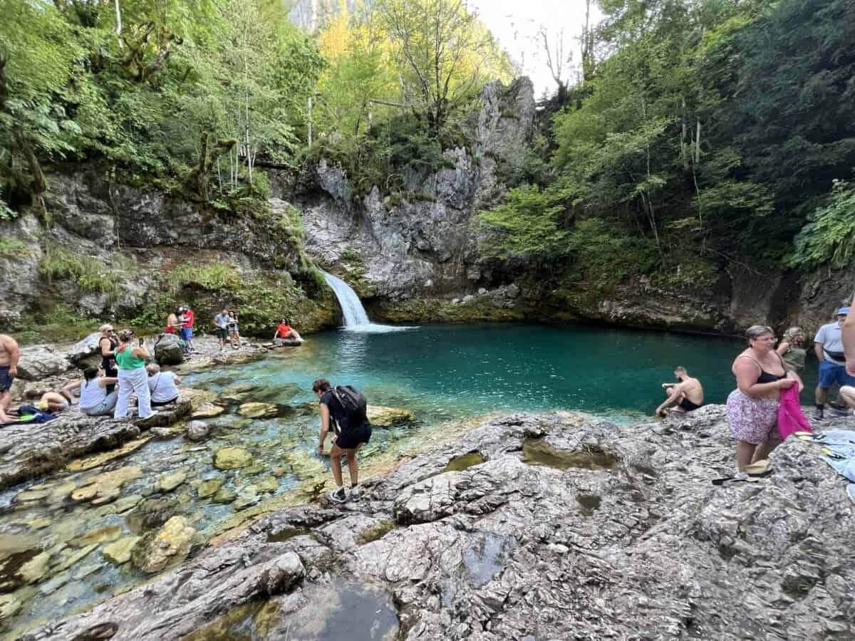
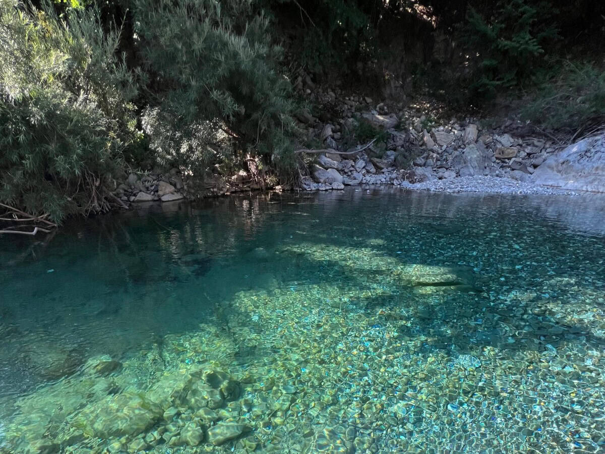
One of the most attractive hiking trails leads from Theth to the Blue Eye via the impressive Grunas waterfall. The water of the Blue Eye is crystal clear and offers pleasant cooling in the summer months.
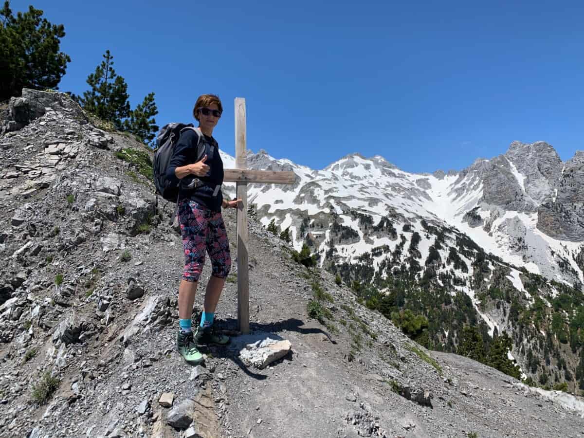
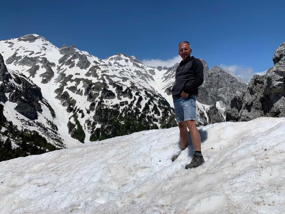
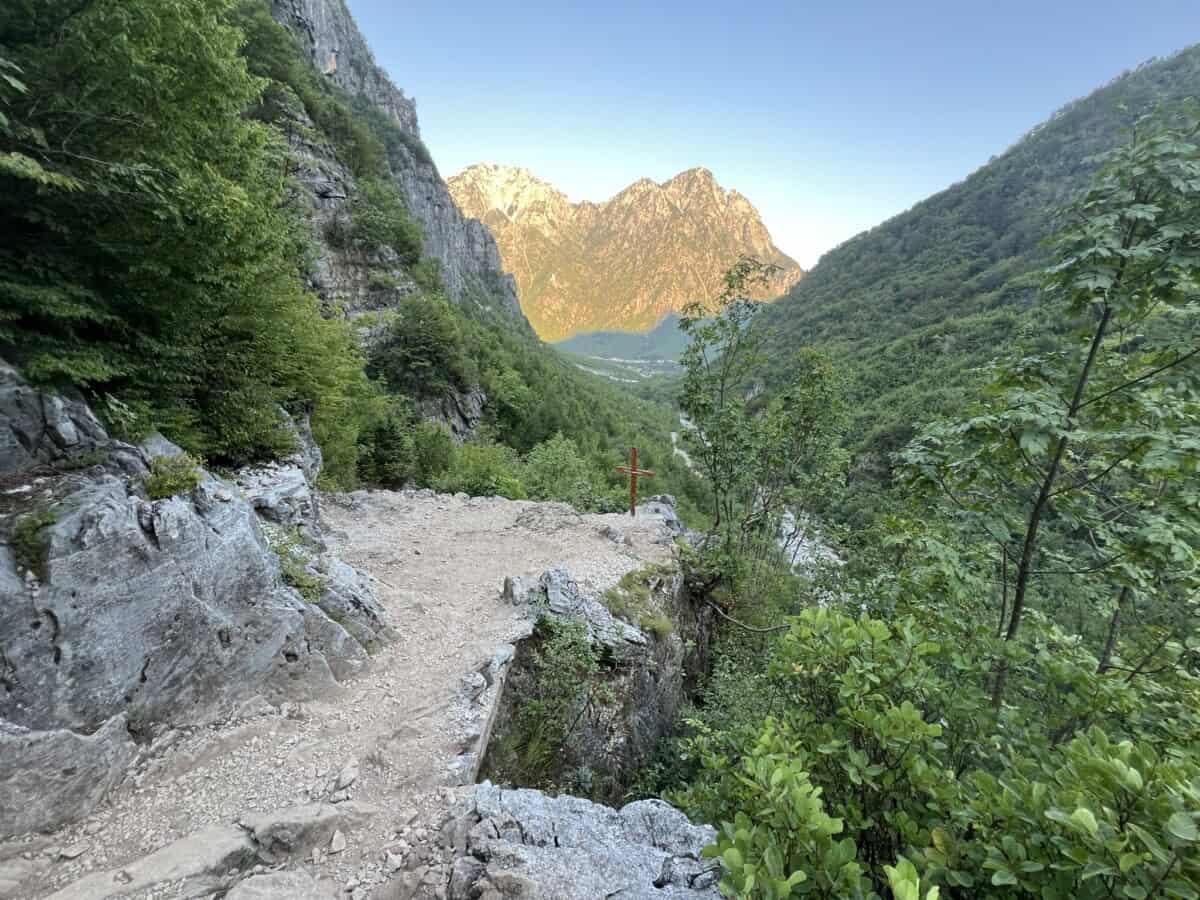
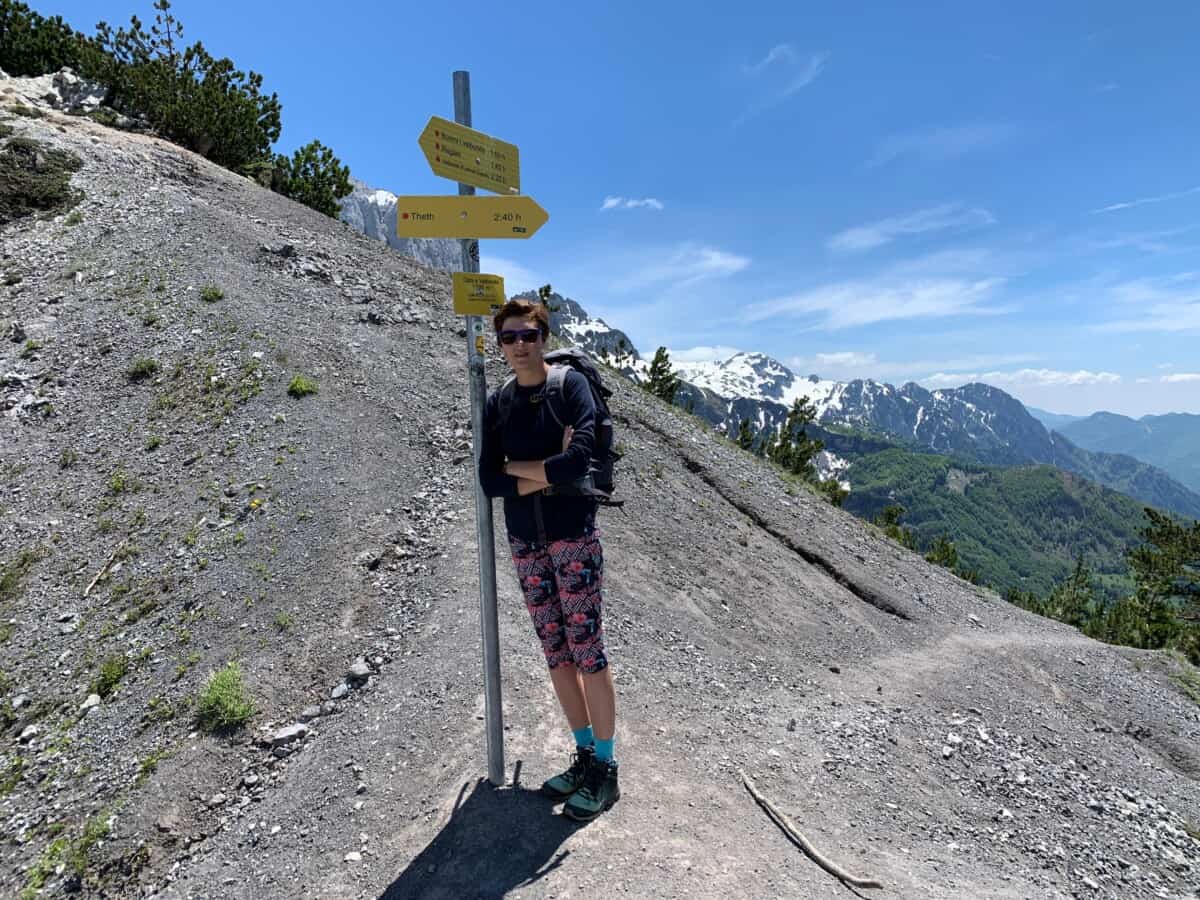
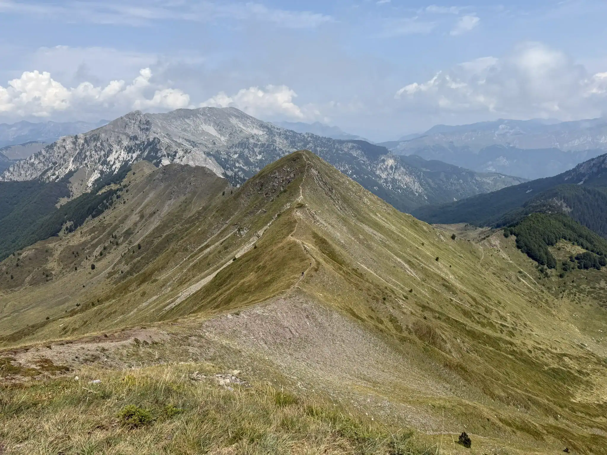
Another frequent destination for visitors to the village of Theth is Valbonë. The trek from Theth to Valbonë leads over the Valbonë Pass. The route is somewhat more challenging, but can be managed by at least a moderately fit hiker. However, prepare yourself for a route of about 15 km in total with an elevation gain of around 1100m, which will take you about 8 hours round trip.
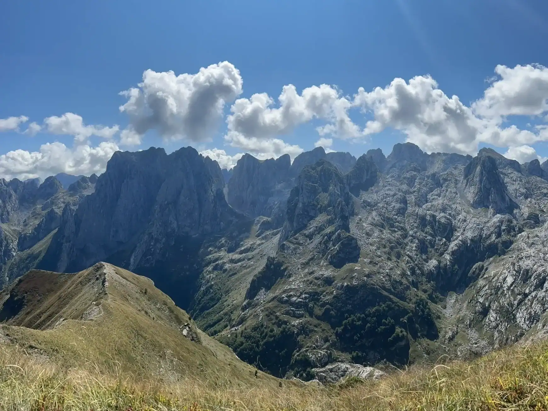
The result of the hike is absolutely amazing views of the entire Cursed Mountains. Given the altitude of the pass (1795 m), it is advisable to monitor current weather conditions to ensure safety and comfort. Proper footwear is essential, and a sufficient supply of drinking water in summer is a must.
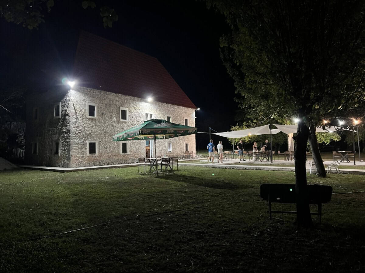
Theth is, thanks to the road from 2022, closer than ever before. There are many wonderful accommodation options here that have retained an authentic atmosphere while adding modern comfort – check out the current selection on Booking.
Více o pohoří
The Cursed Mountains got their name allegedly according to a legend that tells of three brothers who set out to hunt in the mountains and there met a fairy. All three immediately fell in love with the fairy and began to argue over who would have her. The argument escalated and a merciless fight to the death broke out between the brothers.
After the merciless battle, three lifeless bodies lay on the battlefield. The fairy watched everything, and when she saw that all three brothers had perished, she fled and hid behind the mountain peaks. Days passed and the mother of the young men began to worry about her sons. She decided to go and look for them. After a long journey, she found their lifeless bodies and wept bitterly. She cried and wailed louder and louder. Her weeping echoed off the rocks and filled the entire mountain range.
The fairy heard the mother’s weeping. She emerged from her hiding place and went to the mother to comfort her and describe what had happened and why her sons had died. The mother listened to the fairy, but immediately accused her of the death of her children. She cursed the fairy and with her the entire mountain range. Since then, the mountains have been called the Cursed Mountains.
Praktické
Arrival in Theth has been without major complications since 2022. A new asphalt road was built here, which is passable by any car. In winter months, despite frequent maintenance, it may become impassable. It is better to check the condition with locals right at the turnoff from the main Skadar road HERE. Albanians will definitely help you even at the cost of calling one of their cousins in Theth.
Snow chains are necessary in winter. There are several parking spaces in Theth, so follow the signs that will lead you to one of the parking areas. The first large parking zone you will encounter is immediately upon arrival in Theth on the left near the Jezerca restaurant HERE.
When hiking into the hills, be aware that you are moving in high mountains where the weather can change quickly. Be well equipped and do not overestimate your strength.
Mapa
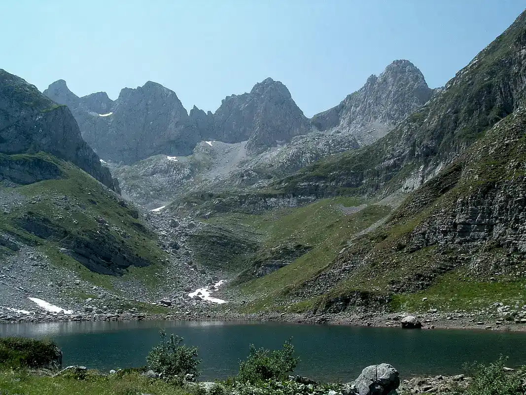
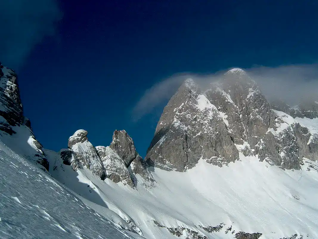
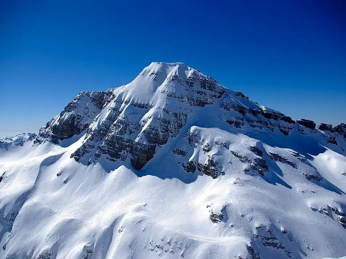
Vrchol Maja e Jezercës
Více o Maja e Jezercës
You can also climb to the summit from the north, with the starting point being the settlement Vusanje in Montenegro. The summit offers magnificent views of the surrounding mountains and, in good weather, also of the Adriatic.
Regarding climbing options, it is also possible to combine the starting point and destination of the ascent. One option is to start on the Albanian side and descend via Buni Jezerces towards Vusanje or vice versa. However, for such a combination you will need a border permit, which you can obtain at the police station. During the trek, you will cross the state border HERE.
The toponym Jezerca comes from the Slavic word “jezero,” which refers to a collection of six picturesque lakes that lie hidden at the foot of the summit and form Buni Jezerce, the Great Valley of Lakes. During communist rule, the summit was named Maja e Rinisë (literally “Mountain of Youth”). However, this name never caught on.
The first people to climb the summit and leave visible traces were Italian surveyors in 1929.
Praktické
The best time to climb is from June to September. In summer, the ascent is safer. In winter it becomes more complicated due to snow and avalanches. The time required for the mentioned routes varies and it is necessary to study it in advance, for example on the Wikiloc application. Between June and August, the length of daylight ranges from 13 to 15 hours. Given that the shortest route requires at least 10 hours, start early enough to finish the hike before the sun sets below the horizon.
Longer routes must be spread over two days including a bivouac in the mountains. In any case, do not underestimate your equipment and do not overestimate your strength. When climbing to the summit, keep in mind that you have enough strength for the return journey. The elevation you must overcome ranges between 1800 to 2100 m.
Mapa
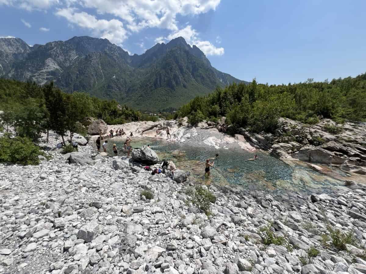
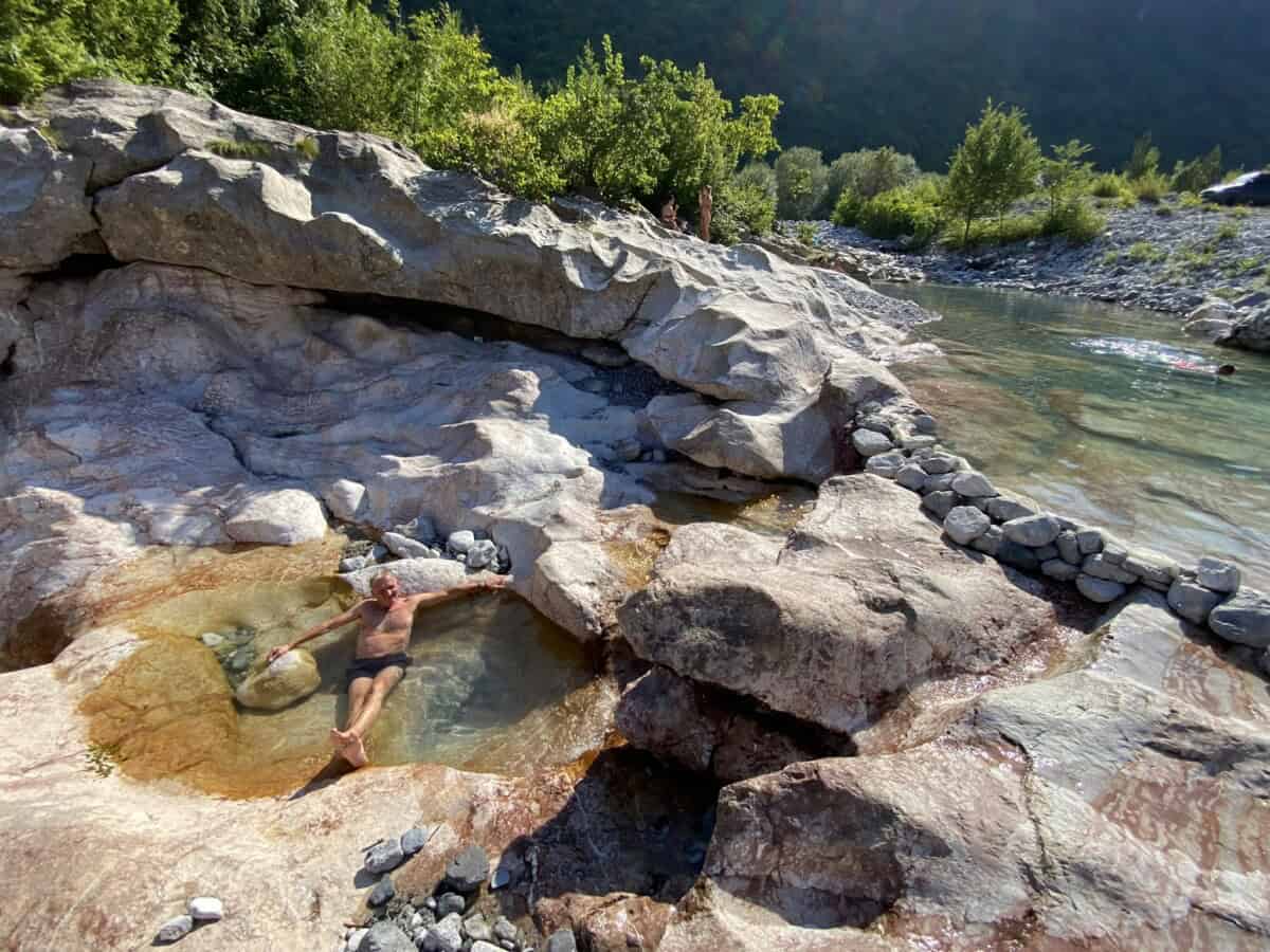
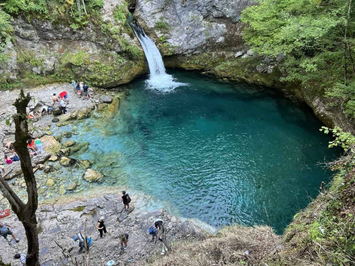
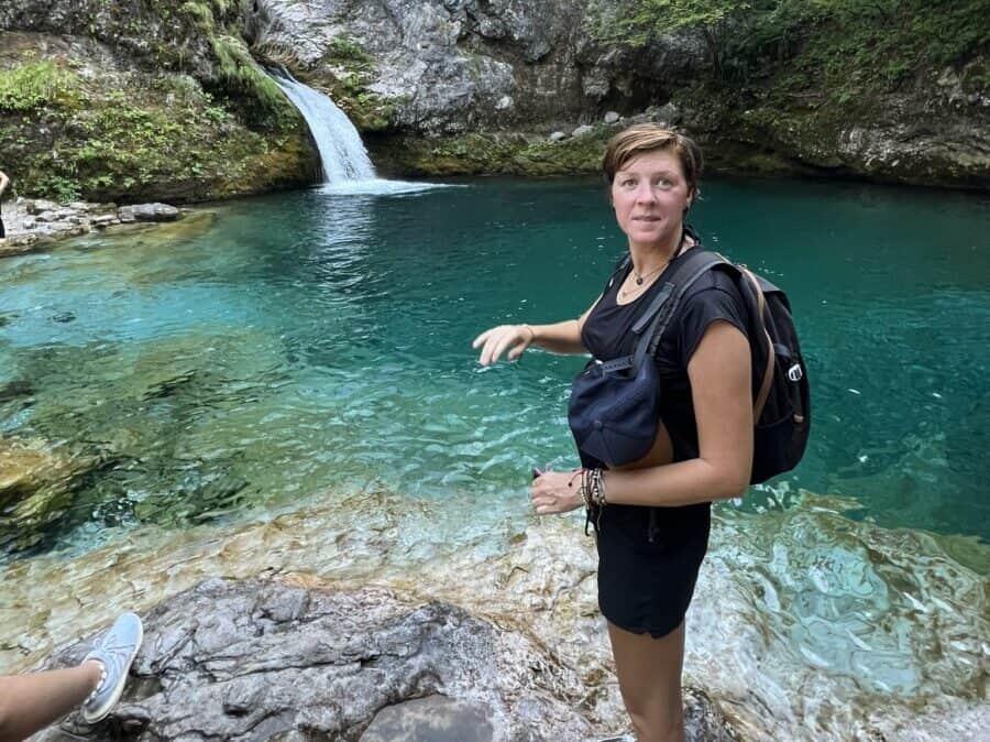
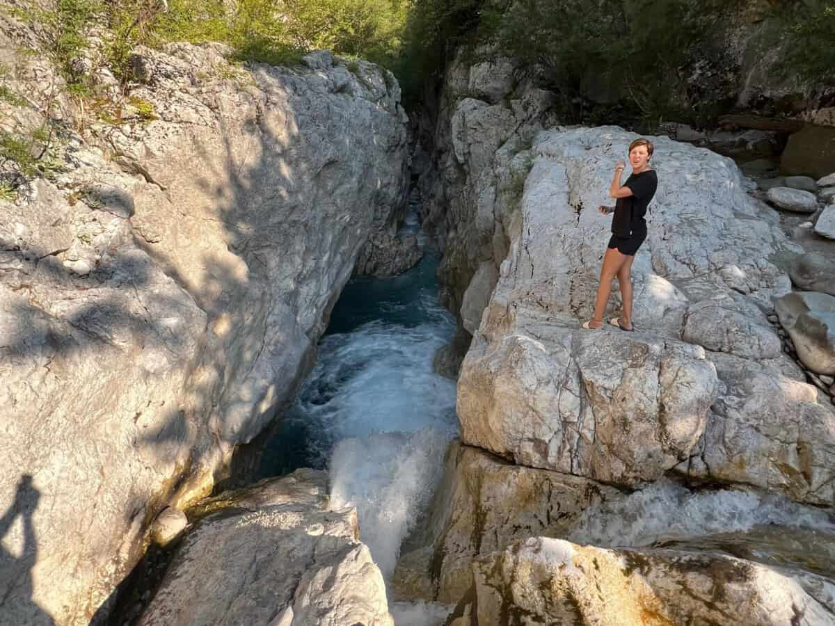
Pramen Blue Eye
Více o Blue Eye
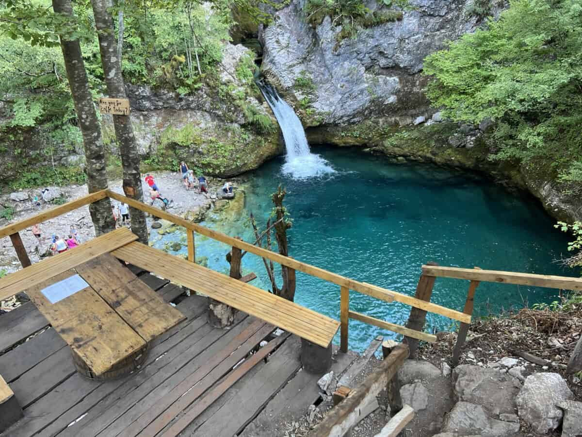
The path to Blue Eye starts at the edge of the village of Nderlysaj and takes approximately one hour of walking. The trail leads through a picturesque valley, along river cascades and rocky sections and is suitable for most tourists. You can enjoy refreshments before the hike to Blue Eye at a restaurant a short distance from the parking lot in Nderlysaj. A little further on, you can enjoy a refreshing relaxation in the Black River (Lumi i Zi), which flows through the valley towards Blue Eye.
Be sure to allow plenty of time for a visit to Blue Eye and expect higher visitor numbers during the season. If you want to enjoy the natural phenomenon with more privacy, visit Theta outside the main tourist season, ideally in May-June or in September.
Praktické
The most attractive route from Theth to Blue Eye leads via the Grunas waterfall. The total route Theth – Grunas waterfall – Blue Eye – Theth is approximately 22 km and takes a complete 7-8 hours of leisurely walking. However, there is also another hiking option that bypasses Grunas. It runs by road from Theth to Nderlysaj along the second bank of the Theth river. However, you won’t save much time and you’ll miss out on the waterfall. This originally dusty road was reconstructed in 2022, so you can now reach Nderlysaj by car as well. From there it’s about three kilometers to Blue Eye. Missing the walk around the Grunas waterfall is really a shame.
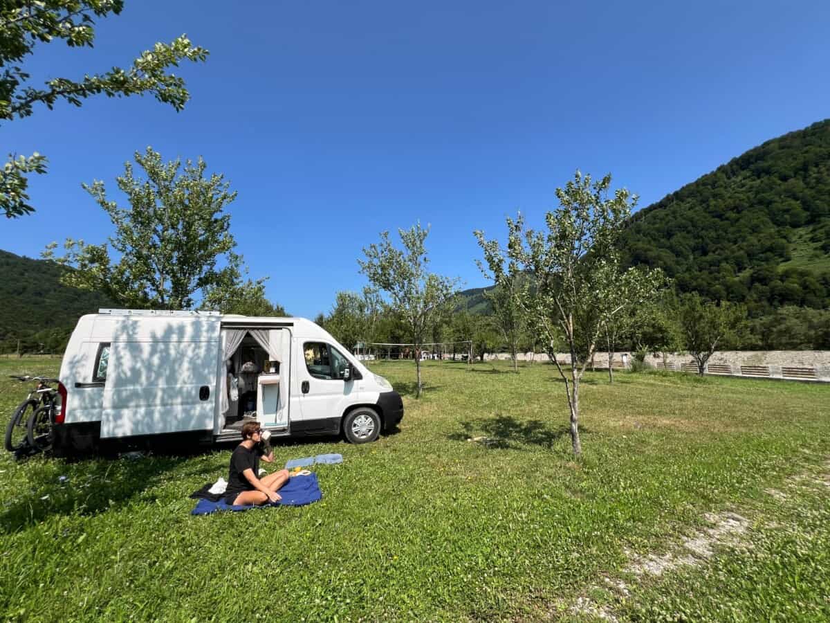
However, you can choose a compromise version of the trip. From Theth, take a car ride to the parking lot at Nderlysaj and from there walk 3.5 km to Blue Eye and return to Theth by about 11 km via the Grunas waterfall. The parking lot in Nderlysaj is HERE. If you want to camp in a tent or campervan near Blue Eye, we recommend the family campsite HERE.
Mapa
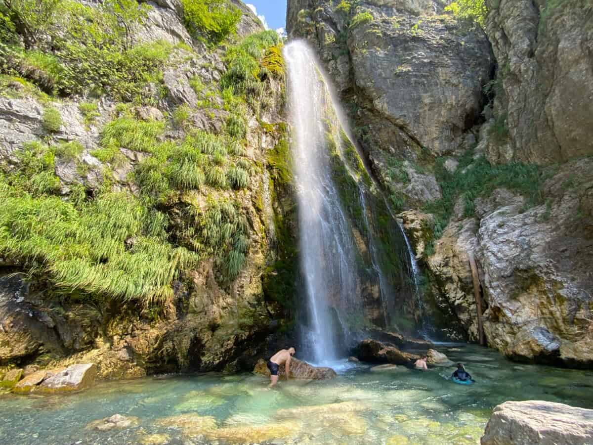
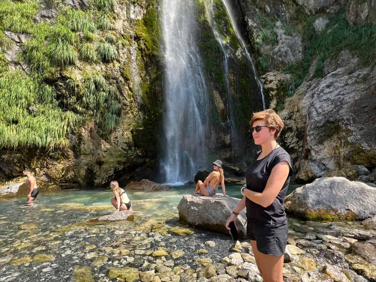
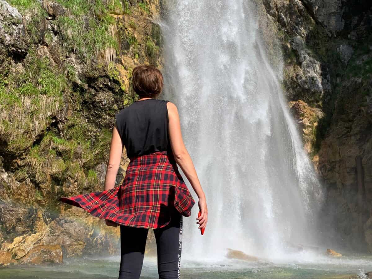
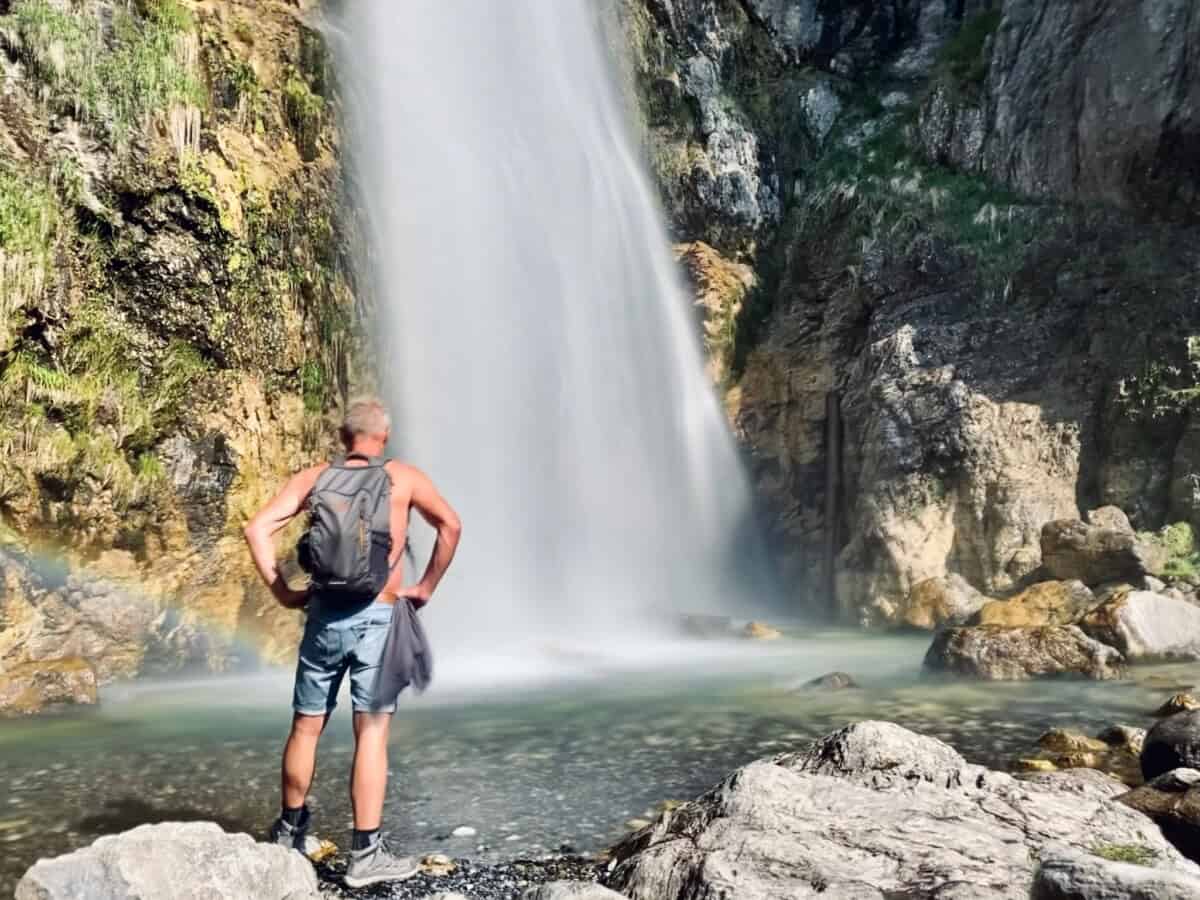
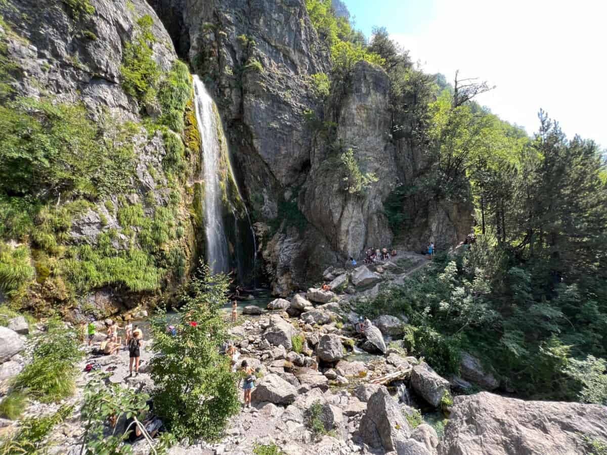
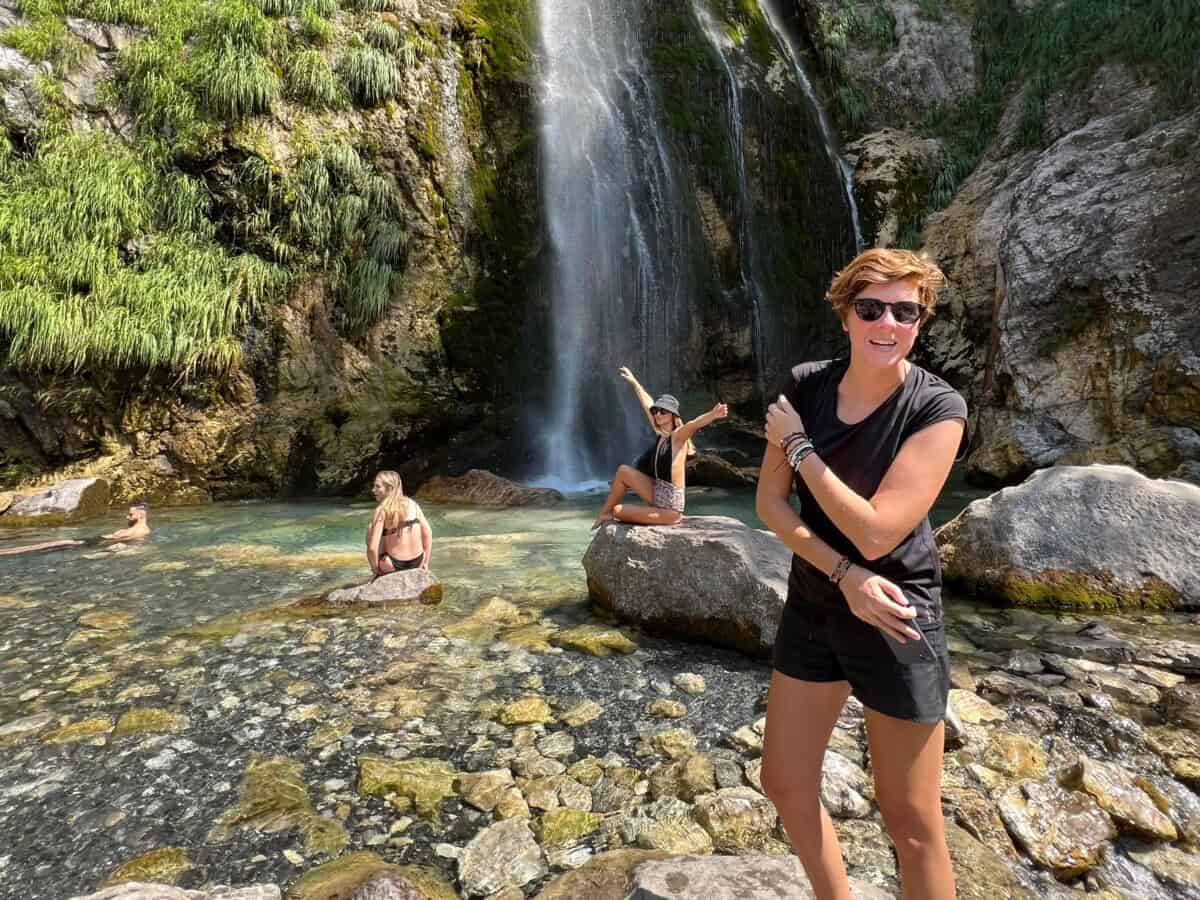
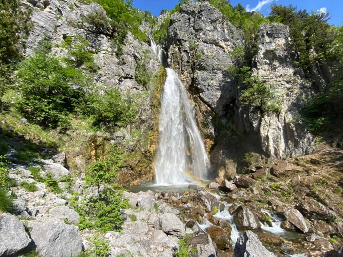
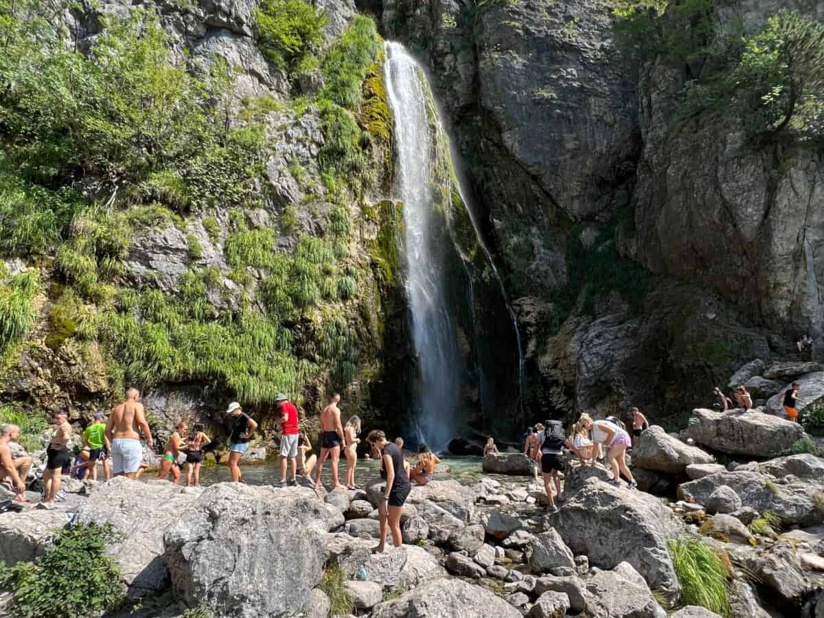
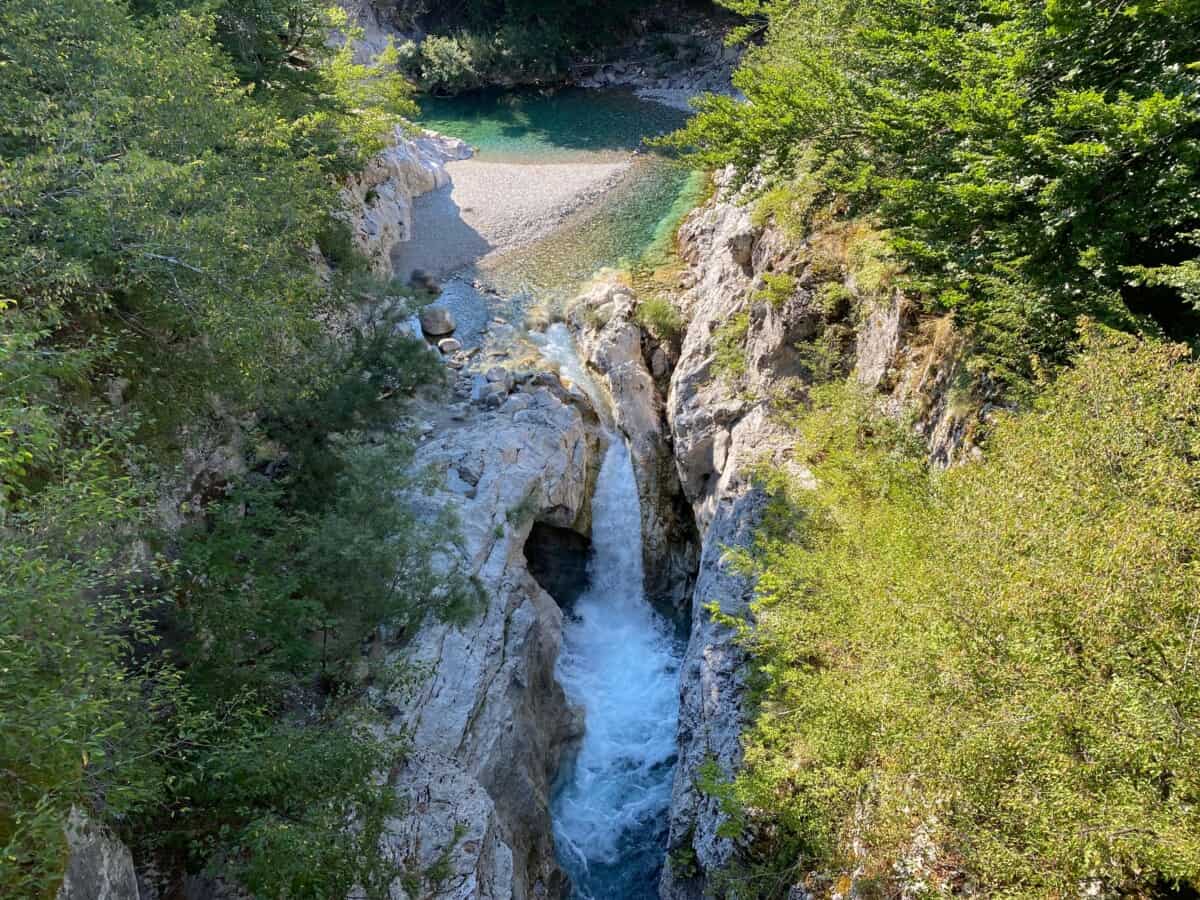
Waterfall Grunas
Více o vodopádu
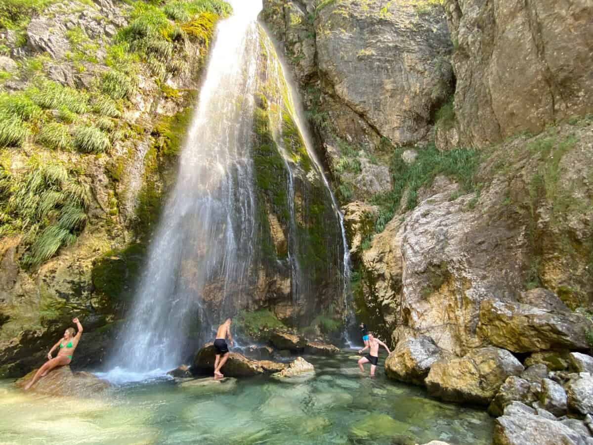
If you plan to visit the mountain village of Theth, be sure to plan a trip to the waterfall. The direct variant of the Theth-Grunas-Theth trek is suitable for families with children, so you don’t need to worry that you won’t be able to handle the trip.
In the first half of the trail between Theth and the waterfall, you will come across a mountain cafe and guesthouse Kunora e Grunasit, so you can count on possible refreshments along the way. If you enjoy longer treks, you will appreciate the popular Theth – Grunas waterfall – Blue Eye – Theth route. This combination of destinations is ideal for a full-day, but relatively undemanding, hike through the Theth valley.
Praktické
The last 15 minutes of the path leading to the waterfall is somewhat steep and rocks can be slippery, so be careful! We recommend wearing hiking boots. Sandals are not the best choice.
Mapa
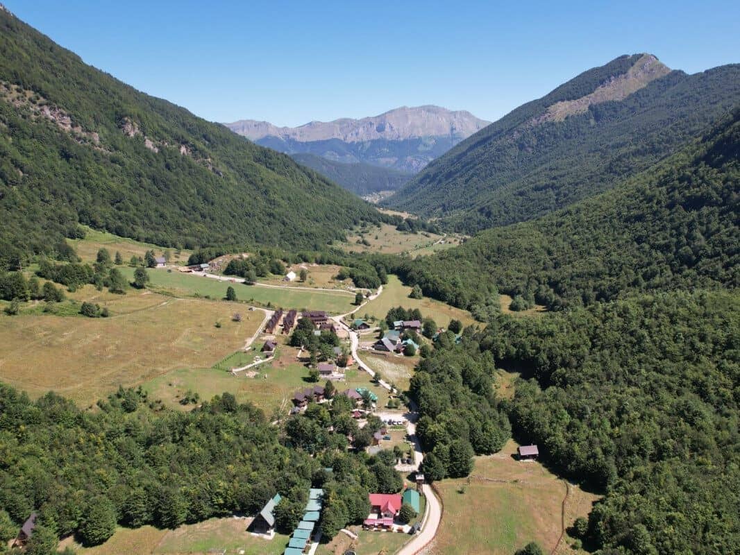
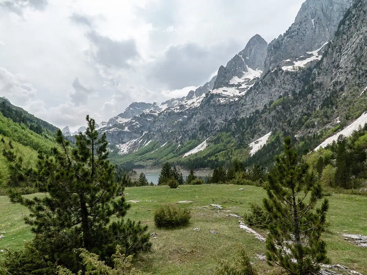
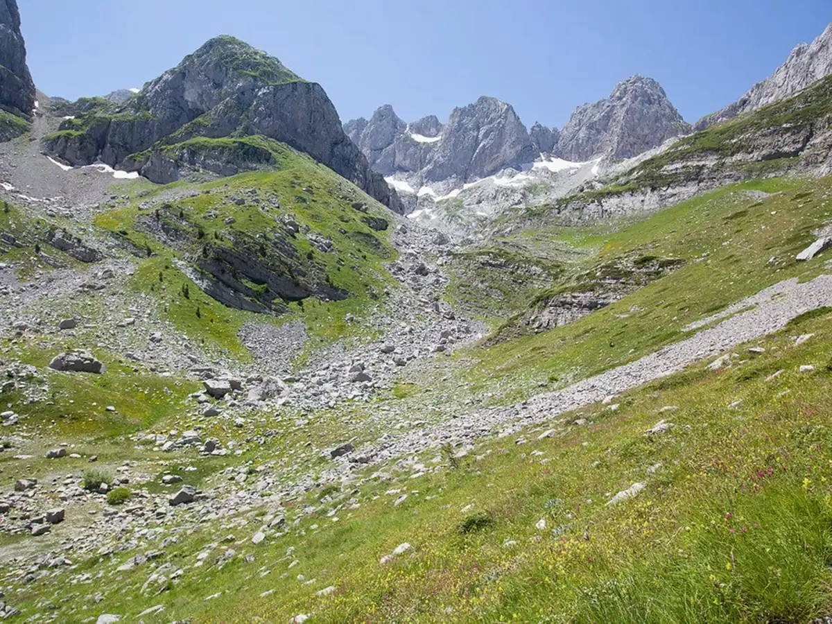
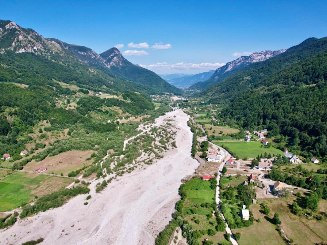
Vesnice Vermosh
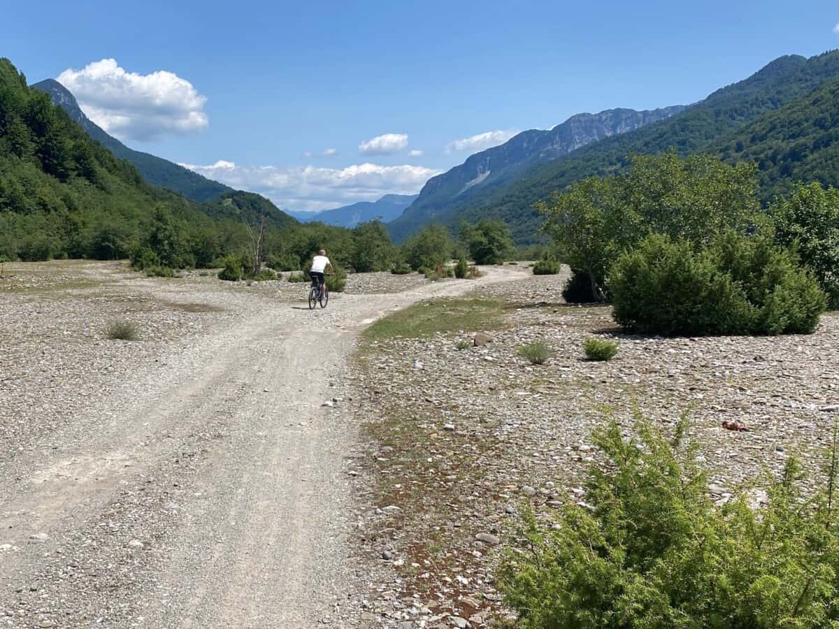
Vermosh is part of Bjeshkët e Namuna (“Cursed Mountains”) or the Albanian Alps. The village is located at an altitude of 1100 m and is part of the Kelmendi region and the Vermosh-Lepushë valley, in whose surroundings there are 45 peaks over 2,000 meters high. The main activities you can pursue in Vermosh are logically mountain tourism and mountaineering. Also attractive are ordinary walks through the valley, trout fishing or mountain biking trips.
The Vermosh river flows through the valley. In the village Vermosh you will find plenty of accommodation capacity in mountain buildings and traditional Albanian restaurants are of course also common. The icon of the municipality is the Catholic church Shën Gjon Pagëzori. You can certainly cool off in a lake above the canyon Kanioni i Bashkimit, which is located on the road leading to Montenegro.
Více o Vermosh
Every year, on the second Saturday in August, one of the most important cultural events in Albania takes place near Kousek od Vermoshe, in the Predelec pass, the mountain festival “Logu i Bjeshkëve”. This event is of great importance for the promotion of culture and the preservation of the ethnographic heritage of Albanian highlanders. It also includes a beauty contest Miss of the Mountains. Its winner is nominated for Miss Universe on behalf of Albania. The event is also connected with the sale of local products.
An interesting fact from relatively recent history is that after the post-war rise of communism in 1946, a large part of the local population fled to the USA, specifically to Detroit, where many Vermosh families still live today. After that, the chance to escape was very small. Enver Hoxha closed the borders almost hermetically. When he died in 1985, many people attempted to flee the country to Montenegro. However, most of them were caught.
A significant event was the case of a 17-year-old boy who attempted to cross the border into Yugoslavia via Hani i Hotit, but was caught by Albanian border guards, tied to a truck and dragged across the Skadar. In the same year, a group of people from Bajzë attempted to cross the green border in Vermosh, but were also caught by Albanian border guards and their bodies were, as a warning, dragged through the village of Kelmend and then across the Skadar.
Praktické
The standard approach to the Vermosh-Lepushë valley is a 100-kilometer asphalt road from the city of Shkodër. The journey takes about two hours by car. One of the hiking destinations is the waterfall Ujëvara e Gjanve, which is located roughly in the middle of the valley. Another, more demanding, but manageable, destination is the peak Maja e Vajushës also known as Talianka.
The route is generally considered moderately difficult and can be completed in a total time of up to 5 hours there and back. Part of the approximately eight-kilometer trip includes a steep climb with an elevation gain of 800m. The incredible views of the surrounding peaks are definitely worth it. However, the starting point is not Vermosh, but rather a turnoff at the hotel Bjeshket E Nemura in the nearby settlement of Lepushë.
Mapa


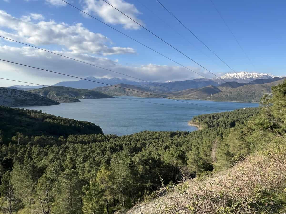
Jezero Komani
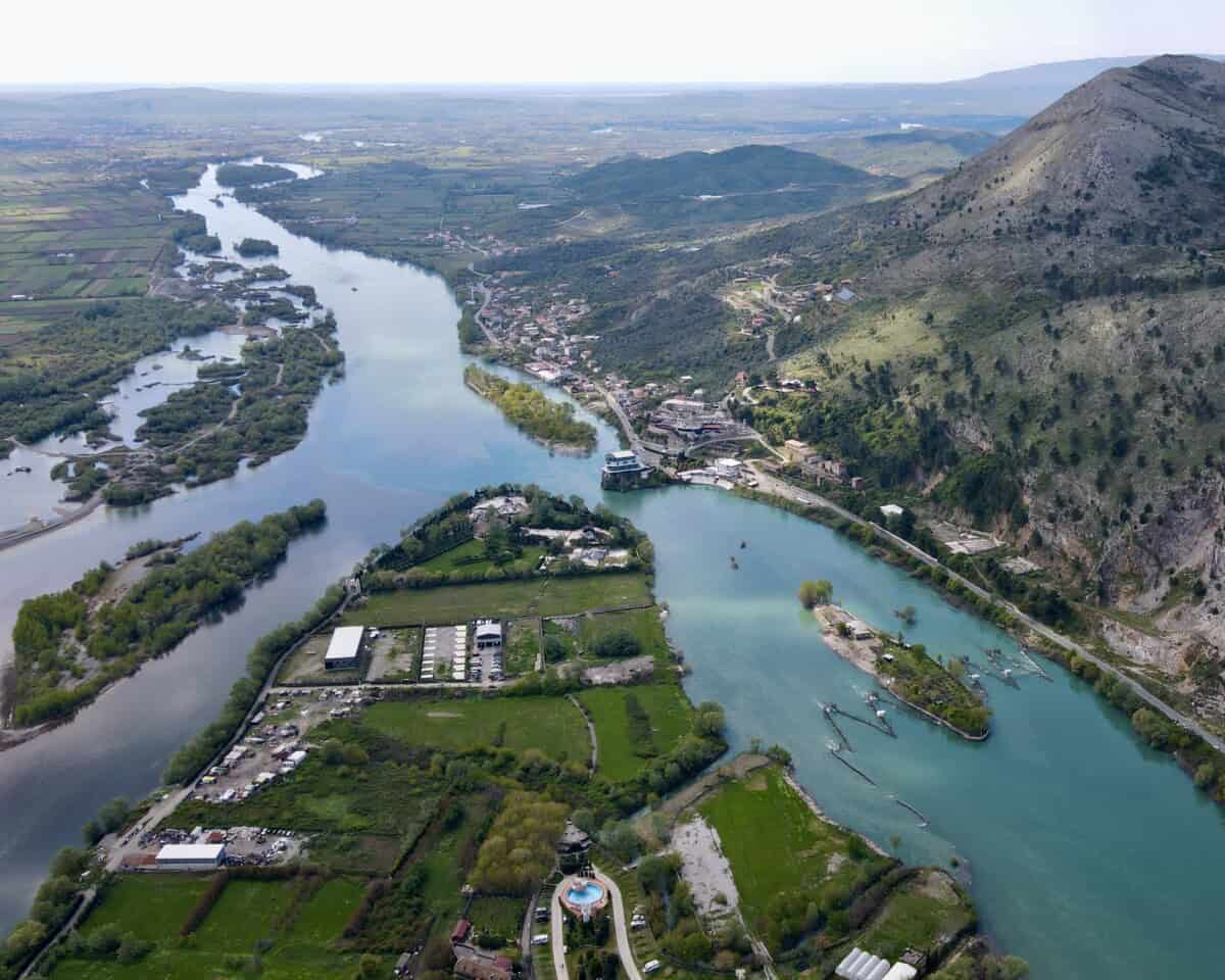
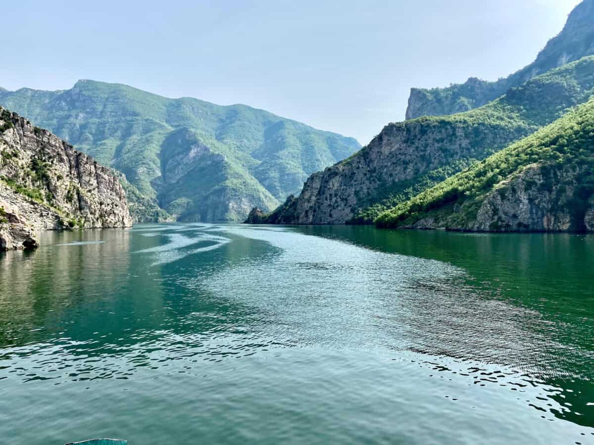
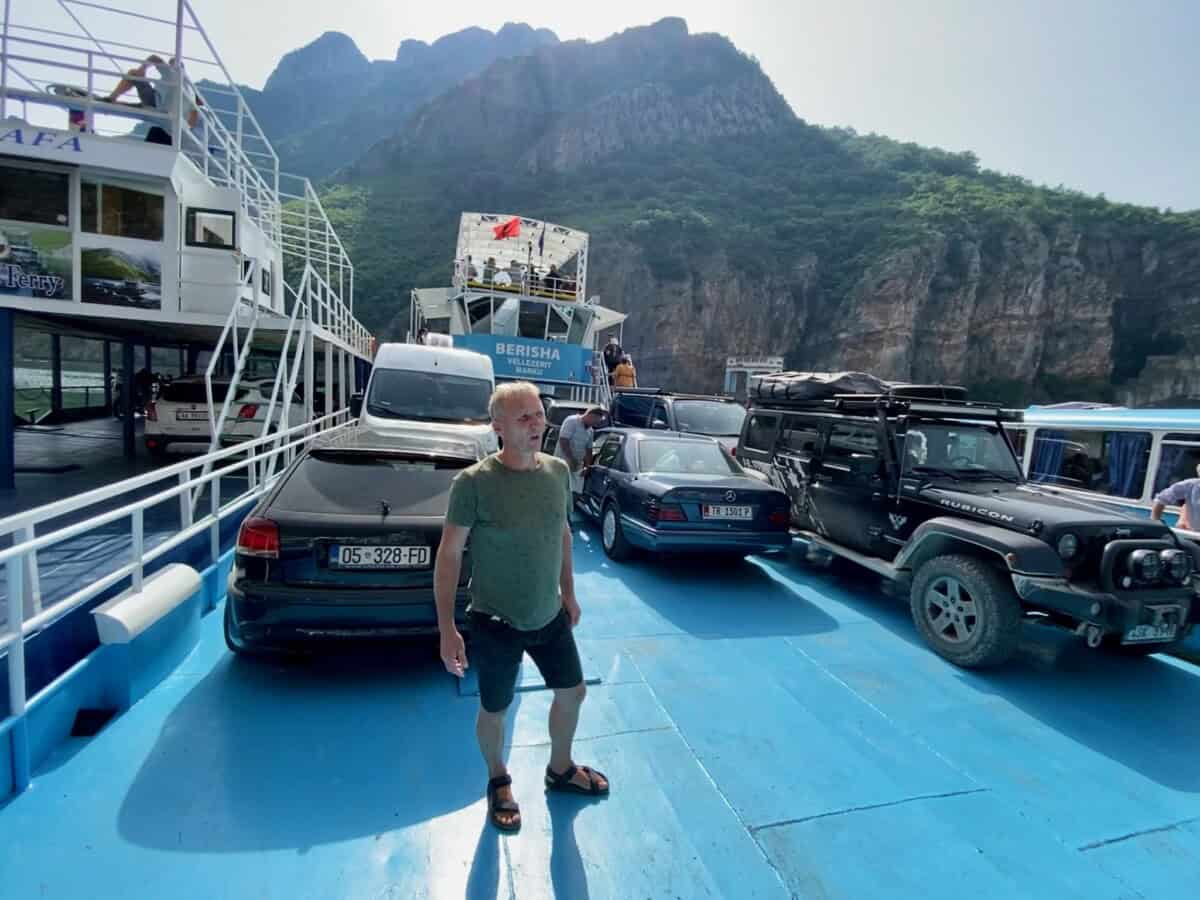
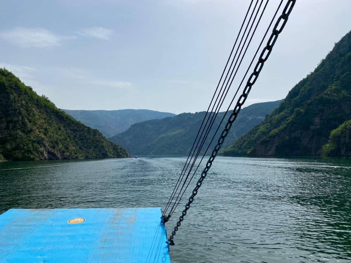
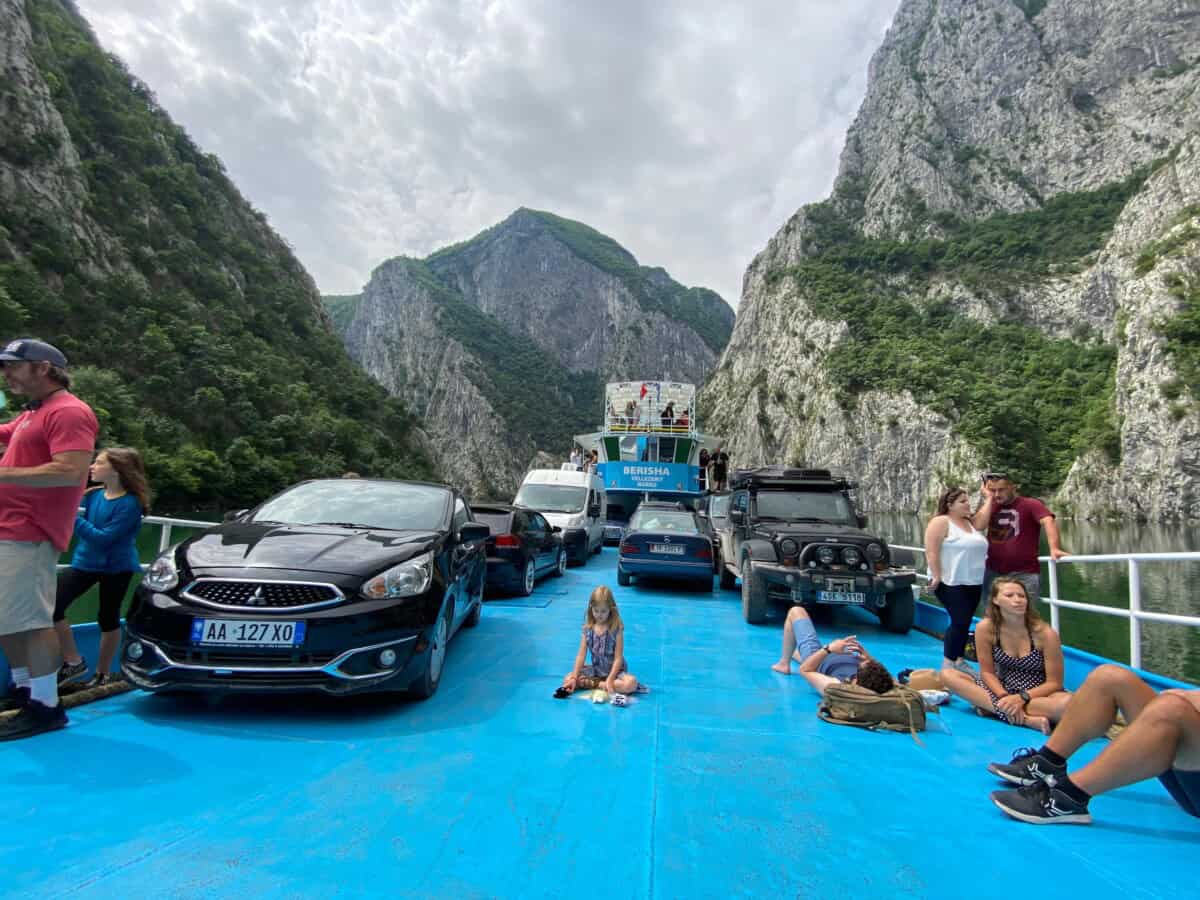
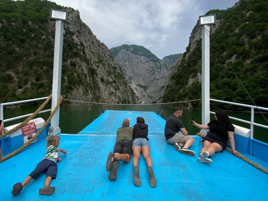
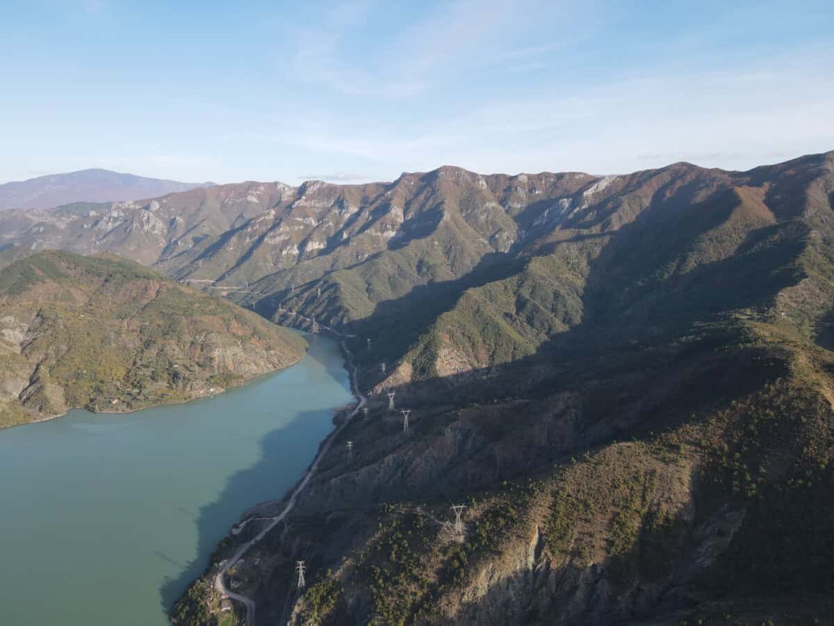
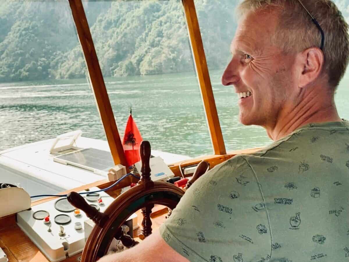
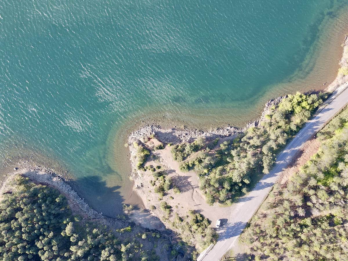
Lake Koman, or also Komani lake, is an artificial lake located in the northern part of Albania. It was created by building a dam on the Drin river near the village of Koman in the second half of the 20th century, specifically between 1979 and 1988. Besides the Drin, it is fed by the Shala and Valbona rivers. It covers an area of 34 km². During a three-hour ferry ride on Lake Komani, you can admire breathtaking scenery with wild mountains and steep rocky cliffs.
A cruise on Komani lake is considered one of the most beautiful water routes in the world, and is often compared to sailing through Norwegian fjords. The lake and its surroundings are a popular destination for tourists interested in outdoor activities such as hiking, mountaineering, or canoeing.
Více o Komani lake
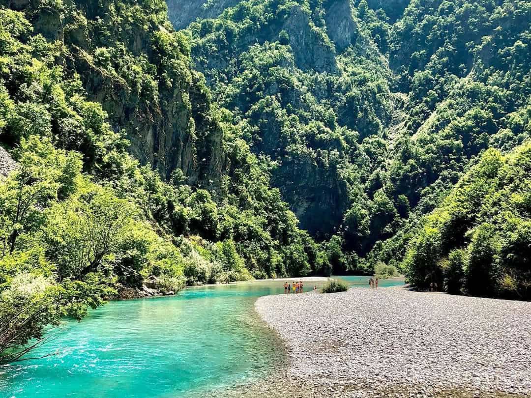
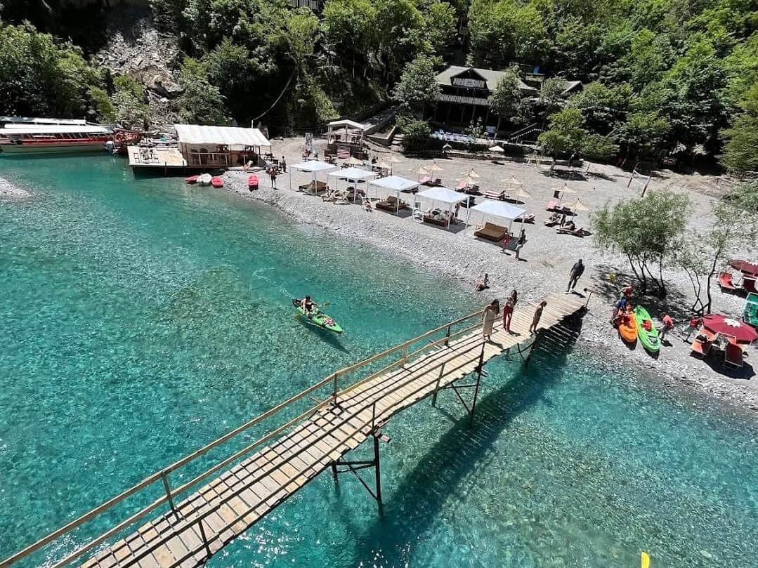
A frequently visited attraction is also the Shala River (Lumi i Shalës). The Shala River flows through a narrow canyon and a few kilometers from where it flows into Lake Komani, it offers visitors magical pebble beaches.
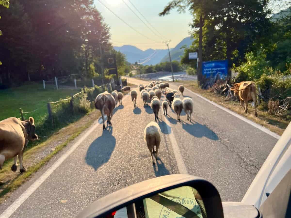
Participants on a cruise on Komani Lake are very often surprised by plastic islands that they encounter during their voyage. These are waste materials that reach the lake from the mountains through tributary streams and rivers. The owner of one of the ferries – and our friend – once explained to us how mountain residents, who are still uneducated in environmental matters, dump waste into rivers, thus solving their waste disposal problem. Somehow it doesn’t occur to them that the waste has to go somewhere. In this case, their path is blocked by a dam, which ferry company owners and volunteers constantly clean. However, some rivers have no dam, so the waste ends up in the sea. In recent years, the Albanian government has been adopting uncompromising legal measures to clean up Albania and allow its beauty to shine in full.
Praktické
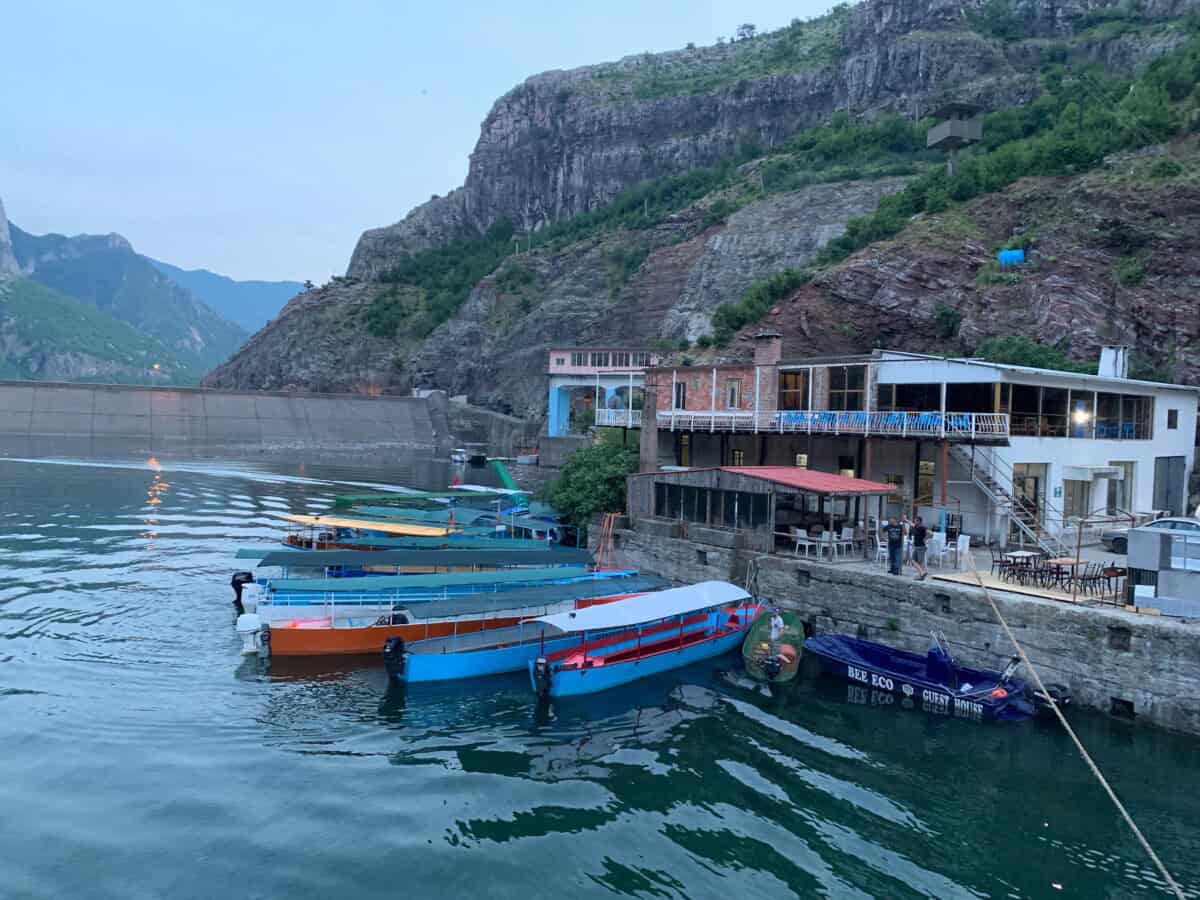
To Komani lake dam, you can get by car or bus from the city of Shkodër. In 2025-26, the access road was reconstructed, so you no longer need to worry about your car. Sailing across the lake by ferry is a great experience and also a practical way to get to the Tropojë region and further for example to Valbonë. To the Shala river beaches – also from the dam – private companies will take you in small boats, for example the company Guri.
You can buy a ferry ticket directly at the departure dock. In season, however, it can get crowded, so it’s better to book your seat for example HERE. Trip options from Shkodër or Durrës to Komani lake and Shala river are offered for example HERE.
Mapa
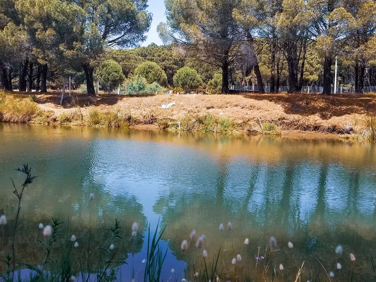
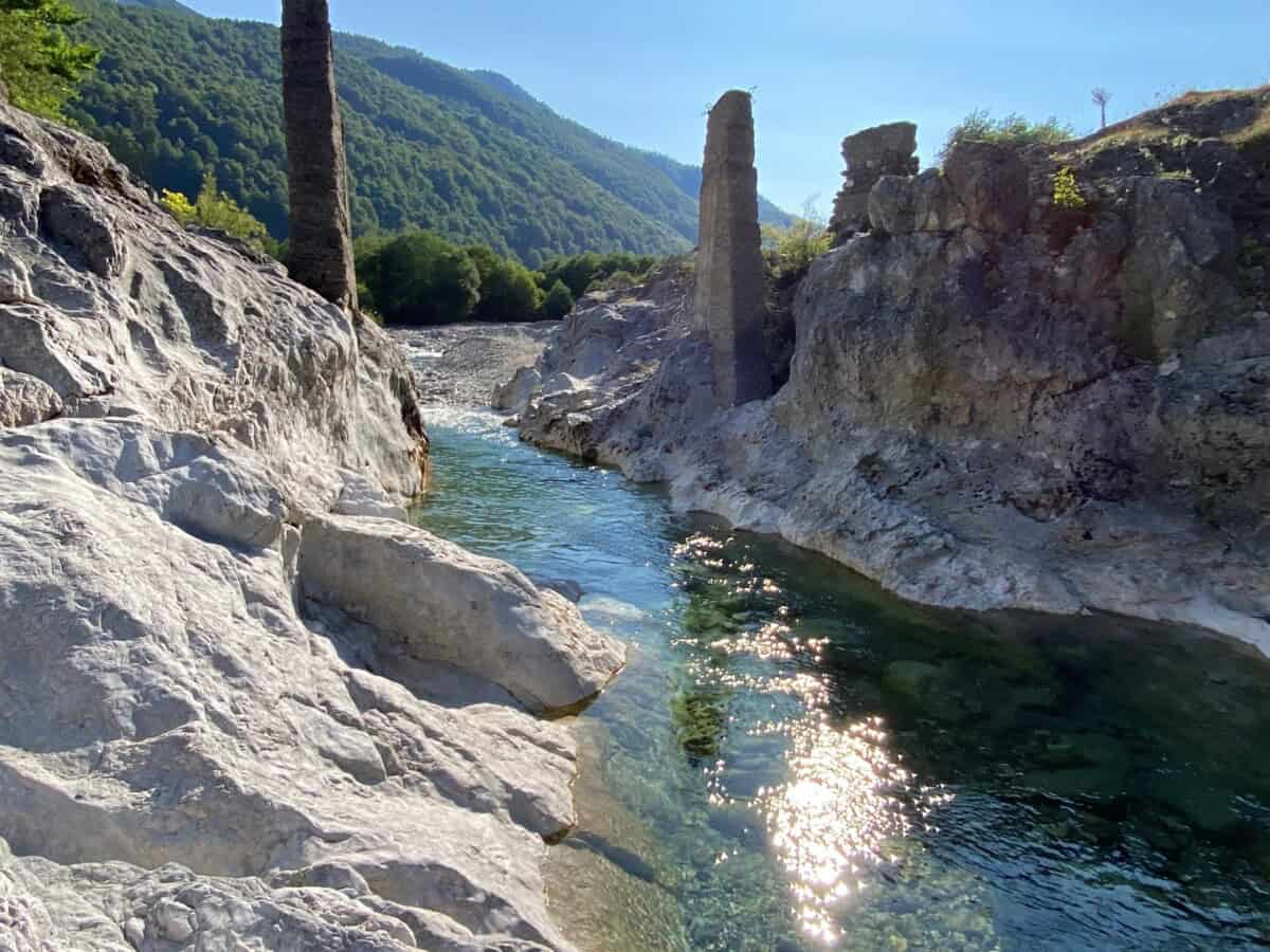
Shalla river
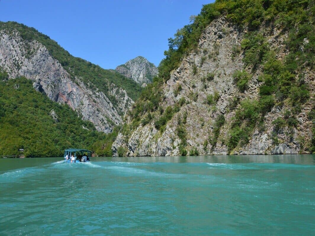
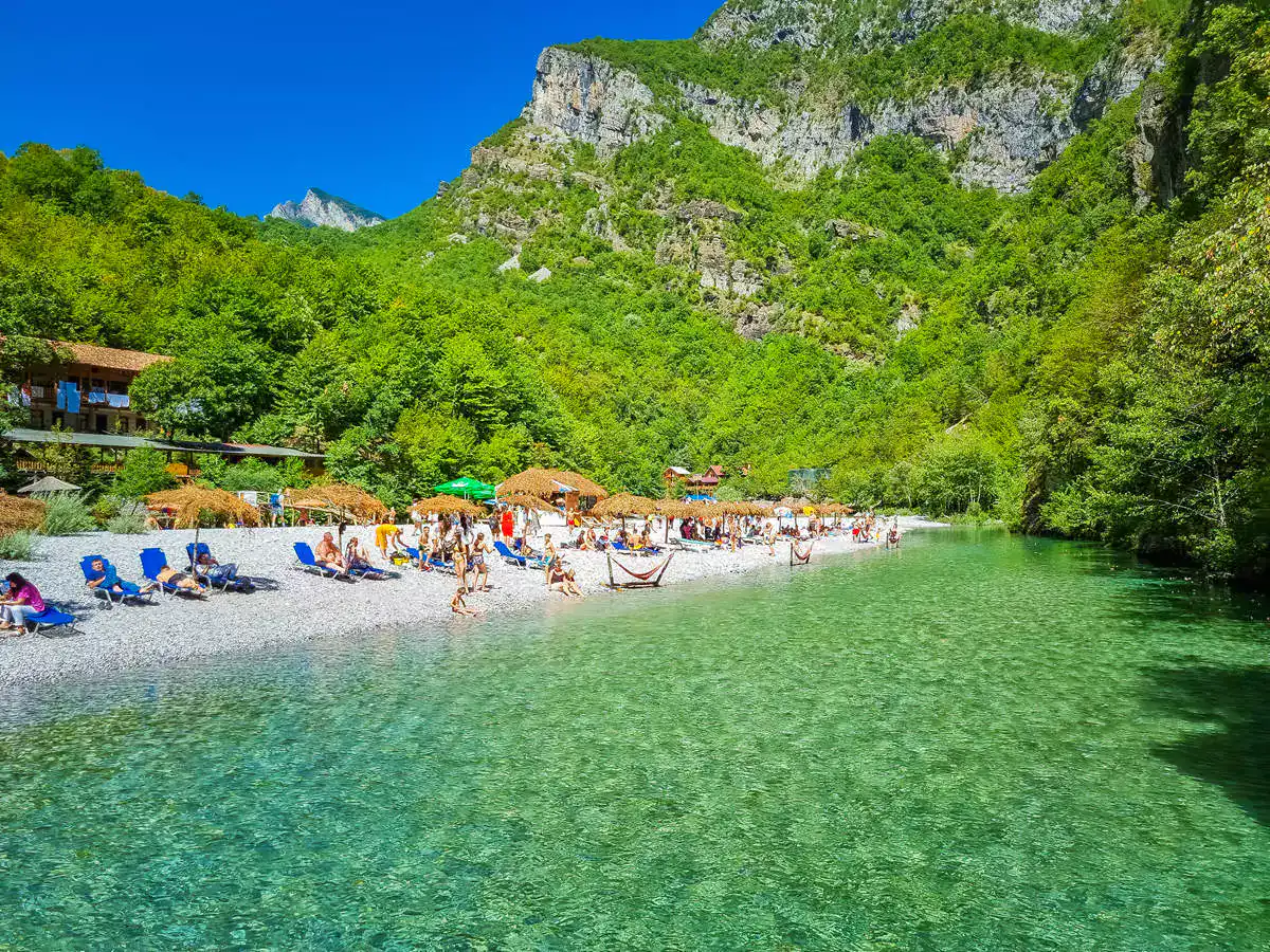
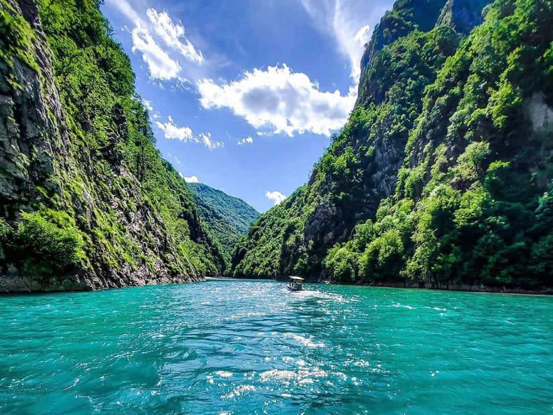
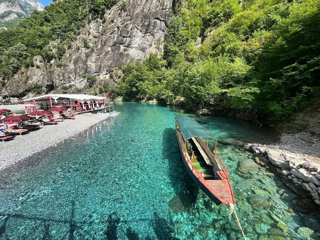
The Shala River (in Albanian Lumi i Shalës) attracts visitors to northern Albania with its turquoise waters amidst dramatic mountain scenery. The entire river from its source to where it flows into Lake Komani is 37 km long. It originates below the village of Theth at an altitude of 950 m below the peak of Radohina (2,568 m). The average slope of the river is 22 meters per kilometer. At the end of its course, it flows into Lake Komani, which was created by damming the Drin River. The confluence point is at an altitude of 175 m above sea level.
This crystal-clear mountain river attracts visitors not only with its refreshing water (which reaches only 7 °C even in summer), but also with the opportunity to observe trout in their natural habitat or adrenaline experiences such as zip-lining and kayaking between steep cliffs. It is accessible exclusively by boat via Lake Komani.
Více o Shalla river
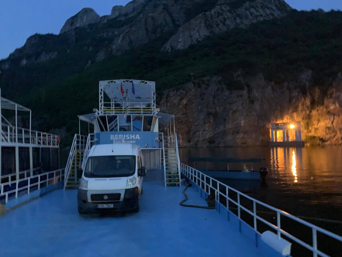
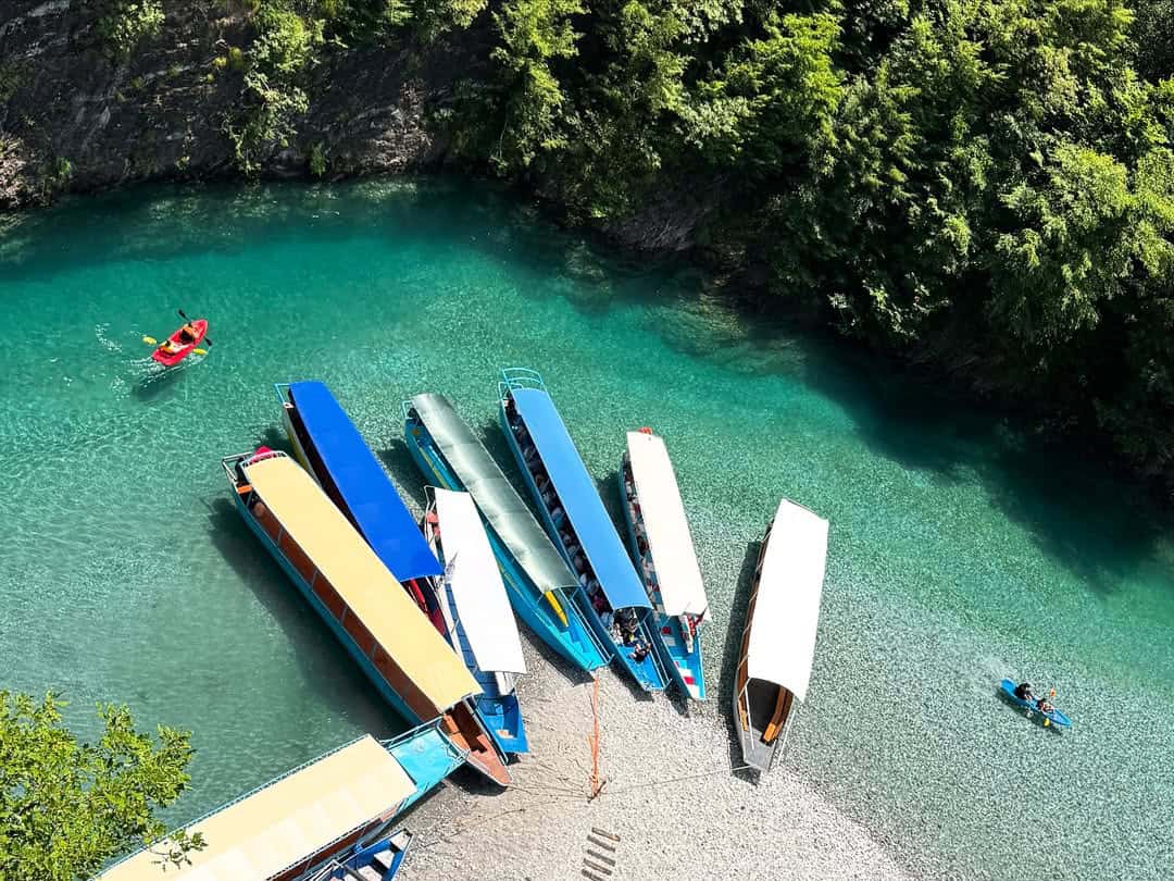
The very voyage on Lake Komani is an experience in itself. The lake is surrounded by towering cliffs, dense pine forests and small villages that have preserved their traditional charm. However, you don’t have to sail across the entire lake. You can experience a shorter section of the voyage on a smaller boat, where you branch off from the lake onto the tributary crystal-clear Shalla river. The boat departs from the Komani lake dam just like the ferries that sail across the entire lake. The most common way to experience the beauty of the Shalla river is to get into its flow by boat. First, you need to get to the ferry terminal at Lake Komani, from where small boats depart.
Guides on small boats often provide informative commentary on the history of the region, local folklore and natural features of Lake Komani. Stories of ancient Albanian tribes, traditional lifestyle and legends about the lake and river make the excursion both educational and visually captivating. One of the stories is about Lekë Dukagjini (1410-1481), a renowned medieval Albanian military commander, who spent his last years above remote and protected peaks with a view of the Shala river valley. Travelers can spot local wildlife on the banks, such as eagles, herons or deer.
Praktické
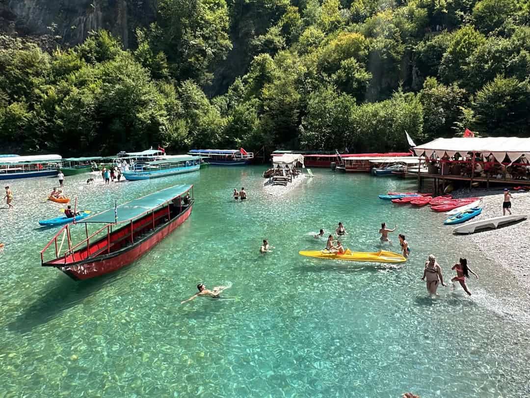
The boat trip from the dam to the destination on the Shalla river takes approximately 1 hour and 15 minutes, and the usual price is around €20 per adult.
At the destination you will spend approximately 4 hours and then the operator will take you back to the dam. During your stay at the river, you can walk around the surrounding hills, swim, sunbathe or rent a kayak and paddle through the calm sections of the river to visit hidden coves and small waterfalls.
During the season, there is also a restaurant where you can enjoy traditional Albanian dishes or fresh fish. The Shalla River also offers the opportunity to spend the night. Spending a night “at the end of the world” will allow you to enjoy the sunset over the river, listen to the soothing sounds of flowing water and observe stars under a clear sky. Guest houses and small eco-cottages are available.
You can purchase a ticket for the boat trip HERE. Book accommodation HERE.
Mapa
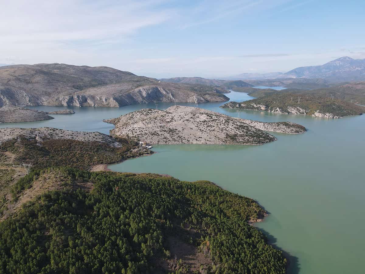
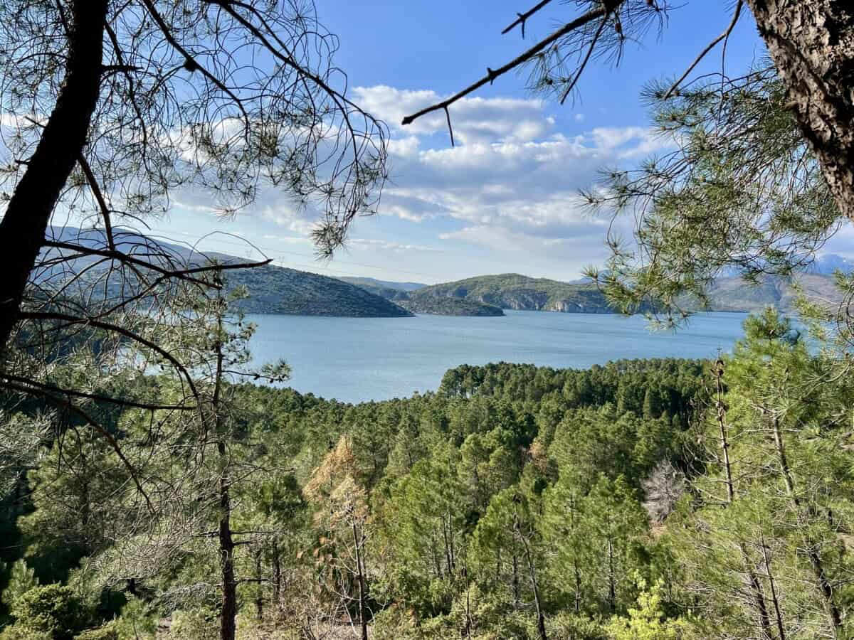
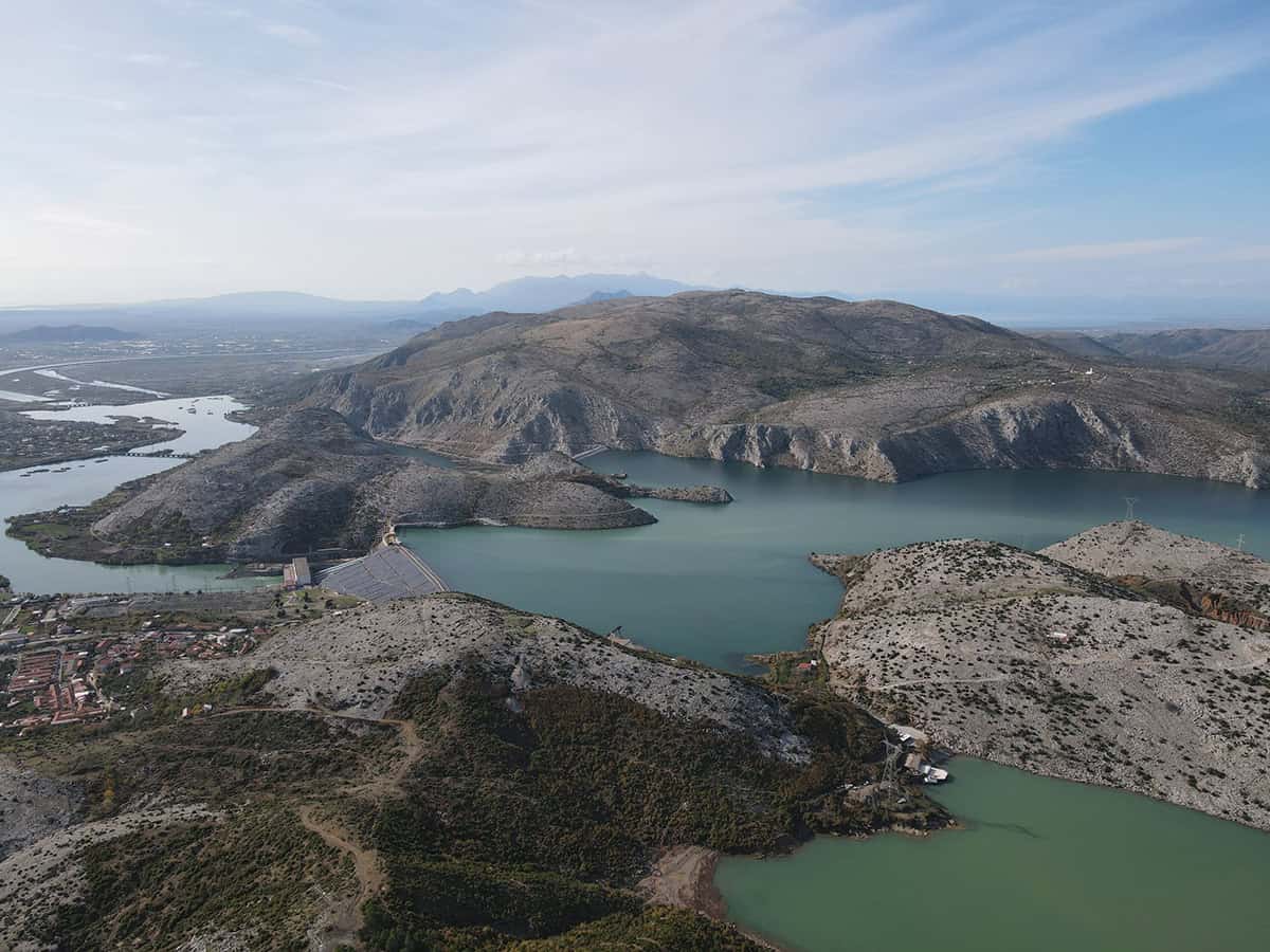
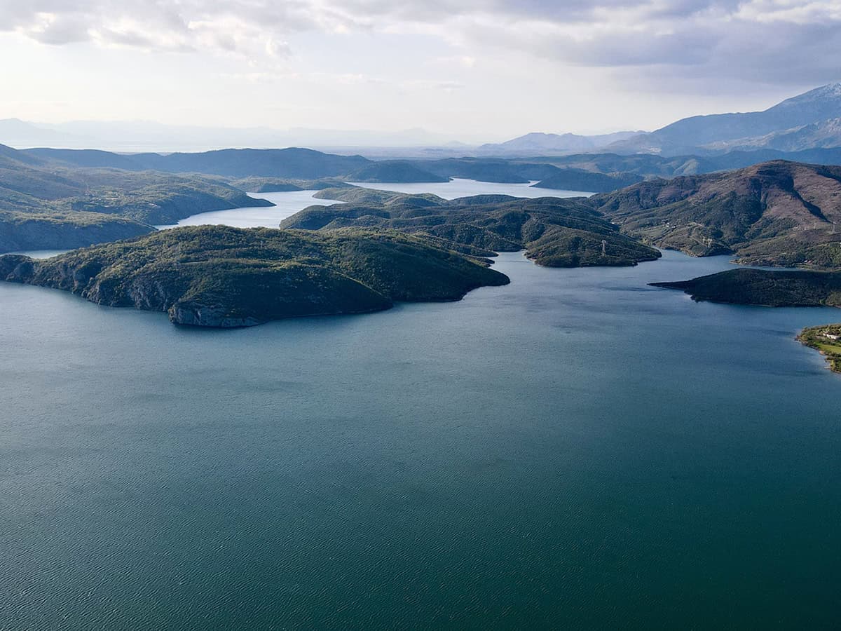
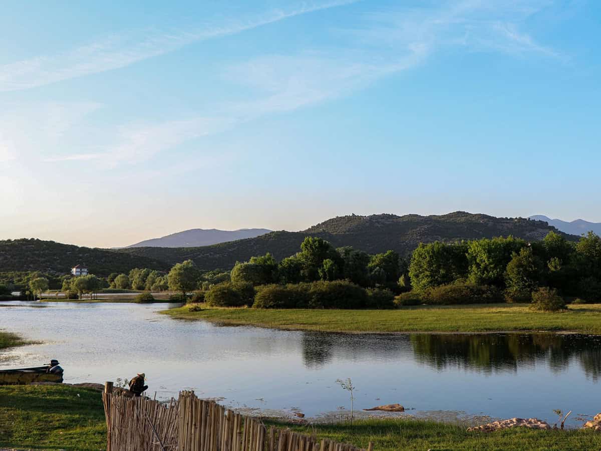
Jezero Vau i Dejës
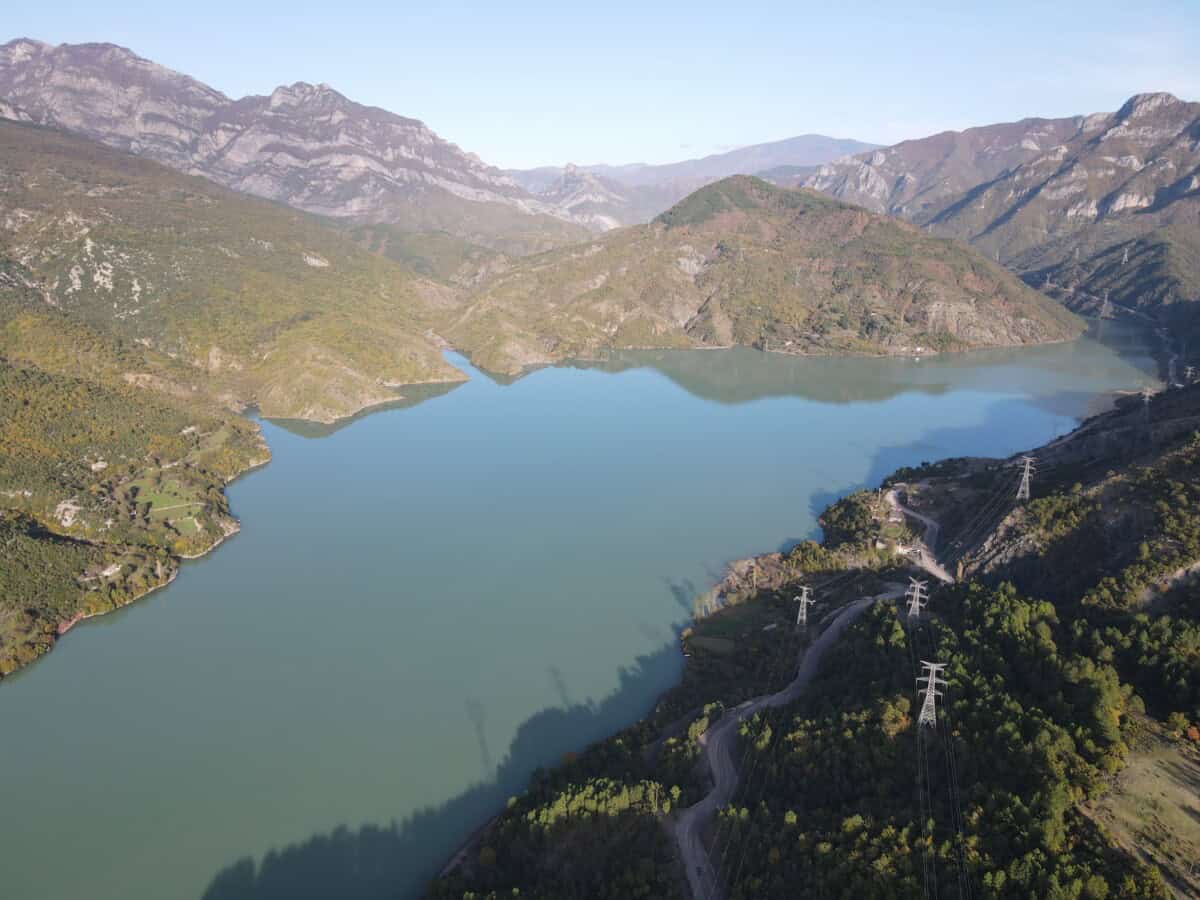
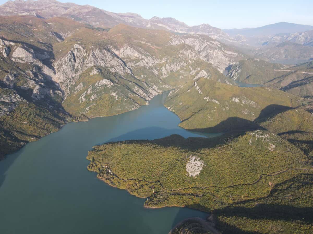
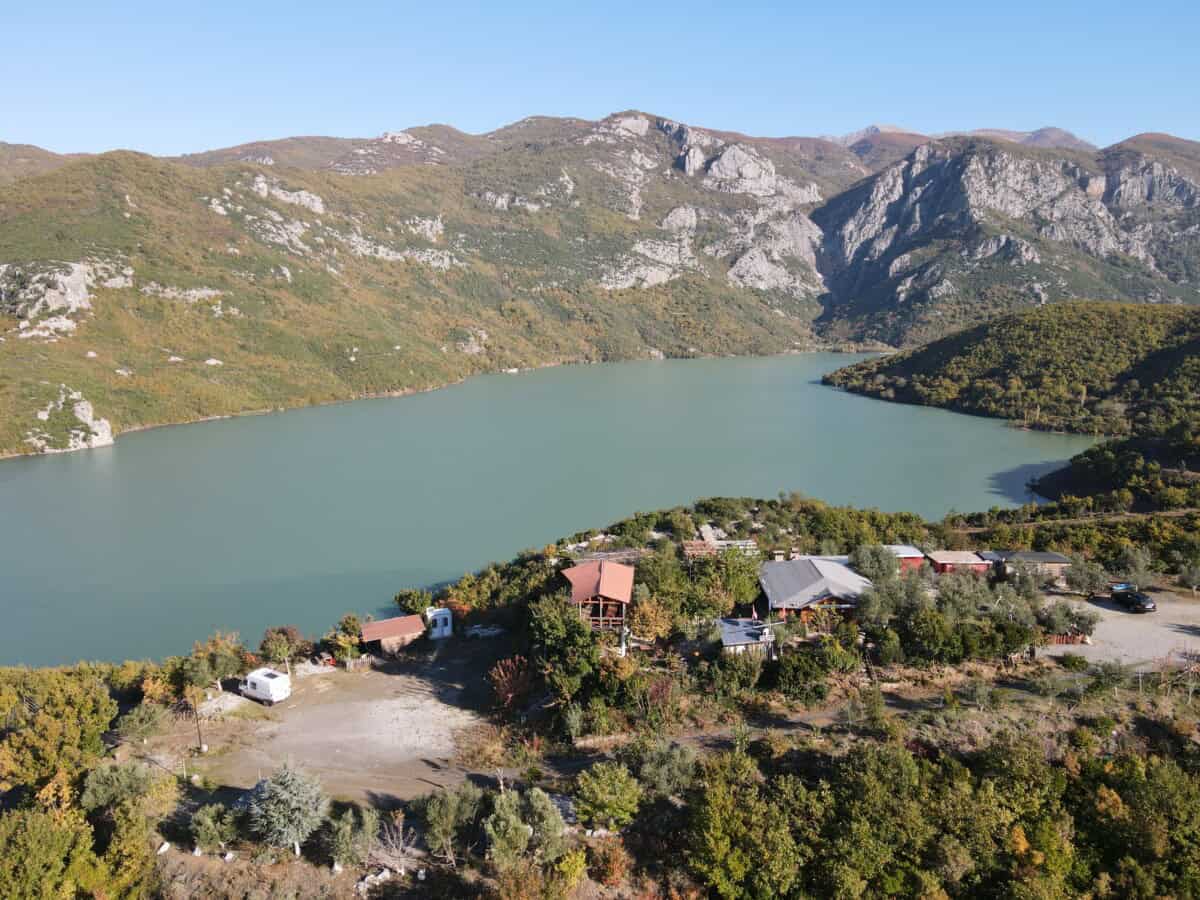
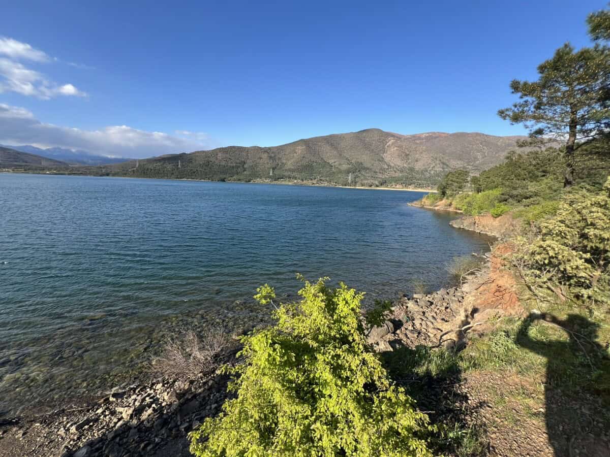
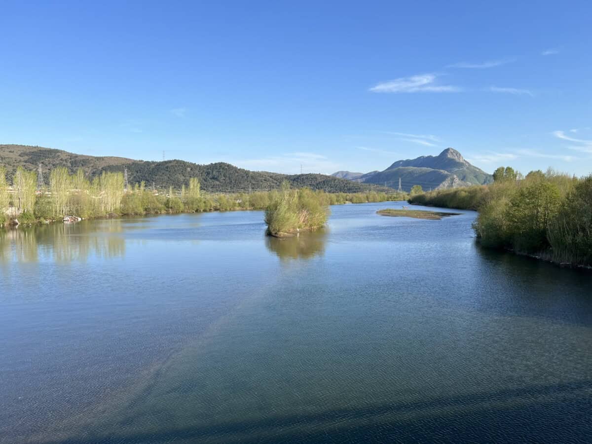
The artificial Lake Vau i Dejës (Liqeni i Vau i Dejës) was created in 1971 by building the historically first major dam on the Drin River. The water level covers an area of 26 km², the maximum depth reaches 50 meters, the total water volume is 600 million m³, the average altitude of the water level is 75 meters, the length of the lake is 10 km and the widest point is 1.2 km. The lake attracts fishing, boat trips, swimming in clear water or simply relaxing on the shore with a view of the surrounding hills.
Food lovers will find their way in local restaurants where fresh fish from the lake is served, fragrant grilled meat, homemade cheeses, herbal salads and other specialties prepared according to recipes that have been passed down through generations in the region – all with a view of the calm water surface.
Více o jezeru
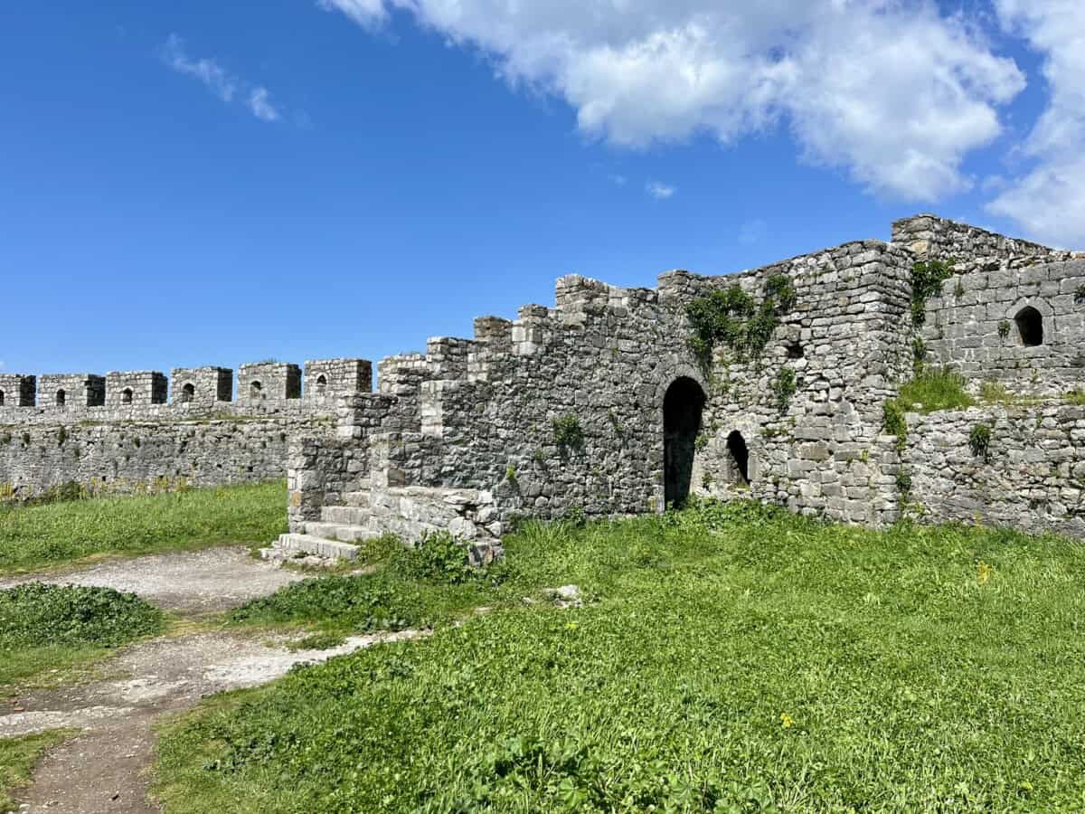
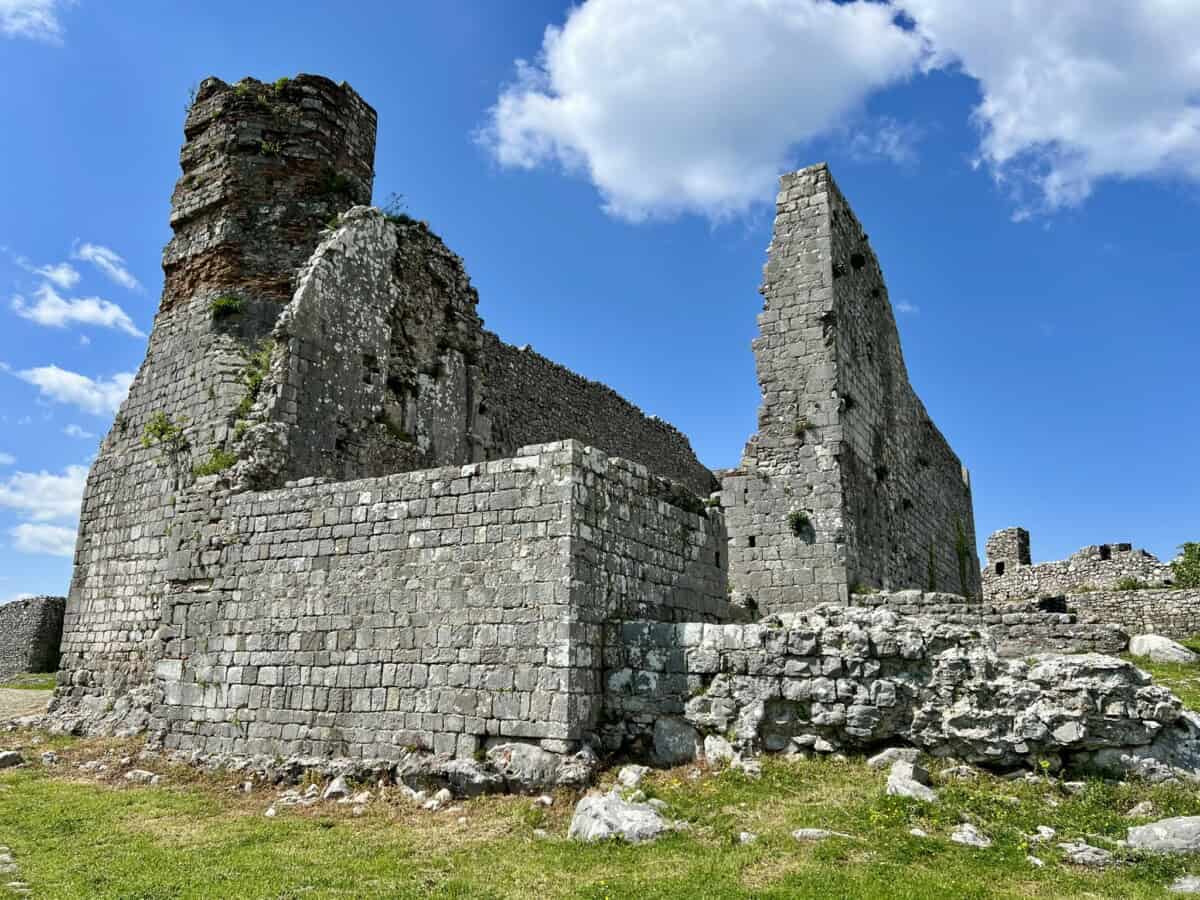
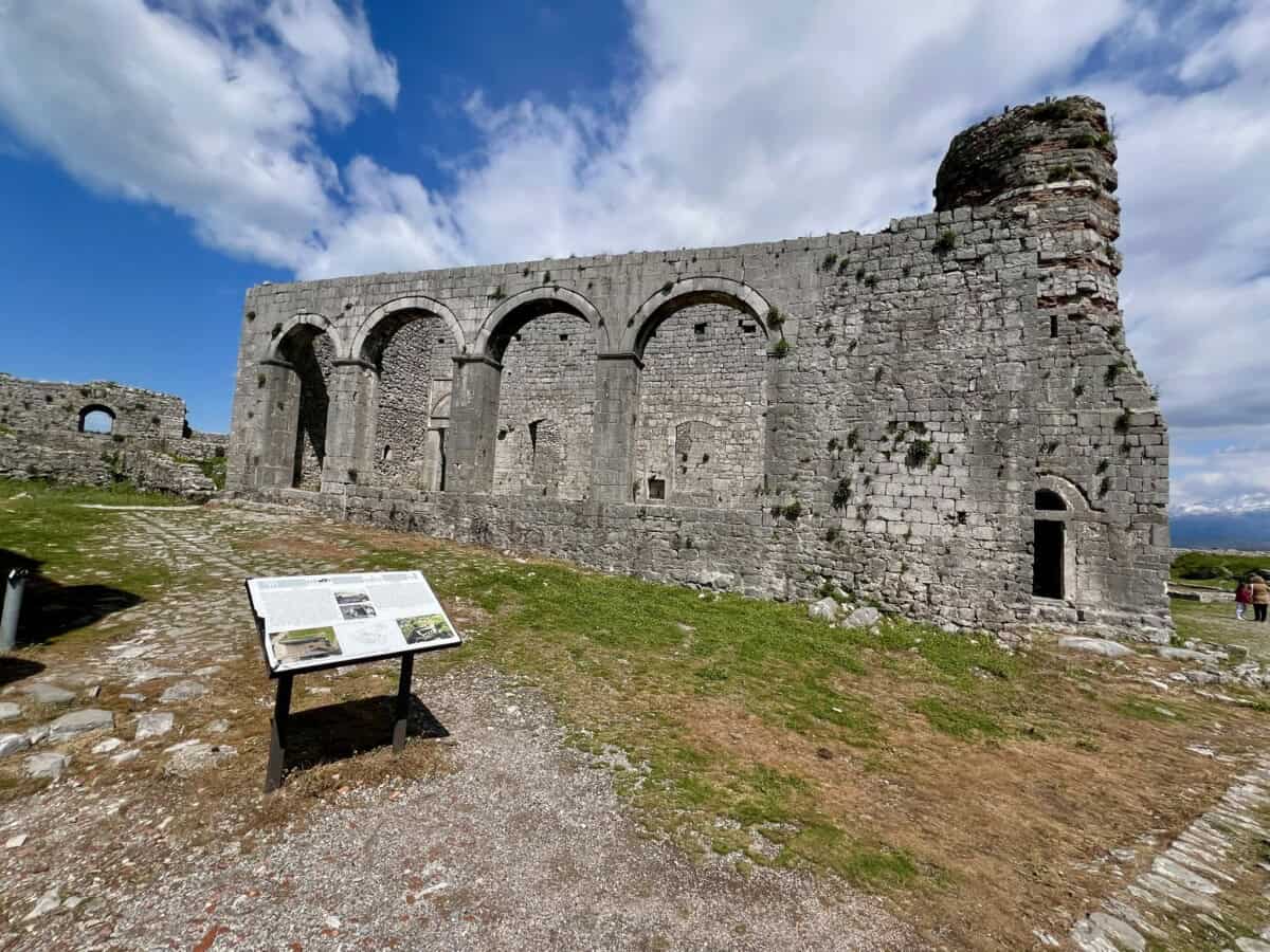
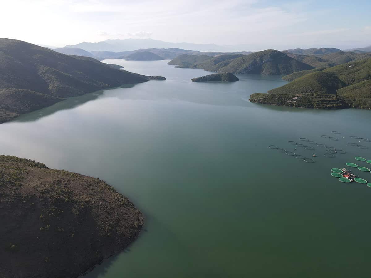
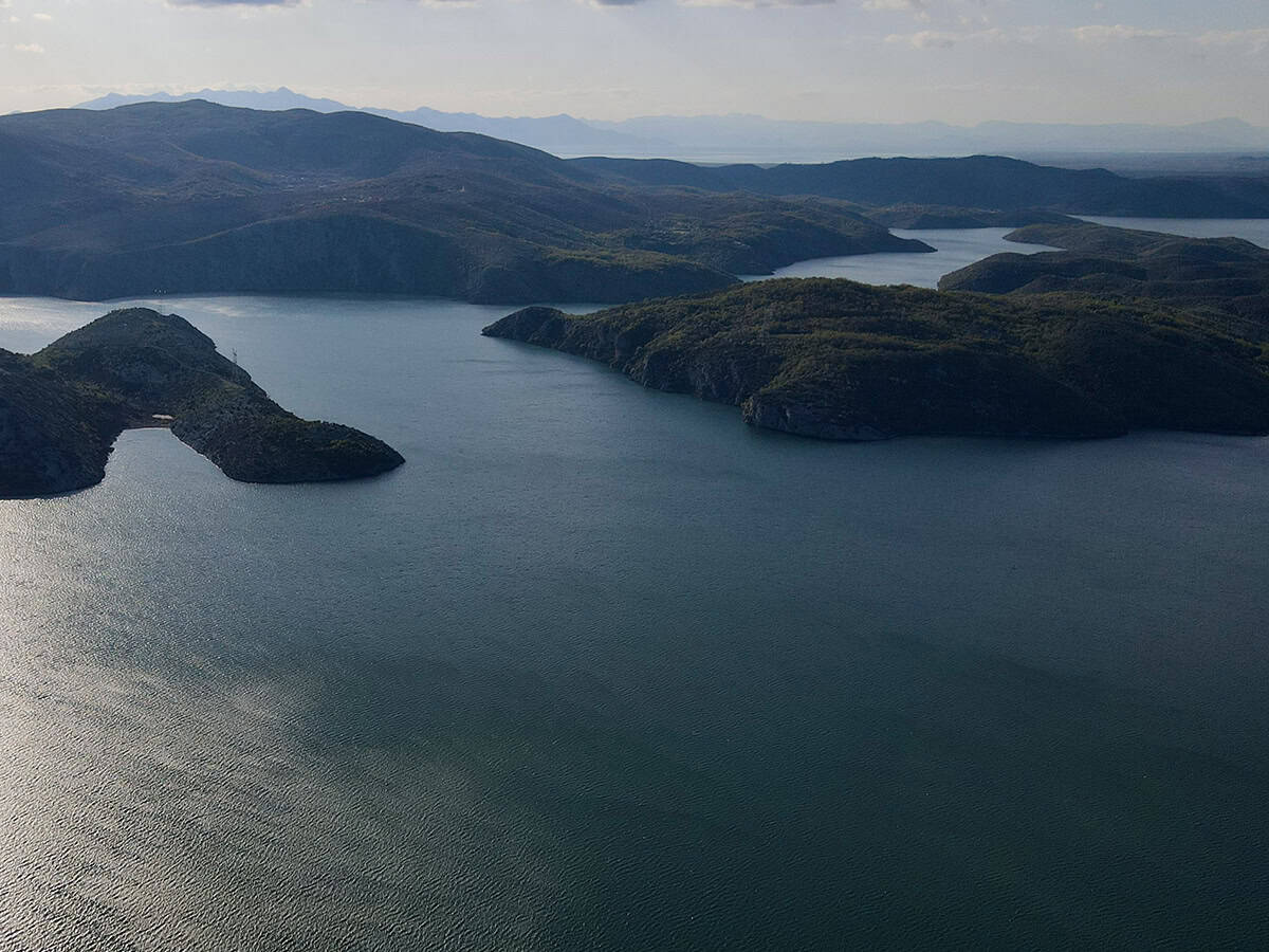
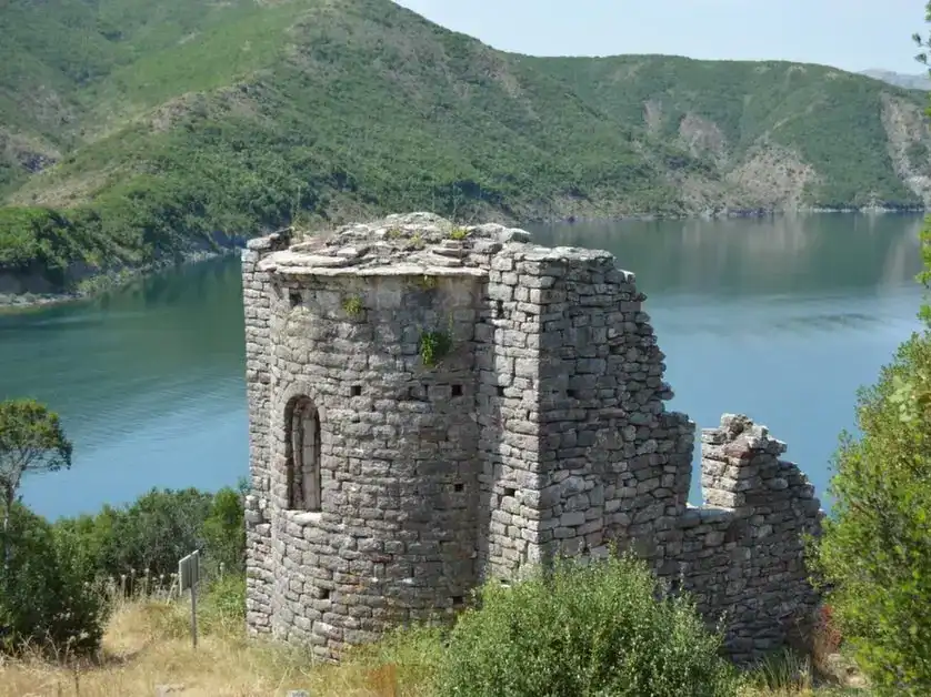
In the vicinity you will also find traces of ancient history – ancient places of worship and sacred monuments that give the place a spiritual dimension. Besides the castle Danja, which is located below the dam of the lake near the village of Vau i Dejës, you will also find here the impressive ruins of the castle Sarda on the island of Shurdhahu (Ishulli i Shurdhahut), which was created after the landscape was flooded with water due to the dam.
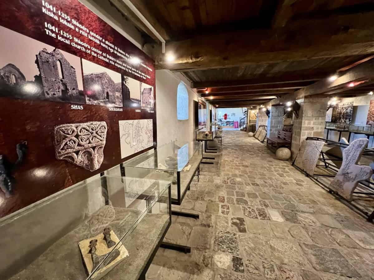
In summer the island is accessible by tourist boat ODSUD from the Vau i Dejës dam. Once there was a settlement on the island from the 6th and 7th centuries, known as Sarda, which played a crucial role in the development of the Komani-Kruja culture in northern Albania. Sarda, strategically located along an ancient trade route connecting the Adriatic Sea with Dardania, served as a key resting place for weary travelers. It provided safety as it was surrounded on three sides by the Drin River. During its history Sarda experienced periods of expansion and development.
From the 9th to the 12th century, two circles of fortifications and fourteen churches were built here. During this period Sarda became a bishopric. In the 13th century the city faced territorial disputes with Shkodër and later suffered destruction during the Ottoman devastations in 1491.
Praktické
Lake Vau i Dejës will be on your left hand side on the way to the ferry across Komani Lake. The approach route SH25 was under reconstruction in 2025 and should be available in a wider form and with new asphalt from spring 2026. The route to Komani Lake will be significantly simplified and faster.
Mapa
What to see in Albania?
Albania is a country full of surprises and diverse beauty waiting to be discovered. From stunning beaches on the southern coast, through majestic mountains in the north, to historic cities like Gjirokastër or Berat.
Our tips for excursions will help you plan unforgettable adventures, whether you are attracted by wild nature, cultural monuments or the charm of traditional Albanian villages. Discover what is worth seeing!
How to enjoy vacation and not overspend
Travel smart
Whether you're planning a trip to Albania or anywhere in the world, you can use the proven Booking.com for accommodation reservations. You'll find a huge selection of cozy private apartments, houses and hotels. The price range is wide and you'll definitely find something to suit you.
Fly for reasonable prices
Do you need a plane ticket? Check out the well-known Kiwi or also the lesser-known, but among seasoned travelers very popular Kayak. It's our favorite. It quickly compares offers from all airlines and shows you the most cost-effective flight combinations. You can also set up price alerts, so as soon as a ticket reaches a price that suits you, you'll get a notification.
Internet v mobilu
In the second half of 2026, Albania is promised free European roaming. Until then, you can get data with the YESIM application, for example. You'll get mobile internet on favorable terms.
Think of a backup plan
Good travel insurance is the foundation of any trip. A trip to Albania is no exception. Insurance covers you in case of illness, injuries and loss of belongings. We ourselves have ended up in a hospital in a foreign country a few times. Having good insurance will save you a lot of stress and, most importantly, money.