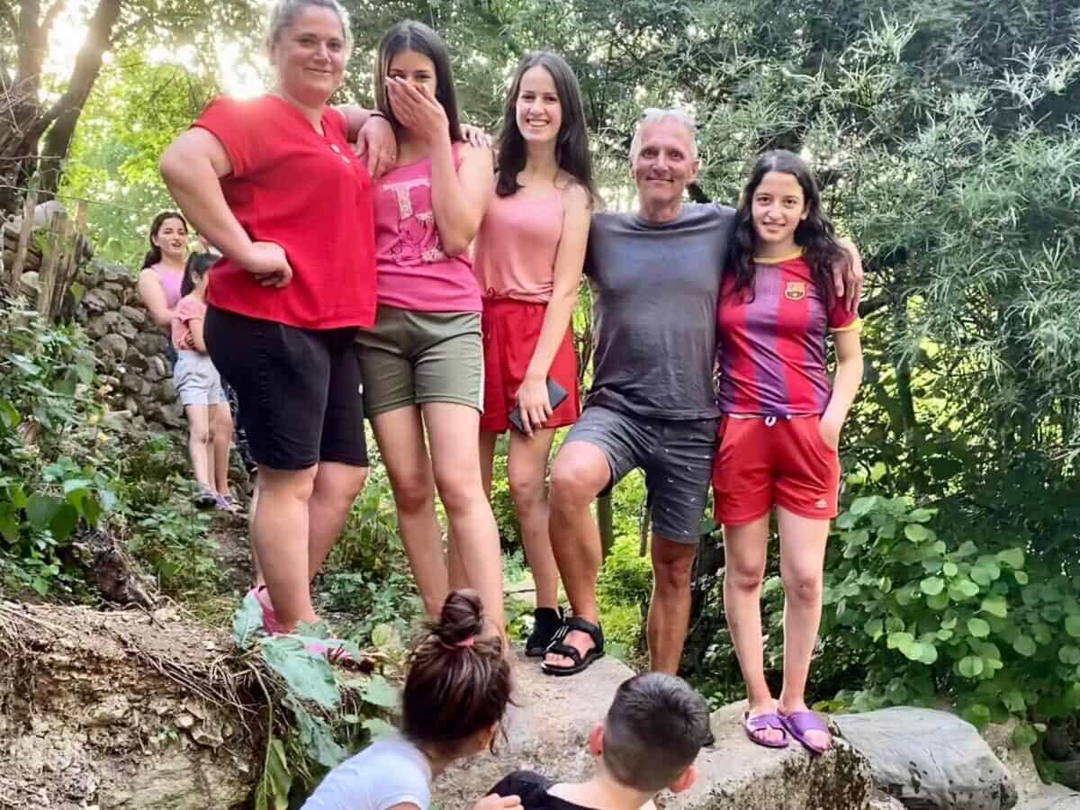
Kraj Kukës
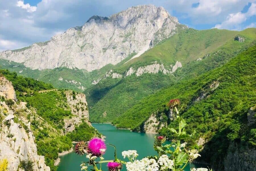
Kukës region remains relatively untouched by tourism, making it an ideal destination for adventurers seeking authentic experiences away from mainstream tourist trails. The area is characterized by rugged mountains and traditional villages. The most interesting and visited tourist attraction is a ferry journey through dramatic rock formations across Lake Fierza and Komani.
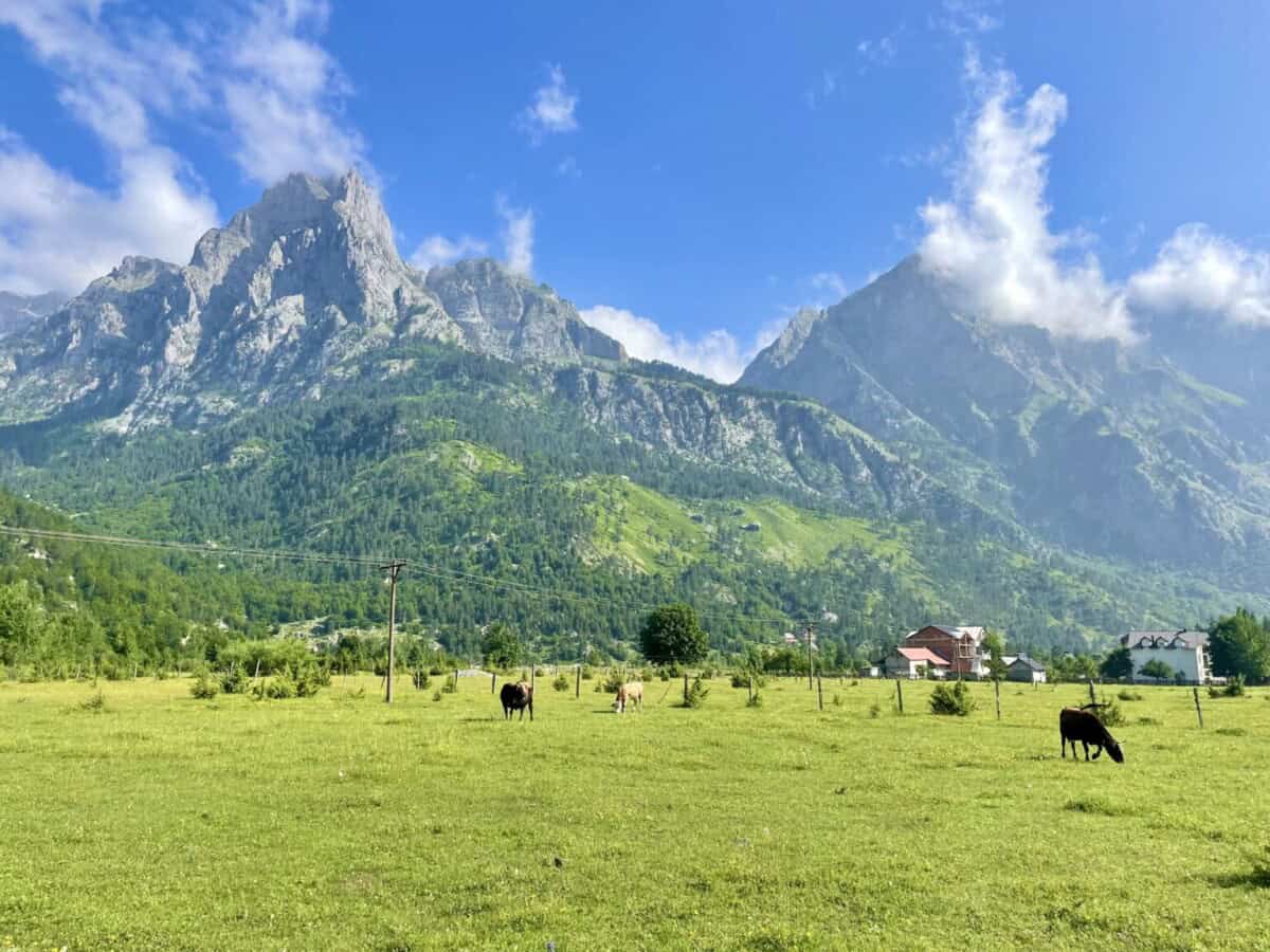
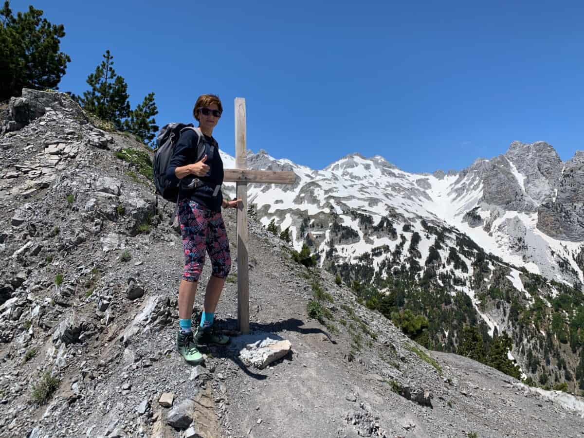
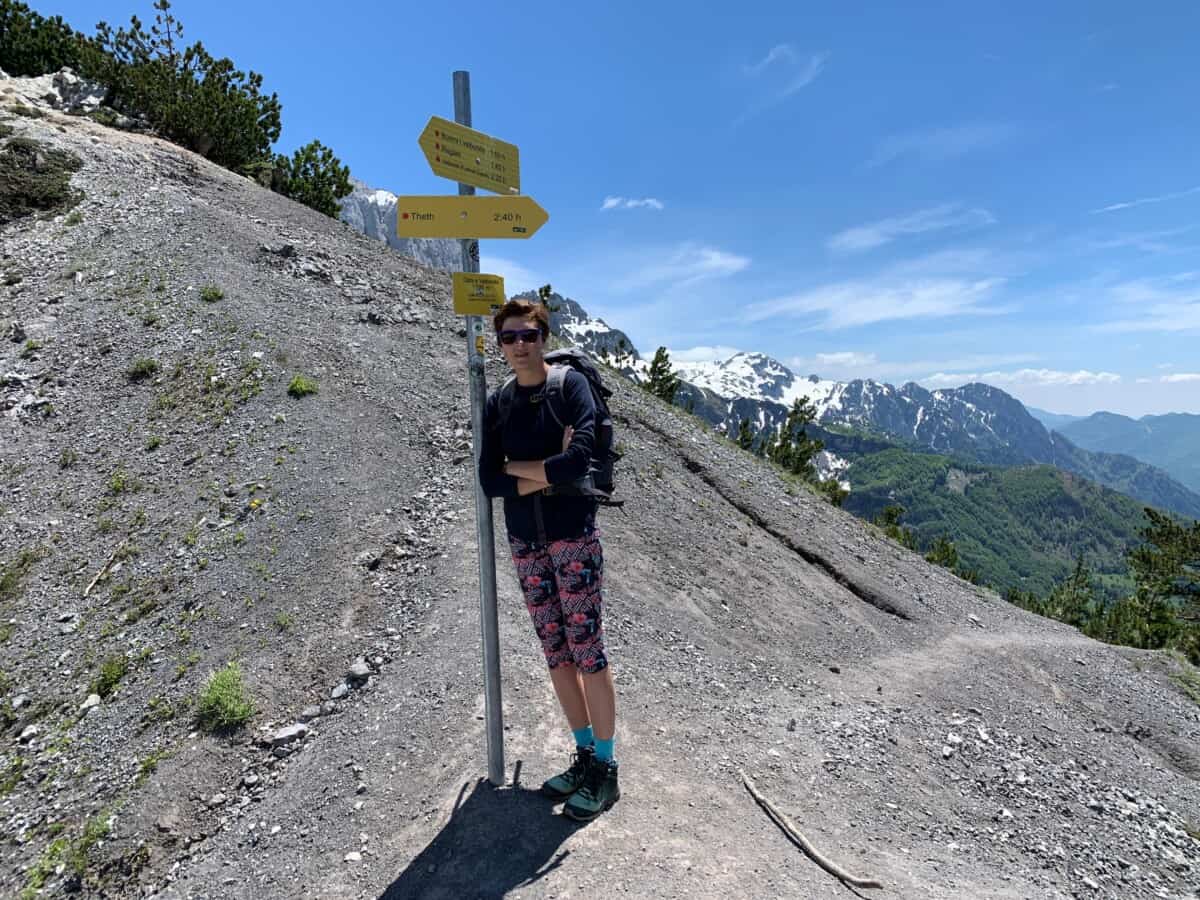
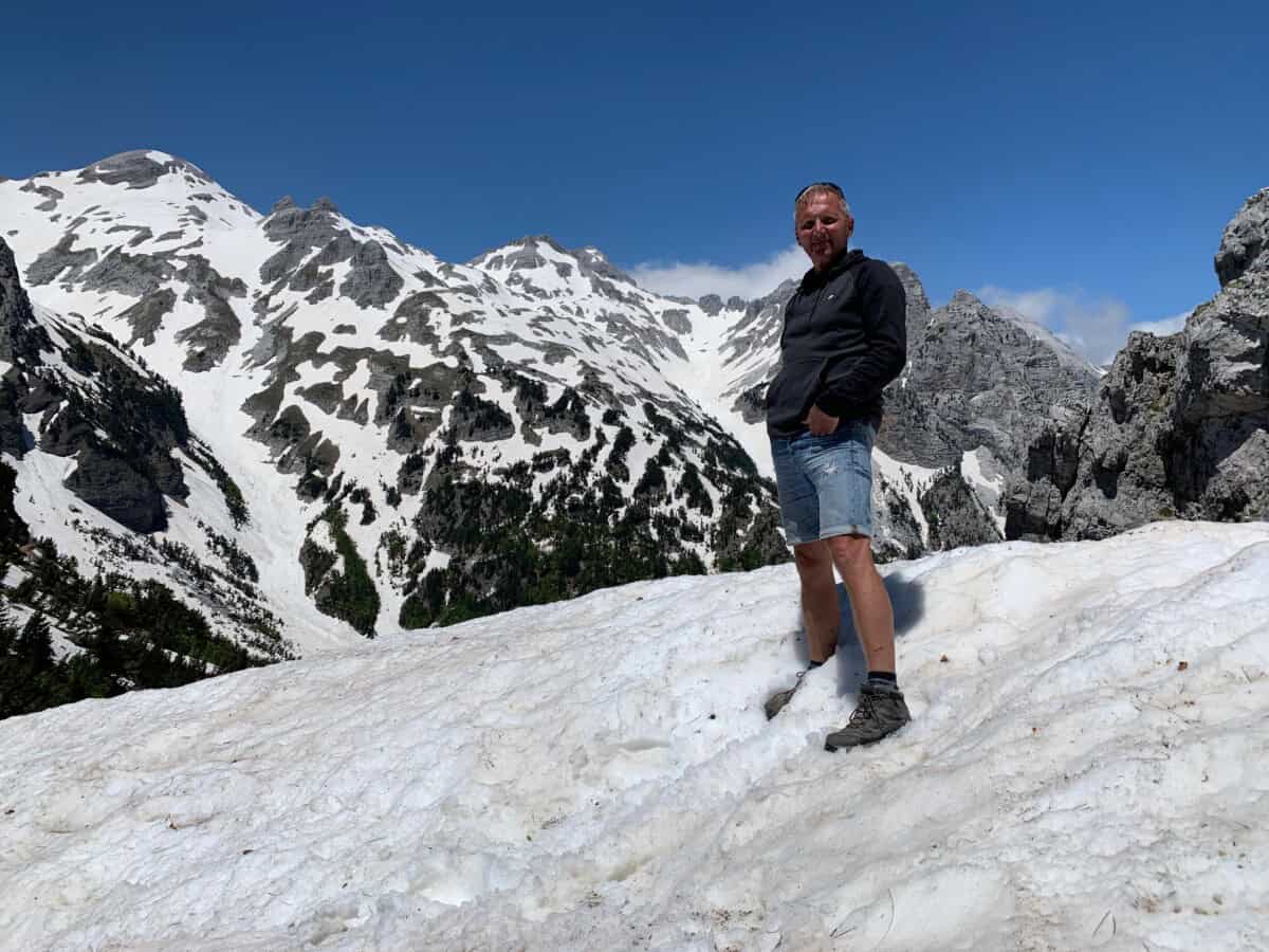
The mountain village of Valbonë, surrounded by towering peaks, is a frequent tourist destination. While getting to these places requires a bit more travel time, it’s absolutely worth the effort. Determined hikers can cross the Valbonë Pass into the mountain village of Theth, and the more adventurous can summit Maja i Jezercës at 2694 meters above sea level.
TIPY NA UBYTOVÁNÍ
MĚSTA
GASTRO-AGRO
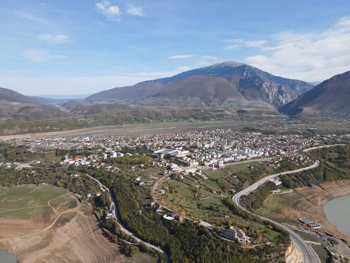
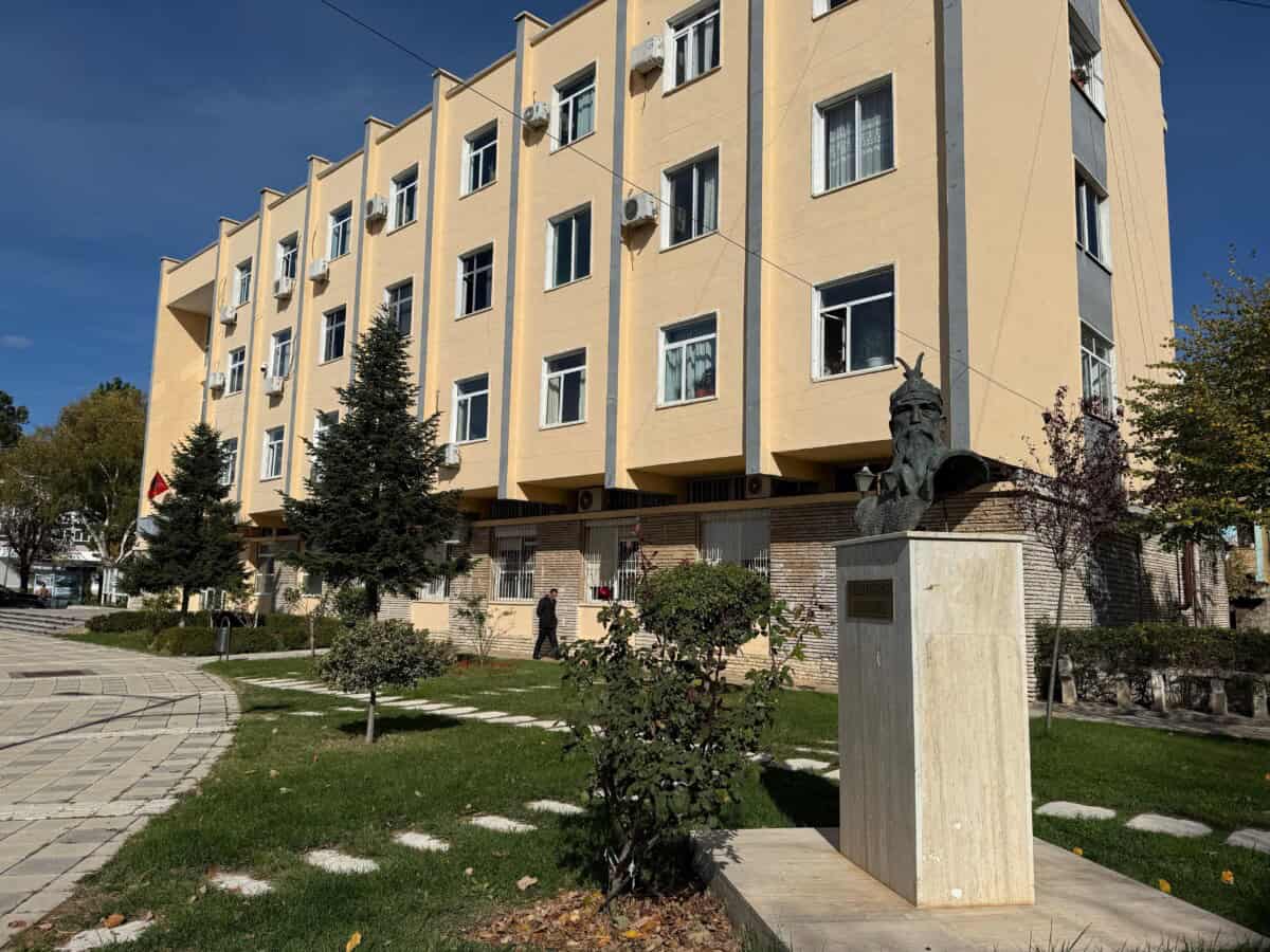
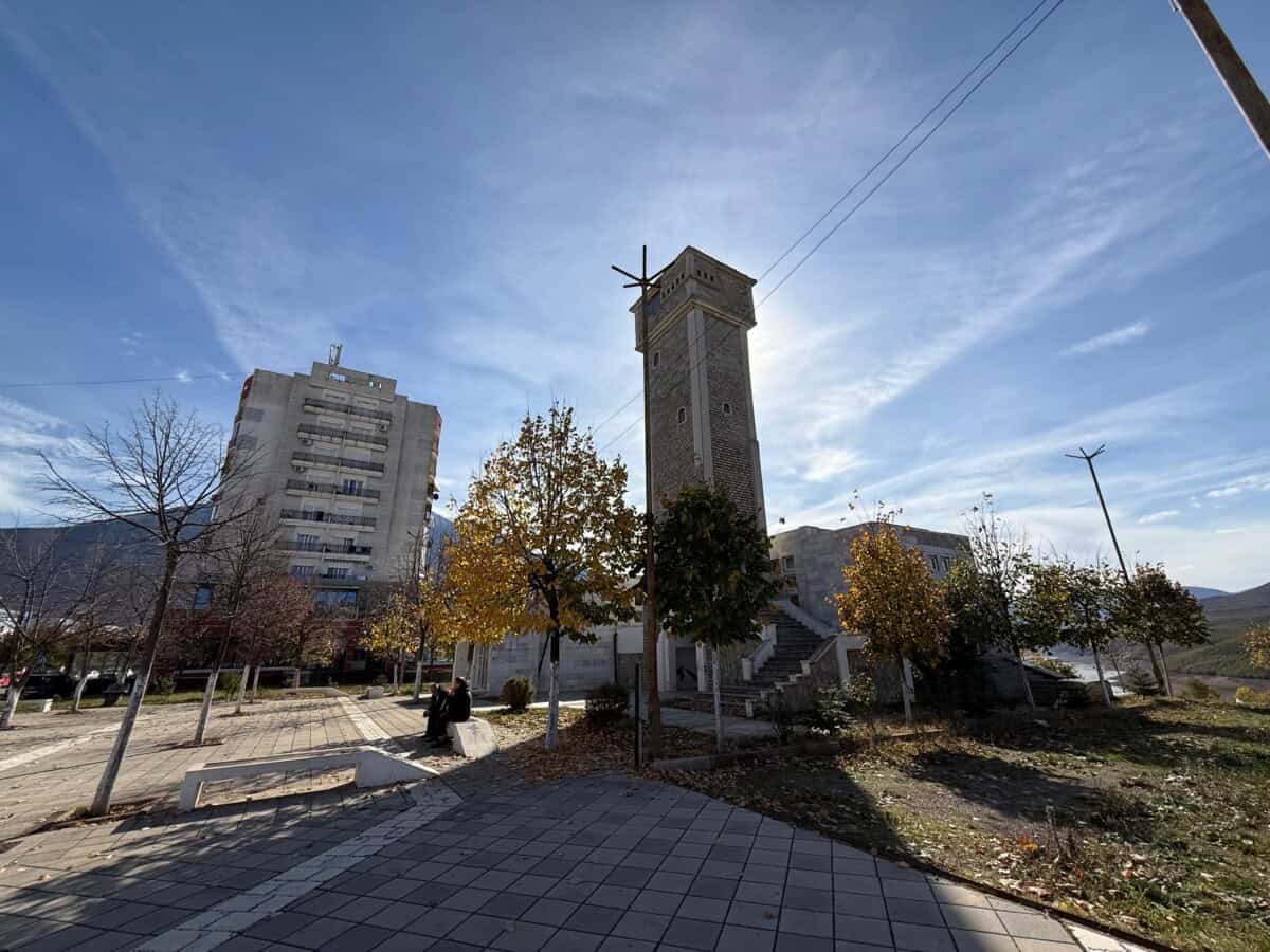
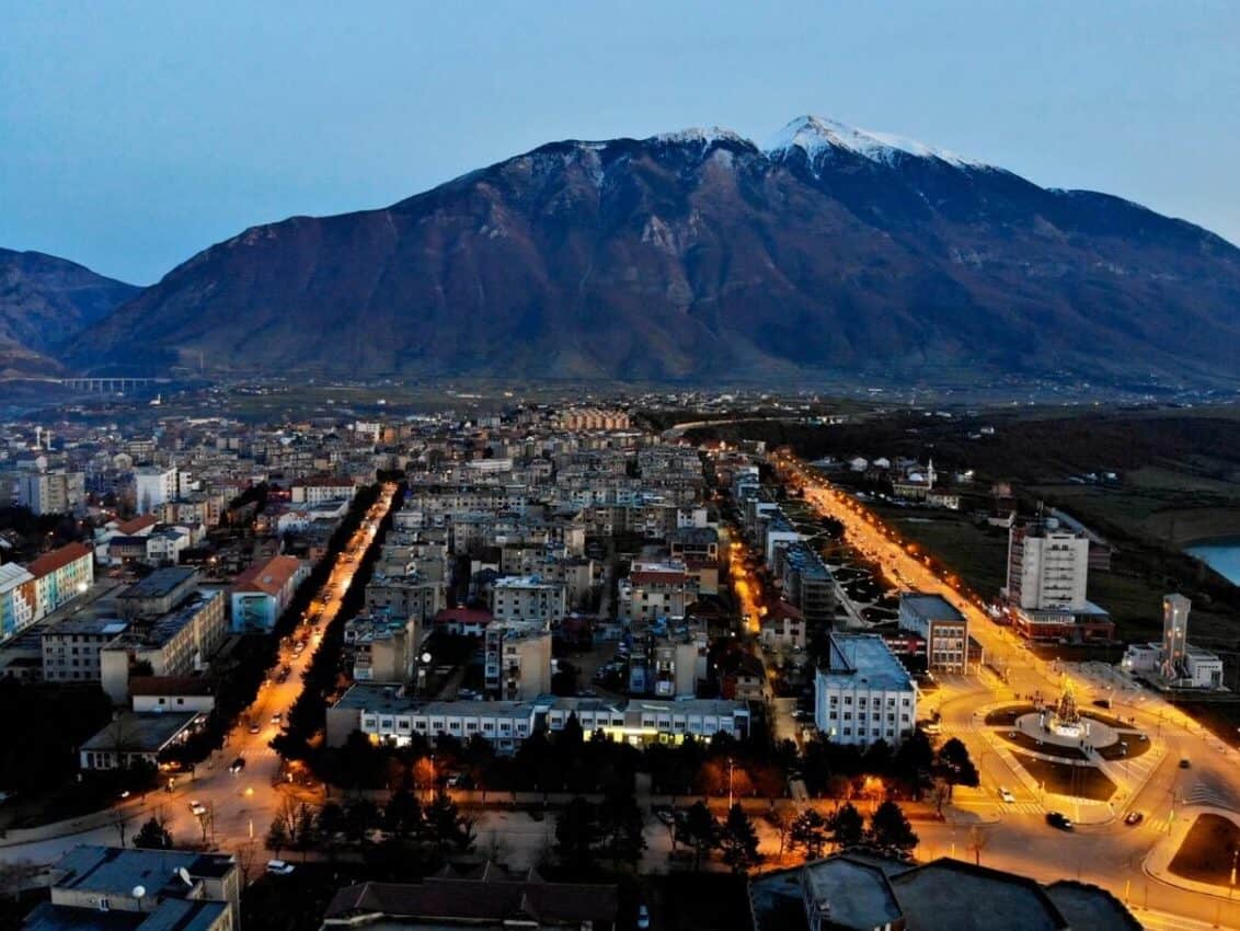

Město Kukës
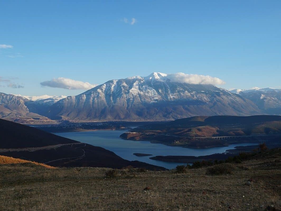
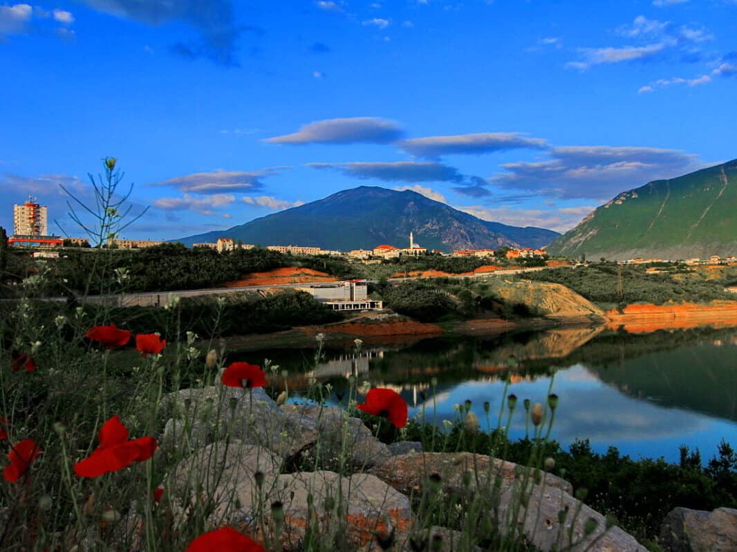
Kukës – a city that literally relocated. In the 1970s, the entire old town of Kukës was submerged with the creation of Lake Fierza, and the new city was built higher up. Atlantis would be jealous. Fragments of the old city’s roofs are said to be visible when the lake level drops.
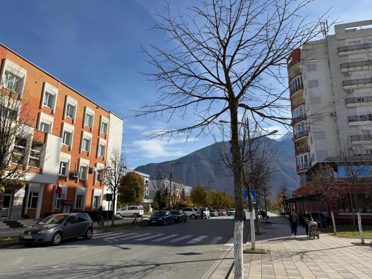
The newly built Kukës is thus one of Europe’s youngest cities. In 2000, Kukës earned a nomination for the Nobel Peace Prize for sheltering hundreds of thousands of Kosovar refugees during the Kosovo War. Surrounded by the Albanian Alps and Šar Mountains, Kukës resembles a rugged mountain amphitheater. Kukës is a paradise for adventurers – offering paragliding, rafting, cycling, and winter hiking through deep snow.
Více o Kukës
Lake Fierza (Liqeni i Fierzës) entices visitors with serene ferry cruises offering spectacular views of surrounding mountains. Kukës sits near the stunning Accursed Mountains, which offer unparalleled mountaineering and hiking opportunities and other nature-based activities. The Alpine village of Valbonë is less than three hours’ drive away.
The history of the Kukës region stretches deep into the past. The area where the city now stands was originally home to several ancient Illyrian tribes. The city itself lay in relative proximity to the Via Egnatia trade route. This 2nd-century Roman road was part of a network that connected Rome with Eastern Europe.
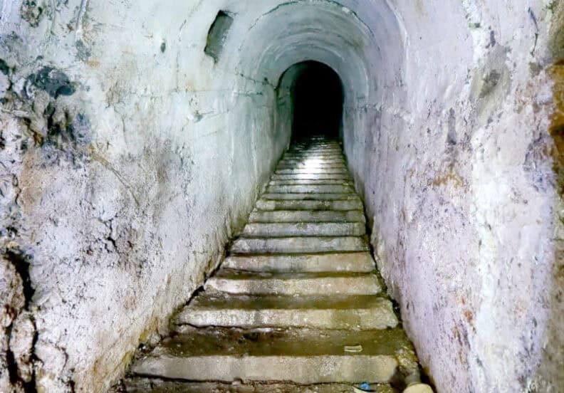
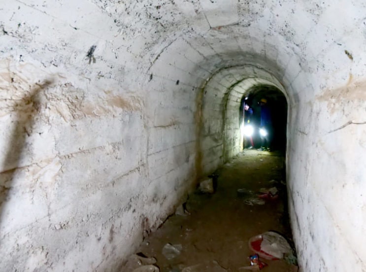
Probably the most unique artifact of present-day Kukës is a network of underground tunnels located roughly 30 meters beneath its streets. Also known as the “underground city,” they were built during the communist era in the 1970s. They were designed to serve as shelter for the city’s inhabitants in case of potential bombing raids. One plan called for building a fully functional city complete with government offices, residential areas, a hospital, and other facilities. After this unfulfilled schizophrenic dream, many unfinished rooms, functioning water taps, and even wine cellars remain. Almost every building from the communist era in Kukës has stairs leading into the tunnels. Entrances can also be found outside buildings in every residential district. The tunnels could accommodate approximately 6,000 people at once. Currently, it’s a tourist attraction awaiting its renaissance.
Praktické
If you’re interested in visiting the tunnels, the starting point is HERE. However, contact guide Afrima in advance via WhatsApp at +355685520330.
Mapa
NP údolí Valbone
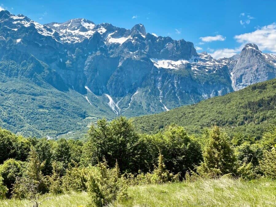
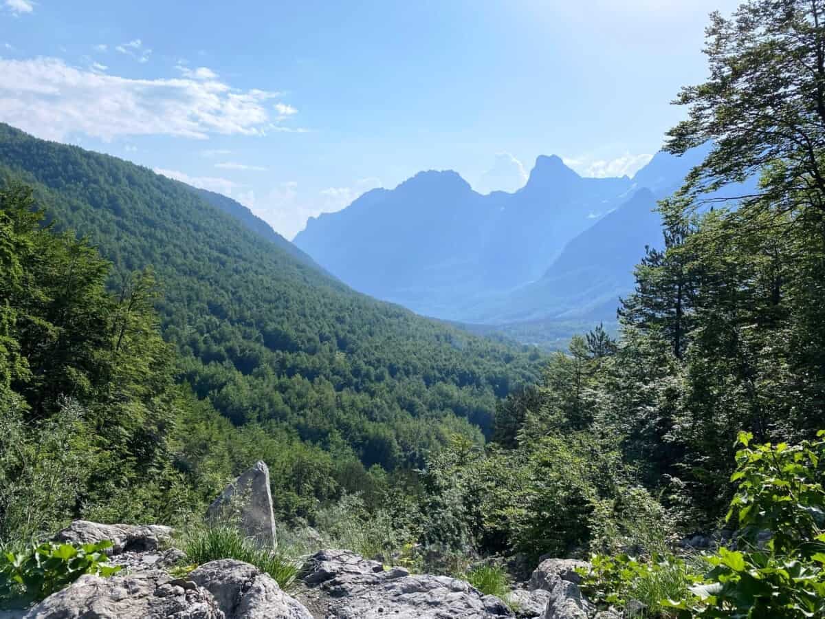
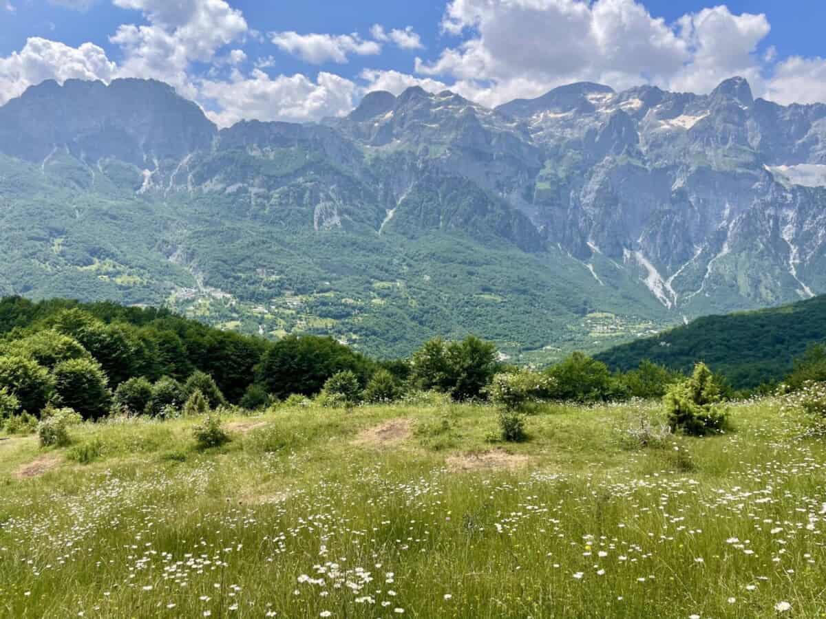
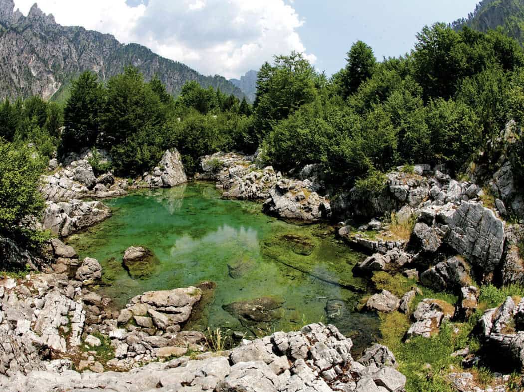
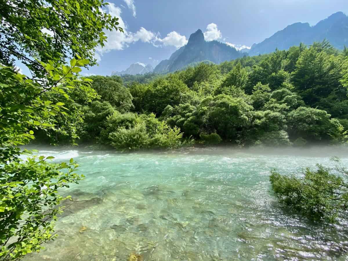
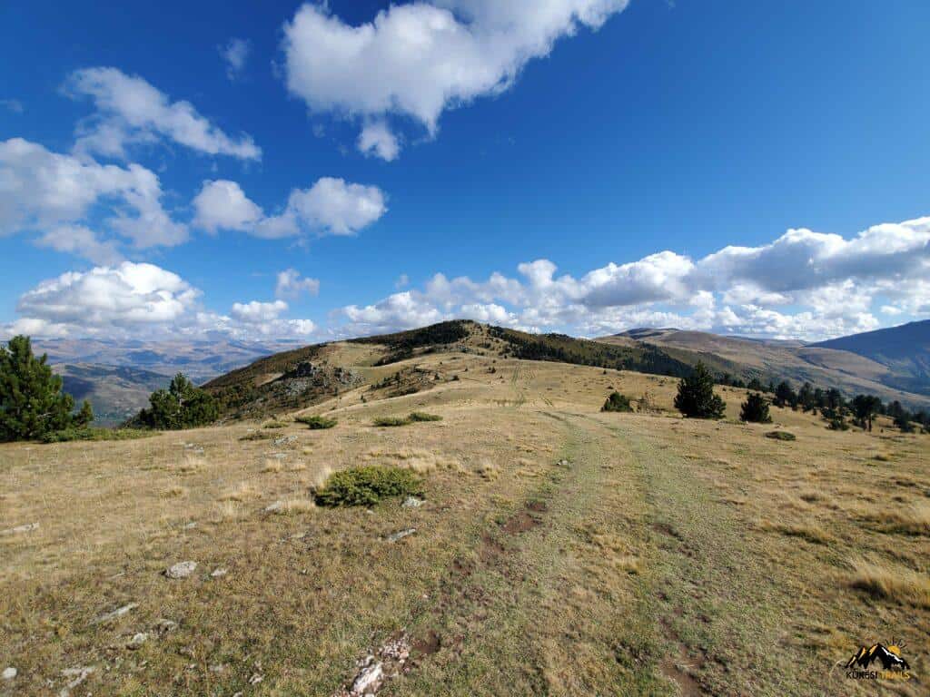
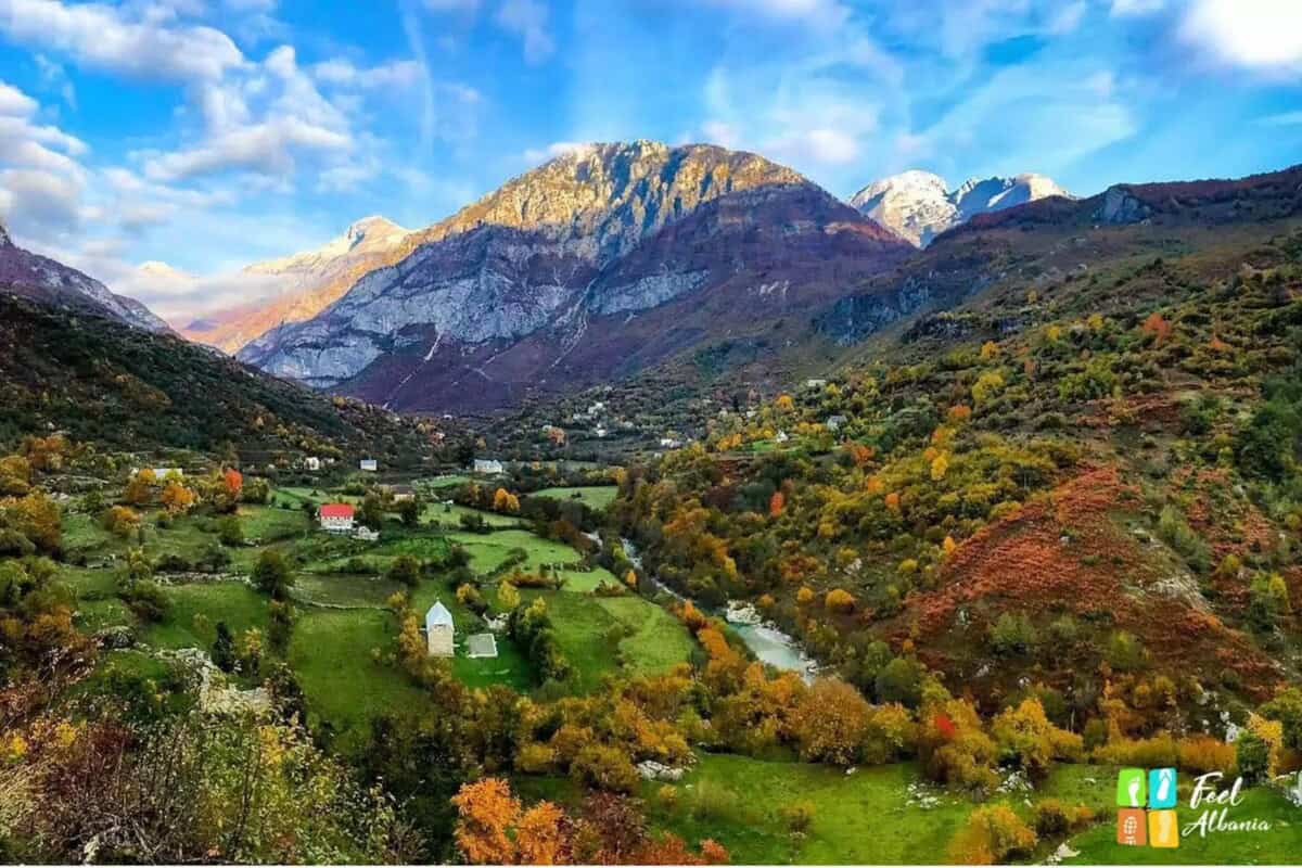
Valbonë Valley is located in northern Albania. It’s one of the least disturbed natural parks on the Balkans. However, things are changing rapidly thanks to new infrastructure development. The valley stretches across the Prokletije mountain range. The national park boasts rich biodiversity, serving as home to many rare plant and animal species. Valbonë Valley is a favourite destination for tourists seeking outdoor activities and exploration of unspoiled natural environments. The region offers countless trekking trails for hiking and mountain biking.
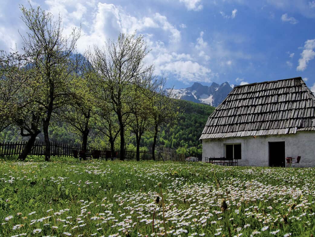
In the surrounding villages, you can visit traditional log cabins, taste local cuisine, and experience the hospitality of local people. Residents here often still live according to ancient traditions and maintain an authentic way of life. Simply wandering through the valley can be equally rewarding.
In Valbonë, nestled in the Albanian Alps, numerous amazing and modern accommodation options have sprung up, which you can book on booking.
Více o údolí Valbone
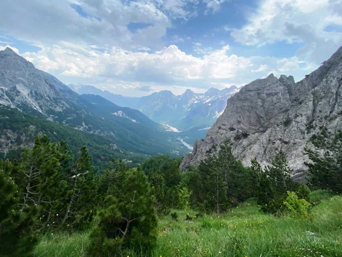
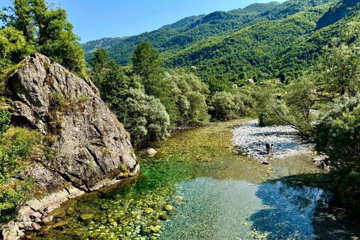
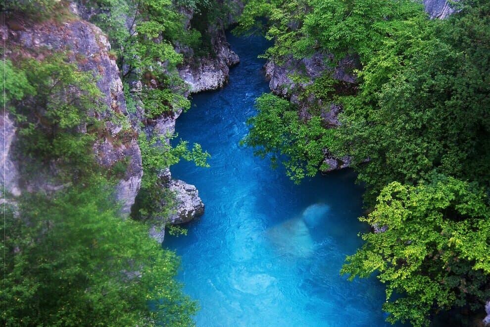
For more challenging hikers, ascents to the surrounding mountain peaks await, the highest being Maja i Jezercës (2694 m).The Valbonë River flows through the valley, renowned for its crystal-clear waters sourced from Alpine springs and fed by tributaries such as the Rragam Waterfall.
Valbonë Valley gained notoriety following the 2001 disappearance of three Czech nationals: brothers Pavel and Petr Pavelka and Lenka Tučková. Initial suspicions suggested organ trafficking involvement, but Albanian police ruled out this theory in April 2010, finding no evidence of foreign involvement. The three remain missing. The case drew widespread attention in the Czech Republic through Josef Habes Urban’s 2019 book “Return to Valbonë,” inspired by this mysterious tragedy.
Praktické
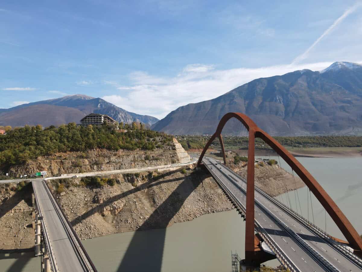
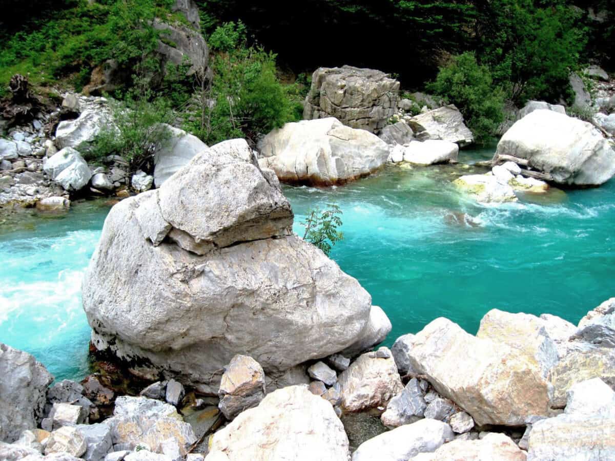
The journey from the capital Tirana to Valbonë is somewhat time-consuming, but the journey itself is an experience. Many travelers combine the trip to Valbonë with a ferry ride across Komani Lake from the dam“>. The nearly three-hour boat journey across the lake surrounded by mountains is considered one of Europe’s most picturesque lake cruises.
However, in 2025 a new tunnel was opened between Tirana and Peshkopi, from where you can reach Valbonë much faster via Kukës“>. From Durrës, the fastest route heads toward Lezhë and then right toward Milot“>. Road signs are functional. The best time to visit the valley is from May through October. Weather conditions during this period are ideal for hiking, and mountain peaks are more accessible due to the absence of snow.
Mapa
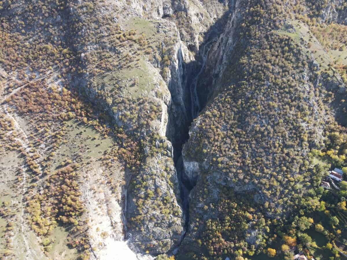
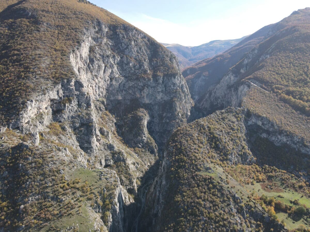
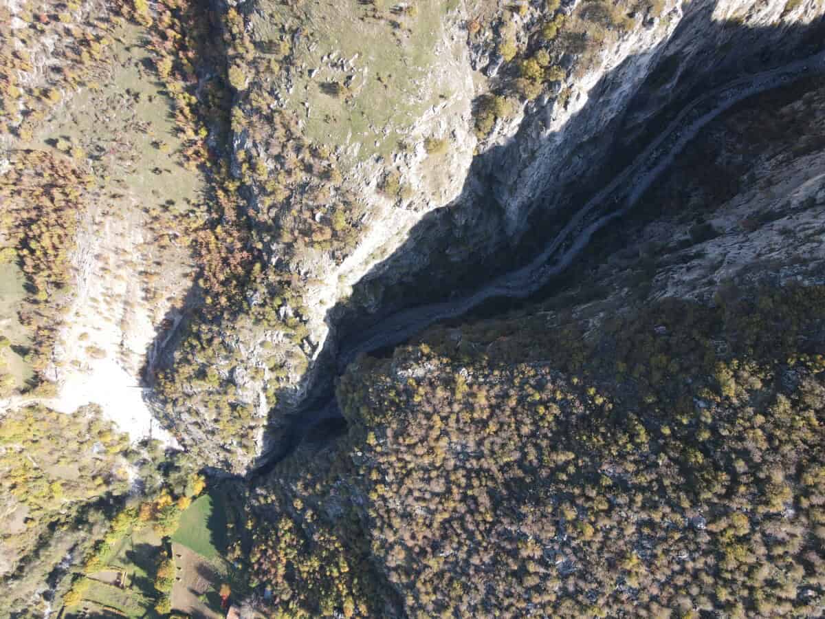
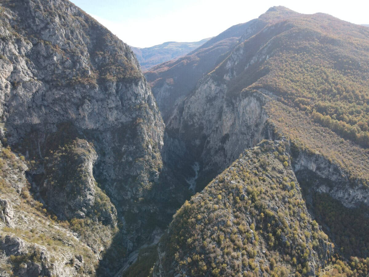
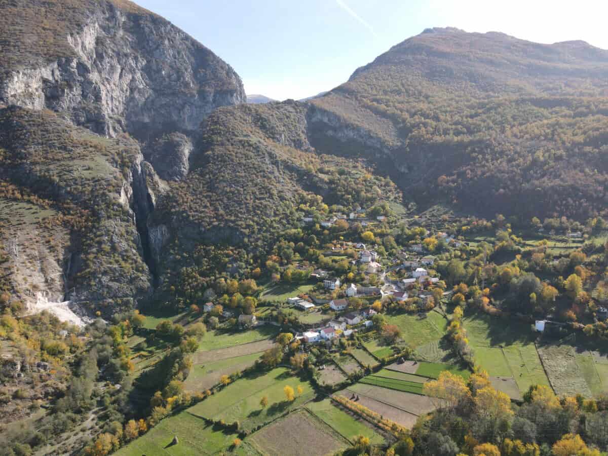
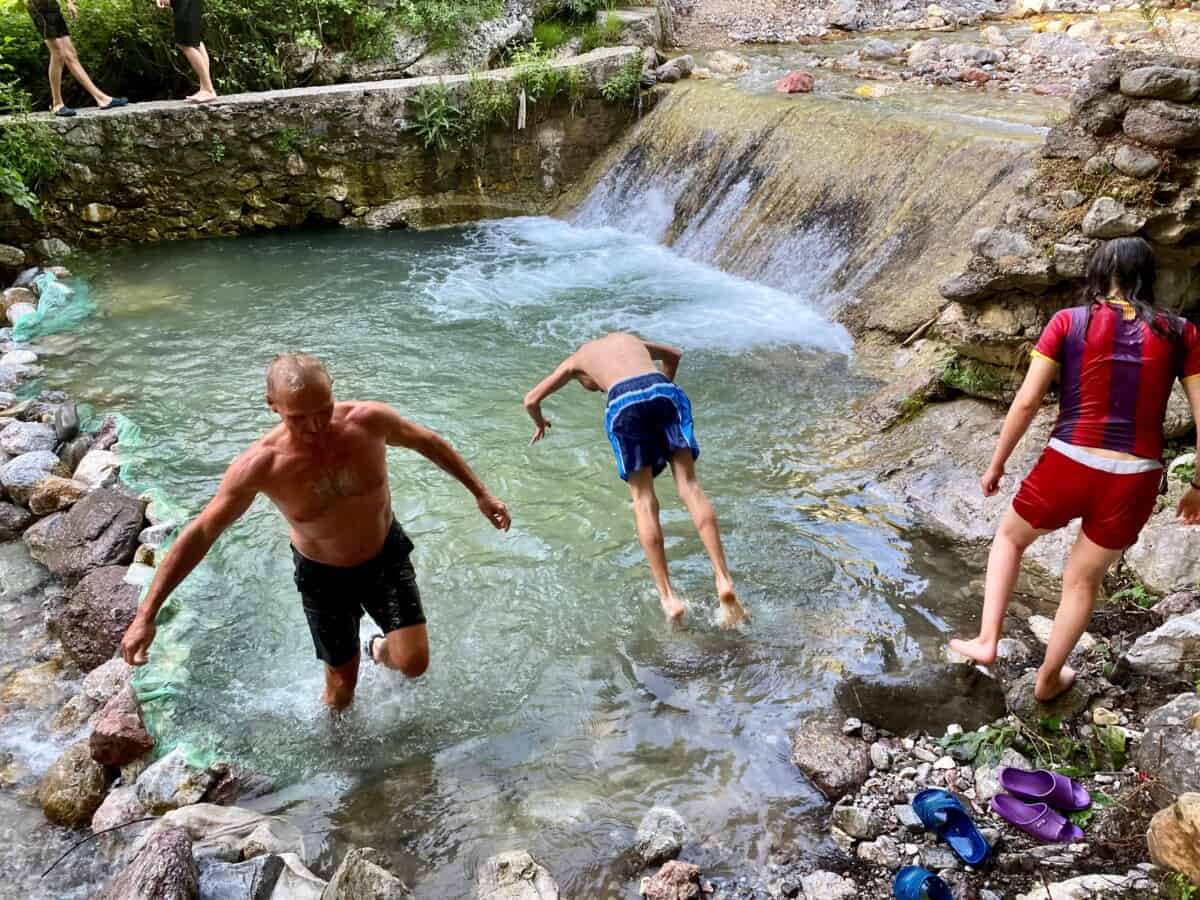
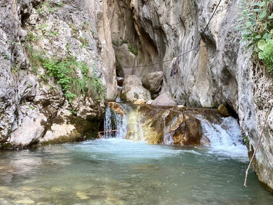
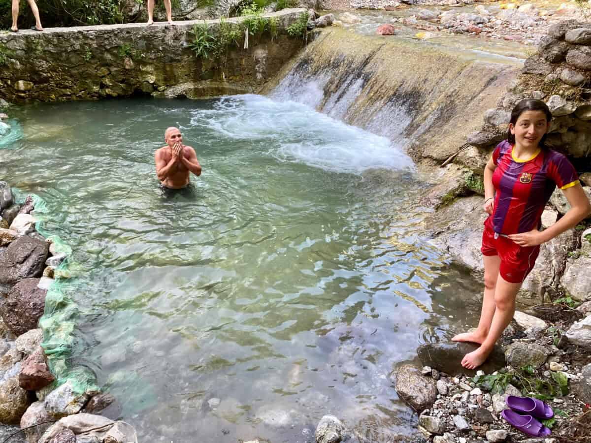
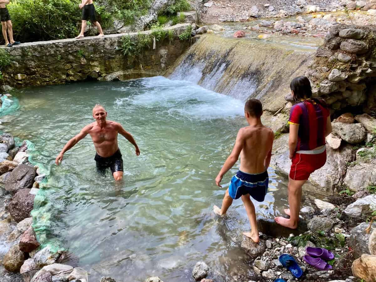
Kaňon Bicaj
Just a few kilometers south of the city of Kukës, near the small village of Bicaj, lies a little-known Bicaj Canyon“> (in Albanian Kanioni i Bicajit) or Kanioni Shejës, named after the stream that has carved a deep groove through the rock over thousands of years. The gorge stretches approximately 2.5 kilometers, narrowing in places to just four meters, with rock walls reaching heights of up to 300 meters. It’s as if the earth itself split open to reveal its raw core.
The canyon can also be explored from above via a hiking trail that leads from the back of Bicaj to the settlement of Tërshenë“>. The more adventurous can experience the canyon from within, wading through the icy river and swimming in a pool beneath a small waterfall. That is, if there’s enough water.
Více o kaňonu
What perspective the canyon will have remains to be seen. On the course of the Sheja stream flowing through the canyon, the Palushi hydroelectric plant received preliminary approval for construction in 2019. The hydroelectric power plant is to have an installed capacity of 1012 kW. However, this canyon is located in the Korab-Koritnik Nature Park and nature conservationists have expressed disagreement with the power plant.
Due to interventions carried out there so far, the waterfall, which was an attractive destination for many tourists, no longer exists. The National Agency for Protected Areas highlights the values of Bicaj Canyon and considers it a natural monument of great scientific, ecological, and tourist value.
Praktické
Mapa
Guri i Mëngjesit
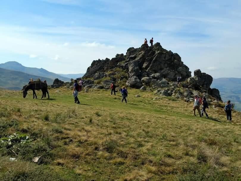
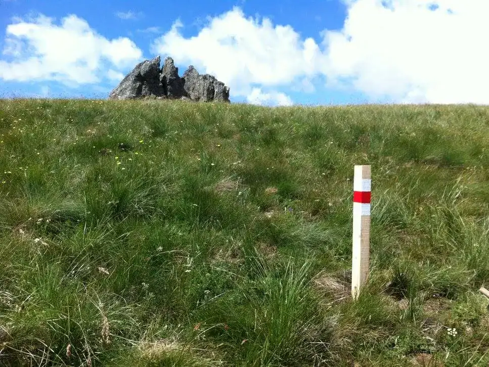
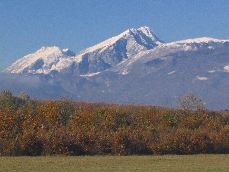
Guri i Mëngjesit (Morning Stone) is a distinctive rock formation reaching 1940 meters above sea level, located directly above the village of Shishtaveci. This stone is part of the Korab-Koritnik Natural Park, a protected area rich in biodiversity and mountain landscapes, and lies on the imaginary border between Albania and Kosovo.
The stone itself is composed of sandstone and has a conical shape measuring approximately 25 meters in length, 13 meters in width, and 11 meters in height, giving it a distinctive and easily recognizable appearance – it stands alone on a ridge leading toward Mount Kallabak, standing out against the surrounding terrain without any vegetation or other rocks obscuring it.
Více
Locals named it “Morning Stone” not because it marks the exact sunrise point, but because it served as a practical landmark for travelers navigating between villages in this mountainous region. People primarily traveled early in the morning to take advantage of visibility and adequate daylight for safe passage.
From the summit of Guri i Mëngjesit, panoramic views sweep across the surrounding mountains and landscape. To the north and east lie the Šar Mountains, stretching across Kosovo into North Macedonia, along with peaks such as Gjallica, Koritnik, Korab, and Kallabak. In the foreground stretch Southeast Europe’s largest alpine pastures, integrated into the tourist trail known as “Shtegu i Ngjyrave” or the Colors Trail, connecting the region’s diverse natural attractions and offering opportunities for extended treks.
Praktické
The ascent to this rock begins in the center of the village Shishtaveci, situated at approximately 1,350 meters above sea level. It’s roughly 30 kilometers from Kukës. From here, Guri i Mëngjesit lies about 6 kilometers away. The trail leads through alpine pastures and approaches beech forests before ascending into the Shishtaveci alpine pastures toward Guri i Mëngjesit.
The trail follows accessible and walkable terrain throughout, running through alpine pastures where spring and summer bring an abundance of colorful wildflowers that enhance the trek’s appeal. Among these, the Albanian lily (Lilium albanicium) stands out—an endemic plant typical to this region and listed as endangered due to its limited range and sensitivity to environmental changes. When encountering it, it’s essential to practice sustainable tourism principles.
The entire round-trip route covers approximately 12 kilometers with an elevation gain of roughly 600–700 meters, typically taking 5 to 7 hours depending on pace and fitness levels.
Overall, the trail is in good condition and classified as moderate difficulty, suitable for people in good physical shape or those who exercise regularly, hike, or run. During winter, extra caution is necessary due to low temperatures, snow, and ice.
Mapa
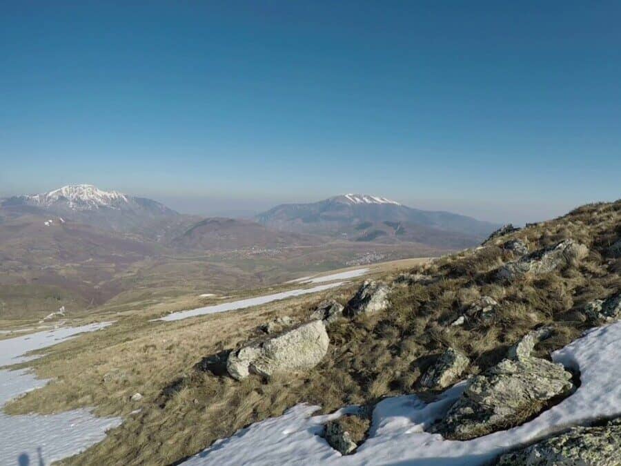
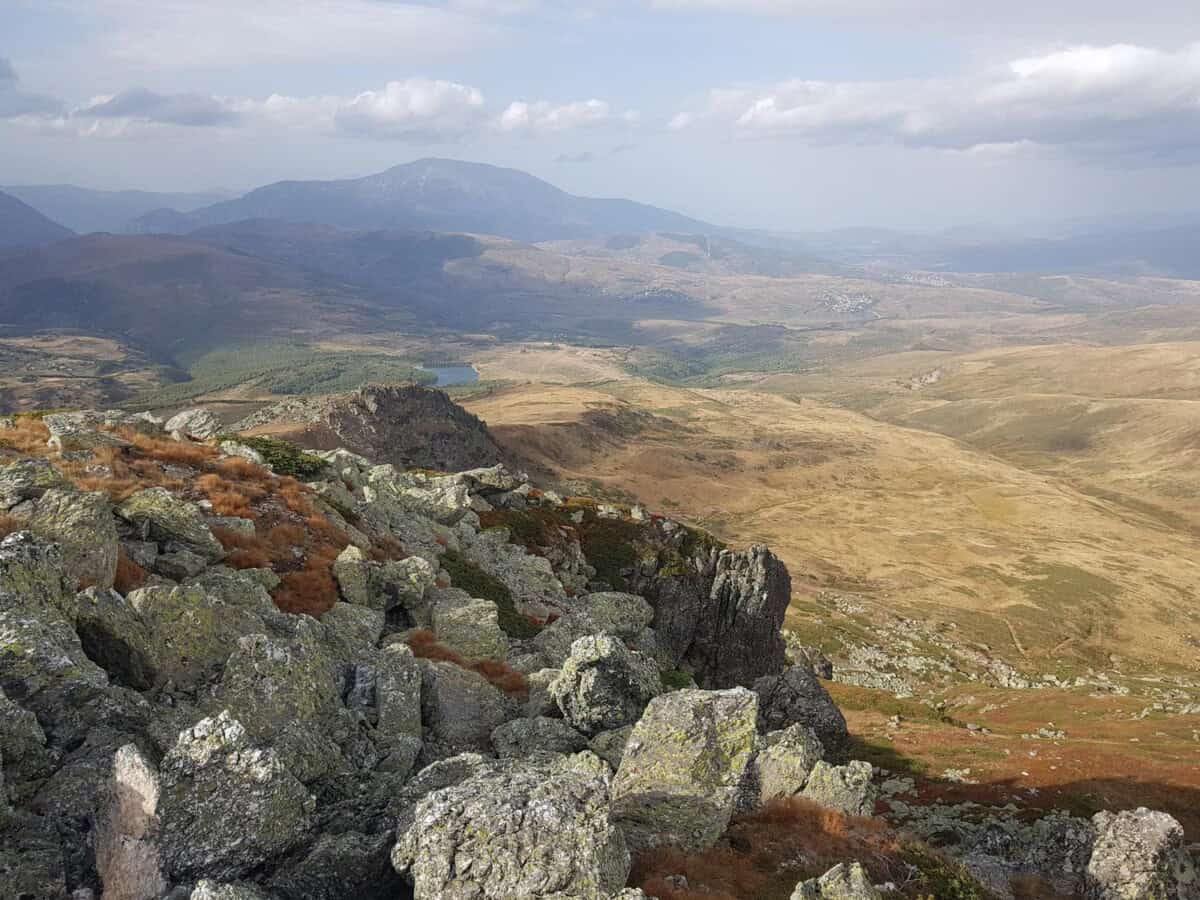
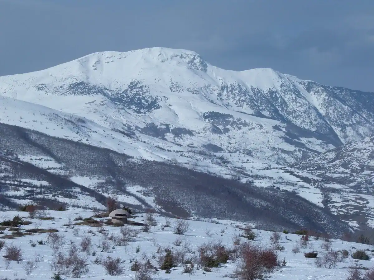
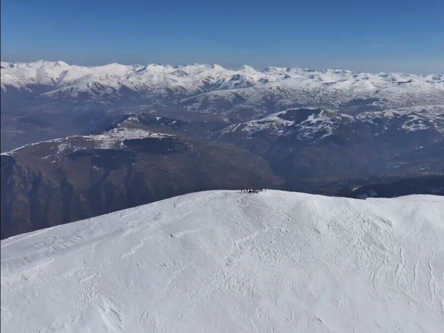
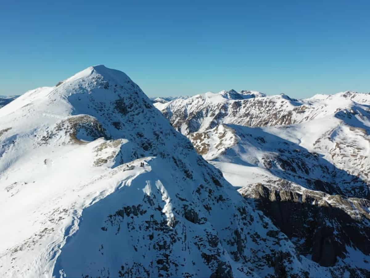
Maja e Gjallicës
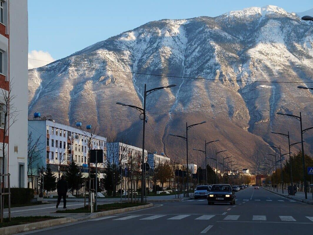
Mount Gjallica (2489 meters) towers directly above the city of Kukës, which sits just 350 meters above sea level. This dramatic elevation difference, combined with panoramic views of peaks in northern Albania, Kosovo, and Macedonia, earned Gjallica the nickname “Balcony of the North”.
You won’t regret the ascent to Gjallica. You’ll enjoy stunning views of the surrounding mountains and encounter traditional livestock shelters with handmade roofs of dried grass – this ancient roofing method is now a rarity.
Více
The ascent of Gjallica begins in the village of Brekije, situated at 1235 meters above sea level. You can reach Brekije by car from central Kukës along the road toward Shishtaveci. Near the end, you’ll drive about 3 kilometers on an unpaved road, though it’s easily passable by any vehicle.
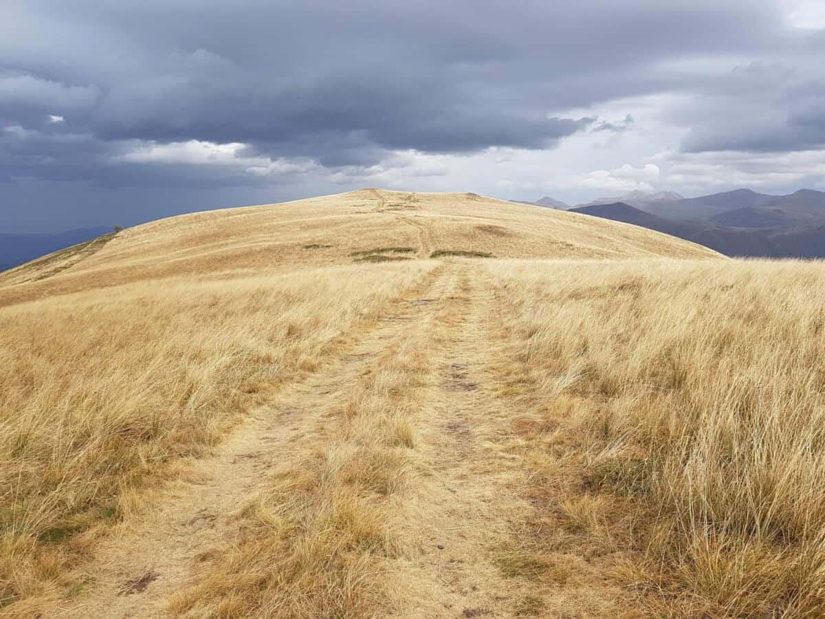
The trail starts in the center of Brekije village. After approximately 2.5 kilometers of walking, you’ll reach 1570 meters elevation. After another 2.5 kilometers through oak forest, alpine meadows and pastures open up before you at 1750 meters—areas where locals from the Bicaj region send their livestock to graze in summer.
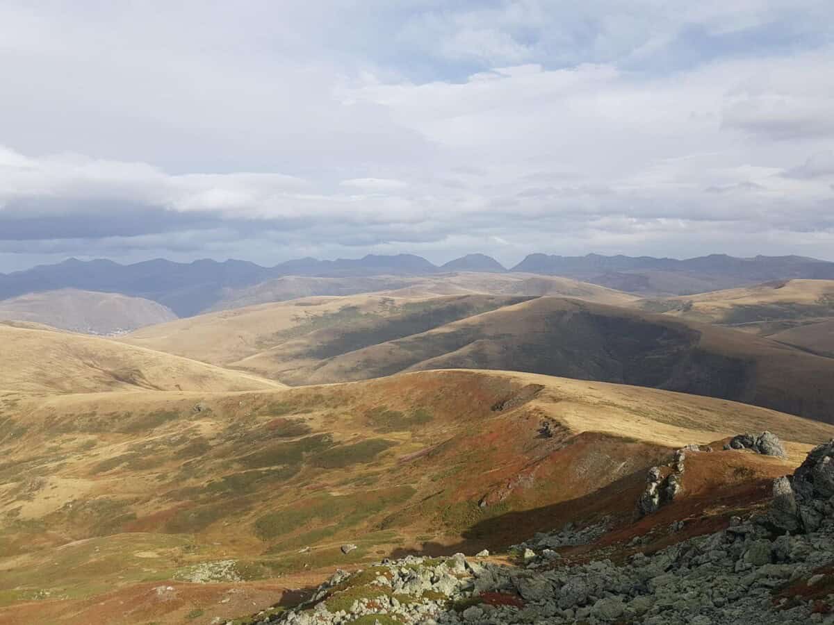
After refreshing yourself at the Kroi i Kuq spring, the path continues about 1 kilometer across bare slopes to 2100 meters, reaching the Laku or Podina meadow, which connects Gjallica’s southern slope with the Vojvoda pine forest, locally called Venmira. The trail then ascends another 1.2 kilometers along Gjallica’s southern flank to 2400 meters, where the first peak offers your first views of Kukës city, the Black Drin from Tetova and the White Drin from Prizren, which merge in Lake Kukës and continue toward Lake Koman. The final stretch to the main summit is less than 1 kilometer, running almost along the ridge to 2489 meters, where a flagpole flying the Albanian flag stands. It’s customary to bring an Albanian flag to the peaks and, if the original is tattered by wind, replace it with a new one.
Praktické
The entire tour has an elevation gain of 1250 meters and a length of 15 kilometers with an estimated time of 7-8 hours. The trail is in good condition, easy to walk and rated as moderately difficult, but in winter it requires extra caution due to possible ice and snow. Given the difficulty of the elevation gain and overall distance, the ascent is intended for tourists in good physical condition or those who exercise regularly.
Mapa
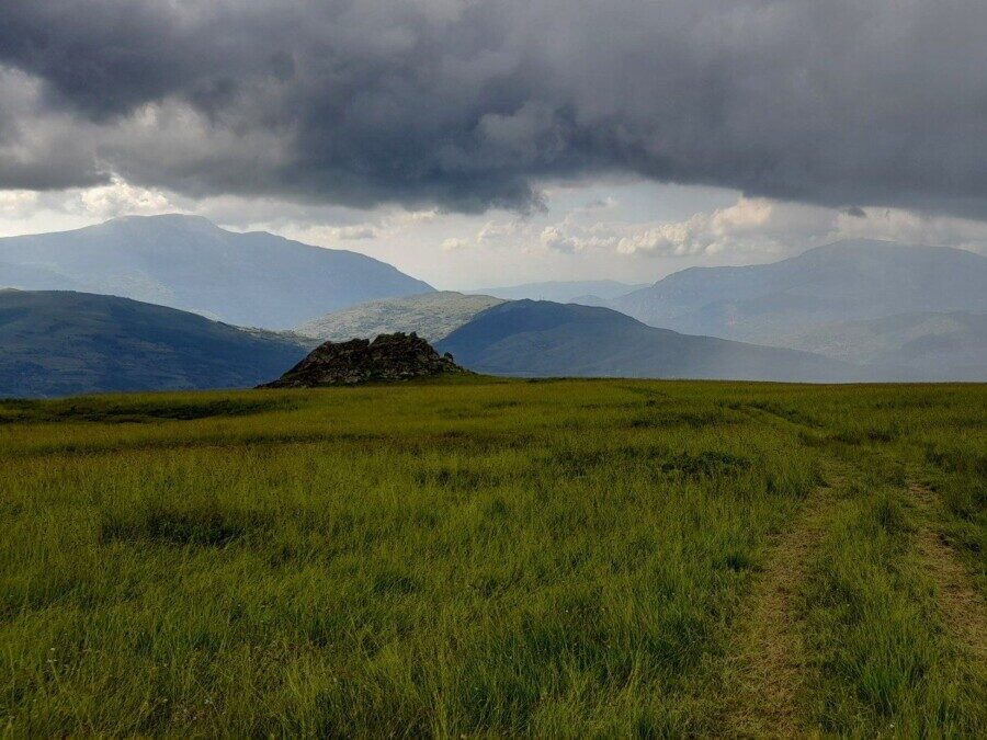
Mali Shkelzenit
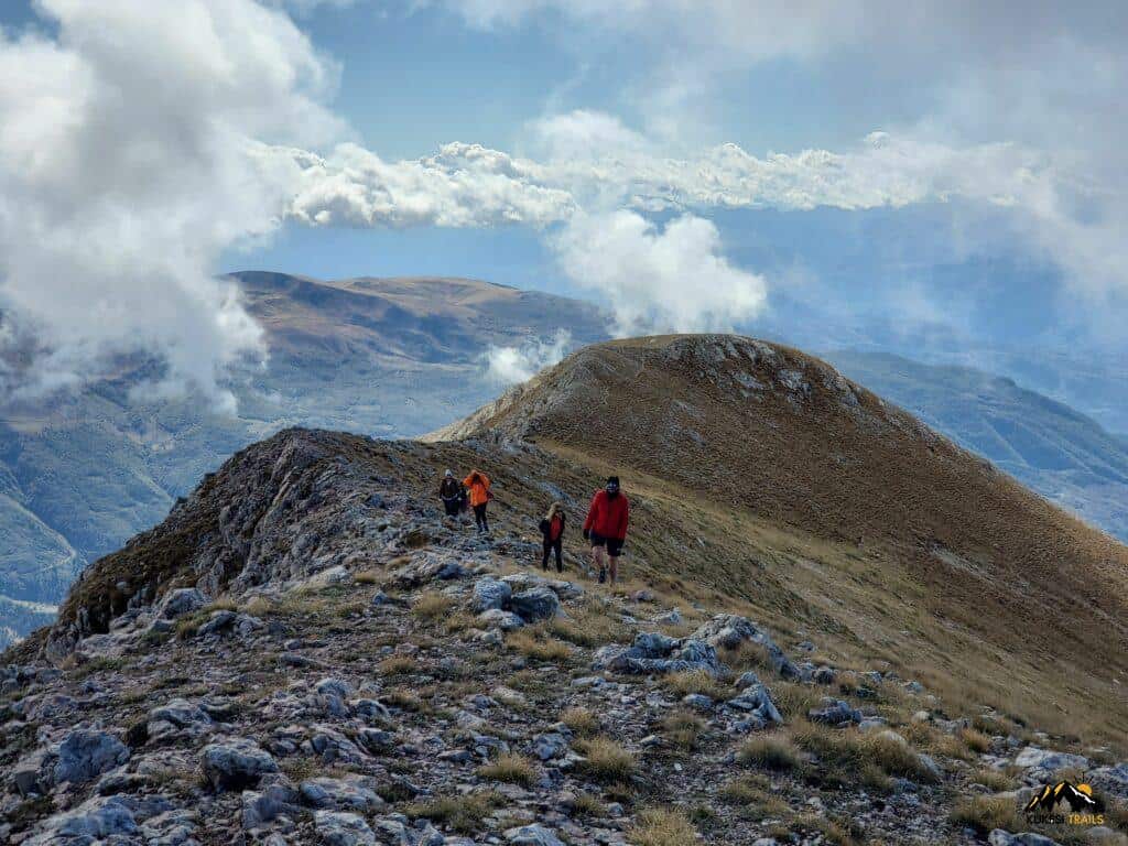
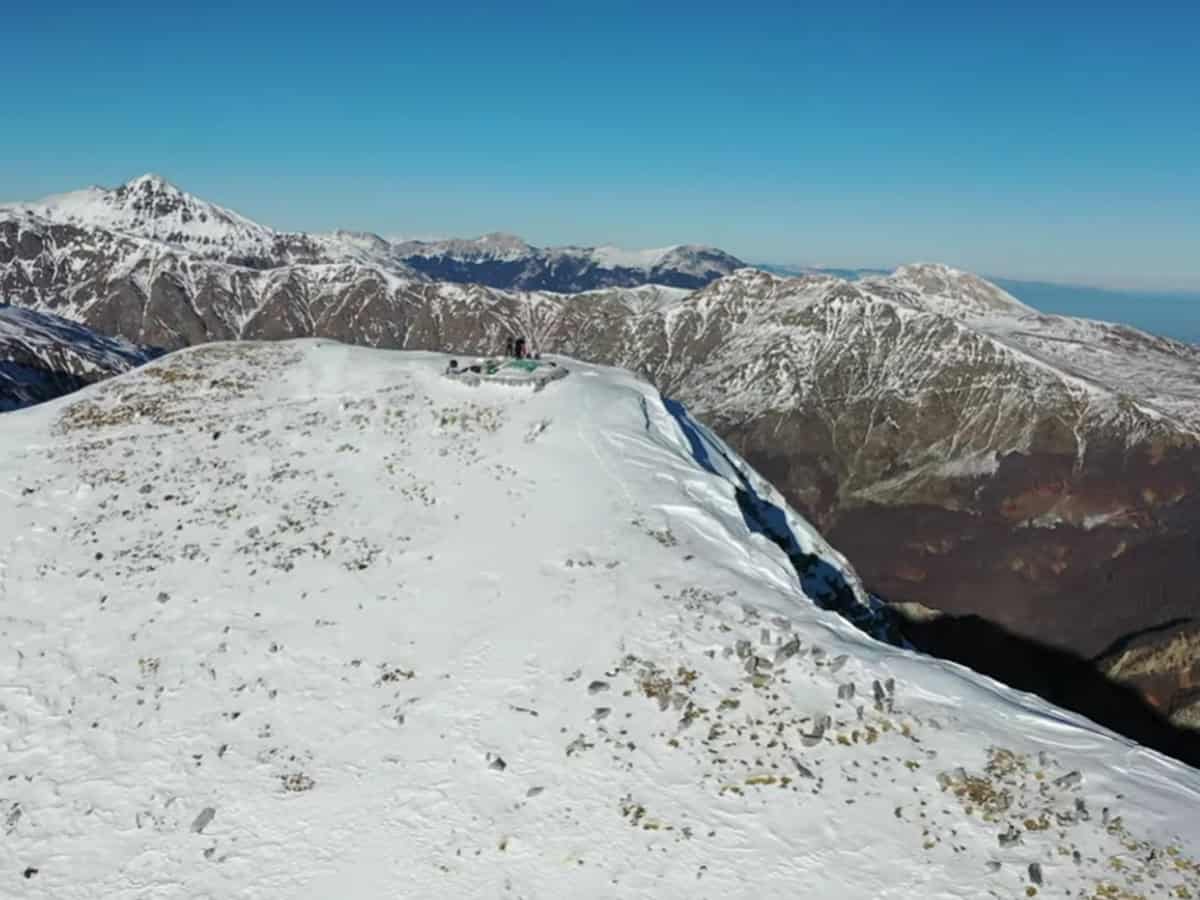
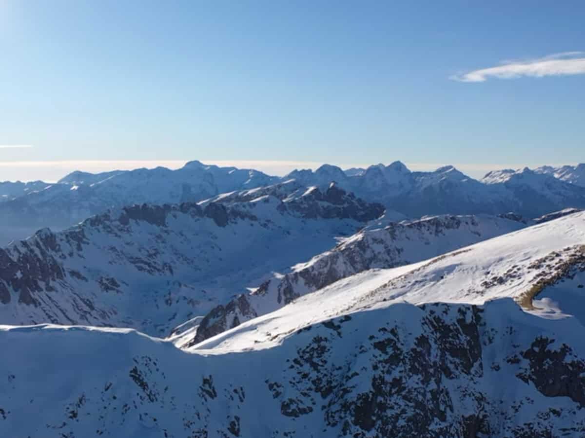
If you’re a dedicated hiker venturing into the Kukës region, you won’t resist climbing Maja i Shkëlzenit (2404 m), located on the border between Kosovo and Albania. During communist rule, this peak was forbidden fruit for tourists due to its proximity to Yugoslav borders.
The starting point is the village of Hoxhaj, situated about 14 km from the Kosovo border at 837 meters elevation. You can reach the trailhead by car or bus from Bajram Curri. Hoxhaj offers accommodation, so it’s worth arriving at the village beforehand to dedicate a full day to the climb.
Více
The ascent is possible year-round, but for less experienced hikers, spring through autumn is preferable. The trail is snow-free during these seasons, making it visible and easier to follow the markings. A winter ascent offers magnificent views of snow-capped mountains, but it’s more challenging.
Navigation is quite straightforward and direct. Locals at the small tavern in the village of Hoxaj will gladly advise where to start. Beyond the village, you’ll hike through forest and along a visible trail up to 2200 meters. The steeper gradient here makes it the most difficult part of the route. From there, you’ll mostly follow the ridge to reach the summit. From the peak, you can enjoy 360-degree views – westward toward the Accursed Mountains and eastward toward the Šar Mountains.
Praktické
The starting point of Hoxhaj is located at an altitude of 837 m above sea level and the goal is the summit of Shkelzen at an altitude of 2404 m above sea level. The elevation gain is therefore around 1600 m. The entire route will take around 9 hours in total and you will cover around 13.5 kilometers. This ascent is, given the elevation gain, intended for experienced tourists. In summer, don’t forget to bring enough water and in winter, bring crampons and possibly an ice axe.
Mapa
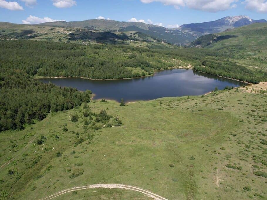
Přírodní park Nikaj Mërtur
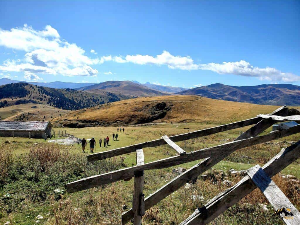
The Nikaj-Mërtur Regional Natural Park is located in the southeastern region of the Albanian Alps in the Tropoja region, on the historic territory of the Nikaj and Mërturi clans. This park represents a typical Alpine landscape with deep valleys, steep rocky cliffs, rich forests of conifers and deciduous trees, small lakes, and waterways. According to the International Union for Conservation of Nature (IUCN), it is an important botanical area due to key plant species.
The park is situated within the Albanian Alps and borders Theth National Park to the northeast and Valbonë Valley National Park to the north and northeast. There is a proposal to expand its boundaries and connect it with the Valbonë and Theth valleys, which could lead to the creation of a large Balkan park.
Více o parku
The region is located in the area of the Dinaric Alps and is typical of extensive mixed forests of the temperate zone. In the park, plant communities of Mediterranean and Central European type alternate. Most commonly we find oaks, beeches and pines, which grow on limestone and dolomite soils typical of mountain landscape. Of the oaks, Italian, Austrian, winter and Macedonian oaks prevail, supplemented by European beech and pines, such as Bosnian and Austrian pine.
The park includes a number of ecosystems and protected areas. Many animal species that are rare in southern Europe today live here. In the deep forests, lynx, brown bears and gray wolves are found. Mountain areas provide shelter for chamois, ibex and griffon vultures. The park is also very important for the protection of birds of prey, particularly the peregrine falcon and the Eurasian hobby.
Praktické
The park’s centerpiece is the somewhat forgotten village of Curraj i Sipërm. The village is quite depopulated year-round. Beyond abandoned houses, you’ll find a campground for pitching your tent, plus guesthouse accommodation options. Check conditions beforehand on WhatsApp +355693011250.
Be aware that regular cars won’t reach the village—4×4 only. However, things are changing rapidly, so paved road access may arrive sooner than expected. Your best current option is hiking from the village of Lekbibaj, which takes 4–5 hours. Reach the Lekbibaj trailhead via regional minibus from Bajram Curri.
Mapa
What to see in Albania?
Albania offers plenty of beautiful and interesting places waiting for your discovery – stunning beaches on the southern coast, majestic mountains in the north, river canyons, lakes, well-preserved historic cities and remnants of previous civilizations. Simply click on the map to select the area that interests you.
How to enjoy your vacation and avoid unnecessary spending
Stay smart
Whether you're heading to Albania or anywhere in the world, you can use the reliable Booking.com to book accommodation. You'll find a huge selection of cozy private apartments, houses and hotels. The price range is wide and you'll definitely find something for you.
Fly at reasonable prices
Need a flight? Check out the well-known Kiwi or the less mainstream but hugely popular Kayak among seasoned travellers. It's our favourite. It quickly compares offers from all airlines and shows you the best flight combinations for your budget. You can even set price alerts, so whenever a ticket reaches your target price, you'll get a notification.
Internet v mobilu
In the second half of 2026, Albania is promised free European roaming. Until then, you can get data with the YESIM app, for example. You'll get mobile internet on favorable terms.
Think about a backup plan
Good travel insurance is the foundation of any trip. A trip to Albania is no exception. Insurance covers you in case of illness, injuries and loss of belongings. We ourselves have ended up in a hospital abroad a couple of times. Having good insurance will save you a lot of stress and, most importantly, money.