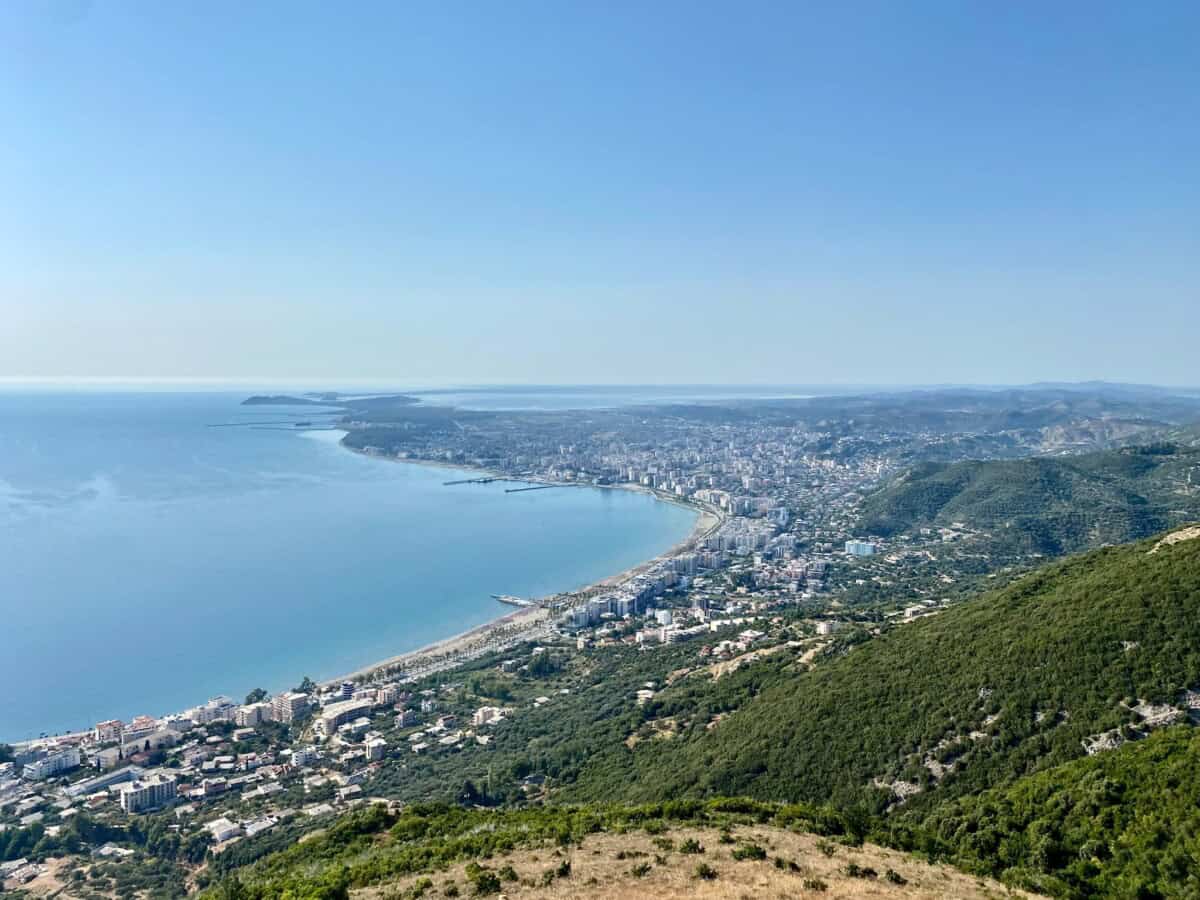
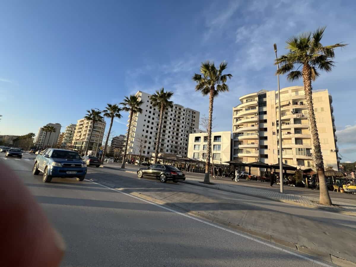
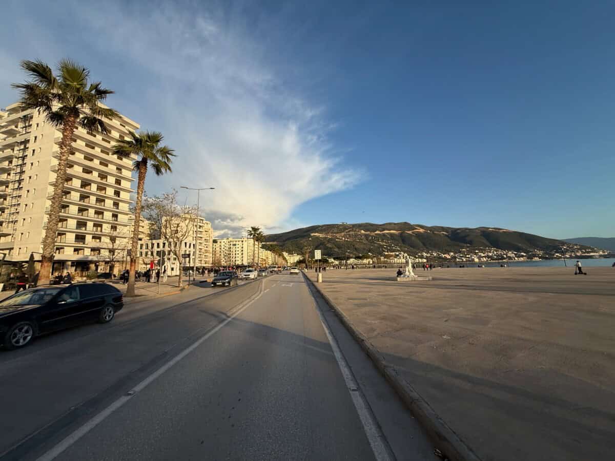
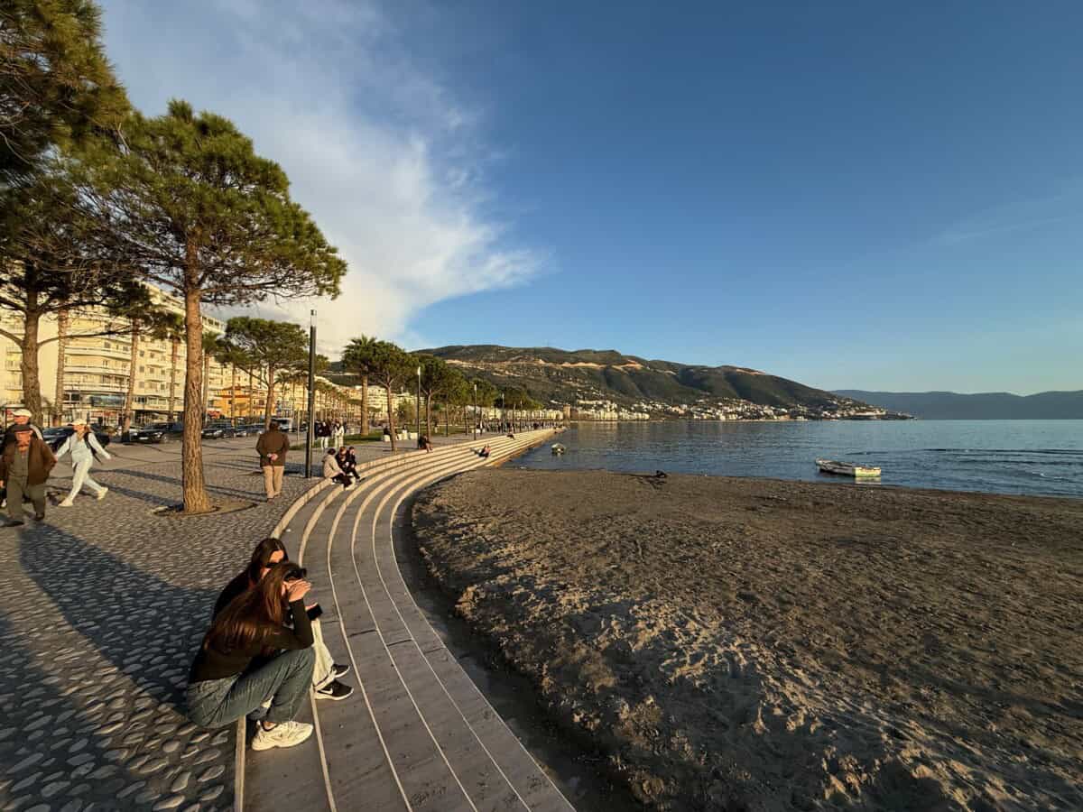
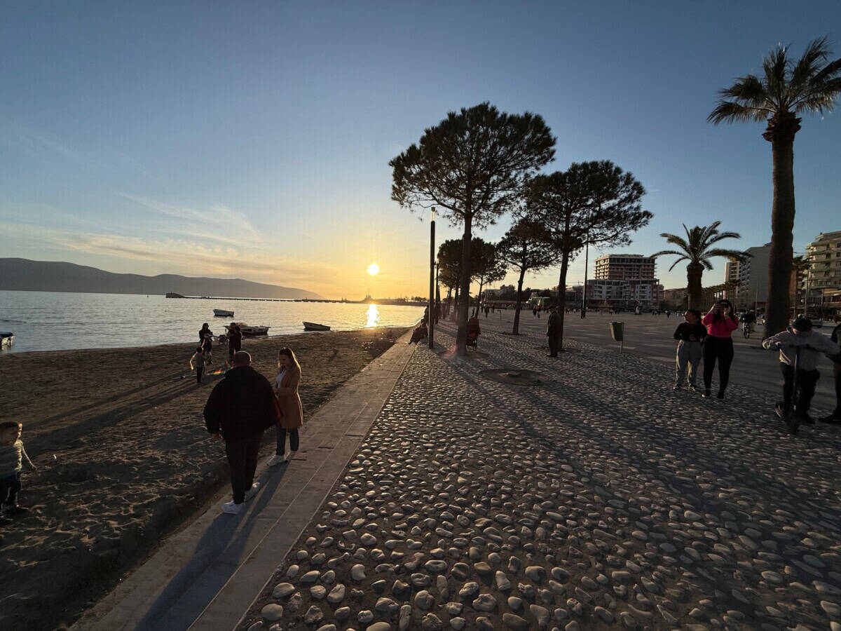
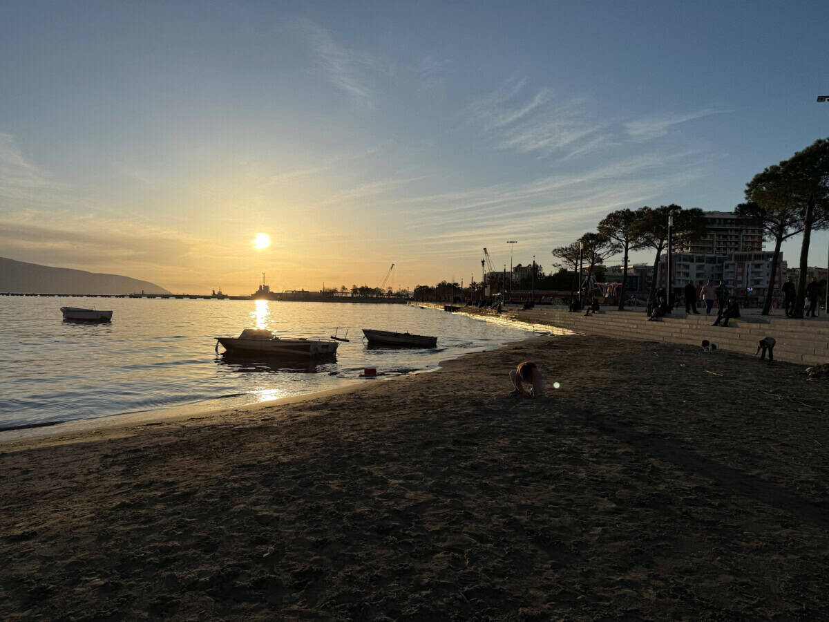
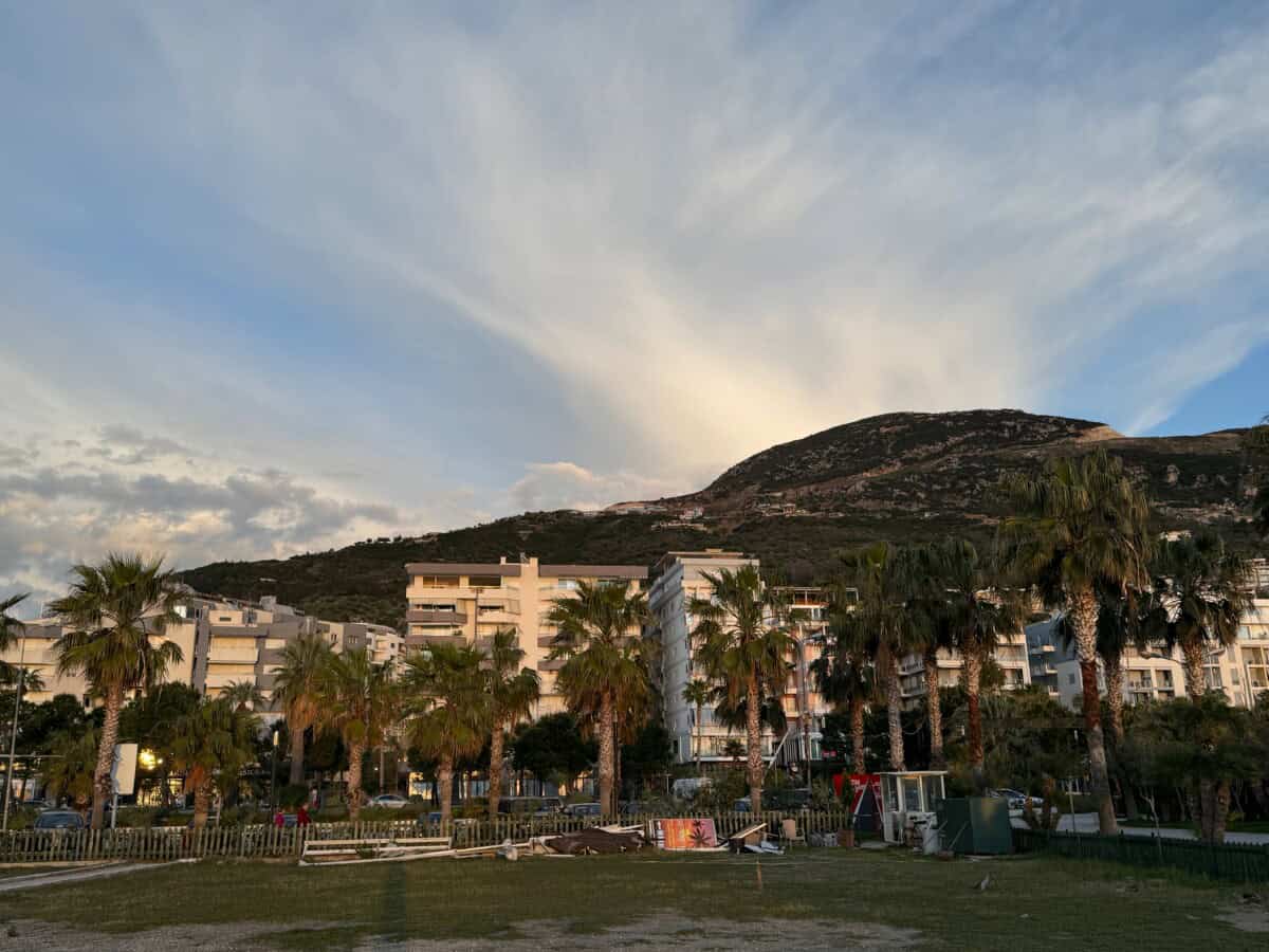
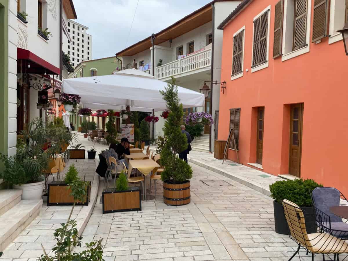
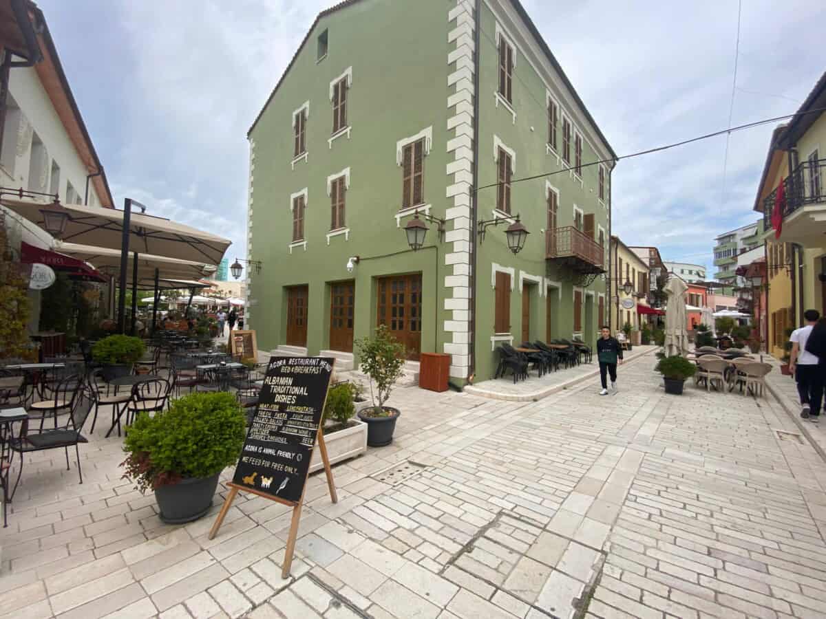
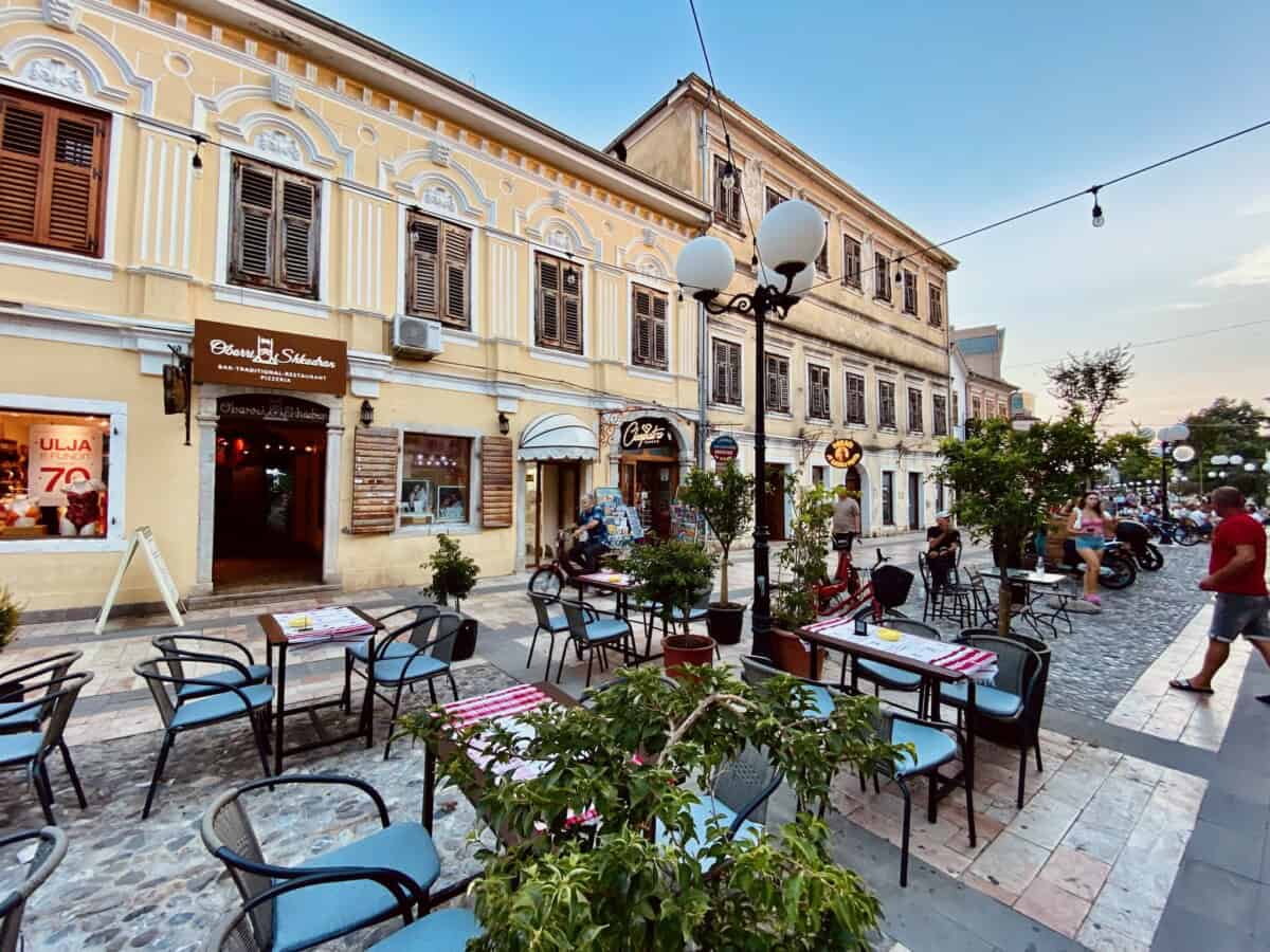
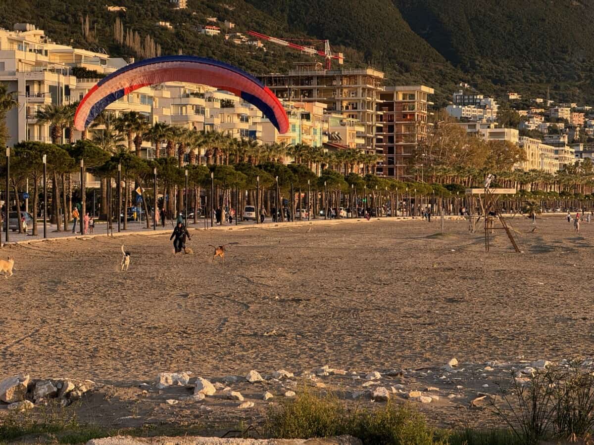
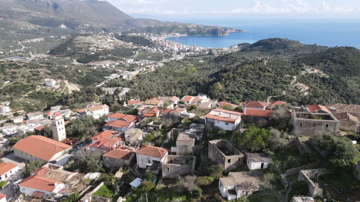
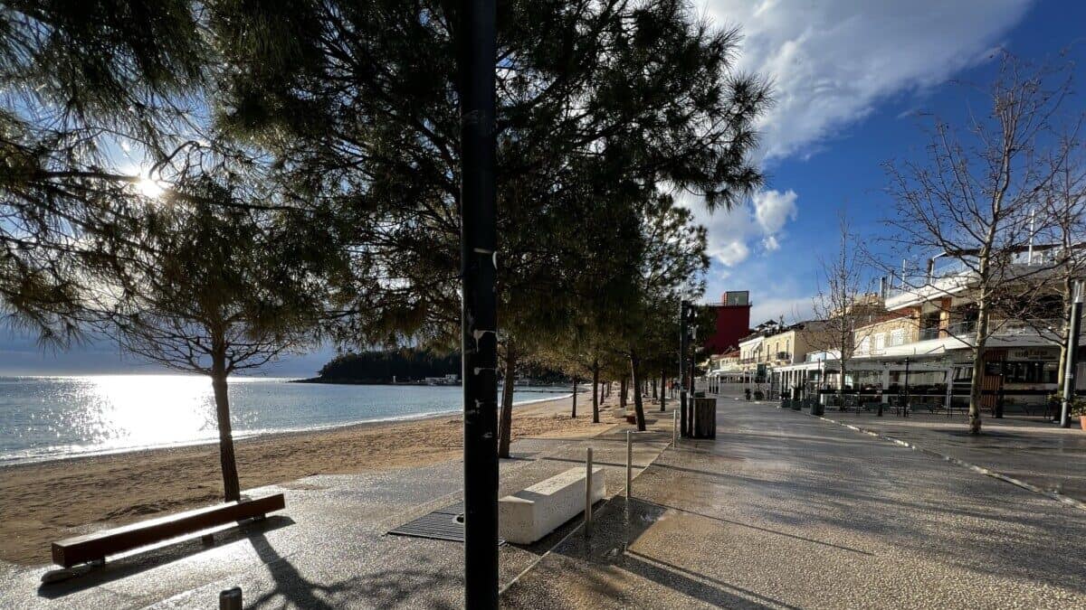
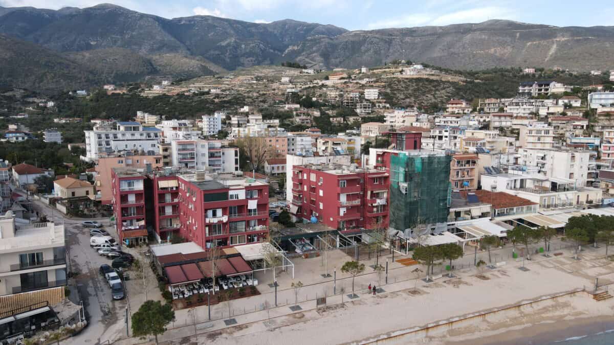
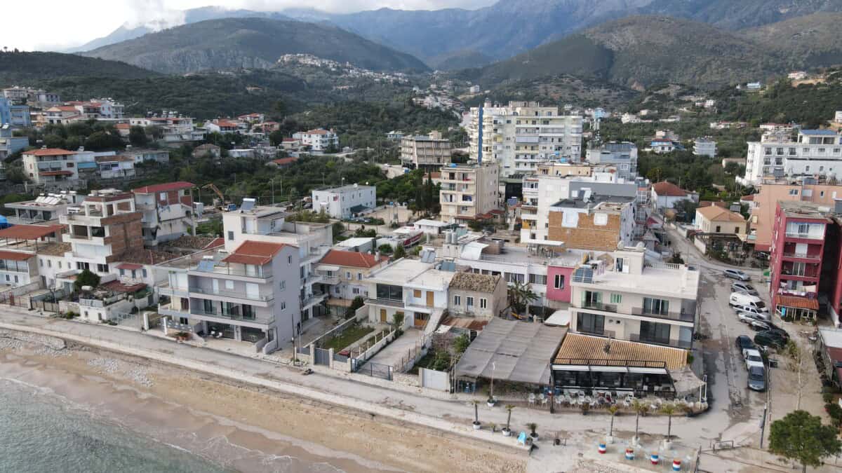
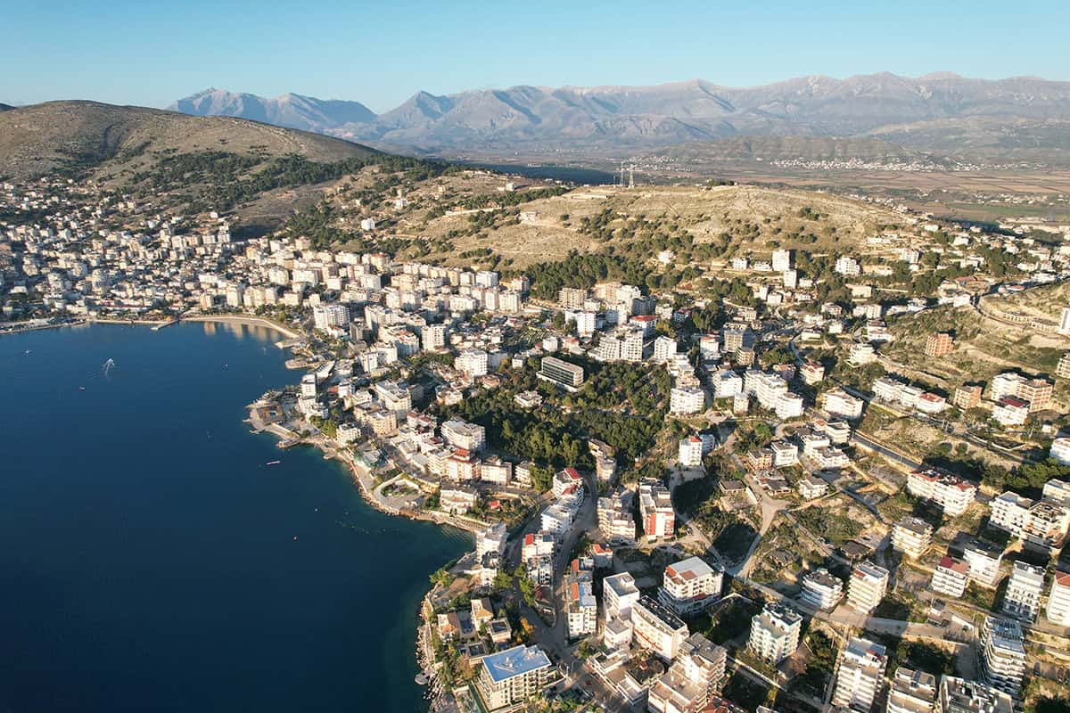
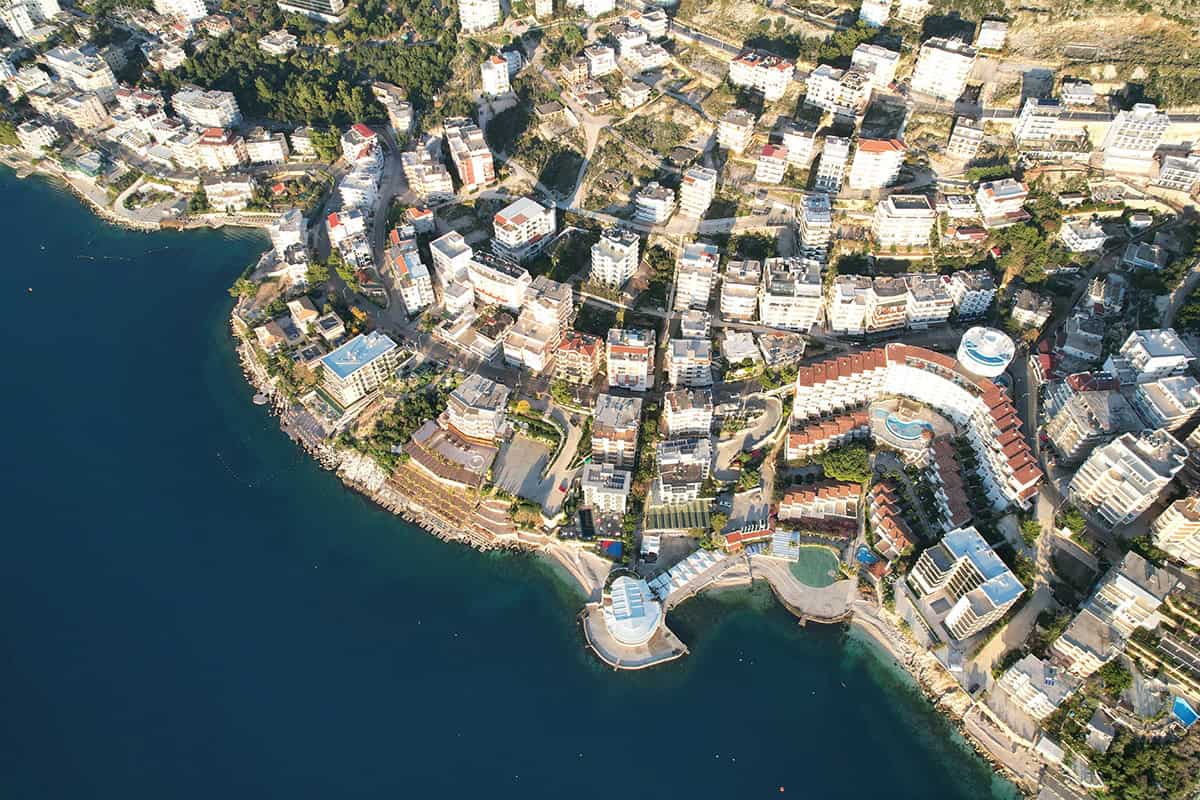
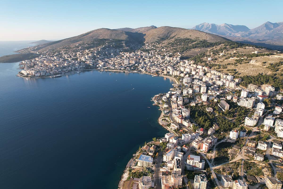
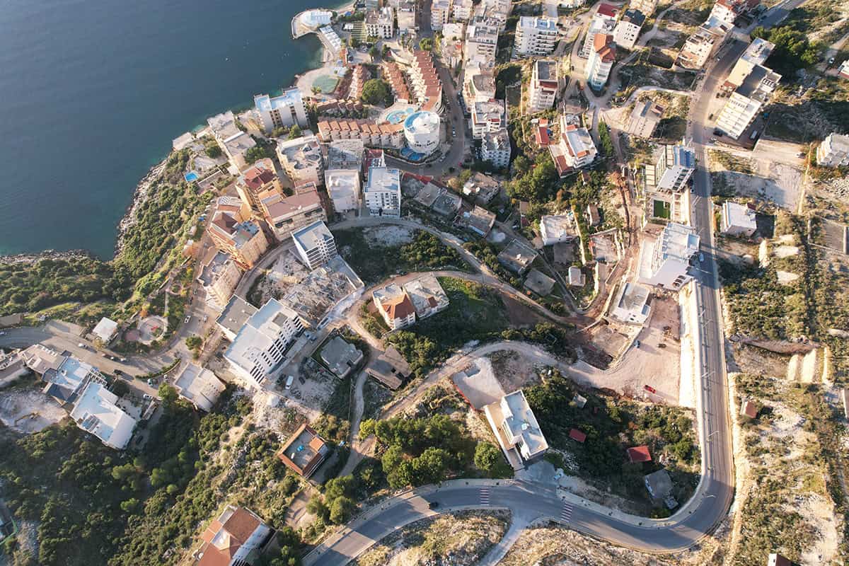
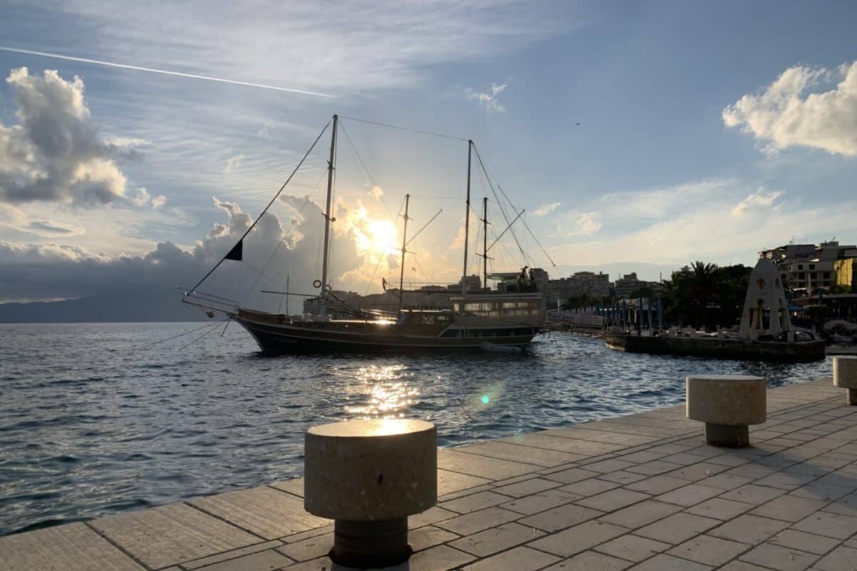
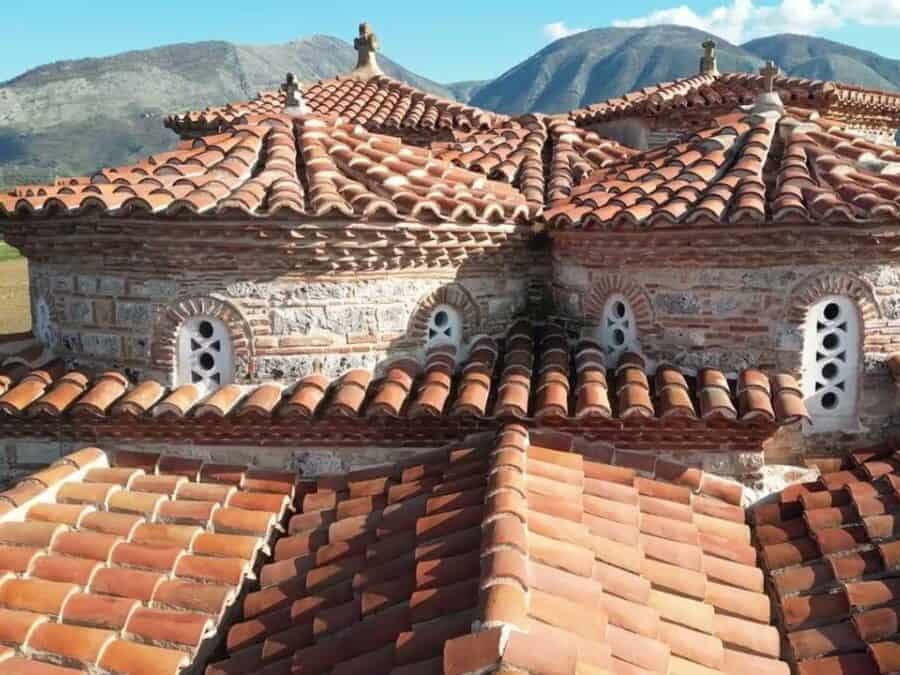
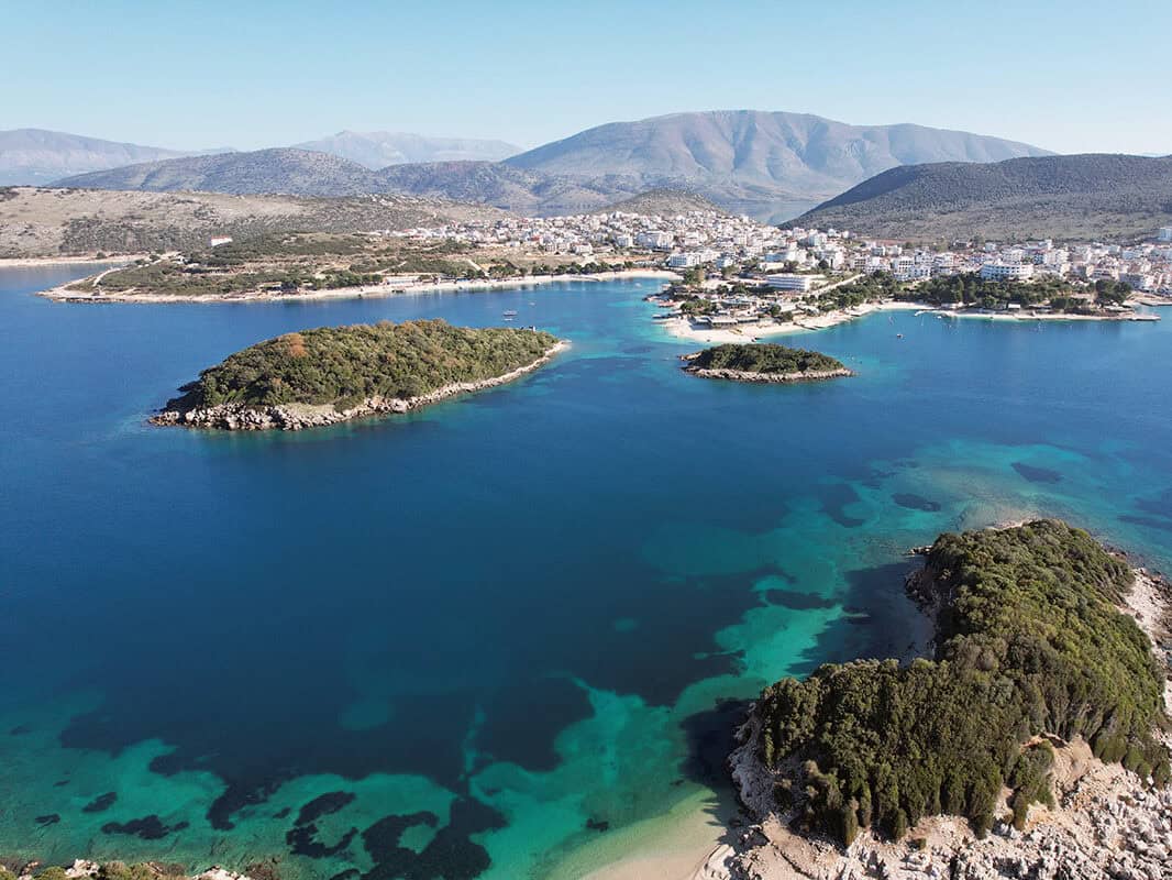
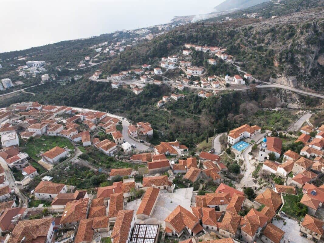
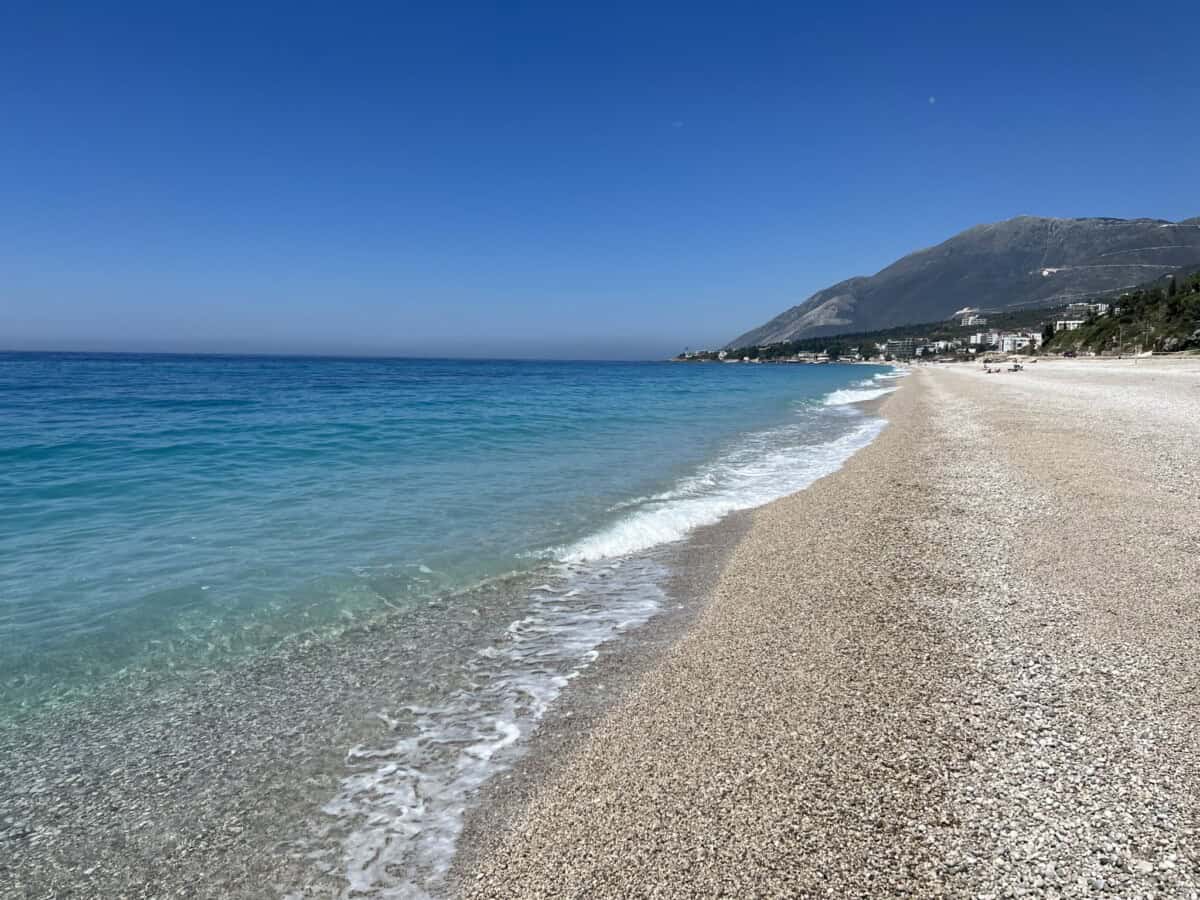
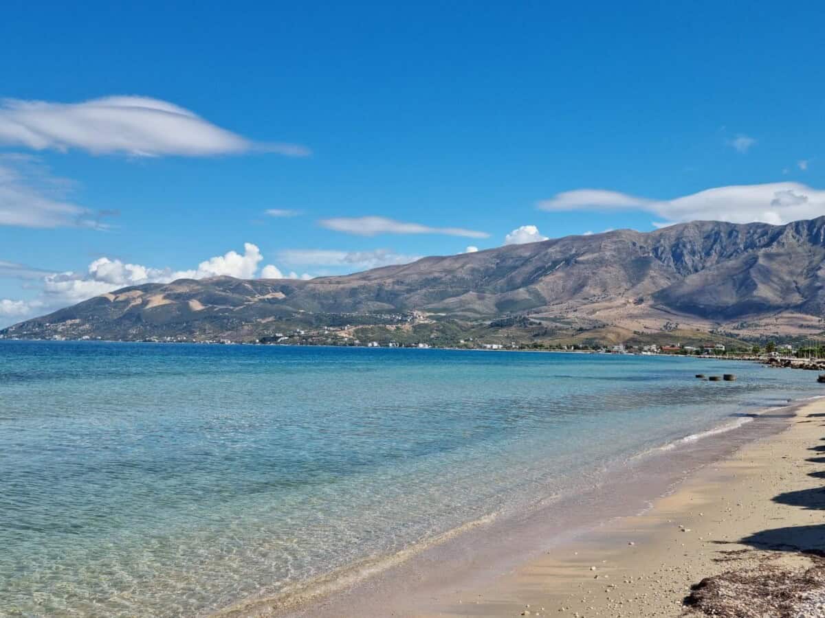
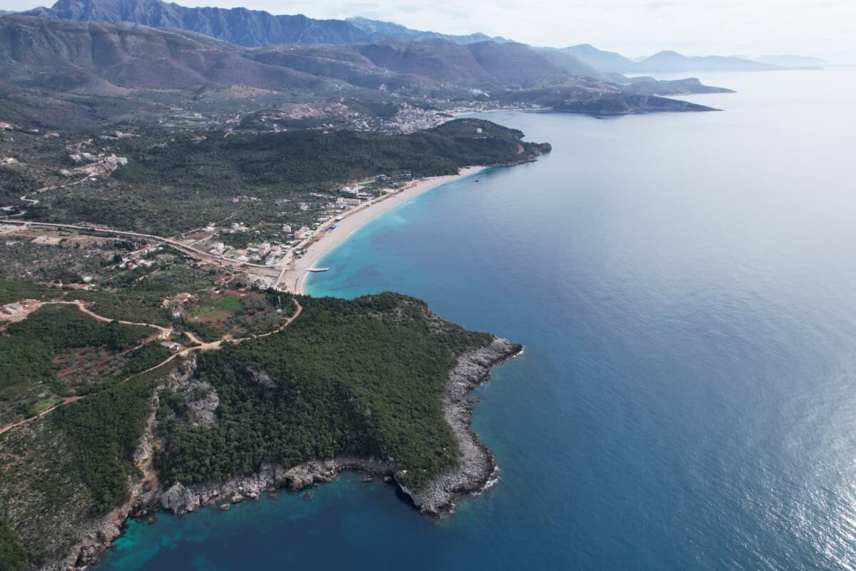
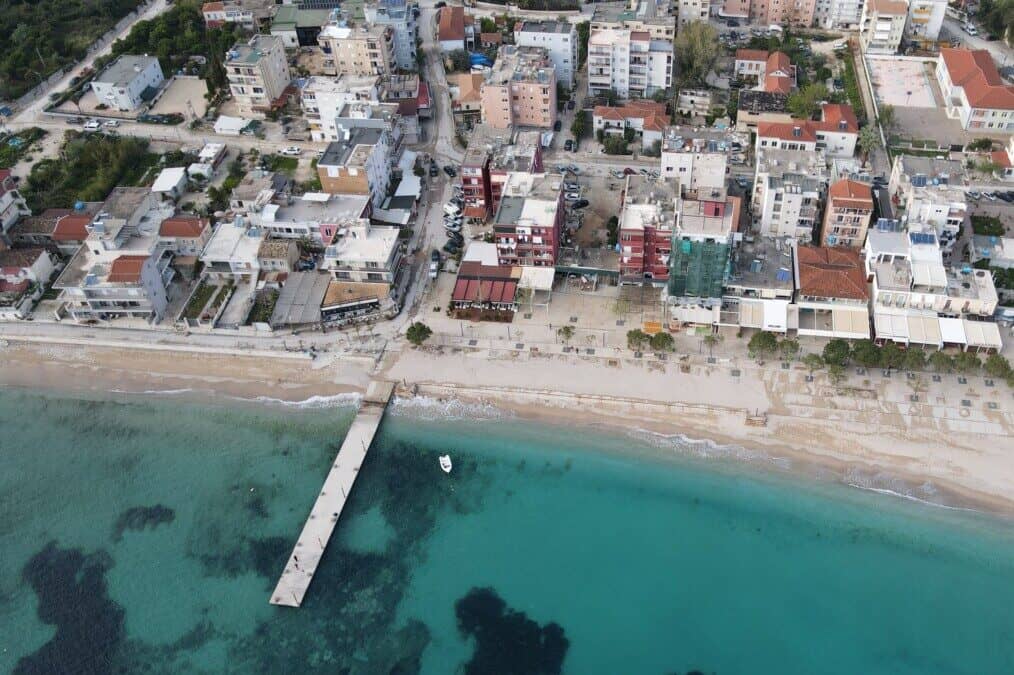
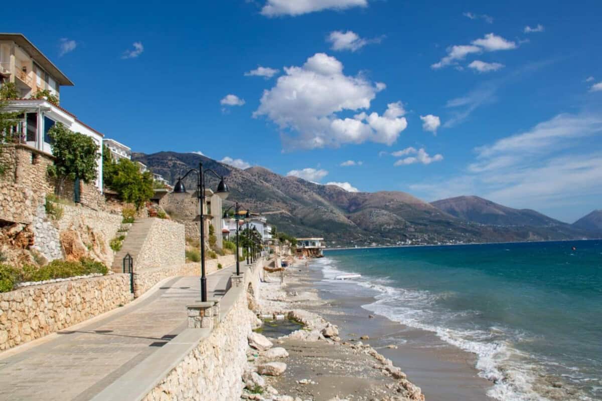
Vlorë Region
OUR ACCOMMODATION TIPS
BOAT TRIPS
City Vlorë
Vlorë is the place where Albania first announced its independence to the world over the Ottomans. Right here, on November 28, 1912, Ismail Qemali raised the red flag flag with a black eagle, and that on the balcony of the building where the Declaration of Independence was signed. This house still stands today and is now National museum of independence. Vlorë is therefore not just a seaside resort, it is the birthplace of modern Albania.
The geographical location of the city is also interesting. It is located at the border between the Adriatic and Ionian seas. The city beach offers a view of turquoise seawater, to the left the Karaburun peninsula (the largest Albanian peninsula and a national marine park) and to the right the island of Sazan (a former strictly secret military base – today a destination for recreational cruises and probably a future residence of Donald Trump’s son-in-law).
Více o Vlorë
The historical face of the city is hidden in the narrow streets of the old town. Besides cafes, you will find here for example the Lead Mosque (Muradiye) from the 16th century and right next to it the Museum of Historical and Cultural Heritage located in a beautiful Ottoman house. New Vlorë is illustrated by a long promenade full of cafes, bars with live music, restaurants with views of the bay and hotels. Vlorë is a place where history, wild nature and a relaxed Mediterranean lifestyle intertwine.
Vlorë was founded in the 6th century B.C. under the name Aulona as part of Illyria and has been continuously inhabited since then. As a crossroads of land and sea routes, known for its wine, olives and salt, after the fall of Apollonia and Orikum it became the main port of Illyria. In the Middle Ages the fate of the city was bound to the fortress Kanina (Kalaja e Kaninës). In 1081 Vlorë was conquered by the Normans, in 1205 by the Venetians and then the city briefly came under the rule of the German Hohenstaufen. In 1272 it was incorporated into the kingdom of Arbëria.
At the beginning of the 15th century (1417) the city of Vlorë became part of the Ottoman Empire. In 1531 Suleiman I the Magnificent had a fortress Skela built about 4 kilometers from the city . It existed complete and well-maintained until the beginning of the 20th century. Unfortunately it was destroyed in 1906 and the stones of its walls were used as material for the construction of the Vlorë-Skela road.
In the 1950s the port in Vlorë served the Soviet Union’s army as a naval base. After the break with the Soviet Union in 1961, several submarines remained there, which the Albanians refused to return. In January 1997 the city became the center of popular demonstrations against fraud in pyramid schemes, in which about 2 million Albanians lost 1.5 million dollars. On February 20, 1997, approximately 50 students from the University of Vlorë started a hunger strike and demanded the resignation of the government and full return of invested funds. The protests eventually led to the fall of the Democratic Party government and civil war. A very rough estimate of the victims of the unrest in 1997 is around 2-3 thousand.
The history of all of Albania and thus also of Vlorë is sprawling and dramatic. Today, however, Vlorë is a peaceful gateway to the Albanian Riviera and after the dramas of old times it is now testified only by historical buildings and entries in chronicles. New construction is growing at an incredible pace and so the city of Vlorë is transforming into a modern seaside resort, which can offer clients the standards they are accustomed to in established recreational destinations. When you sit in the evening over a glass of raki or wine and watch the sun set behind the island of Sazan, you will understand why Albanians call this city “the city of two seas and one great love”.
Praktické
Parking in Albanian cities is becoming an increasingly bigger problem even outside the season. It’s ideal to find out information about official larger parking lots in the given city in advance and not waste time wandering around. After all, vacation has its time limits. Great are places that are within walking distance of historic centers or perhaps the coast. Such places include in Vore for example this. However, you must count on the fact that both to the center and to the coast you will walk a little bit.
Mapa
Hrad Kanina
On a hill rising 380 meters above sea level, just six kilometers from the Albanian port city of Vlora, stands the once-imposing Kanina Castle. Its massive walls, stretching an entire kilometer, enclose an area of 3.5 hectares and remain a silent witness to past battles, reconstructions, renovations, and successive rulers. The castle has a rich history dating back to antiquity, and was gradually expanded and rebuilt during the Byzantine, Ottoman, and medieval Albanian eras.
The first phase of the fortress dates from the late 4th to early 3rd century BC and is associated with the development of fortified sites in the region by Illyrian tribes. The most significant mark was left by Byzantine Emperor Justinian in the 6th century, who rebuilt the castle as part of his ambitious program – in total in the Epirus region (a broad area from Montenegro to Greece) he repaired or built nearly one hundred fortifications.
Více o hradu
In historical records, the castle appears under the name Kionin. The name Kanina was first documented in the early 11th century AD. In the 12th and 13th centuries, the castle became a key military center of the medieval Albanian Kingdom. In 1530, when the castle already belonged to the Turks, it was renovated by Ottoman Sultan Suleiman. From the 17th to 19th centuries, local Albanian feudals from Vlora invested in it.
Today we can admire the remains of walls, towers, and other architectural elements that reflect the influences of various cultures and epochs. An interesting documented event is certainly the wedding of national hero Skanderbeg, who married here in 1451 to Donika, who came from the influential noble family Arianiti. The wedding lasted three days and three nights. The marriage connected two important Albanian noble families, which was crucial in the struggle against the Ottoman Empire.
Inside the fortifications once stood residential houses, barracks for the garrison, ammunition stores, and water cisterns. In the early 16th century, Kanina had 514 civilian households, all of which were Christian. It is remarkable how cities in southern Albania managed to retain many of their privileges even under Turkish rule – for example, religion. Of course, it was not free; everything was a trade-off. At the end of the 17th century, Kanina was described as a city with a garrison of 400 soldiers and a citadel. Inside the walls, there were reportedly 320 stone houses and 300 houses outside the walls.
Praktické
Parking is possible directly at the fortress HERE. Work on the infrastructure is ongoing. Entry between the dilapidated fortress walls is free. If you have accommodation in Vlorë, spending a few hours on an excursion to the ruins of Kanina Castle is worth it. If only for the view and further proof of how human populations thought strategically and placed their settlements in locations that were safe and provided an excellent overview of the surroundings.
Mapa
Ostrov Zvërnec
The island of Zvërnec is located in the middle of the Narta Lagoon. It measures 430 meters in length and 300 meters in width and is almost entirely covered with tall pine trees, which border the medieval monastery from the 13th century (another theory estimates its construction to the 10th century). The monastery is dedicated to the Virgin Mary and is one of many examples of magnificent Byzantine (or Eastern Roman) architecture in Albania.
The island offered, and still offers today, ideal conditions for rest, walks, and quiet spiritual contemplation. A picturesque wooden bridge about 270 meters long leads to the island. During a walk above the lagoon surface, you can enjoy stunning views of the water with wading flamingos. You’ll see the most of them in spring and autumn. The Narta Lagoon, in which the island of Zvërnec is located, is one of the largest and ecologically most significant lagoons in Albania.
Více o Zvërneci
With an area of 41.8 km², it represents a significant natural complex, approximately one-third of which – primarily the northern part – is used for salt extraction. It is separated from the Adriatic Sea by a narrow strip of dunes, about 8 km long.
The beginnings of organized monastic life date back to the 4th century in Egypt, where Saint Pachomius (ca. 292–346) founded the first cenobitic (communal) monastic communities. Unlike the previous eremitic (hermitic) way of life that dominated under Saint Anthony, Pachomius created structured monasteries where monks lived under a common rule in obedience to an abbot (or hegumen). During their stay in the monastery, they devoted themselves to common prayer, manual work, crafts, copying and writing books, and other useful activities.
Monasteries were deliberately placed in isolated locations, far from worldly bustle, to enable deeper concentration and spiritual peace. This model spread rapidly and around the 6th century reached the territory of present-day Albania, where the first Byzantine monasteries appeared. It is precisely in the context of Albanian Orthodox heritage that the monastery on the island of Zvërnec (Manastiri i Shën Mërisë) stands out with its historical depth. However, the island also has its more modern history.
The uniqueness of the island is further contributed to by the fact that in 1932, Marigo Posio (1882–1932) was buried in the small monastery cemetery, a significant Albanian patriot who is traditionally recognized as the embroiderer of the Albanian flag raised by Ismail Qemali at the declaration of Albanian independence on November 28, 1912 in Vlora. The story of the discovery of her grave is interesting. After the atheist campaign in 1967, when the communist regime of Enver Hoxha systematically destroyed religious monuments and closed all monasteries, the cemetery was abandoned and the location of the grave was forgotten.
In the 1980s, however, a letter arrived at a cultural association in the then Vlora district. It was written by an elderly relative of Marigo Posio from the Kolonja area, who insisted that the grave was located here. Based on this testimony, the grave was subsequently located and identified. It is a touching example of how the nation’s memory is preserved in details and emerges bravely to the surface even in times of deepest oppression. This monastery thus embodies not only the continuity of Byzantine tradition in Albania, but becomes a place connecting spiritual heritage with modern national history.
If you’re looking for an escape from crowds, venture to the island of Zvërnec and let yourself be enchanted by the quiet charm of this hidden place.
Praktické
Arrival from Durrës to the Zvërnec area is easy. On the way from Durrës, you turn right at a large roundabout before Vlorë. The turnoff is well marked. You will reach a parking lot where you can find a spot even during peak season. Parking and entry to the church are free. As already mentioned, large flocks of flamingos unfortunately cannot be seen in summer. These birds migrate to cooler zones during this period. If you want to enjoy the view of pink creatures with long legs, come in spring or autumn. Since you are already in this area, it is worth taking a trip to the nearby lighthouse, from which there is a beautiful view of the surrounding wild sea, cliffs, Sazan island and the Karaburun peninsula. If you continue a bit further, you will reach Dalan beach, which was recently a mecca for freestyle camping. However, in 2024, overnight stays in this area in campervans and caravans were banned. A walk to the rocky promontory is definitely worth it.
Mapa
NP Karaburun-Sazan
The Karaburun-Sazan Marine National Park was established in 2010 and is the only marine national park in Albania. The park is renowned for its exceptional biodiversity, crystal-clear water, and rich marine life, including dolphins and sea turtles. From ancient times through World War II, the Vlora Bay area was an important maritime crossroads and the site of military operations. Intense shipping, military conflicts, and occasionally unfavorable weather conditions led to numerous shipwrecks here.
As a result, the area is rich in underwater archaeological finds, including wrecks from the Roman period and both world wars. The park area extends in a strip of 1 nautical mile (1.9 km) along the coast of the Karaburun peninsula and the island of Sazan. The highest peak of the island of Sazan is located at a height of 342 m above sea level. It has an area of 5.7 km² and a coastline of about 15 km. The island was long under military administration. In July 2015, however, it was opened to the public by the National Coastal Agency and since then regular boat trips from Vlora have been organized to it.
Více o NP
In recent years, the island area has become the subject of discussion around a controversial plan to build a luxury tourist resort for Donald Trump’s son-in-law. The park is a fascinating place for diving, boat trips, and nature exploration, but its future is now influenced by a debate about the balance between tourism and its protection.
Regarding the planned resort on the island of Sazan, the Albanian government granted strategic investor status to the American company Atlantic Incubation Partners LLC (associated with Jared Kushner, son-in-law of American President Donald Trump), with a planned investment of over 1.4 billion euros. The project includes hotels, villas, a marina, and other facilities, covering approximately 45 hectares of the western part of the island, which represents about one-fourteenth of the island.
This plan has provoked strong opposition from nature conservationists, environmentalists, and cultural heritage organizations, who warn of possible negative impacts on the park’s unique ecosystems, biodiversity, and historical monuments. Critics point to risks for the protected marine area and fear restrictions on public access to the island.
Praktické
Karaburun Peninsula is accessible on foot from the small town of Orikum. However, there are certain restrictions because some areas of the peninsula are part of a military zone. If you want to hike there, it’s a good idea to stop at the Pasha Liman military garrison HERE and ask about the current situation. The rules often change. It is possible to sail to Sazan Island on a larger excursion boat from Vlorë.
Small boats also depart from here, which will offer you a Vlorë-Sazan-some of the caves and bays on the Karaburun Peninsula route. The price depends on the length of the route. The length of the route depends on how far away a cave or bay you want to visit. There are multiple destinations, we provide a few examples from closest to farthest: Haxhi Ali Cave, Dafina Bay, Bristani Bay, Blue Cave, Grama Bay. Contact for some of the verified small operators HERE and HERE.
Mapa
National Park Llogara
Llogara National Park (Parku Kombëtar i Llogarasë) is located approximately 40 km southeast of the city of Vlora on the spatial border between the Adriatic and Ionian seas. It stretches across the Llogara Pass area, which reaches an altitude of 1,027 meters and connects the Albanian Riviera with central Albanian coastline. The park is home to dense forests of pine, cypress and fir trees. Protected animals can also be found here, such as the bearded vulture or wild goats.
If you travel along the picturesque road from the Dukat area towards the Llogara Pass, amazing nature will unfold before you. Along the way, you will certainly be captivated by the iconic Pisha e Flamurit (Flag Pine) – a century-old pine tree that was bent by strong winds into the shape of a waving flag and left branches on only one side of the trunk. Along the road you will come across traditional restaurants that are particularly attractive for their excellent meat dishes – grilled lamb, qofte or roasted meat on a spit. On a terrace with a view of the mountains and the Ionian Sea, the food will taste even better.
Více o NP Llogara
Llogara Pass is a popular starting point for paragliding with landing on Palase beach. Flight booking HERE. Llogara pass also offers experiences for tourists. From Llogara Pass you can hike to the summit of Maja e Qorres (2018 m) or even to Maja e Çikës (2 044 m). The longer variant to the higher peak requires a 6-8 hour moderately difficult hike. The trailhead is at the Apollonia restaurant.
Both summits offer unforgettable views of the Albanian Riviera, the Ionian Sea and inland mountains. Near Llogara Pass you will also find Caesar’s Neck, named after Julius Caesar. In 48 BC, at this location, after landing north of Dhërmi, Caesar’s army stopped to continue the war against Pompey into the Bay of Vlora. This significant location is part of a short easy trek of 2.4 km, which you can complete in 1.5 hours. The start is near the information center of the NP.
Praktické
You will find the Infocentrum NP Llogara HERE. There are several ways to get from northern Albania to the south. One of them is to cross through the Llogara Pass. Although in 2024 a nine-kilometer tunnel under the pass was opened, which shortens the journey south by up to 50 minutes, we recommend completing at least one trip through the pass. The views are truly unforgettable.
After completing the tunnel or pass from the north, you will find attractive coastal destinations such as Dhërmi beach, Gjipe beach, Jalë beach, Livadh beach, Himarë or Lukovë beach. You cannot miss Himarë or Sarandë either. A frequent destination for trips to the south is also Ksamil with the nickname “Albanian Maldives”.
Mapa
City Himarë
Himarë is a popular, pleasantly large town that offers excellent recreational conditions. In Himarë itself, it is possible to swim on beaches with crystal clear waters of the Ionian Sea and further beaches are accessible by car during a short drive – to the north Livadhi, Jalë, Gjipe or Dhërmi and to the south Qeparo, Borsh, Buneci, Lukovë.
The name Himarë allegedly comes from an old Albanian expression “Hij Marë”, used in these regions as an invitation to a girl or woman to participate in a family celebration or to join a group singing a polyphonic song. “Hij” means “come” and “Marë” is in this area a popular Albanian girl’s name. The first inhabitants in this zone were members of the Illyrian tribe Kaonëve (interestingly – the name of the Kaon beer derives from the tribe’s name). In ancient times, the settlement built on the site of present-day Himarë was called Kêrkyrë.
Více o Himarë
Modern history, however, only begins in 1199, when the Venetians settled here. In the 13th century, Charles of Anjou included Himara in the kingdom of Arberia. In 1431, the area became part of the Ottoman Empire. The lack of roads and the surrounding mountains made communication with the interior of the country difficult, so Himara established trade relations by sea, and that with Venice and Greece – especially with Corfu. As a result of these circumstances, Greek and Italian began to be used here as well, and relations with Italy and Greece were strengthened. Due to the occupation of this territory by the Ottomans, some families left for Sicily in 1482 and founded a settlement near Palermo called Hora e Arbëreshëvet (Town of Albanians). Starting from the 16th century, Himara secured a number of privileges and autonomy through protest actions, which allowed it to preserve the Greek Orthodox religion.
The inhabitants of Himara have since time immemorial fiercely preserved the traditions and customs of the region. The area is particularly famous for its polyphonic songs, elaborate dances and traditional clothing for festive occasions. Himara olive oil is also very popular. Himara opened around 1160-1161 one of the first Albanian schools. TheAlbanian dialect spoken in Himara is labërishta. The historical region of Labëria is located in southern Albania and borders with another province of Chameria in northwestern Greece.
The so-called Lab people were historically known as shepherds and warriors with a strong clan structure, which allowed them to resist even Ottoman power. The northern region of Greece is still inhabited by a very large group of ethnic Albanians. Most of them, however, have already been Hellenized. The inhabitants of the Himara region, due to historical ties with Greece, predominantly profess the Orthodox Christian faith. Historical facts prove that Byzantine (Eastern Roman) Christianity took root in Himara in the first centuries of the spread of this religion and did not disappear even with the presence of the Ottomans. Many Byzantine churches in this area date from the early Middle Ages, from the 4th to 6th centuries AD. Greek influence wove through the centuries.
At the end of World War II, a Greek minority lived in Himara, which claimed Himara as a Greek city, which caused some tension and created problems between Greeks and the local Albanian community. Some contemporary Albanians, in turn, feel deprived of the northwestern Greek region. Albania was only officially declared in 1912, and at that time it did not yet have precisely defined borders, as it had recently been part of the large territory of the Ottoman Empire. After the collapse of the Ottoman Empire and especially after the Balkan Wars of 1912-1913, the territory was divided and logically there was a feeling of injustice on all sides. The division of territory simply could not be fair for everyone. The Albanian dream of seizing most of the former Epirus territory faded away.
To this day, we occasionally hear about the so-called Greater Albania, which was supposed to include parts of Montenegro, Serbia, North Macedonia and Greece. What is important is that after the division of the area, forty percent of ethnic Albanians remained outside the borders of the newly created Albania. It should be noted that Serbia was allocated present-day Kosovo. Ethnic Albanians, however, made their demands for this in an uncompromising way in recent decades of the last century by declaring the Kosovo Republic. However, it is still waiting for full international recognition.
Praktické
You cannot miss Himarë during a coastal trip from Durrës via Llogarský Pass to Sarandë. The most frequented beach is Plazhi i Himarës, which is adjacent to the city center. The main parking lot nearby is HERE. However, capacity is limited, so be prepared to look for alternative parking during the season. A more southern parking lot, further from the center, is HERE. The southernmost beach in Himarë, which is still easily accessible from the city, is Potami beach. The parking lot is HERE. Just below it is an amazing hidden beach Filikuri beach. It is accessible from Himarë only by a goat path or by water, so it is often empty of people. An amazing experience is to paddle there from Potami beach on a paddleboard. The route is short, making it suitable as a family-friendly, easy water trip.
Mapa
Beach Gjipe
Gjipe Beach is said to be one of the most beautiful in Albania. It is located at the end of a deep canyon of the same name, which is approximately 1.5 km long. The canyon offers amazing opportunities for hiking and discovering natural beauty, including caves and rock formations. The bed of the former river is, however, normally almost dry.
The name “Gjipe” allegedly comes from Albanian expressions meaning “nursing, bosom”. You will truly feel a certain maternal embrace of nature here. The widening rocky gorge leads towards the sea and opens into crystal-clear waters with an endless horizon. As if a mother led you from nursing and first steps through life’s pitfalls and eventually released you from her arms into paradise. However, you cannot reach the beach through the canyon, whether with maternal accompaniment or without. The beach is accessible only on foot from the parking lot HERE and the walk takes about 35 minutes. Thanks to the more difficult accessibility, you will not find masses of tourists here.
Více o Gjipe beach
Gjipe Beach is popular among camping enthusiasts and those who want to sleep on the beach under the open sky. You will find two natural bars here and a campsite with tents and basic facilities. Accessible from the beach by paddleboard is Pigeon Cave with a dry cave and also Pirate Cave, which you can paddle into. Gjipe Beach is an excellent choice for those seeking an authentic experience on the Albanian Riviera, far from crowded tourist destinations.
Most people heading from the parking lot to the beach are unaware that behind them lies the monastery of St. Theodore (Manastiri i Shën Theodorit), which has a remarkable history. It is located right at the parking lot HERE. If you wish to visit it, you will find a phone number on the monastery gate to which you need to write. However, during the season you will likely encounter parking attendants right at the parking lot who have keys from the monastery, so it is enough to show interest. Admission is free (donations welcome).
The monastery was built in the 14th century on the site of an ancient temple of the god Zeus and the goddess of hunting Artemis – a typical example of how Christians intentionally took over pagan sacred sites to symbolically demonstrate the superiority of the new faith over the old gods. Traces of the pagan temple were erased by time. The construction of St. Theodore’s Monastery was built over half a millennium through contributions from generations of Christian monks and local residents, but paradoxically also from Ottoman rulers.
In 1946, the communist regime closed all religious institutions and the monastery was abandoned. A few years later, the Soviet Army transformed it into a recreation facility for officers of its navy. The nearby base Pasha Liman near Orikum was the only Soviet Mediterranean port with submarines and was a key point during the Cold War period, and the monastery with its stunning sea views was an ideal place for rest.
The monastery functioned as a military recreation center until 1962, when Enver Hoxha, after his break with the Soviet Union, expelled all Soviet soldiers. Afterwards, the facility became a military observation post of the Albanian army and served in this capacity until the fall of communism in 1991. Since the end of 2010, extensive reconstruction has been ongoing under the autocephalous Orthodox Church of Albania, as part of the restoration of more than 250 churches destroyed or damaged during communism.
Praktické
The road to the parking lot is passable by any car. The walk to the beach will pass very quickly because you will enjoy amazing views of the Ionian Sea along the way. Don’t forget to take a backpack with a paddleboard and paddles – Pirate’s Cave will compensate your aching back with its beauty. As a reminder of quite recent history, you will see a series of typical concrete bunkers from communist times on your left before arriving at the beach.
And about the Monastery of St. Theodore. Although the monastery is not architecturally stunning, we still recommend visiting it before or after swimming. The missing architectural brilliance is compensated by the awareness of historical layers from antiquity through Byzantium, the Ottomans, the Soviet era to the present restoration. The Monastery of Saint Theodore is a living witness to 2000 years of history. A variation can be sitting on a stone wall, from which there is an amazing view of one of the most beautiful parts of the Albanian Riviera.
Mapa
Hrad Porto Palermo
Porto Palermo Castle (Kalaja e Porto Palermos) is located between Himara and the village of Qeparo on a peninsula in a small tectonic bay of Porto Palermo (known in antiquity as the bay of Panorme). The peninsula is connected to the mainland by a short and narrow strip of land. The castle has a triangular shape with wall lengths of 150m and a height of up to 20m. The fortress was allegedly built by the Ottoman ruler Ali Pasha Tepelena on the site of a Byzantine structure in the early 19th century. However, some sources suggest that the fortress dates back to the Venetian period, about 100 years earlier. The fortress was supposed to serve its owner as a refuge in case of escape from the Turks towards the west.
At the entrance to the fortress, there was allegedly a sign reading: “Whoever dares to touch these walls, the black serpent will devour his eyes”. Whether you will make contact with the stone walls or not, we leave to you. For a few coins, it is possible to enter the depths of the castle and the viewpoint. In the vicinity of the peninsula there are abandoned underground naval tunnels (Tuneli i Porto Palermos) from the communist era. The naval tunnel attracts adventurers and military history enthusiasts, unfortunately it is closed to the public. There are rumors that a museum dealing with military history will be built here.
Více o Porto Palermo
In the communist regime – after the Warsaw Pact was established in 1955 – the castle space served as part of a Soviet Navy base. From those post-war times come small abandoned barracks, located in front of the fortress, and the mentioned nearby naval tunnel. It served to hide Soviet submarines.
After dictator Enver Hodža definitively broke with the USSR in 1961, he appropriated four submarines out of twelve. To be honest, the dispute between the USSR and Albania intensified, partly thanks to the submarines. The non-functional submarines are now located in the Bay of Vlora at the military base Pasha Liman.
The tunnel is more than 650 meters long and 12 meters high. It provided space for four, 75 meter long, Whiskey-class submarines. Inside there were all the necessary supply systems. The tunnel is now unfortunately closed to the public.
Praktické
You cannot miss the fortress if you travel along the coastal road SH8 from Vlore to Sarandë or in the opposite direction. You can combine a visit to Porto Palerma with refreshments in a restaurant, which is located right opposite the peninsula on the mainland. For parking, there is a spot either at the restaurant or in the neck of the peninsula.
Overnight stays in a campervan are usually problem-free here, but this can change anytime with Albania’s evolving situation. Reason to stop on a hot summer day can be refreshment in the Ionian Sea right by the castle at Palermo beach.
Mapa
Hrad Borsh
Borsh Castle (Kalaja e Borshit) – formerly Sopot Castle – is located on a hill above the village of Borsh at a distance of 3 km from the sea. The advantageous geographical location supported the settlement of this area since ancient times. Parts of prehistoric perimeter walls were discovered in the western part of the castle. Bones found inside the foundations date from the late copper age. Theroots of the castle extend back to the 4th–3rd century BC.
This considerable fortification complex experienced its greatest flourishing between the middle of the 4th century BC and the middle of the 1st century BC, when the original Illyrian fortification developed into a full-fledged city with mighty ramparts whose stones have a characteristic convex outer surface similar to those in Butrint. Byzantine and Venetian sources mention the fortifications at this site. In the Byzantine period, Emperor Justinian I classified the Sopot castle among key strategic fortifications.
Více o Borsh
The advantage of the castle’s location lay both in its proximity to the sea and in its proximity to one of the gorges that cut through the local mountain range and connect the coast with the interior. In the Middle Ages, the castle was adapted for a military garrison and under the rule of Ali Pasha Tepelena, at the turn of the 18th and 19th centuries, it acquired the full appearance of a fortification. The Ottoman period is documented by a mosque, which is believed to date from the 19th century. It is dome-shaped and was built from dressed stone. The mosque has a square floor plan with dimensions of 8.05 x 8.12 m.
Borsh Castle and its mosque have undoubted historical and architectural value and are rare cultural heritage of Albania. However, the condition of the monument is not very good, despite its significance. There are reports that the monument will undergo conservation and certain steps to make it more attractive. A visit to the castle ruins is an ideal stop for those who want to take an easy walk combined with amazing scenery and the feeling of standing in a place through which deep history has passed.
Not far from the castle is a popular pebble beach with crystal clear water, which is one of the longest beaches on the Albanian Riviera (about 7 km long). Along the beach you will find cozy restaurants and cafes offering fresh fish and local specialties.
Praktické
Borsh Castle is easily accessible by car via an asphalt road. In summer, a visit to the castle can be combined with a swimming stop at Borsh beach during a trip from the north to the southern riviera or vice versa.
Mapa
City Sarandë
Sarandë is an extremely popular city on the southern riviera. It attracts with its permanent social hustle, constantly improving infrastructure, and proximity to the azure sea. There are many foreign apartment owners here. In ancient times, Sarandë was mentioned under the name Onhezmi. According to one of the legends, Onhezi was a southeastern wind that facilitated sailing ships’ travel. Onhezmi was one of the main ports connecting the western Balkans with the countries of Eastern Europe and was an important strategic point for the Illyrians. The current name, Sarandë, dates back to 1412 and is derived from the name of an early Christian monastery from the 6th century AD, dedicated to the Forty Saints. The Forty Saints is in fact Agioi Saránta in Greek (where “saránta” means forty).
During the fascist Italian occupation of Albania in 1939, the city was called Porto Eda, in honor of Benito Mussolini’s eldest daughter. Sarandë is an excellent starting point for exploring the Albanian south. A distinctive landmark above the city is the castle Lëkurësi (Kalaja e Lëkurësit). Not far from the city is the famous resort Ksamil and many beaches with azure sea. The Greek island Corfu is also within sight. Statistics claim that in the Sarandë area there are around 270 sunny days per year. Could it be an ideal place to escape from the often cloudy Central Europe?
Více o Sarandë
Lëkurësi was once a fortress and today is a picturesque ruin on a strategic hill southeast of Sarandë. It offers a stunning panoramic view of the city, the Corfu Strait, Butrint and the Ksamil islands. It was built around 1537 by Sultan Suleiman the Magnificent as a defense against the Venetians and with a garrison of 220 soldiers served to control the entire region. At the end of the 18th century, the city was conquered by Ali Pasha of Ioannina, also known as Ali Pasha Tepelena. In February to March 1878, the fortress became the site of an Albanian-Greek conflict, when Greek rebels clashed with local Albanians. The fighting culminated in a siege of the fortress, where the retreating Greeks took refuge. The siege ended in victory for the Albanians, thereby suppressing the Greek uprising.
Today, Lëkurësi is a popular viewpoint a short distance from busy Sarandë and offers a romantic experience combined with a sunset view from the terrace of a restaurant located in the immediate vicinity of the fortress. Sarandë and its surroundings offer an unforgettable mix of history, nature and relaxation. Take a panoramic tour to the Monastery of the 40 Saints from the 6th century or to the Lëkurësi fortress with a beautiful view of Sarandë and the Ionian Sea, stroll along the palm promenade full of lively atmosphere, taste authentic Albanian cuisine accompanied by local wine and in the evening enjoy the pulsing nightlife with live music, dancing and cocktails in bars and clubs. In the surrounding area, start by exploring the ancient ruins of nearby Butrint, a UNESCO site with Greek, Roman, Byzantine and Venetian monuments, then move on to the cinematic beaches of Ksamil with soft white sand and turquoise water or take a trip to the enchanting Blue Eye (Blue Eye).
Praktické
You can reach Sarandë by land, sea, or air. The international Mother Teresa Airport in Tirana is 284 kilometers away and the journey from there to Sarandë takes around 3.5 hours. In season even longer. Foreign tourists often choose the Corfu airport in Greece as the fastest way to get to Sarandë, which is 36 km away by water. This route includes a ferry journey from Corfu to Sarandë. You definitely won’t get bored here.
Sarandë is after all a rather larger city, so it’s a good idea to gather current information about activities directly at the info center HERE. You will find essential information about Sarandë and the surrounding area and you will also be offered interesting printed materials.
Mapa
Kostel St. Nicholas
The Byzantine Church of St. Nicholas (Manastiri i Shën Nikollës) is located about 12 kilometers from Saranda and stands on a hilltop near the village of Mesopotam. The medieval church is a significant monument of Byzantine architecture and Albanian religious heritage. It was built in the 13th century on the destroyed foundations of an Orthodox church from massive stone blocks and is decorated with motifs of lions, eagles, and mythical beings.
Apparently, the original church was built in 306 A.D. and rebuilt in 1042 – 1045. The monastery, of which the church was a part, was surrounded by a high wall that encompassed the entire hill like a fortified acropolis. Inside you can now admire preserved fragments of wall frescoes depicting saints and biblical scenes, which provide a fascinating insight into medieval religious art and iconography in Albania. The monastery is dedicated to St. Nicholas, the patron saint of sailors, and its location near the Ionian Sea symbolizes protection for local fishermen and travelers.
Více o kostelu
As an official cultural monument protected by the Ministry of Culture, the church is undergoing continuous careful restoration to preserve its unique features. The place attracts historians, architects, and spiritual pilgrims alike. Once serving as an important spiritual center for surrounding communities, it comes alive to this day during religious holidays, when locals and visitors come to honor the memory of Saint Nicholas. The peaceful atmosphere and magnificent views of the surrounding landscape make the monastery an ideal place to visit from both a historical and spiritual perspective.
Praktické
The road from Sarandë via paved road takes approximately 20 minutes. The main gate is often locked, but upon arrival, local residents or clergy will be happy to provide you with access. If you are arriving from the north or from Greece via Gjirokastër or Kakavijë, you will enjoy beautiful mountain views along the way. A visit to the church can be combined with a trip to the nearby Blue Eye.
Mapa
Syri i Kaltër Blue Eye
Více o Syri i Kaltër
The water from the spring is about ten degrees and gushes from an underground reservoir beneath the mountain Mali i Gjerë (Broad Mountain). The abundant spring of the Bistrica River fascinates with its color and unexplored depth. Looking into the endlessly flowing water raises many questions and great respect for nature. Remember that swimming is forbidden here. It is said that if someone jumps into the Blue Eye, they will appear a few minutes later on a beach in Greece… and without swimsuits.
Another local legend tells that in the Albanian region of Delvina, a giant snake wandered around eating children. One day the snake encountered a cunning old man with a donkey. The snake was about to eat the donkey, but the old man had set the donkey and the straw around it on fire moments before. The snake swallowed the donkey along with the burning straw. The burning donkey sat in the snake’s belly, which cried out in pain. The snake’s crying eye fell from the mountain and created the Blue Eye, which weeps to this day. Other versions of this story replace the snake with a dragon or a hybrid of the two. The symbols of dragons and snakes are visible throughout southern Albania and play a major role in the country’s mythology.
Praktické
You can’t miss Blue Eye. The route from Sarandë is well marked. Navigation won’t let you down either. After parking (1€) at the official parking lot you head to the turnstiles, where you pay a modest entrance fee (5€). Then you can walk about a kilometer and a half or you can take a ride on a little train for a fee or rent an electric scooter. Upon arrival at Blue Eye you’ll have a restaurant on your right with platforms hovering on stilts over the Bistrica river. A bit closer to Syri i Klater (Blue Eye) itself you’ll come across an info center with a souvenir shop.
Mapa
Small town Ksamil
Ksamil is one of the most popular tourist destinations on the Albanian Riviera. The town is known primarily for its stunning white sand beaches and turquoise blue waters, which resemble a tropical paradise. It is located about 15 km south of the city of Saranda. In addition to beaches on the mainland, it also offers four small islands that can be easily visited by boat, pedal boat, or paddleboard.
Ksamil is renowned for its gastronomy, especially thanks to fresh fish and seafood. At the peak of the season, overcrowding can be a problem. Interest in Ksamil is extraordinary and the wonderful beaches with crystal clear water simply do not have unlimited capacity. However, more sections of the coast are being opened every year and preparedness for larger numbers of visitors continues to grow. Ksamil, due to its attractiveness, is experiencing a major construction boom. Many new guesthouses and hotels are being built here and the entire town is changing and modernizing.
Více o Ksamilu
Ksamil itself as a modern settlement was only established in 1966 under the communist regime – the government recognized the tourism potential at that time and began building the village primarily as a vacation destination. Before that, the area was sparsely populated by a small mixed population of Albanians and Greeks and was focused on olive and citrus cultivation and fishing.
After the fall of communism in the 1990s, Ksamil began opening up to tourism even more intensively. Previously closed islands were made accessible, new restaurants offering seafood began to emerge, and luxury hotels were built. Today, Ksamil is one of the fastest-growing and most popular destinations in Albania, which is one of the greatest attractions for foreign beach culture enthusiasts.
Thanks to its proximity to the archaeological site Butrint and Blue Eye, Ksamil is an excellent starting point for discovering Albanian history and natural beauty. Within a day trip, the city of Gjirokastër is also accessible.
Praktické
At the peak of the season, it is not unlikely that you will have a parking problem. Arm yourself with patience. Rather park further away from the beach and walk to the sea. Don’t waste precious vacation time looking for parking in the immediate vicinity of beaches. One of the larger parking lots right by the beach can be found HERE.
If the crowds in Ksamil at the peak of the season stop being fun for you, we have a secret tip for you. It is the nearby beach Pulëbardha. There will probably be crowds of people there too, but the beach is surrounded by rocks and thus evokes a much more natural feeling. The access road to it is gravel, but fine for any car.
Mapa
Archeopark Butrint
Butrint is an archaeological site near the city of Ksamil in southern Albania, which has been on the UNESCO World Heritage List since 1992. Butrint is a display of ruins representing individual periods in the city’s development. If you think ruins are just a pile of stones, Butrint will prove you wrong. It is likely that the place was inhabited as early as prehistoric times, and later this ancient city was passed through by Greeks, Romans, Byzantines, and Venetians. Each left a mark here in the form of buildings, many of which are in very well-preserved condition.
One of the legendary versions claims that Butrint was founded in the 13th century B.C. by Aeneas himself, the hero from Virgil’s Aeneid, who according to legend was supposed to land at this very place during his escape from Troy during its final downfall, when the Greeks breached the city’s defenses with warriors hidden in a wooden horse. Around the middle of the 1st century B.C., Butrint became a Greek colony and in 44 B.C. a Roman city. In the 6th century A.D., a bishop resided here. The Venetian Republic took possession of it in the 14th century, and about 500 years later the Ottoman governor Ali Pasha Tepelena was active here.
Více u Butrintu
The first written mentions of the city date back to the 6th century B.C. and refer to the city of Buthrotum. It was settled by the Greek tribe of the Chaonians. In this era, the city was a significant port and commercial center. Around 10,000 inhabitants lived within it. Among the attractive monuments of Butrint are, for example, the Temple of Asclepius. Asclepius was a legendary healer whose art was so extraordinary that he supposedly could bring the dead back to life – for which Zeus killed him with a lightning bolt in a fit of jealousy.
Another gem is the amphitheater, which dates from the 3rd century B.C. (with possible roots already in the 4th century) and was probably built during the era of the Epirote king Pyrrhus, cousin of Alexander the Great – the famous military commander after whom the saying “Pyrrhic victory” is known. It comes from his victory over the Romans, which was achieved at the cost of heavy losses.
The baptistery in Butrint is another of the city’s most significant monuments and was among the largest and most advanced in the Mediterranean world of its time. Thanks to detailed analysis of the preserved mosaic floor, we date it to around 550–570 A.D. The central space had a circular floor plan with a double circle of eight columns – the number eight symbolized perfection and resurrection for early Christians. These columns carried arcades, on which rested an impressive domed roof.
The Great Basilica in Butrint was also built at the end of the 5th century A.D. and represents an impressive basilica-style church of generous dimensions. Its walls have survived up to the height of the original roof, which is why it ranks among the best-preserved late antique basilicas in the entire region. Despite its size and significance, this basilica was not the first cathedral of the city (that stood elsewhere), and was apparently built by a private donor. It most likely served as a funerary church, as evidenced by numerous tombs discovered beneath its floor – perhaps the donor wanted to place his own remains here as well.
This is just a quick overview of objects worth seeing. There is much more in Butrint. Not far from the park, about three kilometers by water, stands the fortress of Ali Pasha Tepelena. It has a regular rectangular floor plan with dimensions of 22 × 30 meters and each corner is fortified with a massive tower armed with cannons. The Venetians probably built the first fortress here as part of their defensive system protecting Butrint. After the fall of the Venetian Republic in 1797, it was occupied and significantly strengthened by Ali Pasha Tepelena. Together with Butrint, it then belonged to him until his violent death in 1822. Locals waiting for the opportunity right at the exit from the archaeological park will take you there by boat for a fee. You might encounter a dolphin along the way.
Due to its historical and cultural value, Butrint is not only one of the most important archaeological sites in Albania, but also a key point for understanding the history and development of ancient Mediterranean civilization.
Praktické
You can reach Butrint best via Ksamil. The parking lot by the park is spacious, so you can park anytime. Admission to the archaeological park is €10 for adults, €5 for teenagers between 12 and 18 years old, and children under 12 can explore history for free. Opening hours during the summer season (April 1 – October 31) are from 8:30 with the last entry at 18:00 and closing at 20:00. In the winter season (November 1 – March 31) it is open from 9:00 and the last visitor can enter at 15:00. The park closes at 17:30. The admission price also includes a tour of the museum with historical relics, which we also recommend visiting.
If you don’t want to drive through Ksamil when coming from the north, you can also reach Butrint by going straight at the intersection HERE in the village of Çukë. Information signs will guide you. At the end of the journey, however, you will have no choice but to use the services of a ferryman, who will transport you and your car across the canal on a pontoon. You will pay €10 for the transport. Allow at least two hours for a tour of the site with the museum. However, if you are passionate about history, it is possible that even a whole day will not be enough.
Mapa
Village and beach Dhërmi
Dhërmi (in Greek Drymades) is a charming mountain village in southwestern Albania in the Himarë region on the coast of the Ionian Sea. It lies at the foot of a high mountain range, dominated by the mountain Çika (Maja e Çikës). The most visible sacred building is the monastery of the Virgin Mary, which overlooks the village from above. The village itself enchants with typical south Albanian architecture with stone houses and churches, but it is currently mainly known for its long pebble beach with crystal clear water with high mountains in the background.
From the beach, a frequent destination for boat trips is the Pirate Cave (Shpella e Piratëve) with legends about Saracens and pirates, or the bay of Gjipe (Gjiri i Gjipesë) with a dramatic canyon. But you don’t necessarily have to go by water, you can reach it on foot via a goat path through the monastery of Saint Theodore. From the beach in Dhërmi to Gjipe beach is about 3 kilometers.
Více o Dhërmi
Another destination accessible from Dhërmi only by motorboat is the bay of Grama with Illyrian inscriptions carved into the rocks (the name comes from the Greek “grammata” – letters). Dhërmi is one of the most beloved pearls of the Albanian Riviera, ideal for relaxation, tourism, and vibrant nightlife. In summer, international music festivals come alive here such as Kala or Anjunadeep Explorations.
The history of the Himara region, including Dhërmi, stretches deep into antiquity. The village is mentioned in ancient sources in connection with the Illyrian tribe of the Chaones (Kaons). The beach, due to its location, was frequently used in military strategy. According to historical sources, for example in 48 B.C., it was touched by the feet of Gaius Julius Caesar during the war against Pompey. When Caesar reached the coast of Epirus with his soldiers, the men hesitated to land on enemy territory. Caesar allegedly jumped from the ship first and spoke an encouraging challenge: “Follow your commander, even if you go against the enemy and fate.” Caesar’s legions then dragged themselves through the Llogara Pass to eventually conquer the port city of Oricum. The convoy then continued north to Durrës (Dyrrachium).
The region covered by mountains and at that time accessible essentially only from the sea, was one of the most difficult areas to conquer in the Middle Ages and Ottoman period. Probably thanks to these circumstances, the Himara region managed to wring more privileges from the Ottomans than other regions of Albania. For example, from Sultan Bayezid in 1492 it gained autonomous status – it paid only tribute and had its own local self-government. It successfully resisted even Suleiman I the Magnificent. The only ruler who managed to temporarily subjugate the region was Ali Pasha Tepelena in 1797–1822.
Local inhabitants generally did not like to submit to foreign conditions and therefore from the 15th to 18th centuries participated in numerous uprisings or simply emigrated. Most often they headed to southern Italy and Sicily, where they founded Arbëreshë communities. Many ethnic Albanians from this region also live in the USA. Dhërmi is part of a region where many inhabitants speak an archaic dialect of Greek in addition to Albanian.
This bilingualism arose from intense historical contacts and trade with Greek islands, particularly with Corfu. The official language is of course Albanian, but Greek remains alive in daily life. Dhërmi is a place where wild nature, thousands of years of history, and the hospitality of educated, multilingual inhabitants intermingle.
Praktické
You will pass through the village of Dhërmi if you travel south from Vlorë to southern Albania along the coast via the Llogar Pass. After navigating the hairpin turns or passing through the tunnel, you will be offered two options at the first intersection. Either you can continue straight on SH8 heading south and thus pass through the village of Dhërmi. However, if your destination is the beach in Dhërmi directly, turn right and after a few hundred meters at the roundabout turn left. The inter-resort road, completed in 2024, will take you directly to Dhërmi beach. Clear signage will guide you. However, if you don’t turn and drive to the village of Dhërmi, no problem. Before the village you will be offered a sharp right turn, which will also take you to the beach. A parking lot right on the beach is HERE. However, the chances of finding a spot here in season are minimal, so it’s better to look for a place to park your car on the upper street above the beach promenade HERE. And watch out for fines. Even though you may see cars parked in some places, check if they are not parked in a no-parking zone. Fining for improper parking in Albania has been quite common in recent years.
Mapa
Bay Grama
Grama Bay (Gjiri i Gramës) is a frequent destination for boat expeditions. Its value lies primarily in the fact that it is a rare archaeological site. This rocky bay with a pebble beach and crystal-clear water, surrounded by steep cliffs, has served since ancient times as a safe haven for ships that got into trouble near the coast during bad weather or when the crew needed to rest without risk of attack by an enemy. The name “Grama” comes from the Greek word “grammata” (letters) and refers to a unique collection of more than 1500 rock inscriptions carved into the cliffs. It is actually one of the richest “stone chronicles” in the Mediterranean.
The oldest Greek inscriptions date from the last centuries before our era and are addressed to the Dioscuri, Castor and Pollux – pagan gods – saviors and protectors of sailors. A typical stone message asks for help for its author, his family, fellow travelers, or his slaves. Latin inscriptions from the Roman Imperial period testify to close ties between the two shores of the Ionian and Adriatic seas, as Latin names translated into Greek appear here.
Více o zátoce Grama
Medieval inscriptions, predominantly Greek, are Christian prayers to Jesus Christ with the typical formula “Lord, help your servant”. Among them stands out a remarkable record from 1369 proving that Byzantine Emperor John V. Palaiologos landed here on his way to Venice. The tradition of inscriptions on stone continued in more modern history.
Grama Bay (Gjiri i Gramës) is one of the most isolated and enchanting places on the Albanian Riviera. Since ancient times, stone has been quarried here, which was used for building cities in Italy. The bay is accessible mainly by boat, which only enhances its atmosphere of a remote, almost untouched paradise – ideal for those seeking peace far from crowds. There are not many such places on the present Albanian coast, which is why beaches like Gramma are rare, especially after the major building boom that occurred after 2020. Witness Palasë beach, where several luxury resorts have been built since then, sacrificing pristine coastline. Civilizational evolution and the need for profit are usually stronger than the inaudible voice of nature. For the new generation, which never knew the original face of Albania’s coast, this causes no trauma, and they freely enjoy everything that the modern coastline has to offer.
But back to Gramma Bay. The history carved here in stone is fascinating. Paleographers are quite puzzled by some names carved in the stone. For example, the name Pompeia. Probably beneath it was a list of names of his soldiers. But they have almost disappeared due to erosion. The presence of Caesar’s rival’s name is of course related to the events of the civil war in the winter of 49-48 BC. From the same turbulent period comes the name of consul P. Dolabella, who in the year of Caesar’s assassination, 44 BC, shared the magistrate with Mark Antony.
Also noteworthy are the connections with the stop of Byzantine Emperor John V. Palaiologos. The Emperor actually met with Pope Urban V in Rome in 1369. His journey had serious reasons and consequences. Before his trip to Italy, the Ottomans had been gradually occupying Byzantine territory for decades, until they eventually threatened the center of the Byzantine Empire – Constantinople. After the Ottoman Turks exacted tribute from the Emperor, John V asked the West for help and proposed ending the schism between the Byzantine and Latin churches by recognizing the supremacy of the Roman Church. In October 1369, he therefore traveled by sea to Naples and from there overland to Rome. To fulfill his plan, he humbly converted to Catholicism in the presence of the Pope.
Unfortunately, it turned out to be in vain. Impoverished by war, after his visit to Venice he was detained as a debtor and in 1371 recognized the sovereignty of Ottoman Sultan Murad I. Constantinople resisted the Ottomans for a few more decades, but eventually Mehmed II the Conqueror took Constantinople in 1453 and renamed it Istanbul. Why did John stop at Grama Bay? Was it really during his supplicant journey west in late summer 1369? Did he fall victim to bad weather? Is it merely a prayer invoking God’s help or an intentional reminder of his lonely journey, which was meant to save his empire?
Praktické
Mapa
Archeopark Amantia
Once you enter the Shushica valley, southeast of Vlora, between the hills that lie at the foot of Mount Kudhsi, your attention will be drawn to a solitary rocky peak that rises high like a giant cone. Here lie the ruins of the ancient city of Amantia. According to ancient classical authors, the city of Amantia belonged to Illyria. The Amanti were indeed Illyrians. The name of the city was first mentioned in the 4th century BC. Its position made Amantia an important crossroads of trade relations between the southern coast of Illyria and inland provinces.
For a long time, there was a lively social life and developed spiritual culture here. In the 3rd century BC, the city economically strengthened and in 268 BC it minted its own currency. It is historically documented that the city of Amantia joined Caesar in his war against Pompey (48 BC) and many centuries later, under its walls rebuilt by Emperor Justinian I, the Byzantine army fought against the Saracens. Contemplation in this place will not leave even history ignoramuses cold.
Více o Amantii
The Amantia archaeological park on a hill reaching a height of 613 meters above sea level is remarkable primarily for how its dwellings and fortifications were masterfully integrated into the demanding mountainous terrain.
The greatest treasure and at the same time the most beautiful part of the site are the ruins of an ancient stadium from approximately the 3rd century BC, built from massive stone blocks. The stadium had 17 rows of seats for spectators and a central grandstand with a horseshoe-shaped track 12.50 meters wide. Names of important officials and notable figures are still carved into the vertical sides of some seats.
Among other significant monuments is the Temple of Aphrodite from the 3rd century BC, which was used even in the first centuries of our era and whose reconstruction is evidenced by a preserved inscription, as well as the vaulted gate of a monumental tomb. The city of Amantia gradually lost its importance after the construction of the trade route Via Egnatia (around the 2nd century BC), but this process was by no means rapid.
Even in late antiquity (3rd century AD) the city served as a bishop’s center, as evidenced by the ruins of an early Christian basilica. It was definitively abandoned probably in the 6th century AD.
Praktické
Road SH76 from Vlore to Borshe will offer you an inconspicuous turnoff beyond the village of Kotë onto an asphalt road leading to the village of Ploçë. Immediately after passing through this village, an inconspicuous left turn will appear leading to a parking point. You will park in the immediate vicinity of the historic stadium. You may be surprised that the 2,000-year-old stadium is freely accessible, as are all other parts of Amantia.
After viewing the stadium, set off along the only path further to the remains of Amantia. Information boards will also help you. Watch out for herding dogs along the way. They are uncompromising. You must not even look at them and their sheep. Rather equip yourself with a stick and gravel, and if they give you murderous looks, do not hesitate to throw gravel at them. Show that you are stronger. Alternatively, back away from them. Under no circumstances turn your back to them and do not run away from them. We have our own experience with this mistake in the form of torn pants and a lifelong scar on the rear of one of us.
If you overcome the dog obstacle, you will reach the former museum, from where a goat path leads left to the tomb gate. From there you will return back to the museum and shortly after you will continue along the path to the Temple of Aphrodite and to the foundations of the Christian church.
Mapa
Most Brataj a Lepenice
In the village of Brataj, about 48 km from the city of Vlora, a stone bridge has stood over the Shushicë River for 6 centuries. In the middle is a large arch and on both sides two smaller arches, resting on a monolithic rock mass. Water flows through the side arches when the currents swell after the winter period.
This is the largest bridge from the Ottoman period on the Shushicë River. It is about 30 m long, 4 m wide and about 10 m high. Its monumentality lies in the harmony of architectural elements with the landscape and the connection of the structure to the rocky terrain.
Near this cultural monument hangs a long suspension bridge (Walesatův – Ura e Wałęsatit) over the Shushicë River, which is definitely worth a visit. It is located at the cemetery near the village of Lepenicë. Its historical value is negligible, but it is more than compensated for by the value of the experience it offers. While walking on it, the bridge swings considerably.
Více o mostech
It is believed that the Brataj bridge was built in the 16th century, in the late Ottoman period. It served as the main crossing of the Shushicë River, part of a former caravan route that connected mountain villages with the coast. For centuries, merchants, travelers and military formations passed through it, making it an important communication and trade hub. Information about the construction of the suspension bridge near the village of Lepenicë cannot be found online. You can therefore only estimate the age of the structure by the wear of the ropes on which the entire system is suspended.
Praktické
Along the SH76 road leading from Borshe to Vlorë, you will find an inconspicuous parking lot in the village of Brataj on the right side, next to an equally inconspicuous bar HERE. Leave your car here and head to the bridge via a goat trail HERE. If you hesitate, rest assured that the locals smoking in the bar over their coffee will point you in the right direction.
In the summer months, you will not resist a swim in the azure water. After about 5 kilometers heading north, you will pass through the village of Lepenicë and behind it, again on your right, you will see a long unmissable suspension bridge. If you enjoy adrenaline, take a walk across the bridge. You can descend to the river bed via the cemetery, which is a short distance from the bridge.
Mapa Bratajský most
Mapa most Lepenicë
Monastery St. George
St. George’s Monastery is a significant cultural monument. It is located south of Sarandë and offers a stunning view of the Ionian Sea and Lake Butrint. This monumental complex is clear evidence of the cultural and religious heritage of the Sarandë area. The monastery complex includes a small church from the 14th century, dedicated to St. George, built in Byzantine style, with stone walls and a tile roof. Inside you can see remnants of frescoes and religious icons that testify to the artistic skill of the creators of that time.
During Ottoman rule, the monastery faced religious persecution, but it survived and became a symbol of resilience for local Christians. Below the hill on the seashore you will find Monastery Beach, which is one of the most beautiful beaches in the vicinity of Sarandë. In the immediate vicinity of the monastery, above the mentioned beach, a new villa Manastiri resort is being developed in a bold colorful style, so it is possible that after the completion of the project, Monastery beach will be well occupied by its users.
Více o klášteru
In December 2025, a serious incident was recorded when a bell was stolen from the tower of the Church of Saint George. In a public appeal, the administrator Dulaj called for the return of the bell and emphasized that it is sacred property and part of cultural heritage. “Return what you have taken, otherwise God’s punishment will not miss you,” said the administrator. The incident caused concern among residents and believers. The bell has not yet been found.
Praktické
If you want to visit the monastery, you can take a bus from Sarandë towards Butrint and ask the driver to stop at the road leading to the monastery marked with a sign “Manastiri i Shën Gjergjit” and then take a short, steeper hike to the monastery. There are also parking problems due to resort construction.
Mapa
Beaches of the southern riviera

Vlorë
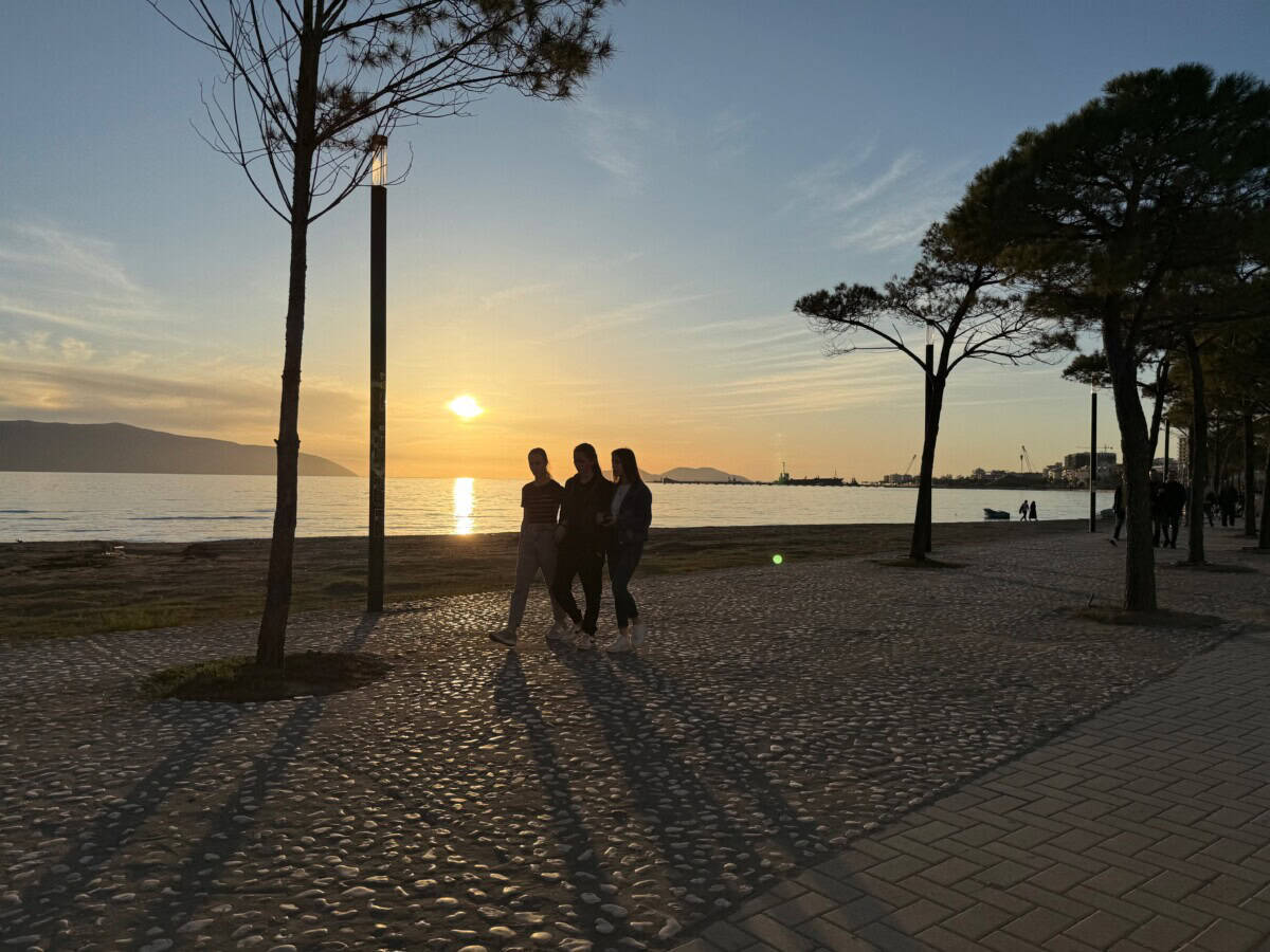
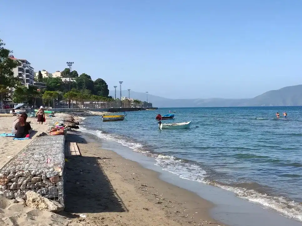
The city of Vlorë offers two city beaches, both sandy with small pebbles in places. They are essentially part of the city, so accessible on foot or by car. Several beautiful small beaches are located south below Vlorë. Many of them, however, are private and entry is allowed for a fee or only for accommodated guests.
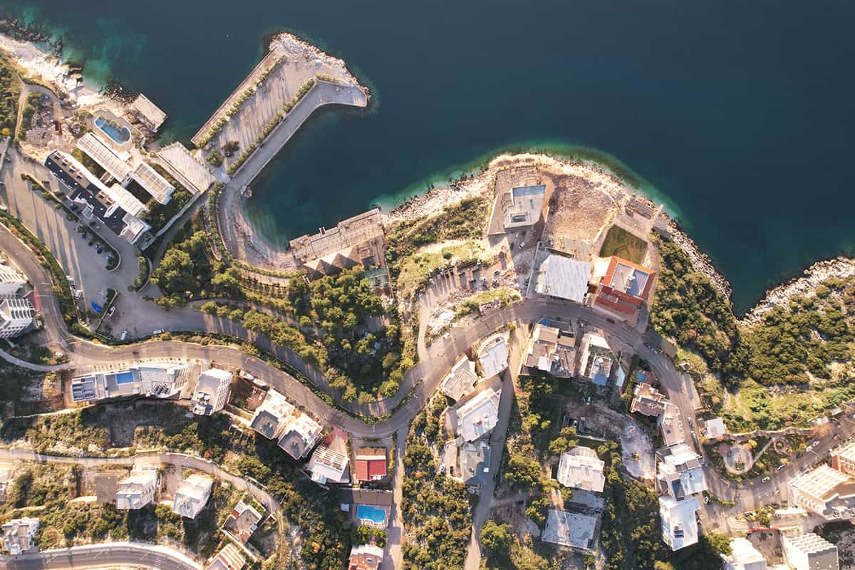
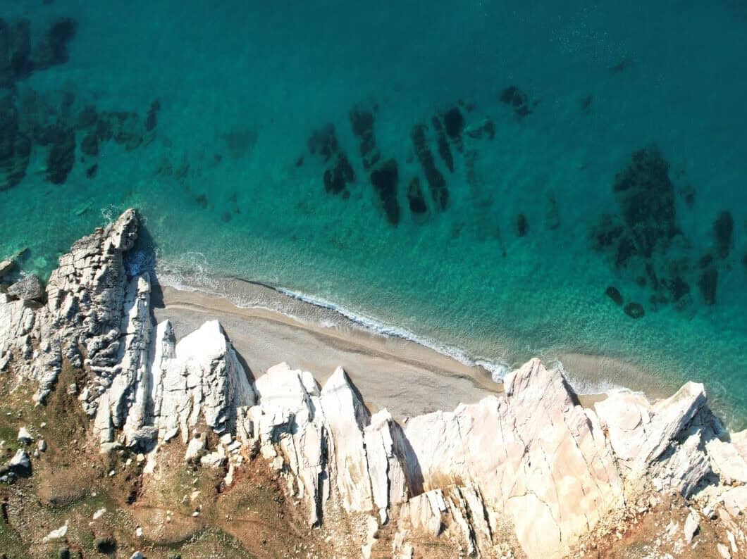
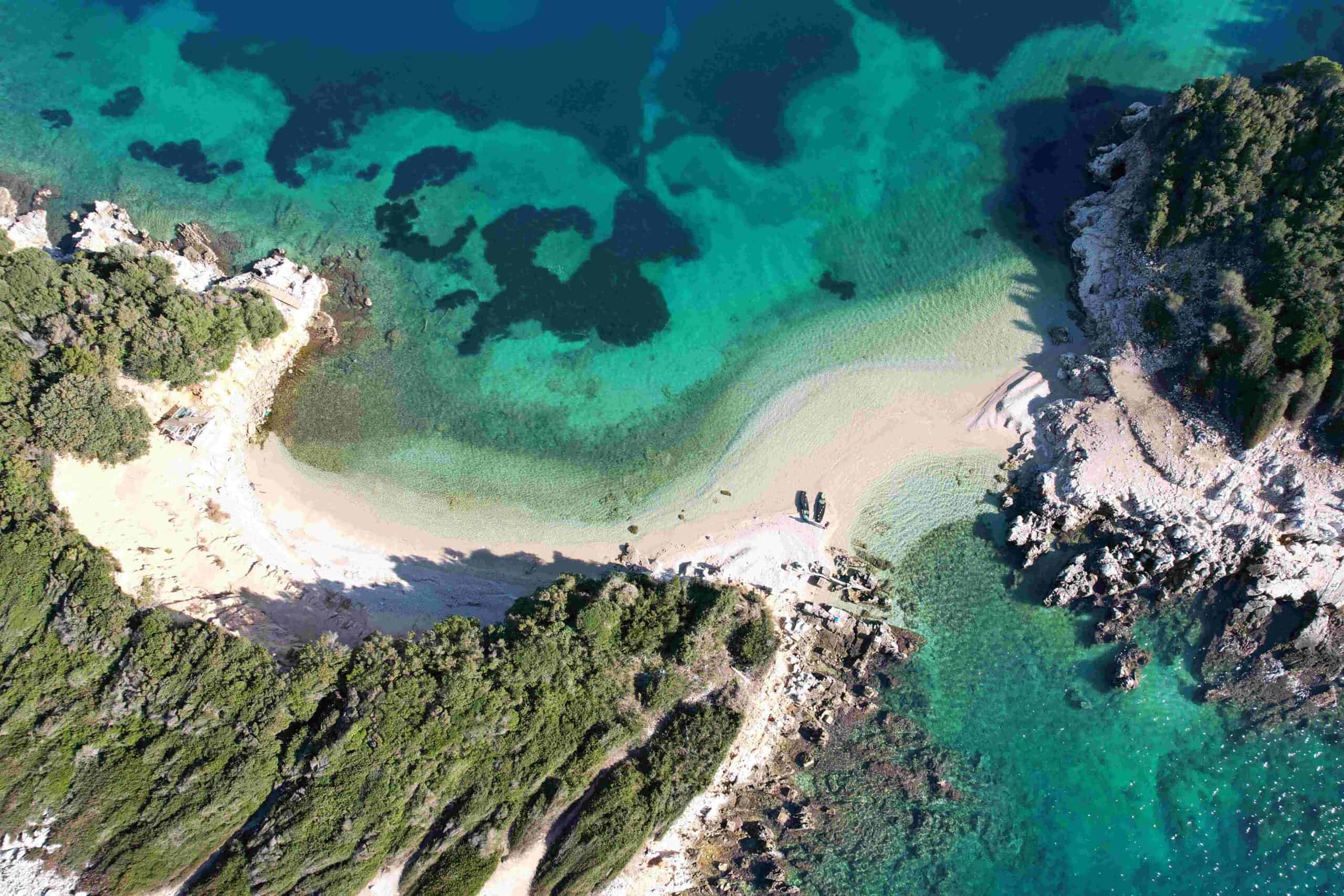
Radhimë
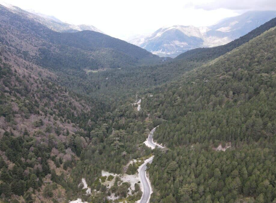
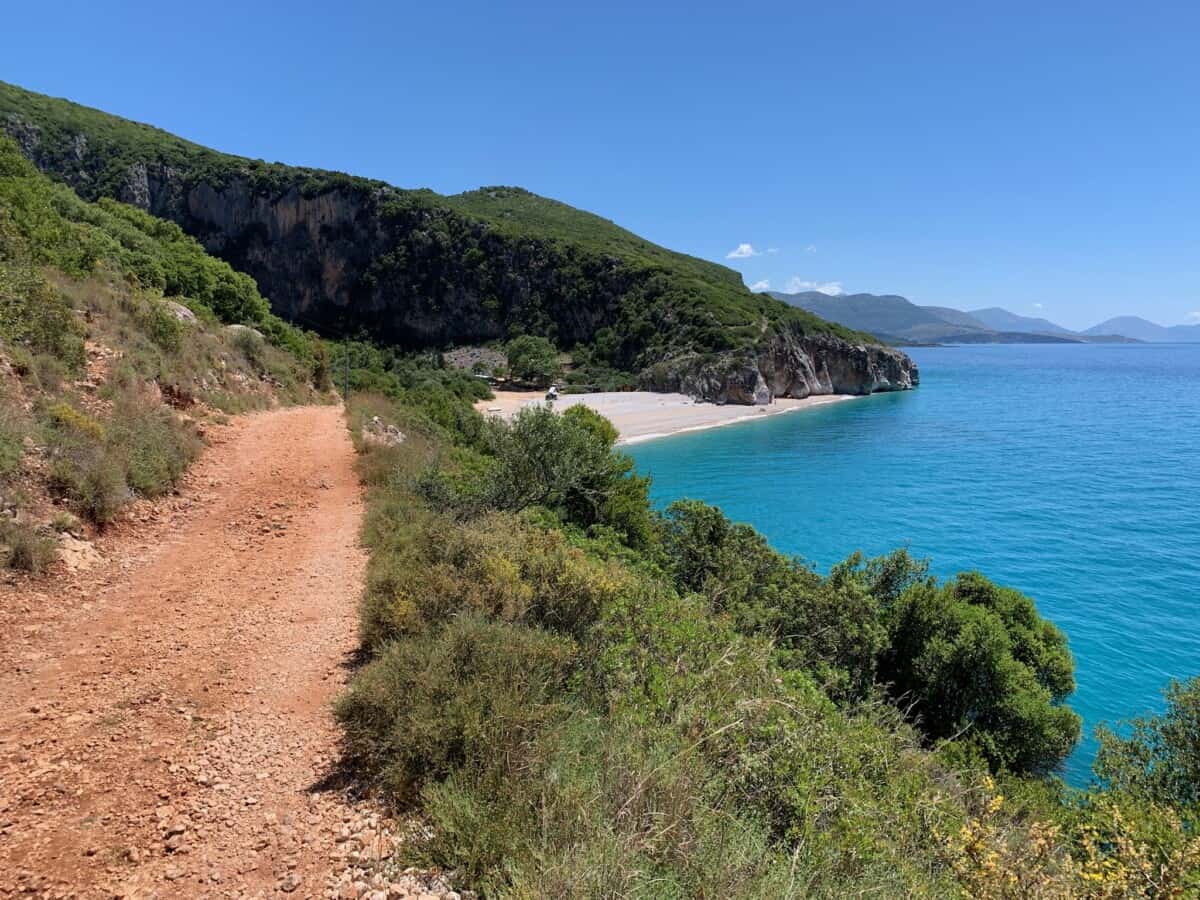
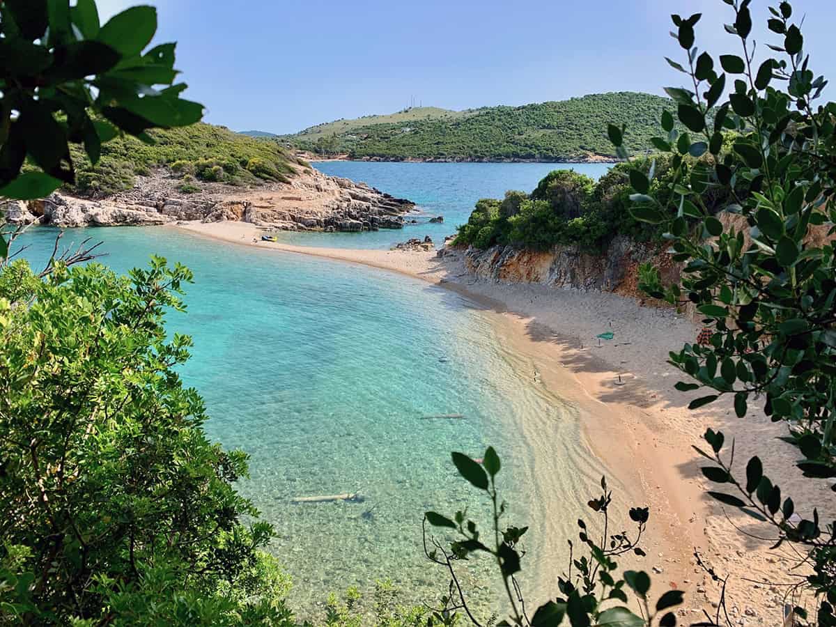
South of Vlorë, below the village of Radhimë, there is a pebble beach with crystal clear water. It is accessible by car, as the entire coast is lined with the road from Vlorë to southern Albania. The beach is long, rugged and divided by many piers. A stay with a view of the Karaburun peninsula is extremely attractive. A new trail connects Radhime with Orikumi.
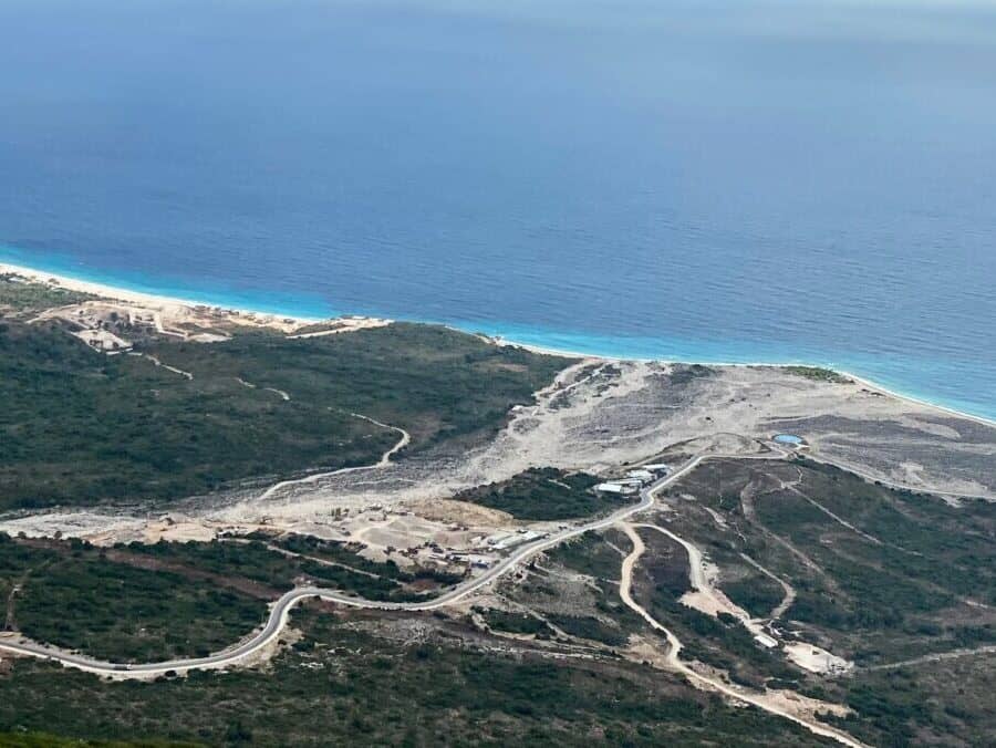
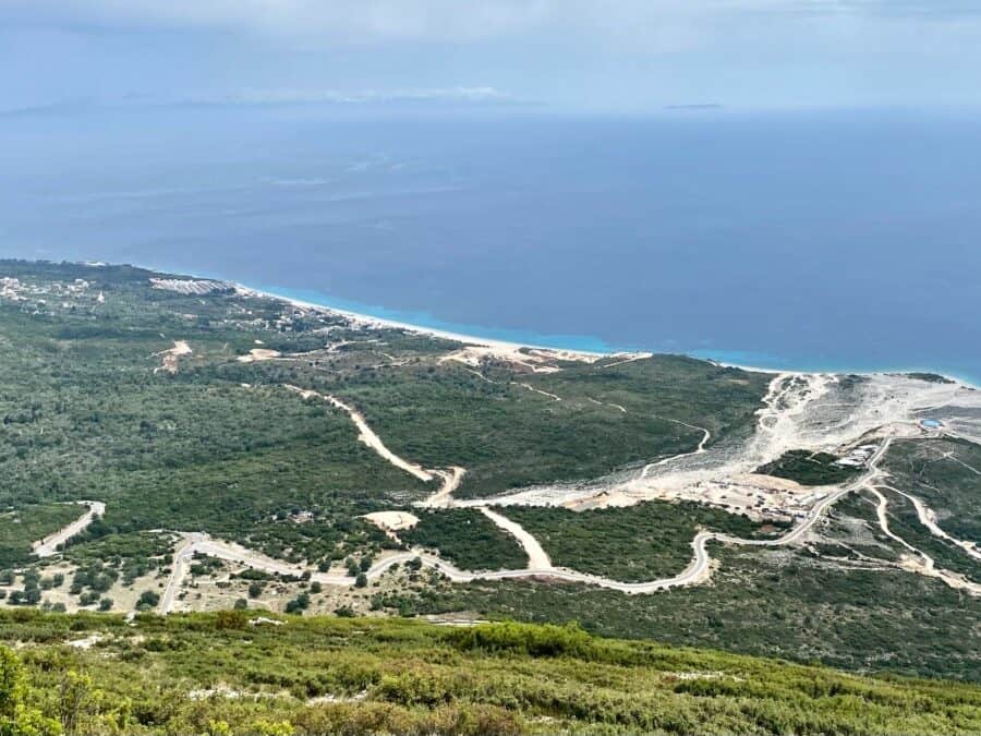
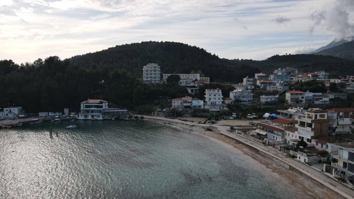
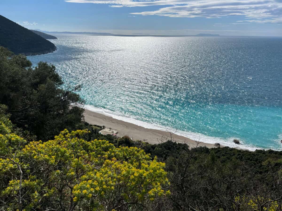
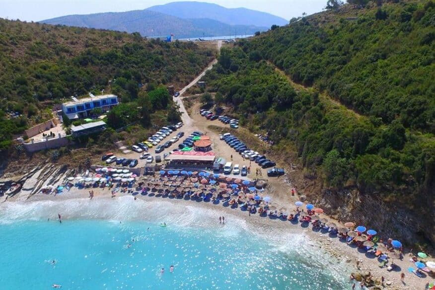
Orikumi
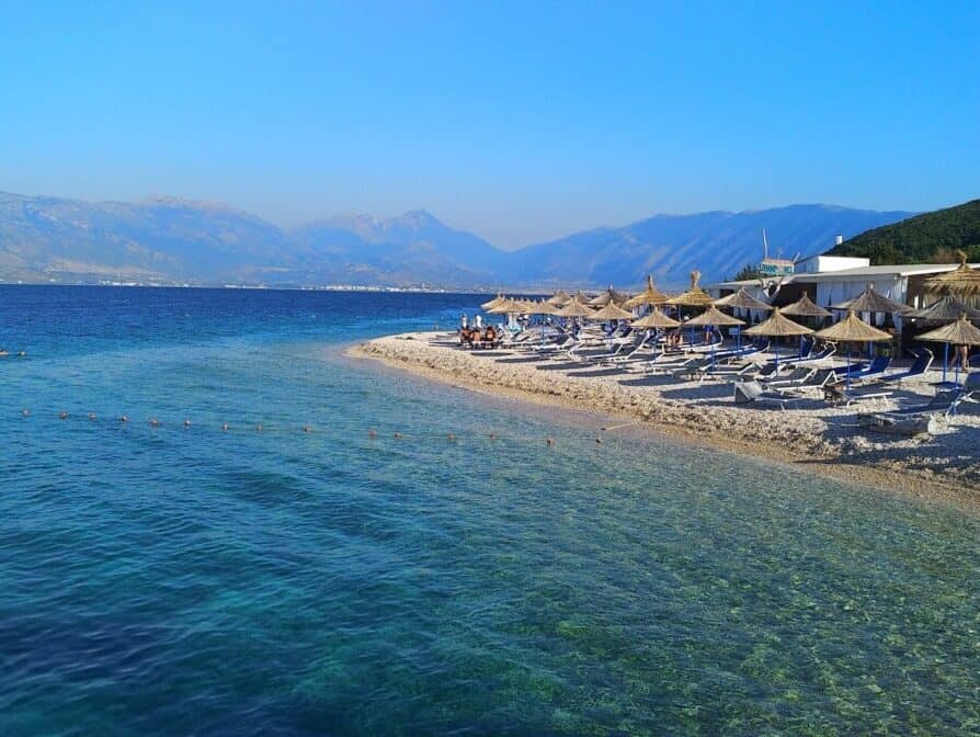
In 2024-26, the reconstruction of the promenade was completed, which also offers a cycling path. The beach with a view of the Karaburun peninsula is long and rugged. No large hotels, just plenty of low buildings with accommodation capacities, bars, restaurants and cafes. Orikumi is experiencing its big boom.
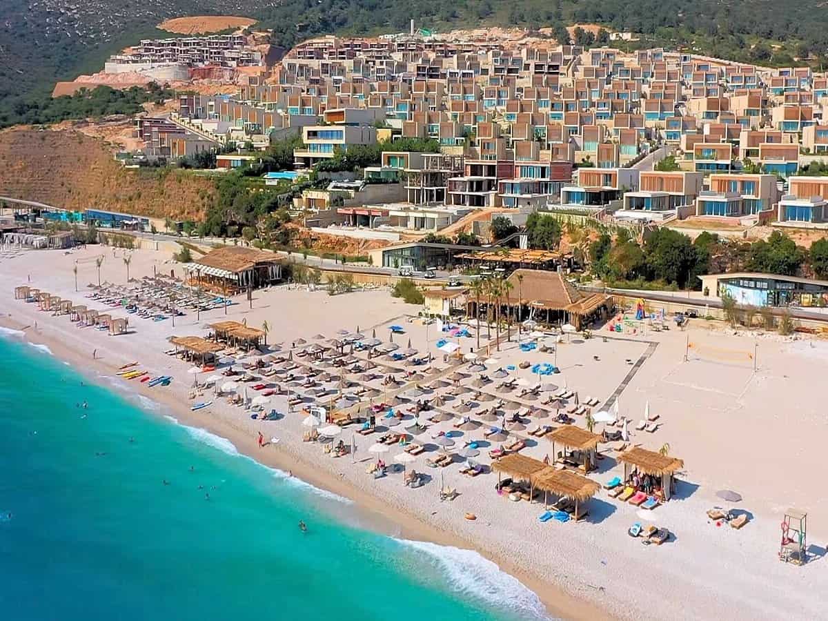
Palasë beach
A long untouched pebble beach that underwent a transformation between 2020-26 into a series of resort accommodations. The resort architecture is based on independent villas that form a cluster in a unified style. Access to many parts of the beach is permitted only to apartment owners or guests.
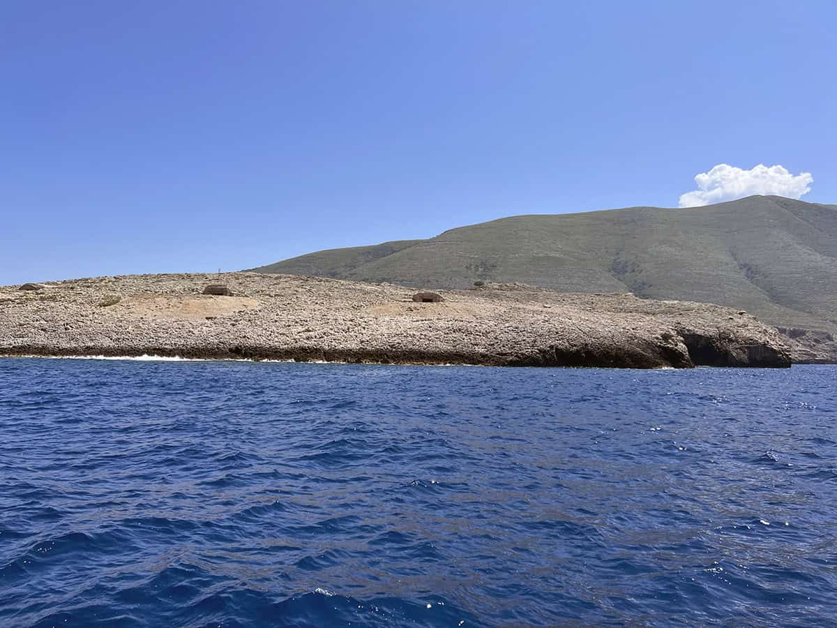
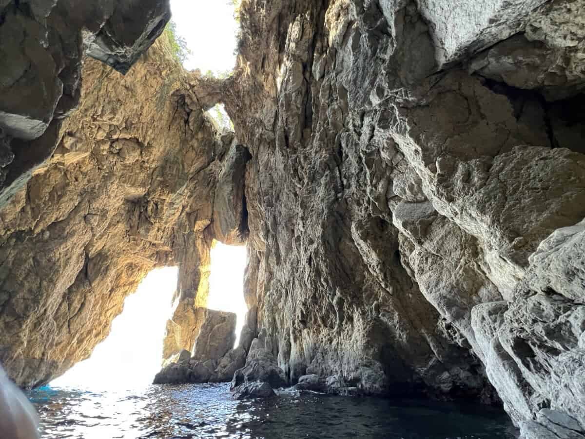
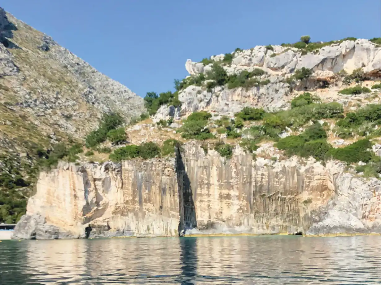
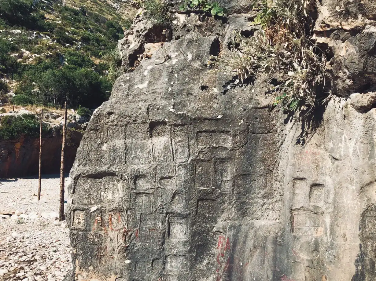
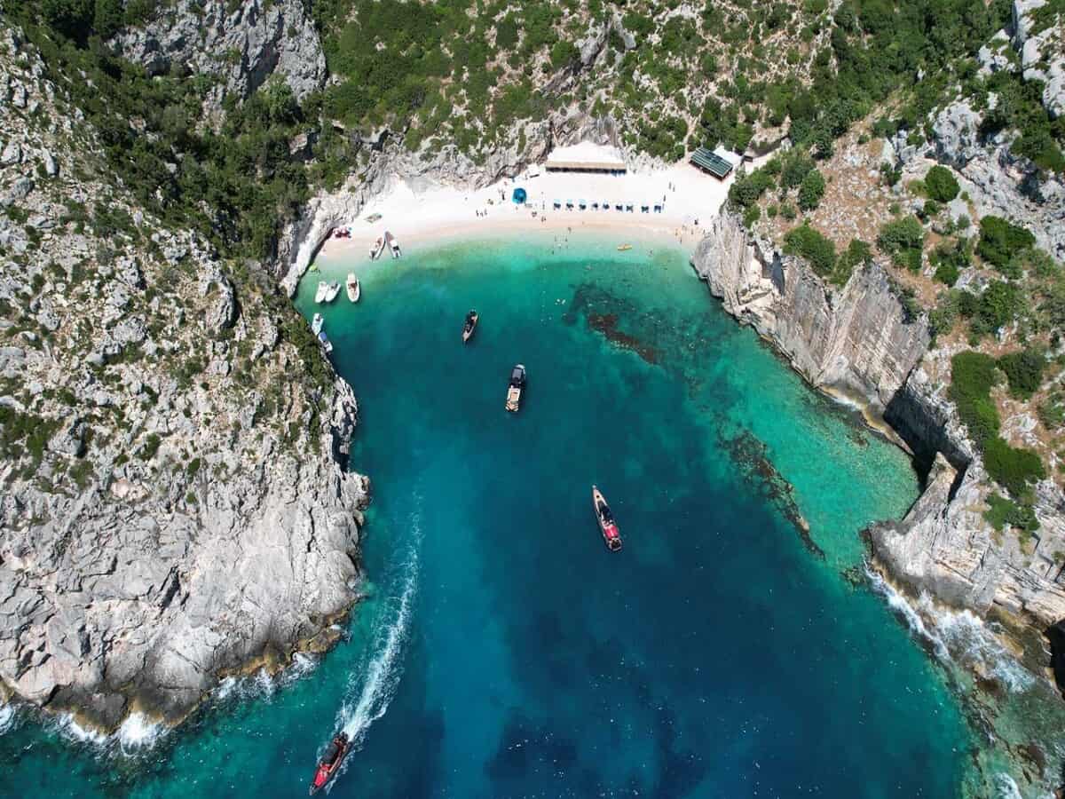
Grama bay
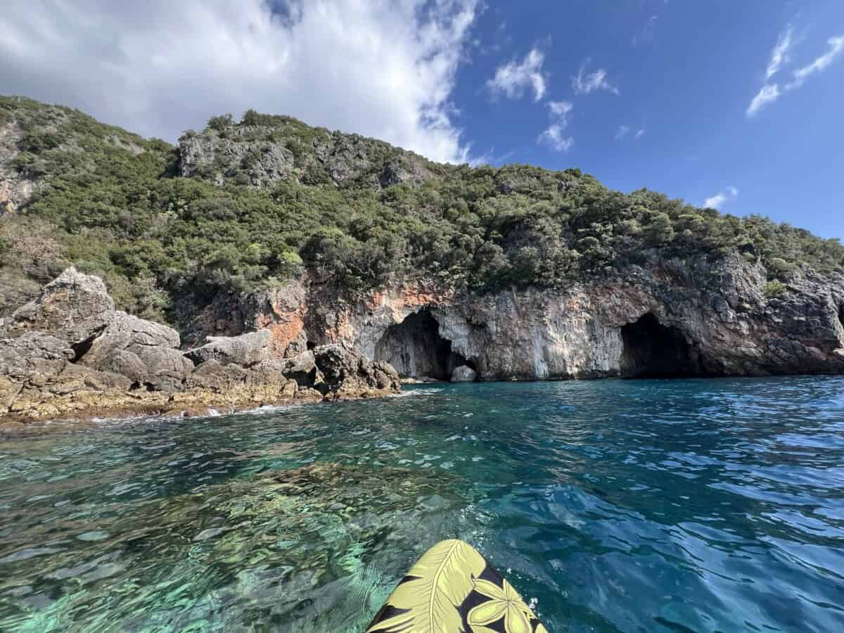
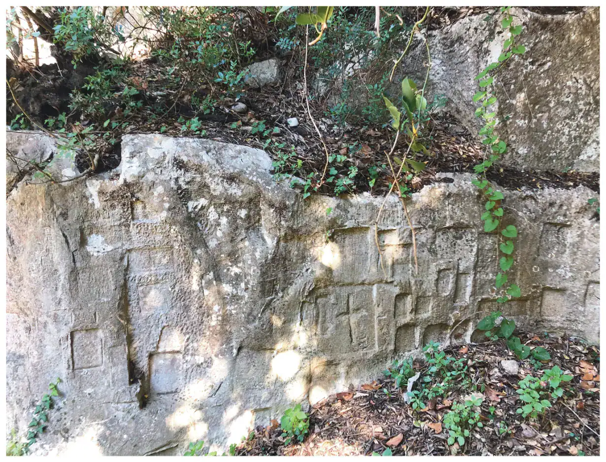
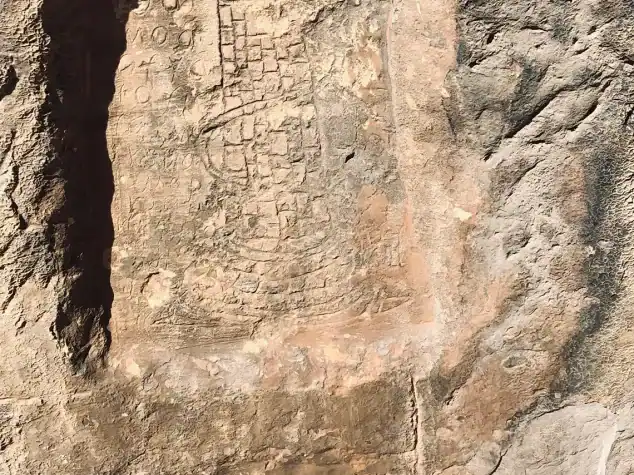
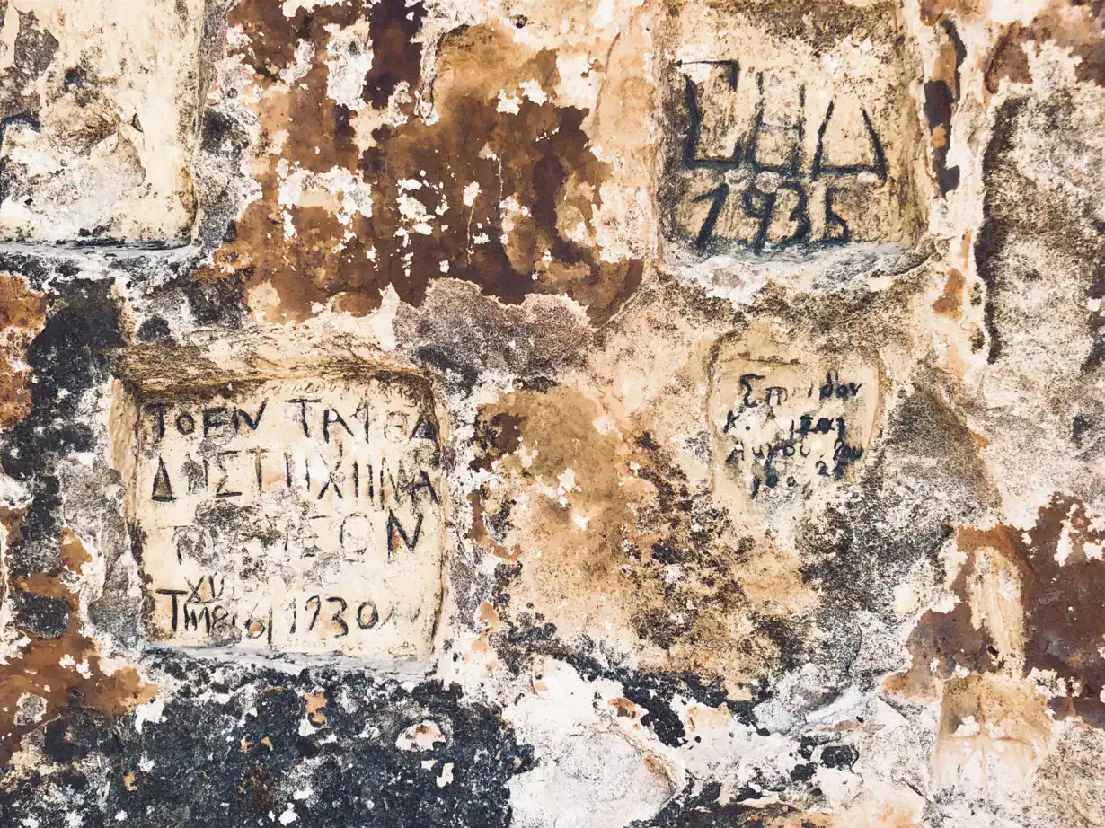
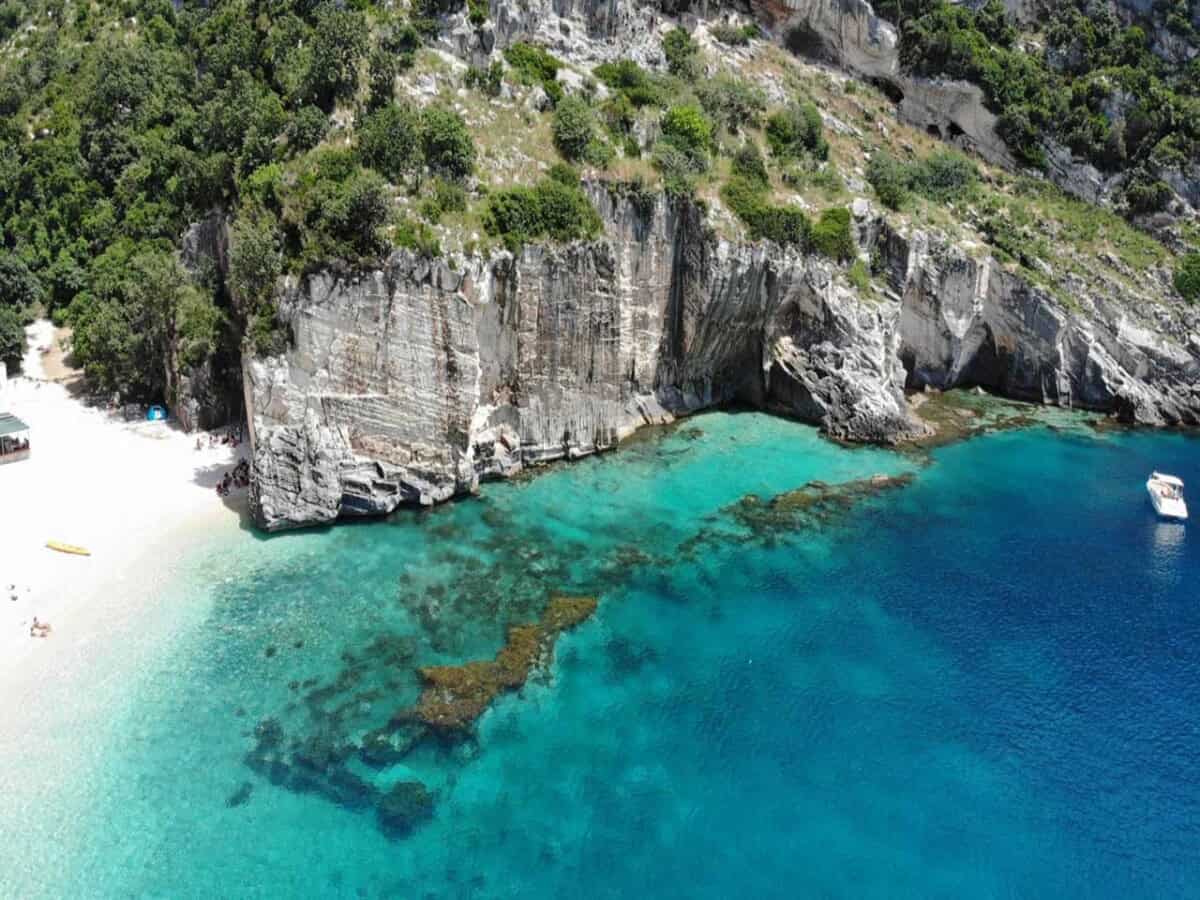
A hidden beach accessible by boat from nearby places such as Dhërmi. For the more adventurous, a hiking tour into Grama Bay offers a challenging but rewarding experience. The reward is a pristine beach with a small inconspicuous natural refreshment stand that operates only in season. The beach hides a historical secret concealed in inscriptions carved into the rocks.
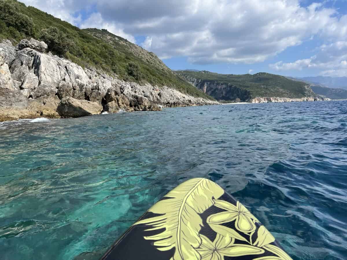
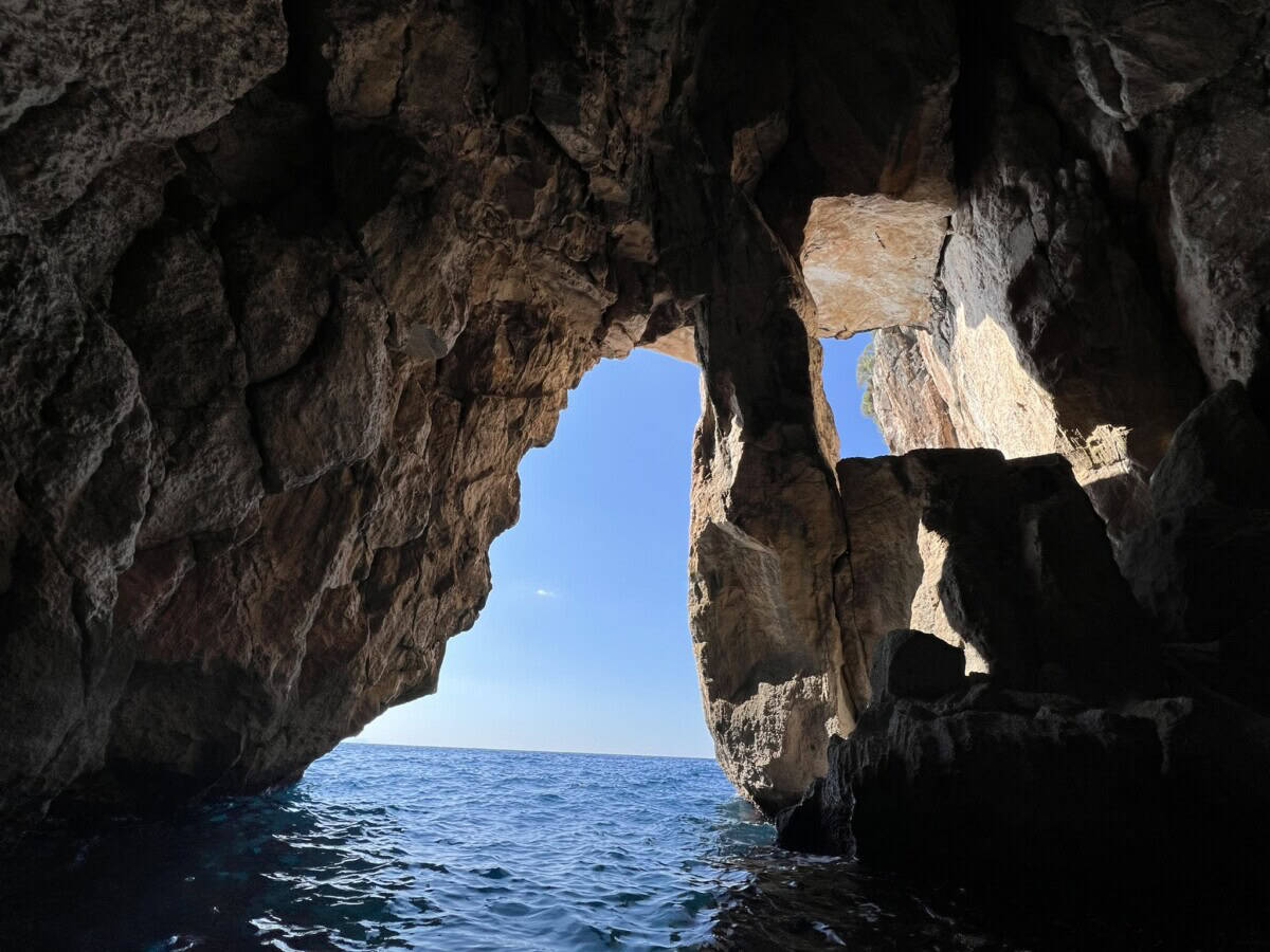
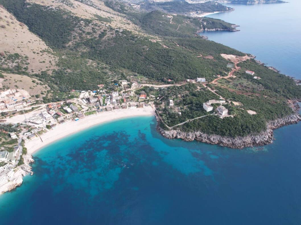
Dhërmi beach
One of the most popular beaches on the Albanian Riviera. The beach is accessible by car. It is long and wide, so there is plenty of space for sunbathing even at peak season. Available are loungers with umbrellas, bars, restaurants and accommodation facilities. If you want to retreat to a secluded spot, you can easily paddleboard to Gjiri i Trendelines bay. Boat tours to the pirate cave, Gramma Bay or Gjipe beach are also available.
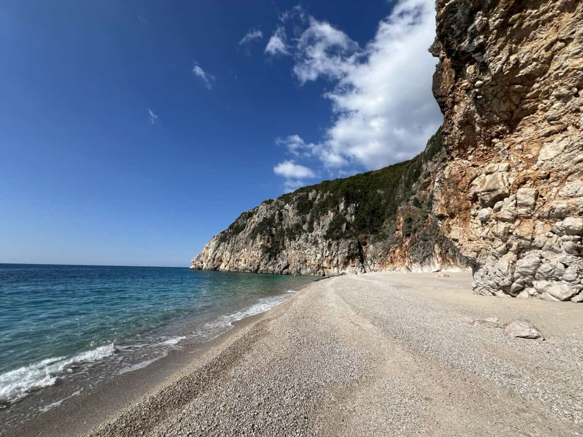
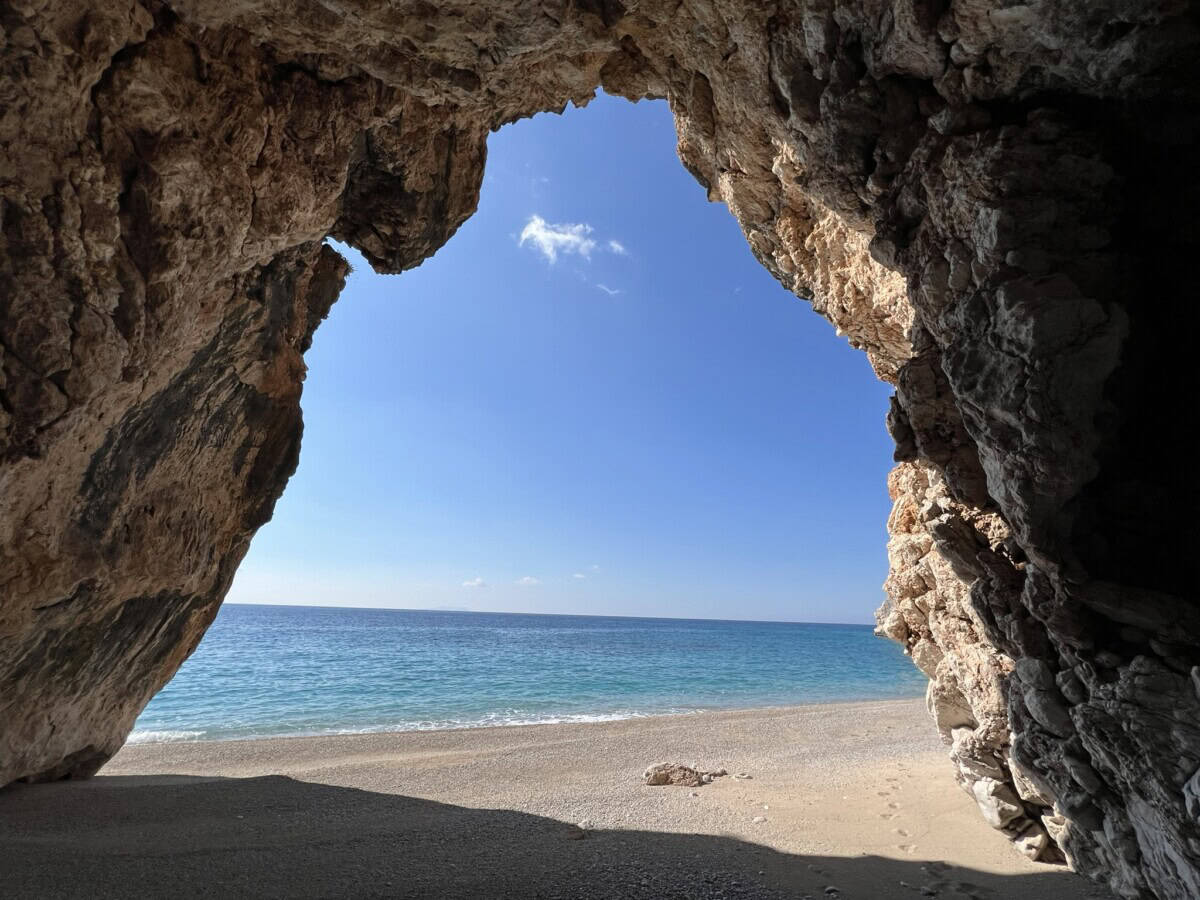
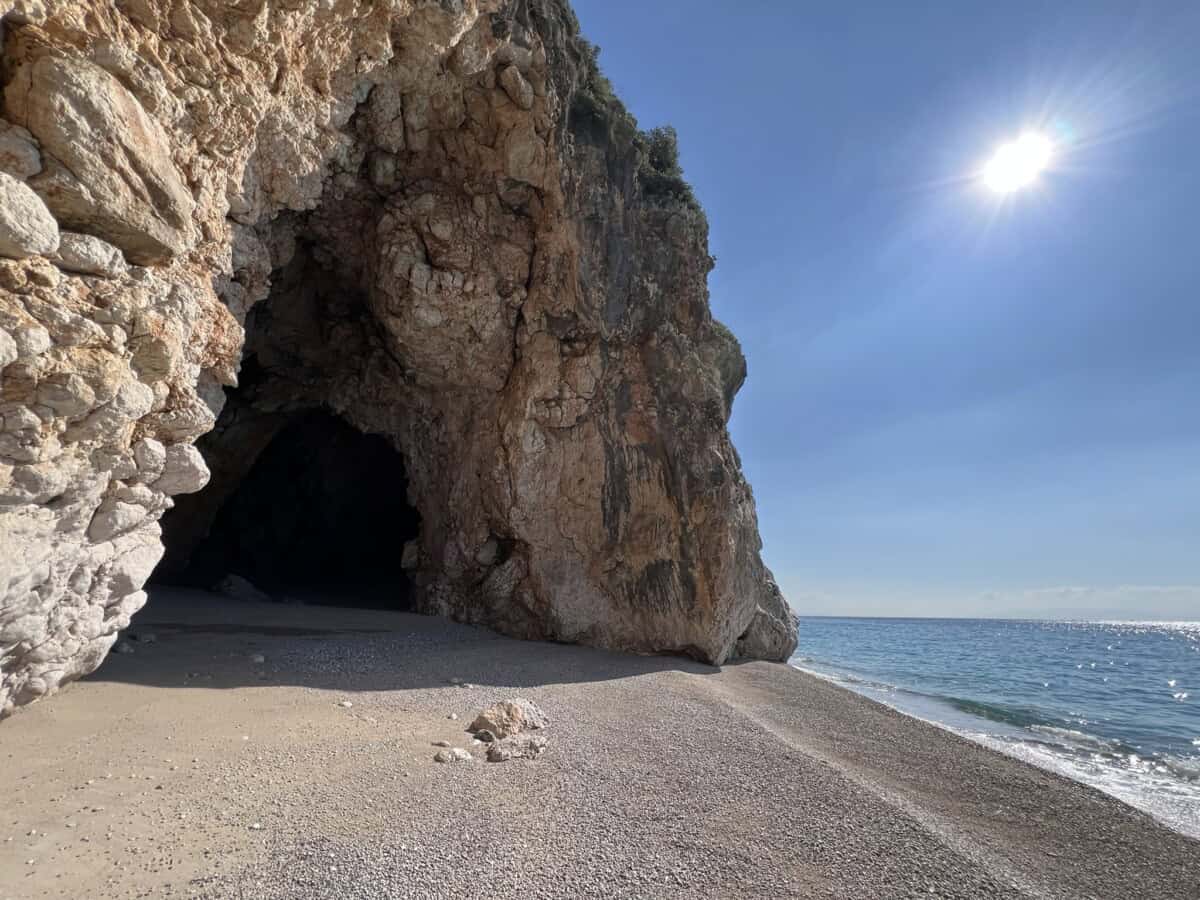
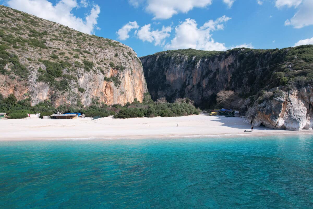
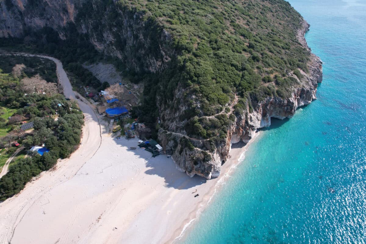
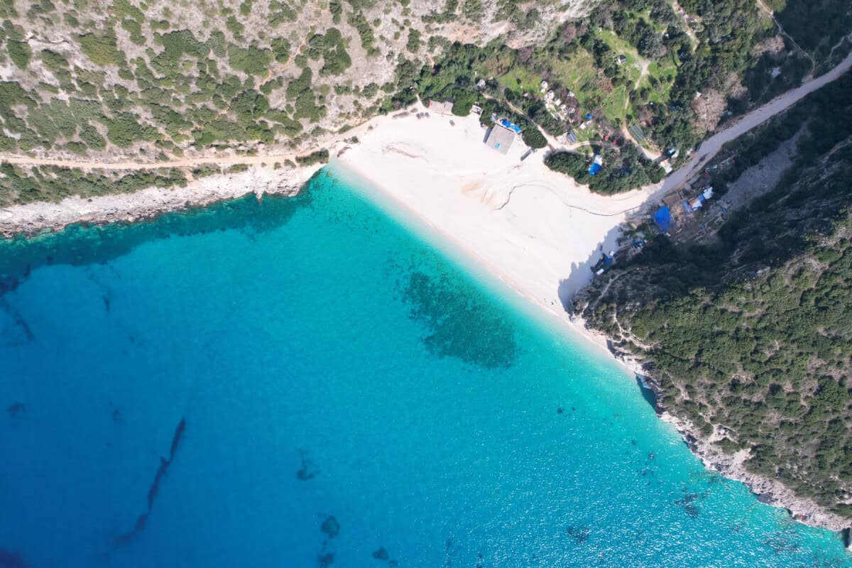
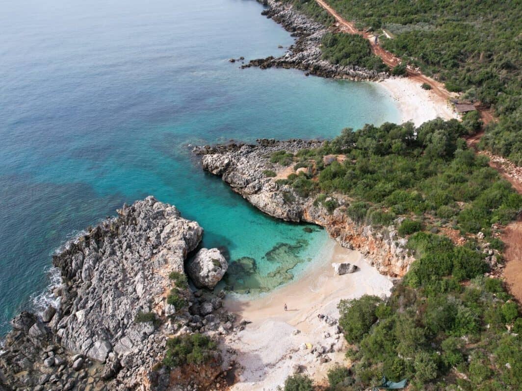
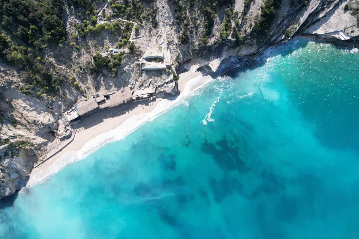
Gjipe beach
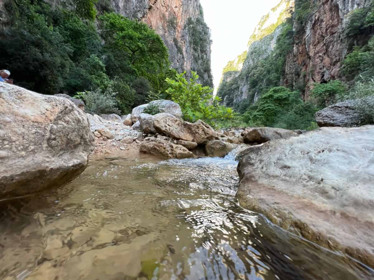
Accessible only on foot or by boat. The rocky path is passable only by off-road vehicle. Above the beach is a paid parking lot and next to it the Monastery of St. Theodore. The walk takes about 30 minutes. It is a pebble beach with crystal clear water and is an ideal destination for adventurers and romantics seeking peace. There are small natural bars with food options. Behind the beach is a canyon worth exploring.
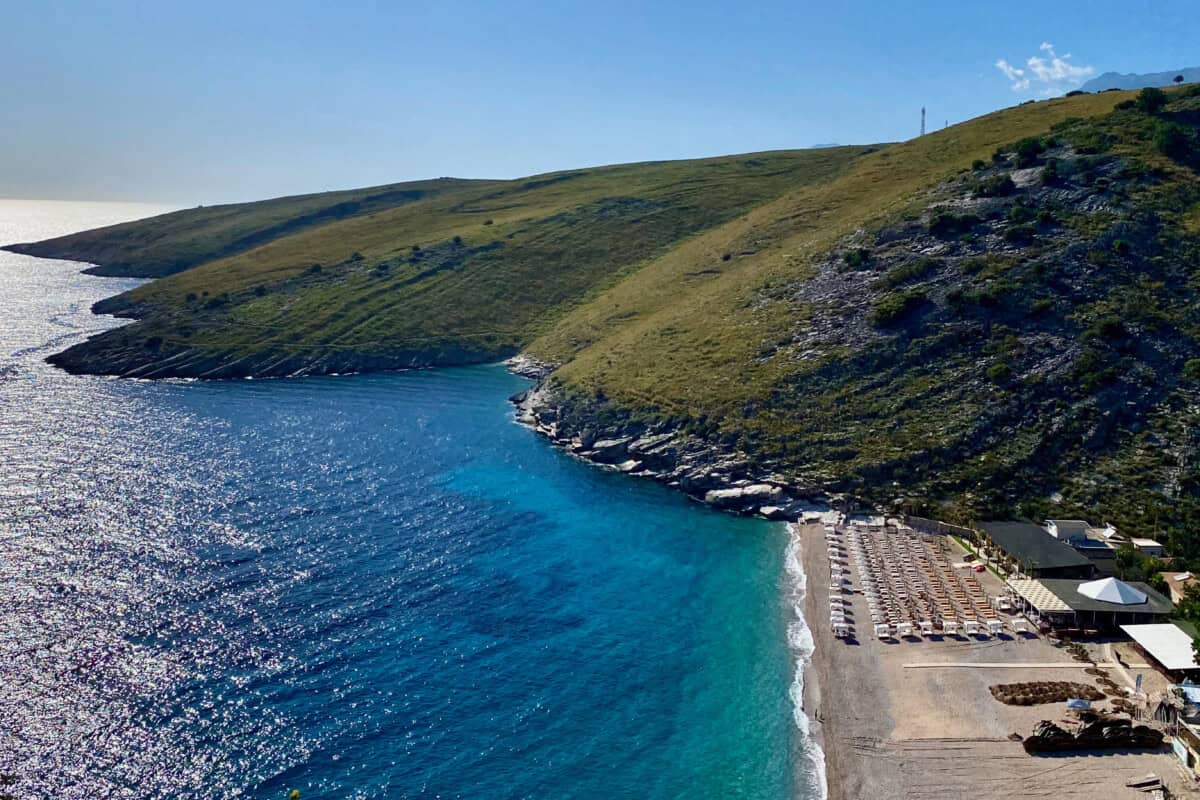
Jalë beach
A picturesque bay with a pebble beach and amazing turquoise water. Accessible by car. In the surroundings are restaurants, bars and cafes. There is plenty of accommodation options. The bay is surrounded by hills and rocks that create a pleasant sense of privacy. Paid loungers and umbrellas are standard. Luxury stylish hotels are increasing and Albanian high society is concentrating here, which generates a rich nightlife.

Akuariumit Bay
Small beautiful romantic beaches with transparent crystal clear water. Accessible only on foot or by off-road vehicle. It is not unlikely that new surfaces will be added to allow access by regular car. The beaches have bars and natural restaurants. Just above Akuariumit beach there is a camping area for small tents.
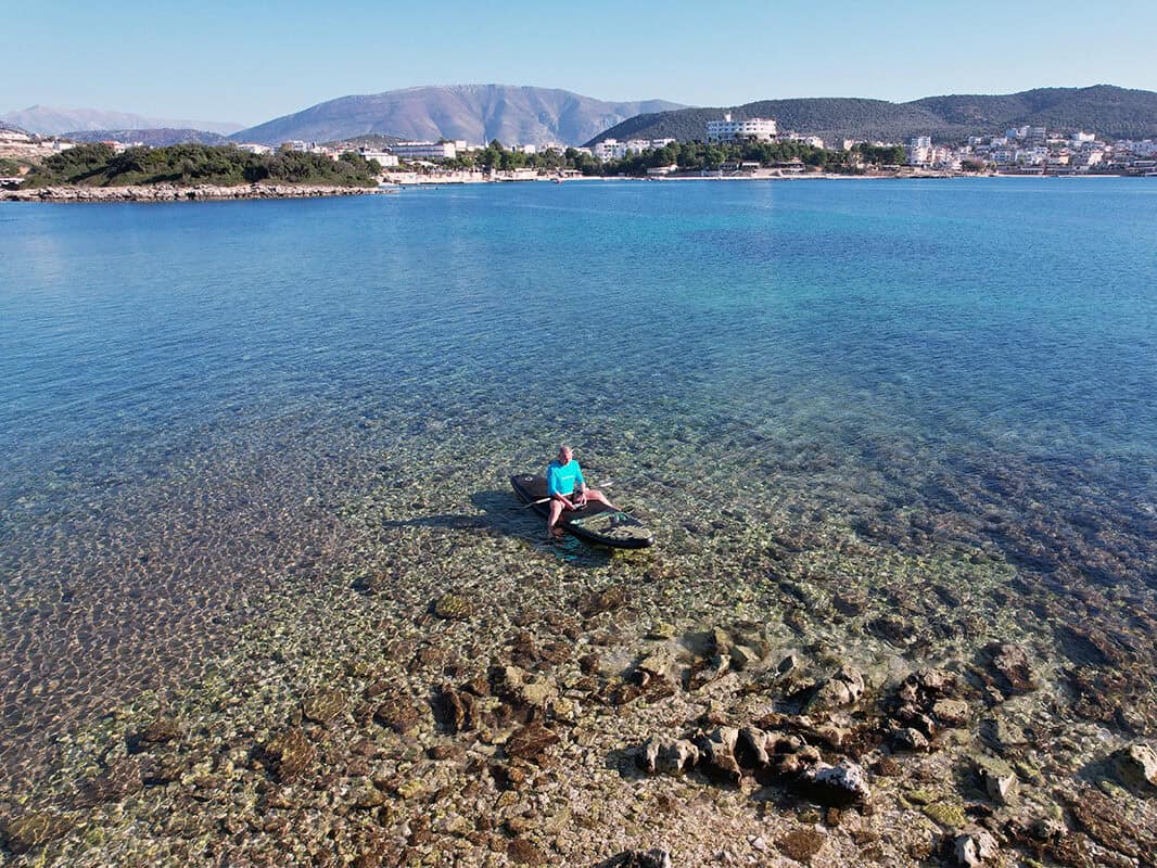
Livadh beach
A pebble beach with transparent turquoise water. Relatively long and wide, which ensures plenty of space even in high season. You will find several restaurants and bars here. The beach has a calm atmosphere. Conditions are suitable for snorkeling, paddleboarding or reef tourism. Accommodation includes campsites, comfortable hotels and private apartments.
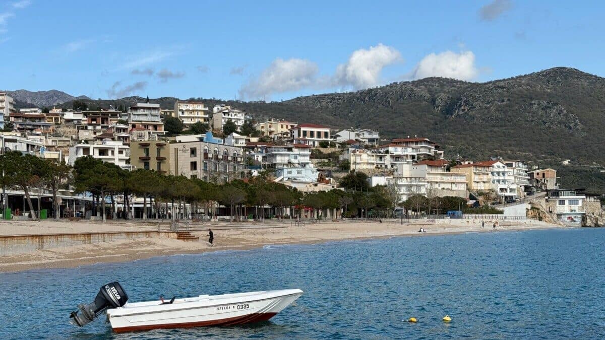
Himarë
The central beach, like others in the area, is pebbly with crystal-clear water. It is surrounded by low-rise restaurants, cafes and hotels. Further north is Spile Beach. Slightly further south you will find Marachi Beach and at the very southern tip of the town is Potami Beach. It has larger pebbles and deeper water, making it ideal for swimming and snorkeling. For a romantic getaway, you can head south on foot or by paddleboard from here to Filikuri Beach.

Filikurit beach
Filikuri Beach is a small cove surrounded by high cliffs. It is accessible on foot from the more northern Potami beach or from a nearby parking lot. You can also reach the beach by boat, for example from Livadh or Himarë. If you want to spend a whole day at Filikuri, don't forget to bring enough food and water. However, it is possible that a bar or two may be added.
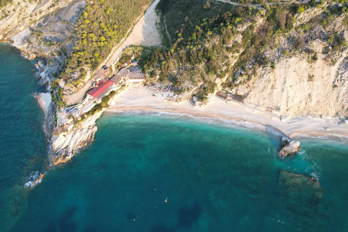
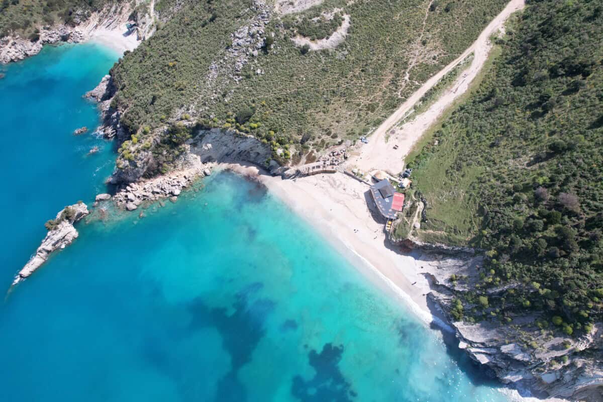
Llamanit beach
A beautiful, very easily accessible beach with an excellent restaurant and full facilities. In summer, sun loungers and umbrellas are available. There is plenty of parking, but at the height of the season you may have trouble. The beach feels extremely private and peaceful, despite full services. The water here is wonderfully clear. Short walks along the cliffs are also offered, which may result in finding a quieter place to sunbathe.
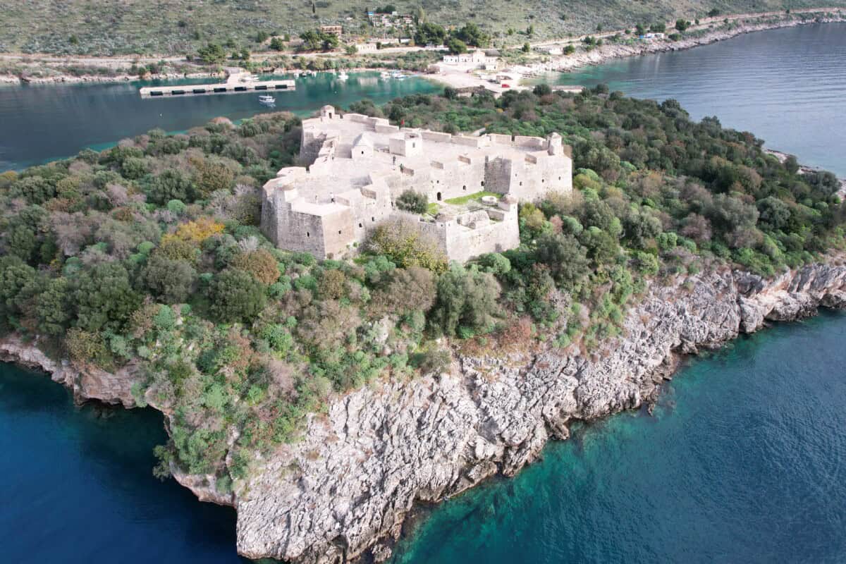
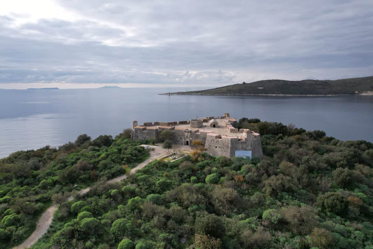
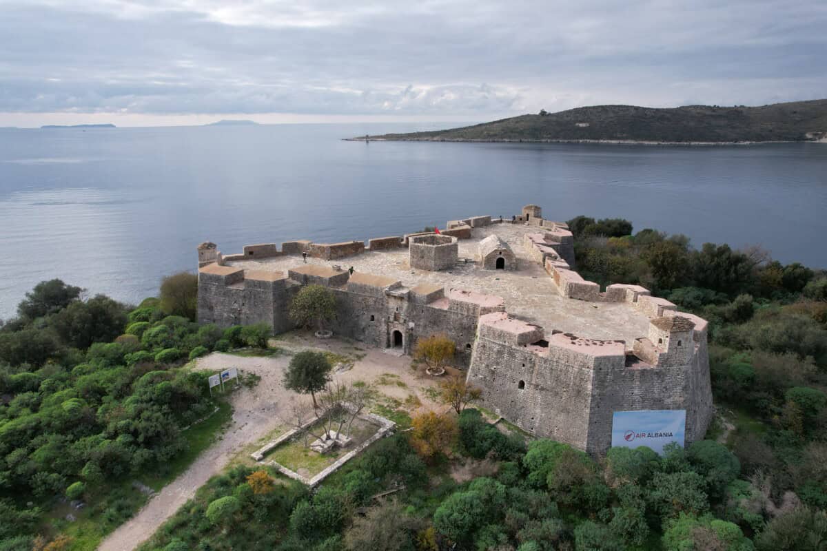
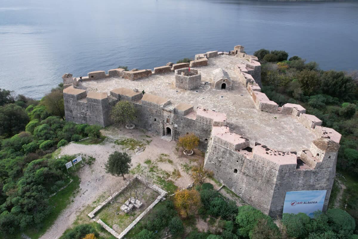
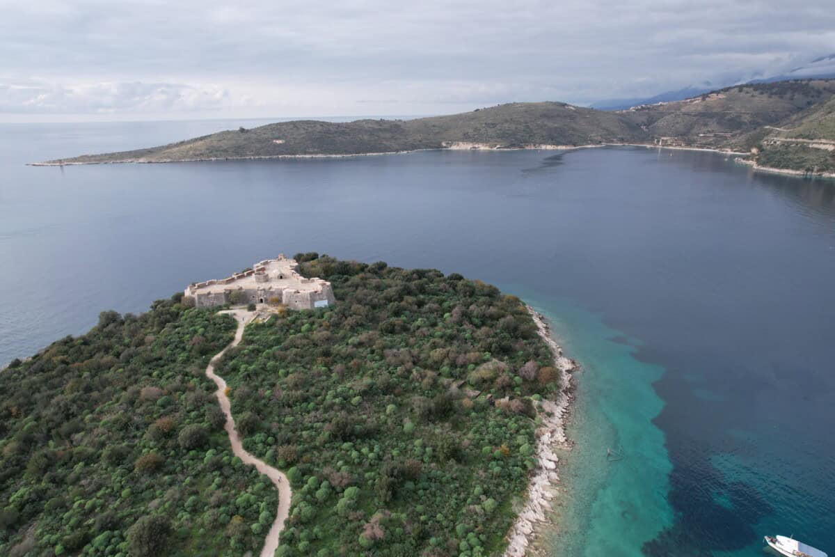
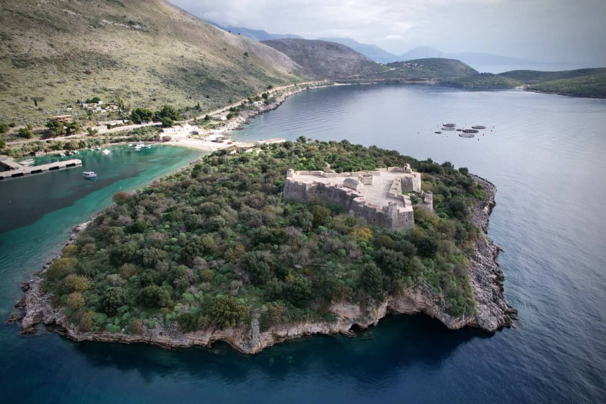
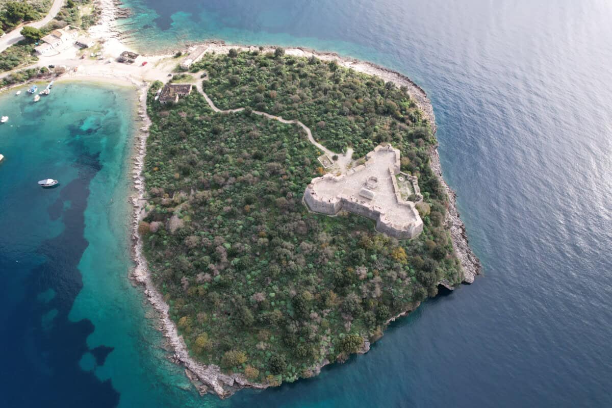
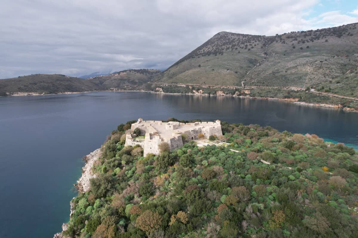
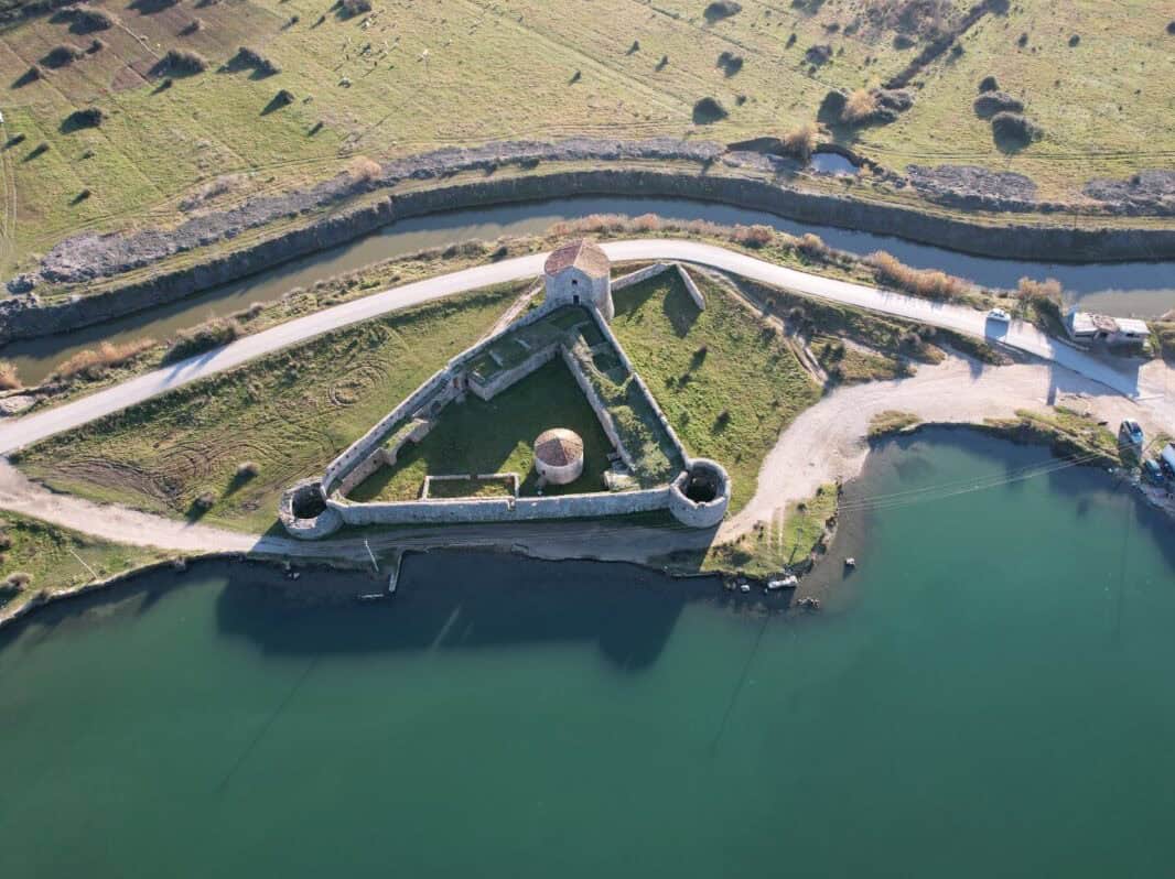
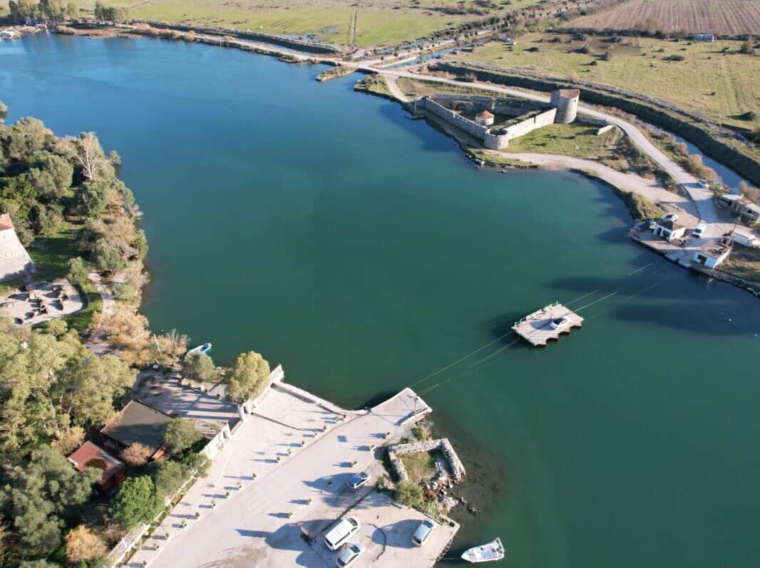
Palermo beach
The beach is located not far from the road leading south from Vlore towards southern Albania and is part of the connecting neck of the peninsula where Porto Palermo Castle is located. It is pebbly with crystal turquoise water. A short distance from the beach, before and behind the road, you will find restaurants with refreshments. A day at the beach can be combined with a visit to Porto Palermo Castle. About a kilometer further south, you can use Porto Palermo Beach. It is located below a restaurant, which you will pass heading south.
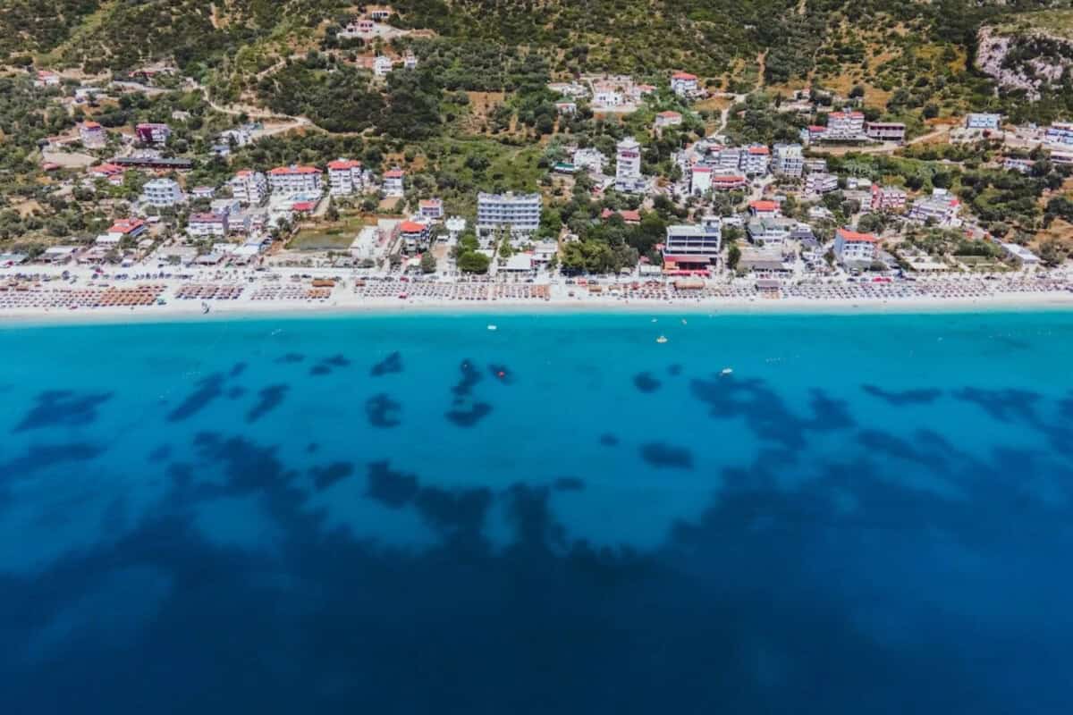
Qeparo beach
A pebbly-sandy beach. A large part of the long beach is outside the built-up area, but even here there are partial services in the season. Buildings are gradually increasing, but the beach still maintains a pleasant intimate atmosphere. The beach was significantly enhanced by the promenade, which was built in 2024-25. Restaurants, bars, cafes, sun loungers and umbrellas are available in the season. You can take a walk from here towards Borsh to Rooster Bay - Gjiri i Këndesave, where you will find peace for private sunbathing.
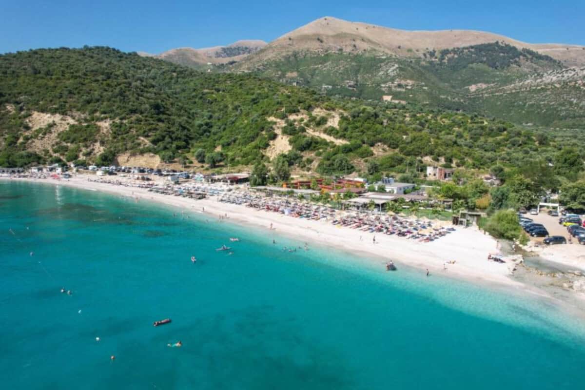
Borsh beach
One of the longest beaches in Albania, with a pebbly surface and clean water. Accessible by car, with restaurants and accommodation in the area. Due to the expanse of the beach, you will have no problem finding parking and a place to sunbathe even in the middle of the season. Sun umbrellas and sun loungers are available for a fee.

Buneci beach
It is located not far from the village of Piqeras. It is a quiet pebbly beach with turquoise water and a steep slope. It is accessible by car with parking available. You will find a section with sun loungers and umbrellas, restaurants, bars and a pier. In the southern part, on a long public beach, there is plenty of private space where you can find more privacy.

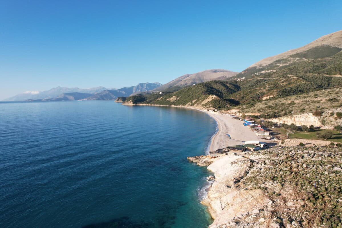
Lukova, Lukovë beach
Lukova beach is a natural pebbly beach with clear water, surrounded by greenery. It is less accessible by car and in summer offers modest but very charming natural refreshments. The atmosphere here is very private. Access by car to the more southern Lukovës beach is without problems. The beach underwent a significant construction boom in 2024-25. Old restaurants and bars were demolished and replaced with new modern buildings. Paid sun loungers and sun loungers are absolutely standard. A walk to the more southern Marutzi beach is possible.

Marutzi beach
A walk from Lukovë beach heading south will offer you a wonderful view from the cliffs of the Greek island of Corfu and the sunset. You can go all the way to Marutzi beach, which is tiny and offers more privacy. Below a small cliff you will find more tiny beaches. In season, however, you probably won't be completely alone here either.
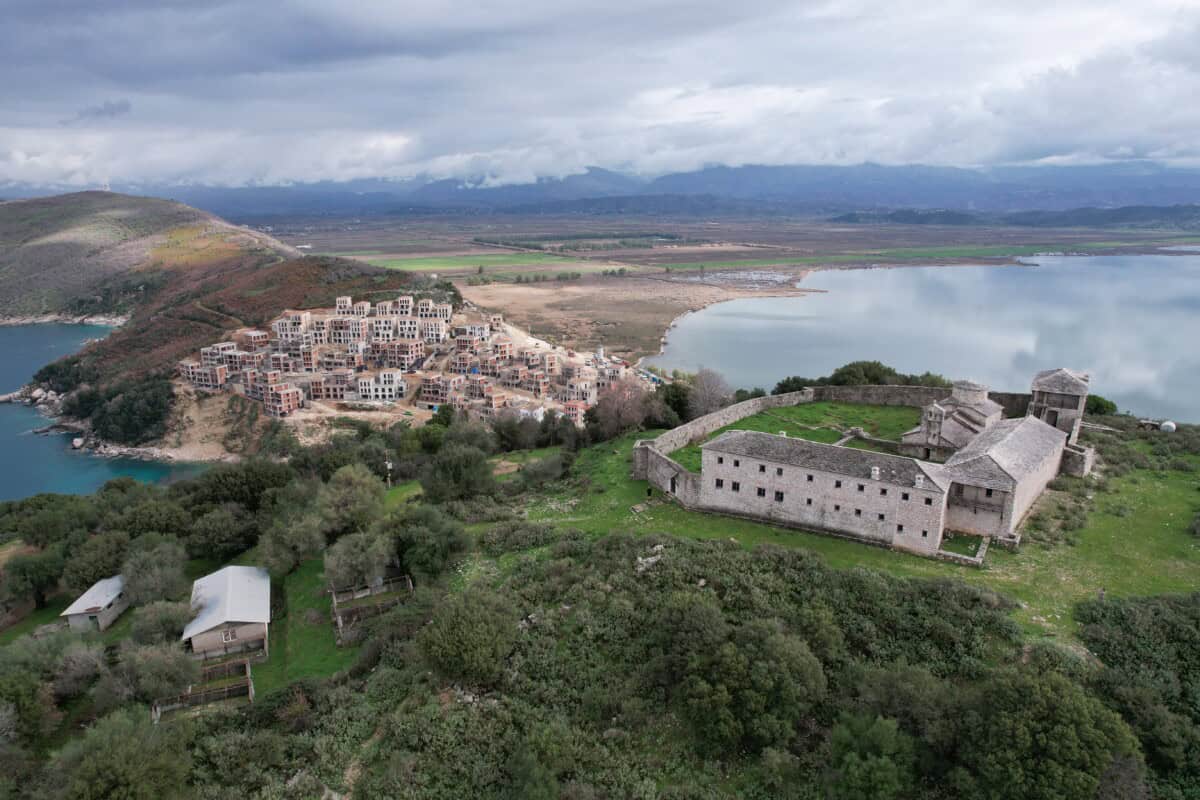
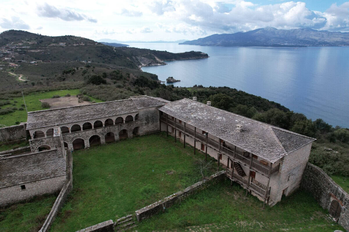
Krorëzës beach
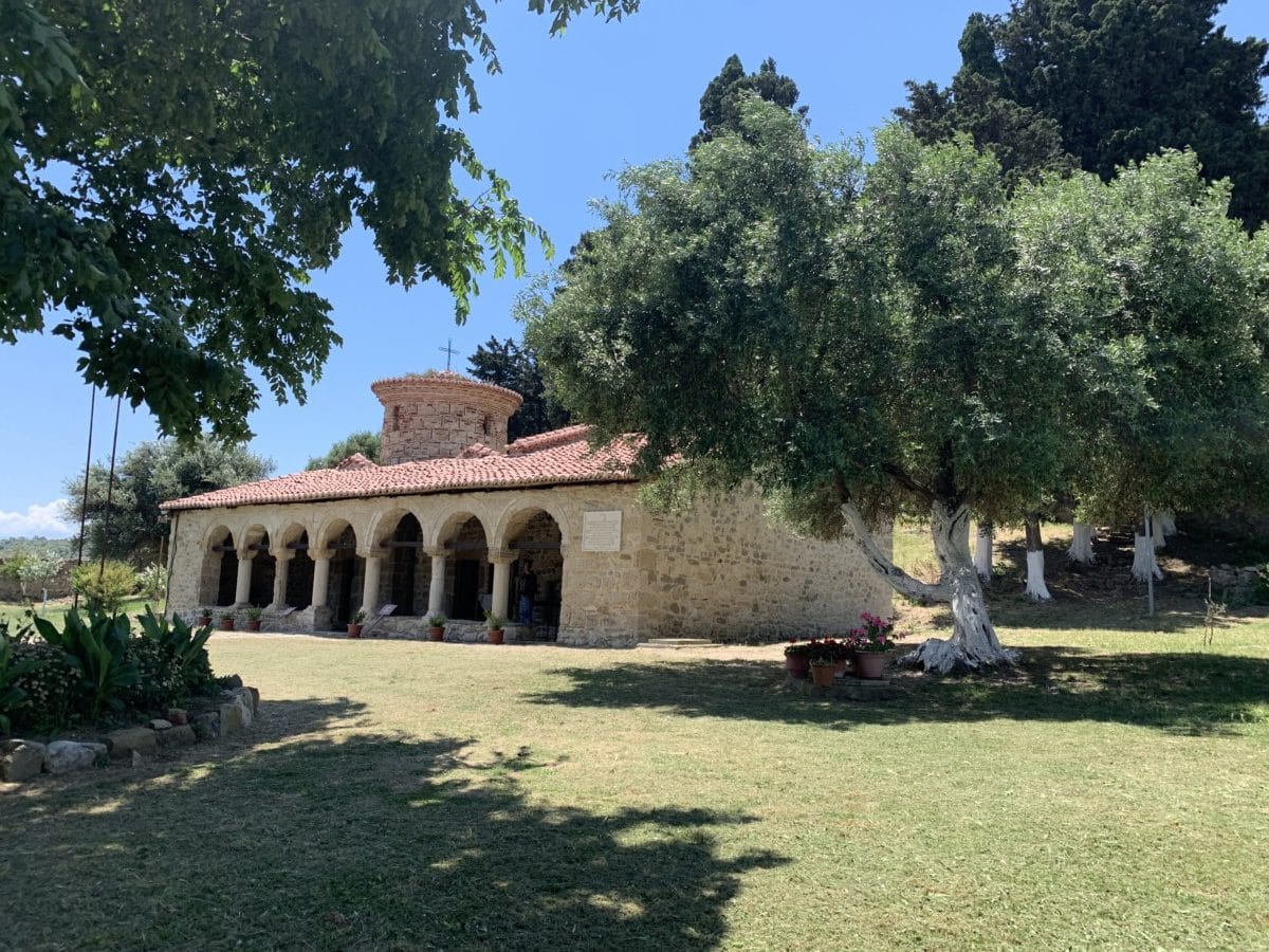
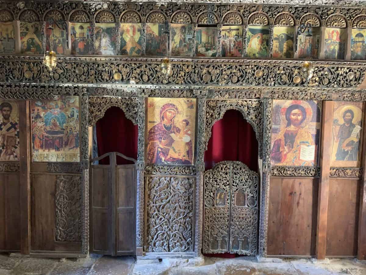
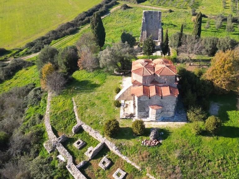
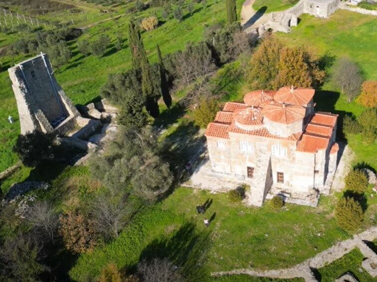
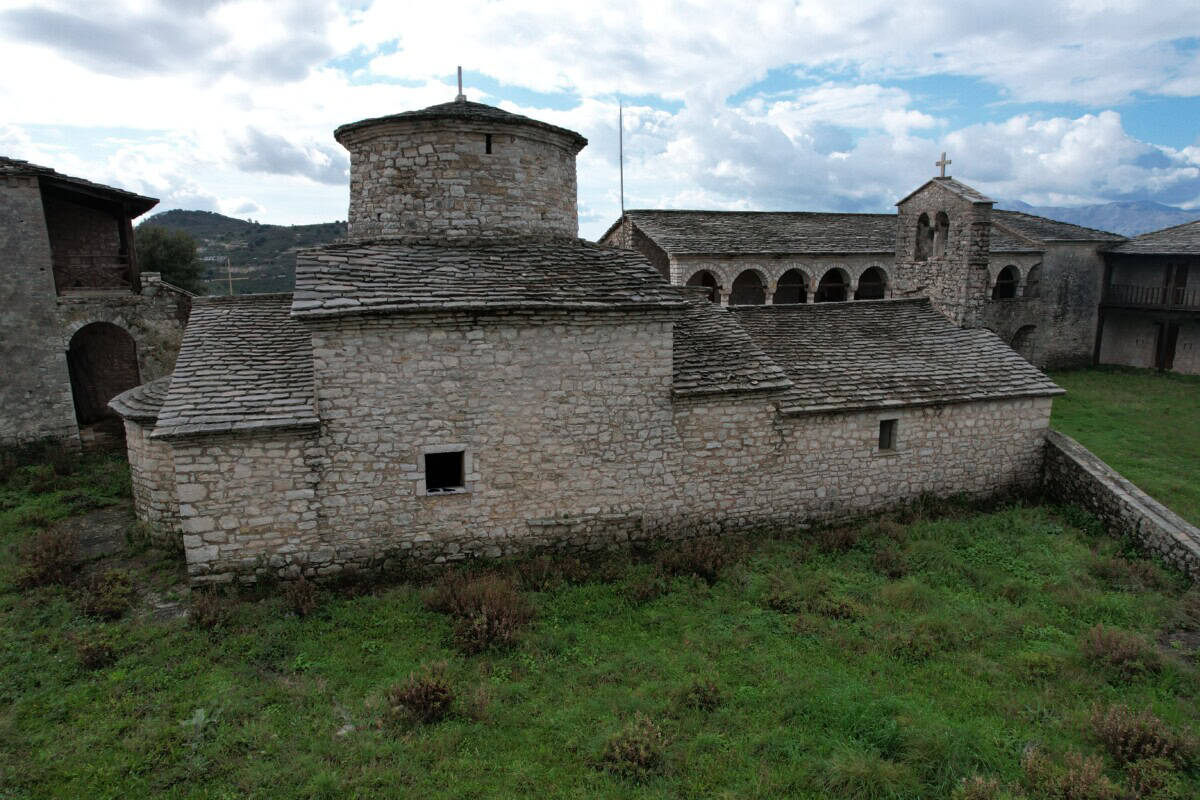
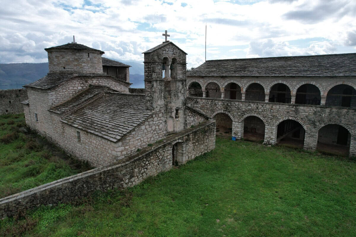
You will find natural bars and a restaurant here, as well as sunbeds and umbrellas. In the crystal-clear water you can observe sea creatures, for example we saw seals from a distance in spring. One option is to come here by boat from Sarandë or from Lukovë Beach. You can also reach the beach on foot in about 1.5 hours from the Kakomë beach guard box. A beautiful walk through unspoiled countryside awaits you, during which you can enjoy the views of Byzantine frescoes in the Church of St. Mary and the Krorëze Monastery. The clifftop path also leads from Lukovë beach and takes about 1.5 hours.
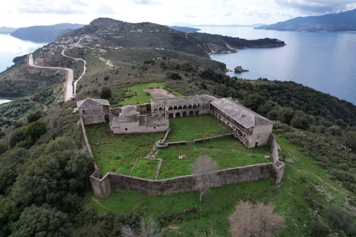
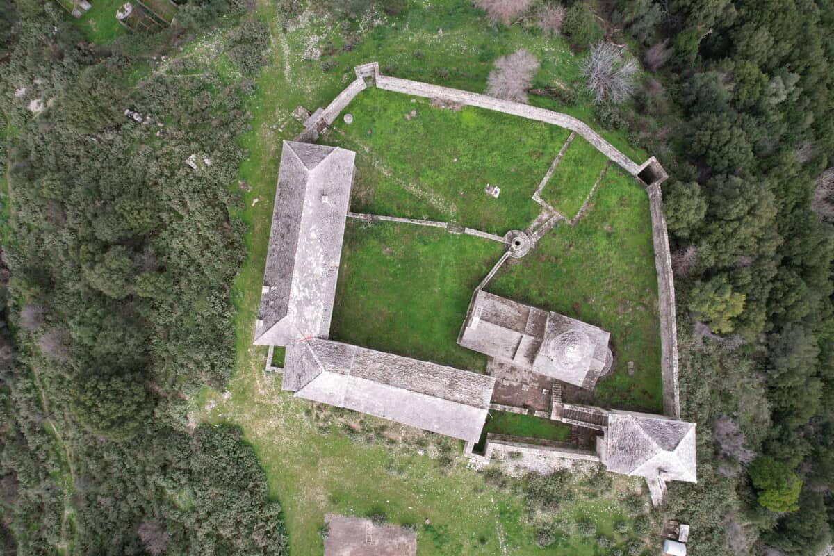
Kakomës
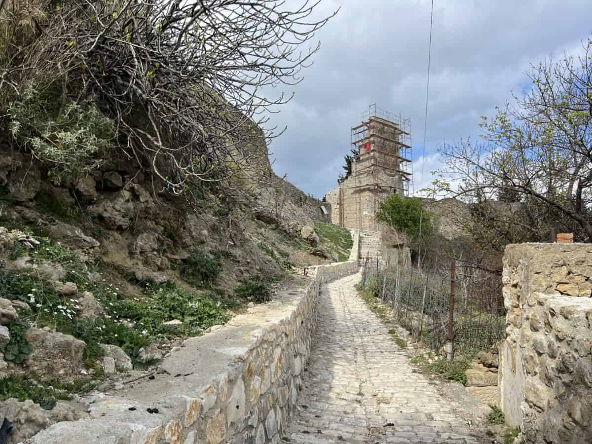
This beach is accessible by car, but closed to the public. The guard, who lives in a house above the beach, may let you onto the beach on foot for a fee if he's in a good mood. However, you can reach it by boat from Sarande or from Lukovë beach. Above the beach there is a small but very interesting monastery of the Virgin Mary (Manastiri i Shën Mërisë) from the 17th century. Lovers of sacred architecture from past times will especially appreciate the original well-preserved frescoes.

Mango Beach
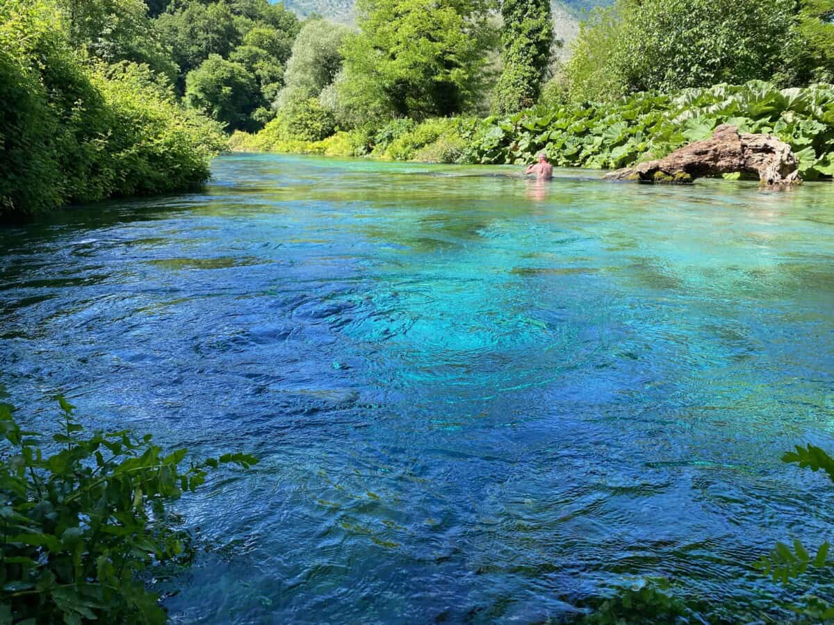
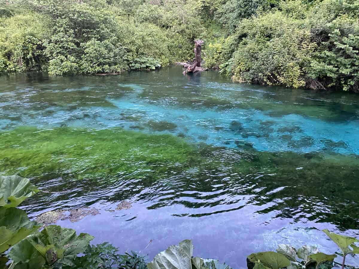
Mango Beach is located in the southern part of Sarandë and is one of the liveliest pebble beaches in the city's vicinity. The combination of crystal-clear sea and the transparent Bistrica river, which flows into the Ionian Sea here, is perfect. The beach is about 300 meters long and offers a steeper entrance to the water. Sunbeds with umbrellas and a wide selection of restaurants and bars are of course available. Due to the steeper entrance to the water and louder music, the beach is sought after by young people looking for fun by the sea.

Manastiri beach
It is located about three kilometers below Sarandë. The name comes from the monastery (manastiri) located on the hill above the beach. It is the monastery of St. George. During 2024-26, a resort project was being built above the beach - so it was not possible to reach the beach by car. It remains to be seen whether after the completion of construction the beach will serve exclusively the owners of apartments. In summer, sunbeds and umbrellas and a restaurant with a bar are available.

Shpella e Pëllumbave
The "Dove Cave" beach is pebbly. There are paid sunbeds and umbrellas available, as well as a public beach. A natural restaurant and bar is available. There are 3 parking lots on the way to the beach, but the road is not the best, so either drive an SUV or park where your car can take you and walk a bit. Another option is to swim here from the nearby northern Pasqyra beach, which is just a few dozen meters away and has trouble-free access.

Pulëbardha beach
"Crab Beach" is located in close proximity to "Pigeon Cave" beach (Shpella e Pëllumbave) heading south. Car access is possible, but the road is not ideal and parking spots can be competitive during peak season. The same applies to commercial sun loungers with umbrellas. A pleasant restaurant with a bar hovers on the cliff above the beach.

Pasqyra Beach
Beautiful "mirror" beach with pebbles and azure water. Car access is possible directly to the beach. The parking capacity is decent. Paid sun loungers with umbrellas are available. A restaurant with a bar is open during the season. Visitor numbers increase year after year. Around a small cliff, you can swim to the small Edon Bina Beach, located to the north. However, you can also reach it on foot from the road leading from Saranda to Ksamil.
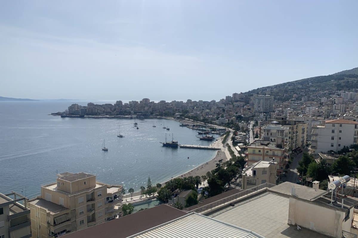
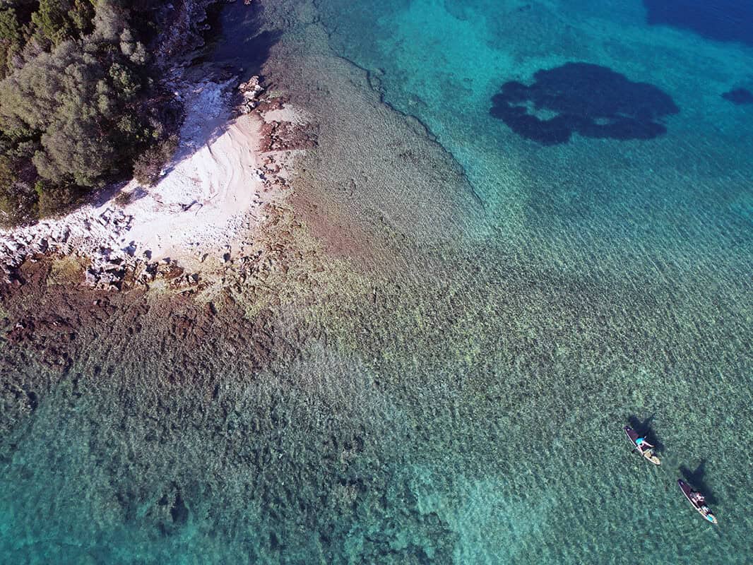
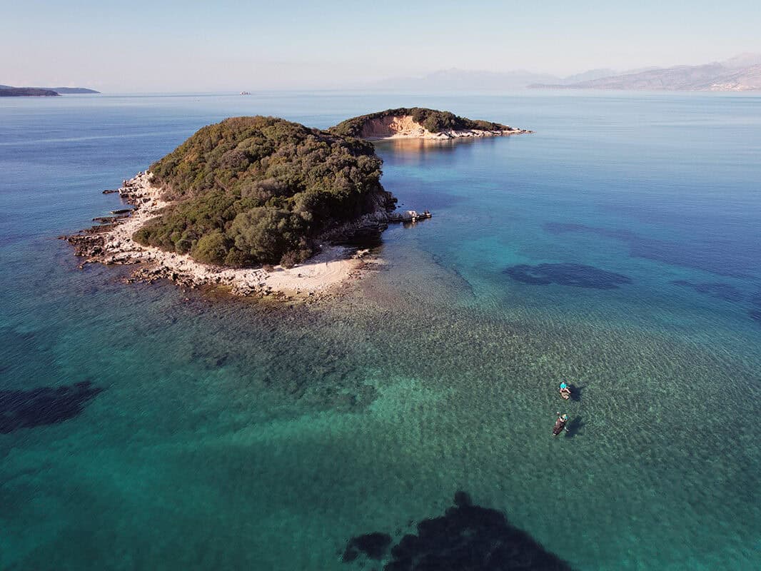
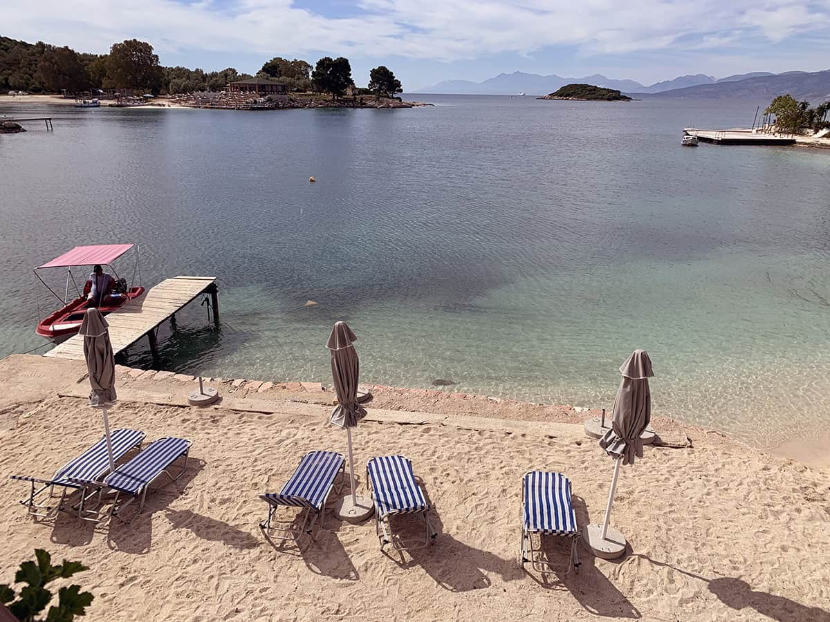
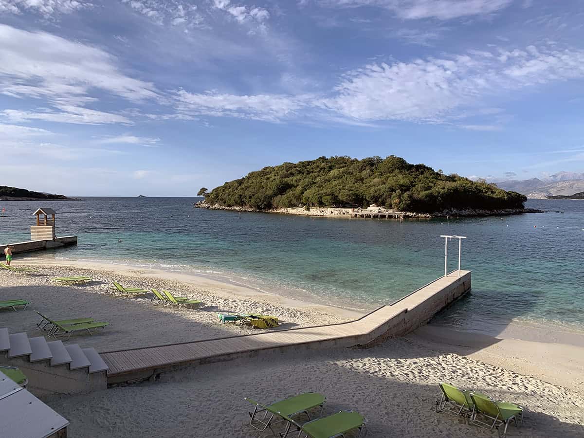
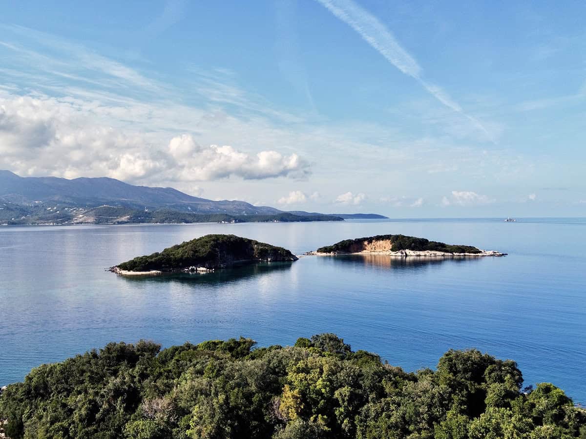
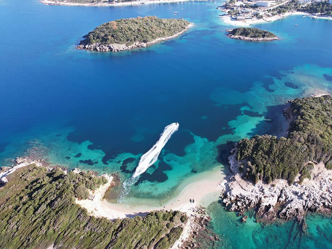
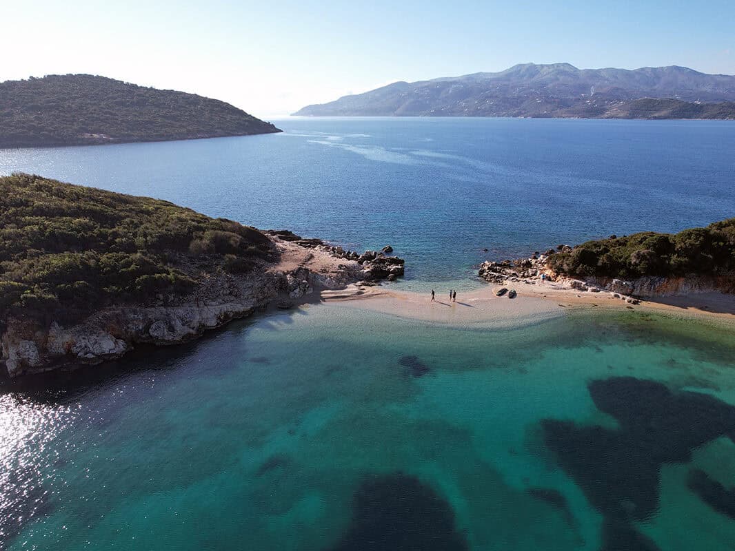
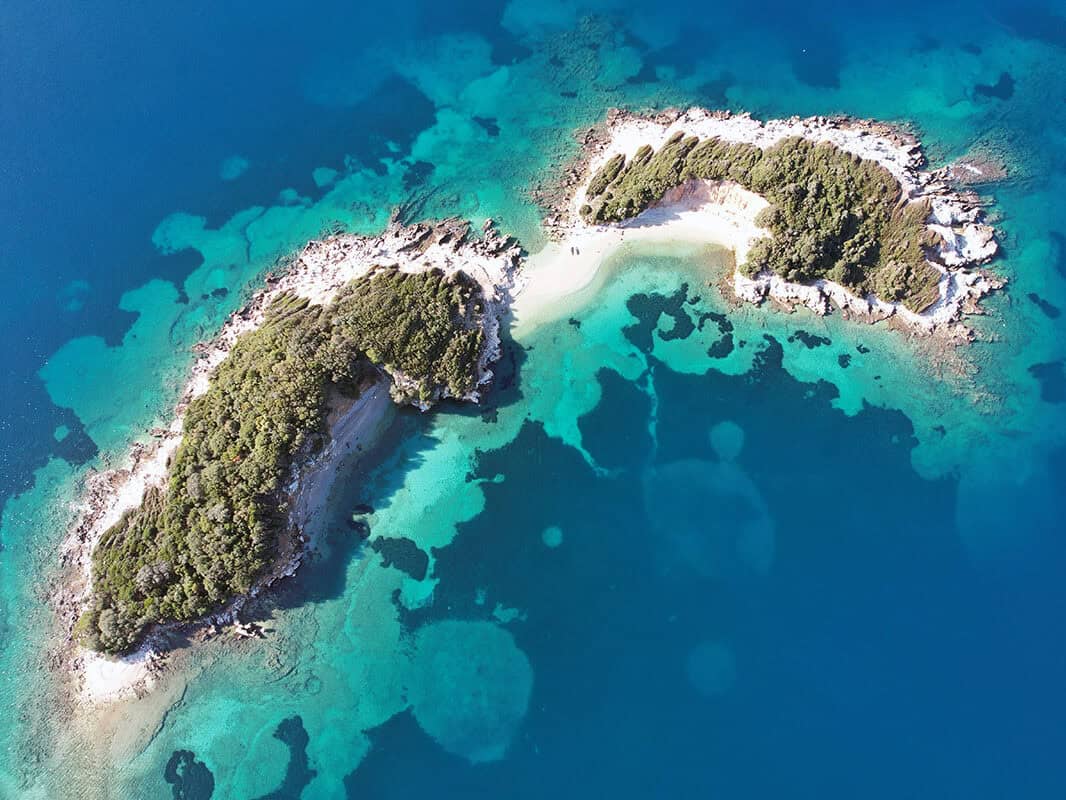
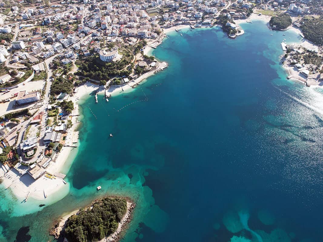
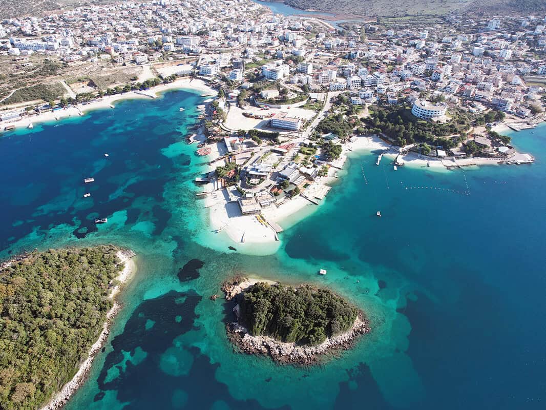
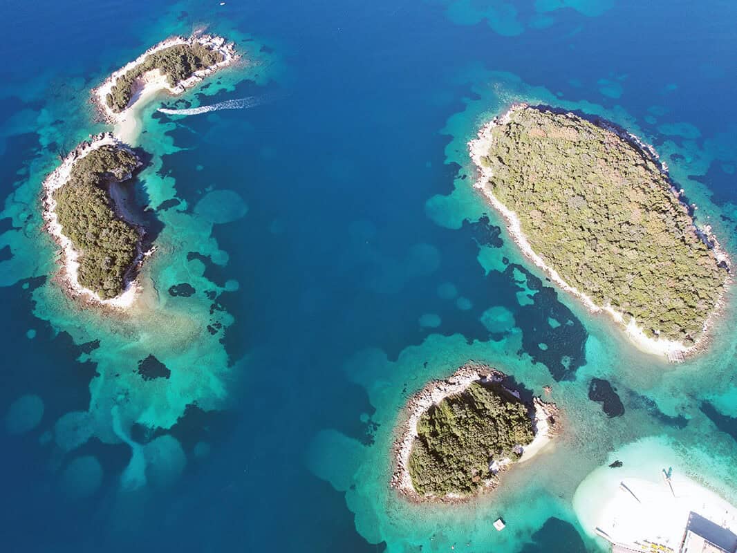
Ksamil
In this small but rapidly growing town, you will find many beaches. Before entering the town, there is a long, irregular beach with a very private atmosphere. Along the town's waterfront, you will find a host of adjacent beaches offering sun loungers, umbrellas, restaurants, bars, paddleboard and pedal boat rentals. The range of all services here is the most developed in Albania. You can also use a boat trip to nearby islands. However, you can reach them by pedal boat or paddleboard.
What to see in Albania?
Albania offers many beautiful and interesting places waiting for your discovery – stunning beaches on the southern coast, majestic mountains in the north, river canyons, lakes, well-preserved historic towns or remnants of previous civilizations. Check out our tips for attractive places in individual regions of Albania. Whether you are drawn to adventure in wild nature, history or the charm of traditional Albanian villages, you will find plenty of places here that, in our opinion, are worth seeing! We will gradually add new places as we visit them. Just click on the map to select the area that interests you.
How to enjoy a vacation and not unnecessarily overspend
Stay smart
Whether you are planning to go to Albania or anywhere in the world, you can use the trusted Booking.com for accommodation reservations. You will find a huge selection of cozy private apartments, houses and hotels. The price range is wide and you will certainly find something to choose from.
Fly for reasonable prices
Do you need a flight ticket? Check out the well-known Kiwi or also the lesser-known, but among seasoned travelers very popular Kayak. It's our favorite. It quickly compares offers from all airlines and shows you the most cost-effective flight combinations. You can also set price alerts, so as soon as a ticket is at a price that suits you, you'll get a notification.
Internet v mobilu
In the second half of 2026, Albania is promised free European roaming. Until then, you can get data with the YESIM app, for example. You will get mobile internet on favorable terms.
Think about the back door
Quality insurance is the basis of any travel. A trip to Albania is no exception. Insurance covers you in case of illness, injuries and loss of belongings. We ourselves have ended up in a hospital in a foreign country a few times. Having good insurance saves a lot of stress and, above all, money.


